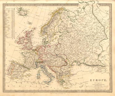
Map of Europe at the end of the 9th Century. 1830.
Similar Sale History
View More Items in Maps & AtlasesRelated Maps & Atlases
More Items in European Maps & Atlases
View MoreRecommended Transportation & Travel Collectibles
View More


Item Details
Description
Victor Lavasseur. Map of Europe at the end of the 9th Century. 1830.
Print of hand colored steel engraving titled Europe a la fin du 9 Siecle“.
Author Victor Lavasseur.
Engraved by unknown.
From Atlas classique universel de Geographie anciene et moderne“ by Victor Levasseur. Paris. 1830.
Victor Levasseur (1800–1870) was a French cartographer widely known for his distinctive decorative style. He produced numerous maps more admired for the artistic content of the scenes and data surrounding the map than for the detail of the map.
Europe is a continent that comprises the westernmost peninsula of Eurasia. It is generally divided from Asia by the watershed divides of the Ural and Caucasus Mountains, the Ural River, the Caspian and Black Seas, and the waterways connecting the Black and Aegean Seas. Europe is bordered by the Arctic Ocean to the north, the Atlantic Ocean to the west, the Mediterranean Sea to the south, and the Black Sea and connected waterways to the southeast. Yet the borders of Europe—a concept dating back to classical antiquity—are arbitrary, as the primarily physiographic term "continent" also incorporates cultural and political elements.Europe, in particular ancient Greece, is the birthplace of Western culture. It played a predominant role in global affairs from the 15th century onwards, especially after the beginning of colonialism. Between the 16th and 20th centuries, European nations controlled at various times the Americas, most of Africa, Oceania, and the overwhelming majority of Asia. The Industrial Revolution, which began in Great Britain around the end of the 18th century, gave rise to radical economic, cultural, and social change in Western Europe, and eventually the wider world.
Approx. image size 12, 1 x 8, 5/13, 9 x 10, 1 cm.Condition: good.
Condition
Condition: good.
Buyer's Premium
- 0%
Map of Europe at the end of the 9th Century. 1830.
Estimate €7 - €9
Get approved to bid.
Shipping & Pickup Options
Item located in Vilnius, ltSee Policy for Shipping
Payment

TOP


![Antique H/C Map EUROPE SOUS CHARLEMAGNE EN 814: EMPIRES D'OCCIDENT ET D'ORIENT: Antique 19th Century French Map EUROPE SOUS CHARLEMAGNE EN 814: EMPIRES D'OCCIDENT ET D'ORIENT [EUROPE UNDER CHARLEMAGNE IN 814: EMPIRES OF THE WEST AND EAST] by Charles V. Monin (French, 1830 - 1880)](https://p1.liveauctioneers.com/6084/330420/178181958_1_x.jpg?height=310&quality=70&version=1716391551)


![Set of Twelve Satirical Anthropomorphic Maps of Europe: [SATIRICAL MAPS] A set of twelve satirical anthropomorphic maps of Europe. London: circa 1868. A set of 12 (believed complete) lithographed maps by Vincent Brooks, Day & Son, London, each offering](https://p1.liveauctioneers.com/292/330597/178279264_1_x.jpg?height=310&quality=70&version=1716409282)
![A block puzzle with maps of Europe, England, Ireland, Scotland, America and the World: [BLOCK PUZZLE] Boxed set of 20 cubical blocks, each face with a portion of one of six hand-colored lithographed maps. Probably Irish: mid-nineteenth century. Blocks overall 7 5/8 x 6 1/4 inches (19.5](https://p1.liveauctioneers.com/292/330597/178279620_1_x.jpg?height=310&quality=70&version=1716409282)


![[FLAGS]. 31-star American parade flag. Ca 1850-1859.: [FLAGS]. 31-star American parade flag. Ca 1850-1859. 22 x 36 1/2 in. cotton flag with 31 printed stars, configured in a double medallion surrounding a much larger central star, that is haloed in both](https://p1.liveauctioneers.com/197/329785/177758218_1_x.jpg?height=310&quality=70&version=1715625218)


