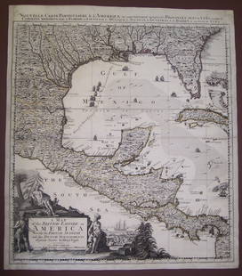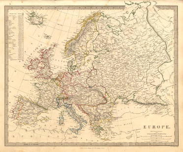
Map of French Empire in 1813. Europe. 1854.
Similar Sale History
View More Items in Maps & AtlasesRelated Maps & Atlases
More Items in European Maps & Atlases
View MoreRecommended Transportation & Travel Collectibles
View More


Item Details
Description
Print of hand colored steel engraving titled „Carte de L’ Empire Francais en 1813”.
Drawn by L. Dussieux.
Engraved by Marlier.
From „Atlas General De Geographie physique, politique et historique par L. Dussieux. Atlas de Geographie ancienne, du moyen age et Moderne“. Paris. 1854.
Louis-Étienne Dussieux, born April 5, 1815 in Lyon and died February 11, 1894 in Paris. He was a French historian-geographer.
The First French Empirewas the empire of Napoleon Bonaparte of France and the dominant power in much of continental Europe at the beginning of the 19th century.On 18 May 1804, Napoleon was granted the title Emperor of the French by the French Sénat and was crowned on 2 December 1804, ending the period of the French Consulate and of the French First Republic. The French Empire won early military victories in the War of the Third Coalition against Austria, Prussia, Russia, Portugal, and allied nations, notably at the Battle of Austerlitz in 1805 and, during the War of the Fourth Coalition, at the Battle of Friedland in 1807.A series of wars, known collectively as the Napoleonic Wars, extended French influence over much of Western Europe and into Poland. At its height in 1812, the French Empire had 130 departments, ruled over 70 million subjects, maintained an extensive military presence in Germany, Italy, Spain, and the Duchy of Warsaw, and could count Prussia and Austria as nominal allies. Early French victories exported many ideological features of the French Revolution throughout Europe: the introduction of the Napoleonic Code throughout the continent increased legal equality, established jury systems and legalised divorce, and seigneurial dues and seigneurial justice were abolished, as were aristocratic privileges in all places with the exception of Poland.
Condition
Approx. image size 38, 6 x 28, 1/44, 1 x 31, 7 cm.
Condition: good.
Buyer's Premium
- 0%
Map of French Empire in 1813. Europe. 1854.
Estimate €7 - €9
2 bidders are watching this item.
Get approved to bid.
Shipping & Pickup Options
Item located in Vilnius, ltSee Policy for Shipping
Payment

Related Searches
TOP


![Antique H/C Map EUROPE SOUS CHARLEMAGNE EN 814: EMPIRES D'OCCIDENT ET D'ORIENT: Antique 19th Century French Map EUROPE SOUS CHARLEMAGNE EN 814: EMPIRES D'OCCIDENT ET D'ORIENT [EUROPE UNDER CHARLEMAGNE IN 814: EMPIRES OF THE WEST AND EAST] by Charles V. Monin (French, 1830 - 1880)](https://p1.liveauctioneers.com/6084/330420/178181958_1_x.jpg?height=310&quality=70&version=1716391551)


![[MAP]. ORTELIUS, Abraham. Romani Imperii Imago. 1592.: [MAP]. ORTELIUS, Abraham (1527-1598). Romani Imperii Imago. Antwerp, 1592. Engraved map with hand-coloring. Matted, framed, and double glazed, visible area 381 x 521 mm (unexamined out of frame). 6 de](https://p1.liveauctioneers.com/197/329395/177650537_1_x.jpg?height=310&quality=70&version=1715364962)


![[FLAGS]. 31-star American parade flag. Ca 1850-1859.: [FLAGS]. 31-star American parade flag. Ca 1850-1859. 22 x 36 1/2 in. cotton flag with 31 printed stars, configured in a double medallion surrounding a much larger central star, that is haloed in both](https://p1.liveauctioneers.com/197/329785/177758218_1_x.jpg?height=310&quality=70&version=1715625218)


