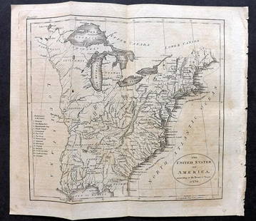
1860 Ettling Map of United States -- United States of
Similar Sale History
View More Items in Maps & Atlases
Related Maps & Atlases
More Items in Maps & Atlases
View MoreRecommended Transportation & Travel Collectibles
View More


Item Details
Description
This is a very large, outstanding map of the US from the eastern seaboard to just past the Rocky Mountains. It shows the westward growth of the emerging states and territories just before the Civil War. Oversized Minnesota, Kanzas, Nebraska and Utah territories are shown, while there are no Dakota or Colorado Territories yet established. Three routes of the proposed transcontinental railroad, Pacific Railroad, as surveyed by Capt. Gunnison, Lieut. Beckwith and Gov. Stevens are described. The tracks of Fremont, Whiting, Connelly and others are shown. The emigrant road is shown with numerous important landmarks along the route noted. Numerous forts and Indian tribes are located. Other detail include topography, rives, lakes, swamps, roads, railroads, etc. Published by the Weekly Dispatch and has the Dispatch Atlas seal above the title.
Reserve: $280.00
Shipping:
Your purchase is protected:
Photos, descriptions, and estimates were prepared with the utmost care by a fully certified expert and appraiser. All items in this sale are guaranteed authentic.
In the rare event that the item did not conform to the lot description in the sale, Jasper52 specialists are here to help. Buyers may return the item for a full refund provided you notify Jasper52 within 5 days of receiving the item.
Condition
Very good. Six sheets joined. Slight toning, mostly in some of the issued folds. A few extra creases. A few marginal splits and narrow margin on lower left. Color outline.
Buyer's Premium
- 15%
1860 Ettling Map of United States -- United States of
Estimate $350 - $400
11 bidders are watching this item.
Shipping & Pickup Options
Item located in Ohio, US$18 shipping in the US
Payment
See More Items From This Jasper52 Seller

Auction Curated By

Maps Expert
Related Searches
TOP


![[PICTORIAL MAPS – TRAVEL]. Three Pictorial Maps. 1940s/50s....: [PICTORIAL MAPS – TRAVEL]. Three Pictorial Maps. 1940s/50s. Three brochure sized foldout maps designed for travel including: Highroads to Happiness. Mexico City: Pemex Travel Club, ca. 1940s. &#](https://p1.liveauctioneers.com/928/325952/175495561_1_x.jpg?height=310&quality=70&version=1712935174)


![[Maps] Gio. Ant. Magnini, Italia, 1620: [Maps] Gio. Ant. Magnini, Italia, 1620, Giovanni Antonio Magnini. Italia, data in luce da Fabio suo figliuolo al Serenissimo Ferdinado Gonzaga Duca di Matoua edi Monserrato etc. Bologna, for Sebastian](https://p1.liveauctioneers.com/188/326797/176317457_1_x.jpg?height=310&quality=70&version=1713847031)


