John Payne Kentucky Map, 1800
Similar Sale History

Recommended Items


Item Details
Description
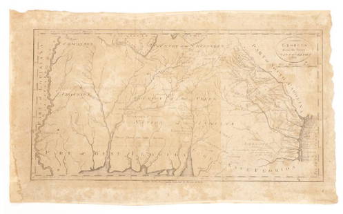
The State of Kentucky with Adjoining Territories Map, by John Payne, engraved by John Scoles, published by John Low, New York, 1800. From "New Encyclopaedia" by John Payne. Copper plate engraving with hand coloring of Kentucky and the surrounding areas including the "Northwestern Territory" of Illinois and Virginia and the "Southwestern Territory" including the "Tennessee Government", parts of Georgia and South Carolina depicting towns and roads, county lines, names of counties, rivers, mountains, and forts. Title, lower left. "Long W from Phila.", top right above map, "West from London", lower left below map. Map surrounded by scale notations and line border. Additional information, en verso. Encapsulated (not laminated) in a plastic archival sleeve and housed in a mat. Image - 7 3/8" H x 8 5/8" W. Plate - 7 7/8" H x 9" W. Sheet - 8 1/2" H x 10 3/8" W. Sight - 7 7/8" H x 9 3/4" W. Mat - 11 1/4" H x 14 1/8" W. Early 19th century. (Additional high-resolution photos are available at www.caseantiques.com.)
Condition
Overall very good condition. Likely deacidified by David Lloyd Swift in the late 20th century.
Buyer's Premium
- 28%
John Payne Kentucky Map, 1800
Estimate $450 - $550
15 bidders are watching this item.
Shipping & Pickup Options
Item located in Knoxville, TN, usSee Policy for Shipping
Payment
Accepts seamless payments through LiveAuctioneers

TOP


![Payne/Low, Map of Tennessee Government, 1799: A MAP OF THE TENNASSEE[sic] GOVERNMENT FROM THE LATEST SURVEYS, 1799, engraved for John Payne's NEW AND COMPLETE UNIVERSAL GEOGRAPHY, published by John Low, New York, 1799. This early copperplate engr](https://p1.liveauctioneers.com/525/230966/119655004_1_x.jpg?height=310&quality=70&version=1640205832)


