Sold2020Antique Amerique Septentrionale Framed MapAntique Amerique Septentrionale Framed Map. Frame measures 13 inches x 17 inches.See Sold Price
Sold20231755 Robert De Vaugondy Map of North America Large1755 Robert De Vaugondy Map of America. Mid-Atlantic, New York, New Jersey, Pennsylvania Virginia, Maryland, New England, Carolina and Ohio. Partie De L'Amerique Septentrionale. Map in matte is aboutSee Sold Price
Sold2017de la Tour: Antique Map of Wartime North America, 1777Title/Content of Map: 'L'Amérique Septentrionale' The map was published during the American War of Independence, predating the Louisiana Purchase. Louisiana territory west of the Mississippi appearsSee Sold Price
Sold2021AN ANTIQUE MAP OF NORTH AMERICA, "AmériqueAN ANTIQUE MAP OF NORTH AMERICA, "Amérique Septentrionale," PARIS, CIRCA 1809, hand-colored lithograph on paper, Pierre M. Lapie, cartographer, Ambroise Tardieu (1788-1841), publisher and engraver, GSee Sold Price
Sold2017de la Tour: Antique Map of North America, 1779Map: L'Amerique Septentrionale ou se Remarquent les Etats Unis Cartographer: Brion de la Tour Place & Date: Paris / 1779/1783 Size: 28 5/8" x 19 7/8" Condition: full wash color; cleaned and sized; minSee Sold Price
Sold2022Antique French map of North America by N. LorrainAntique French map of North America (Amerique Septentrionale' by N. Lorrain. Marked on bottom Longitude Occidentale de Paris. Early 20th century. 22 3/4"h x 25 1/4"wSee Sold Price
Sold2024Two (2) Antique 18th C. Copper Engraved Framed Maps - America & EuropeTwo (2) antique 18th C. copper engraved framed maps. One of Amerique and other titled Carte d'Europe. Both framed under glass. Frame Size: 13.5H x 14.5W (each)See Sold Price
Sold2017Bonne: Antique Map of Northeastern Canada, 1783Map: Partie de l'Amerique Septentrionale qui comprend le Canada, la Louisiane, le Labrador, le Grenland, les Etats Unis, et la Floride Cartographer: Bonne Place & Date: Paris / 1783 Size: 17" x 11 5/8See Sold Price
Sold2017Jaillot: Antique Map of North America, 1696Map: 1696 Jaillot Map of North America (California as an Island) -- Amerique Septentrionale Divisee en ses Principales Parties Date Printed: 1696 Amsterdam Cartographer: H. Jaillot Size: 19.3 x 23 in.See Sold Price
Sold2020Guillaume de L'Isle and Peter Schenk MapGuillaume de L'Isle and Peter Schenk "L'Amerique Septentrionale Dressee sur les Observations...", Amsterdam, Pierre Schenk, 1708, hand-colored engraved map, 17 1/2 in. x 23 in., matted and framed ProvSee Sold Price
Sold2021Antique map, Northeast US, by Robert De VaugondyAntique map, Northeast US, by Robert De Vaugondy "Partie De L'Amerique Septentrionale Qui Comprend Le Cours De L'Ohio, La Nlle Angleterre, La Nlle York, Le New Jersey, La Pensyvanie, Le Maryland La ViSee Sold Price
Sold2018Janvier, L'Amerique Septentrionale, Antique MapAn antique engraved map with outline hand-coloring and cartouche: Janvier (Jean) L'Amerique Septentrionale divisee, Etats Par le Sr. Janvier, Geographe, A Paris, 1792, Avec Privilege du Roy. Depicts MSee Sold Price
Sold2016Map of Canada Framed Vintage 40s Print After 1720Map of Canada Framed Vintage 40-s Print After 1720 Guillaume De L'Isle Carte Du Canada Qui Comprend la Partie Septentrionale Des Etats Unis D'Amerique Canada and Great Lakes Map Approximately 21 5/8"See Sold Price
Sold2021Antique Framed Map. Virginia Marylandia et Carolina. JoAntique Framed Map. Virginia Marylandia et Carolina. Johannes Baptisa Homann-- Dimensions: Image Size: H: 21 inches: W: 24.5 inches -- FRAME SIZE: Frame Height 25 inches - Frame Width 28.5 inches ---See Sold Price
Sold2016Antique Framed Map of Israel, C. 1748.Ivdaea Sev Palaestina, ... Terra Sancta. By Johann Baptist Homann. Framed, 18.5" x 21.5" sight size. Visible foxing. From a Larchmont NY estate. Dimensions: 23" w x 20" h framed. Condition: Foxing, noSee Sold Price
Sold2023Antique Framed Map of CubaAntique Framed Map of Cuba. Framed measures 15 inches x 20 inchesSee Sold Price
Sold2021Antique Framed Map Livingston,Germantown,Claremont NYAntique Framed Map of Livingston, Germantown and Claremont, Columbia County, NY. Dated 1850. Engraved by R.H.Pease, Albany, NY. Lovely early map is nicely framed in dark brown wood, and wired on the bSee Sold Price
Sold2017Antique framed map of Indian Ocean, Asia, AustraliaTitle/Content of Map: Antique framed map of Indian Ocean, Asia, Australia Date Printed: 1713 Cartographer: Aa, Pieter van der Size (in): 11 x 8 Very attractive framed copper-engraved antique map by PiSee Sold Price
Sold2021Antique Framed Map of Columbia County, NY 1829Antique Framed Map of Columbia County, NY, dated 1829. Engraved by Rawdon Clark & Co, Albany, NY. Also marked Rawdon Wright, New York. Map includes locations of mills, churches and stage roads. NicelySee Sold Price
Sold2019Antique Framed Map Showing Estonia Coast & RussiaAntique Framed Map Showing Estonia Coast & Russia. Professionally framed and matted. Showing the current coast and islands of Estonia as well as a portion of Russia. Measures 26 x 31 inches.See Sold Price
Sold2023Antique Framed Map of Greece by Nicolaum VisscherAntique Framed Map of Greece by Nicolaum Visscher. 21 inches x 25 inches.See Sold Price
Sold2021Antique Framed Map of Europe, Europa Guilielmo BlaeuwAntique Color Map of Europe, Dutch Cartography. "Europa Recens Descripta" by Guilielmo Blaeuw, a cartographer for the Dutch East India Company. Lots of colorful detail of different nationalitiSee Sold Price
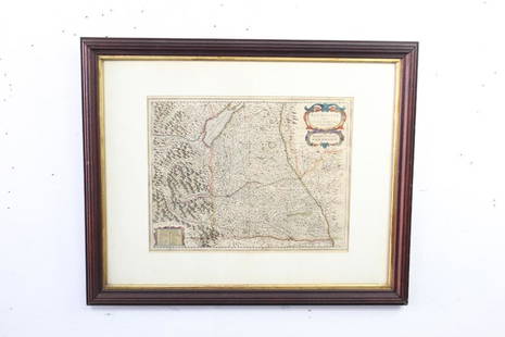
Sold2021Antique Framed Map of Germany by A Christophoro HurteroAntique Framed Map of Germany by A Christophoro Hurtero. Full title: Alemannia Sive Svevia Superior. Date of printing is somewhere in 1640's, and possibly engraved. Golden painted inner frame. DimSee Sold Price
Jun 14DuMouchellesRigobert Bonne (French, 1727-1794) Hand Colored Engraving Ca. 18th Century, Les Etats Unis De$50(1 bid)
Featured5 days LeftJasper52Coste Orientale d’Afrique…' East Africa Kenya Tanzania Somalia. BELLIN 1746 map$80
5 days LeftJasper52Carte de la partie septentrionale d'Afrique, ou de la Barbarie… BONNE 1780 map$25
5 days LeftJasper52Coste Occidentale d’Afrique…' West Africa. Gulf of Guinea. BELLIN 1746 map$55
4 days LeftMark Louis Weseloh Estate LiquidationsSix - 17th c. Maps of Europe, Asia, England, Germany x2, Crete, Greece.8 1/4" x 6 5/8".$300