Sold2023Hondius Map of The AmericasHONDIUS, Jodocus (1563-1612). America. Engraved map with original hand color. Amsterdam, 1606, or later. 17 1/2” x 21 1/2” sheet, 29 1/2” x 33” framed. A striking map of the WeSee Sold Price
Sold2017America, Rare Early Map of the Americas"America", Rare Early Map of the Americas by Jodocus Hondius (Flemish/Dutch, 1563-1612) for a French edition of Mercator's Atlas, North and South America, hand-colored copper engraved map, published ASee Sold Price
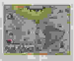
Sold2020JANSSONIUS, JOHANNES; after HONDIUS, JODOCUS. AmericaJANSSONIUS, JOHANNES; after HONDIUS, JODOCUS. America Noviter Delineata. Double-page engraved map of the Americas. 19½x22½ inches sheet size, wide margins, Latin text on verso; original handSee Sold Price
Sold2024RARE 1638 HONDIUS MAP OF BERMUDA, FRAMEDHenricus Hondius (1597-1651): "Mappa Aestivarum Insularum, alias Barmudas." First atlas issue, two joined sheets as issued, copperplate engraving on wove paper with original contemporary color, printeSee Sold Price
Sold2023Hondius - Map of Virginia and the CarolinasJodocus Hondius (1563-1612), Virginiae Item et Floridae, Amsterdam, circa 1636, text in English verso, engraving on laid paper with hand color, 14-1/8 x 19-3/8 in.; double sided wood frame, 20-1/8 x 2See Sold Price
Sold2022Hondius, Map of Virginia, After John Smith, FramedHenry Hondius, after Capt. John Smith, "Nova Virginiae Tabula" (Amsterdam: 1639-'42) Engraving with hand coloring, 15 1/8 x 19 1/4 in., plus margins; in a birds-eye maple frameSee Sold Price
Sold2017Hondius Map of Asia, 1606Map: 1606 c. Hondius Map of Asia -- Asiae Nova Descriptio Cartographer: J Hondius Year / Place: 1606 c., Amsterdam Map Dimension: 14.8 X 19.7 in. This is an excellent map of Asia. It is believed to beSee Sold Price
Sold20191633 Hondius Map od Bermuda -- Mappa AestivarumReserve Reduced! Title/Content of Map: 1633 Hondius Map od Bermuda -- Mappa Aestivarum Insularum, alias Barmudas dictarum… Date: 1633, Amsterdam Cartographer: H Hondius Size: 15.5 X 20.5 in. This isSee Sold Price
Sold2017Hondius Map of IndiaIndia quae Orientalis dicitur et Insulae Adiacentes. Henricus Hondius (1597-1651). Copperplate engraving. Amsterdam, c. 1636. 17 x 21 3/4 inches sheet. An important Dutch map of South East Asia, notewSee Sold Price
Sold20221633 Hondius Map of Bermuda -- Mappa Aestivarum Insularum, alias Barmudas dictarum…Title: 1633 Hondius Map of Bermuda -- Mappa Aestivarum Insularum, alias Barmudas dictarum… Cartographer: H Hondius Year/Place: 1633, Amsterdam Dimensions: 15.5 X 20.5 in. Description: This is aSee Sold Price
Sold2020Hondius Map of MoroccoHONDIUS, Jodocus (1563-1612) / MERCATOR, Gerard (1512-1594). [Morocco] Fessae et Marocchi Regna. Engraving with original hand color. Amsterdam, c. 1606 or later. 17 3/4" x 21" sheet. Comparable: Old WSee Sold Price
Sold2020Hendrik Hondius Map of Tierra del Fuego and StraiHendrik Hondius (1588-1651) "Freti Magellanici ac novi Freti vulgo Le Maire exactissima delineatio," Amsterdam, ca. 1630. This hand colored map depicts the southern tip of South America, featuring TieSee Sold Price
Sold202217C. Jodocus Hondius Map of Asia Colored EngravingAntique 17th century map of Asia by Jodocus Hondius (Belgian Dutch, 1563-1612). Colored engraving originally published in 1631. Displayed in a wooden frame. Work Size: 15 x 19.5 in.SHIPPINGHill AuctioSee Sold Price
Sold2016Asiae Nova Descriptio Jodocus Hondius MapFrame: 28" x 23.25" / Image: 20" x 15.5". Map has some folds and staining.See Sold Price
Sold20201638 Hondius Map of Edinburgh Environs in Scotland -- ATitle/Content of Map: 1638 Hondius Map of Edinburgh Environs in Scotland -- A New Description of the Shyres Lothian and Linlitquo. Be T. Pont. Date: 1638, Amsterdam Cartographer: Hondius [family] SizeSee Sold Price
Sold2021Hondius Map of the Grand Duchy of Lithuania, 1613Hondius Map of the Grand Duchy of Lithuania, 1613Lithuania / LithuanieAutorius Jodocus Hondius I (Joost de Hondt 1563-1612)Graveris Jodocus Hondius II (1594-1629)Leidejai: Jodocus Hondius II (1594-162See Sold Price
Sold2016Hondius. Map of Hartford Shire. Map.Harford Shire Described. The sittuations of Hartford and the most ancient towne S Albons with such memorable actions as have happened. Copper engraving hand colored. 15" x 20" some tearing to upper riSee Sold Price
Sold2020JODOCUS HONDIUS "Map of Andalucia"ANDALUSIA. (HUELVA, SEVILLA, part of CÓRDOBA and CÃDIZ.) ANDALUSIAN DESCRIPTION. Amsterdam, 1616. Copper engraved map for Bertius' minor atlas: "Tabularum geographicarum contractarum libri septemSee Sold Price
20241620s CRIMEA HONDIUS MAP OF TAURICA CHERSONESUS copper engraving ANTIQUEEarly 17th century hand colored map of MAP OF TAURICA CHERSONESUS (CRIMEA) from English edition of Hondius atlas, c. 1620s size 5 by 6 1/2" (leaf 8 1/4 by 12 1/2") Very good condition Henricus HondiusSee Sold Price
Sold2021HENRICO HONDIUS Map of Gaul Decorative ArtsHENRICO HONDIUS Map of Gaul, inscriptions to piece in Latin, inscriptions to lower right illegible, subject a map of Gaul, measures 24 3/8 x 28 1/4 inches, green wooden frame surface wear to frame, prSee Sold Price
Sold20221606 Hondius map of Moroccoca 1606 Hondius hand colored map of Morocco, "Fessae et Marocchi Regna", crease, foxing stains, sheet 17 3/4' x 21"See Sold Price
Sold2024Antique Maps - Americas - Emanuel Bowen - North America - South AmericaMap "A new general map of America. Drawn from several accurate particular maps and charts, and regulated by astronomical observations. By Eman. Bowen". An impressive publication by Emanuel Bowen, "A NSee Sold Price
Sold20231620s CRIMEA HONDIUS MAP OF TAURICA CHERSONESUS copper engraving ANTIQUEEarly 17th century hand colored map of MAP OF TAURICA CHERSONESUS (CRIMEA) from English edition of Hondius atlas, c. 1620s size 5 by 6 1/2" (leaf 8 1/4 by 12 1/2") Very good condition Henricus HondiusSee Sold Price
Sold2021Jodocus Hondius, Map of Beauvaisis, c.1620"Beauvaisis -- Comitatus Belovcium" hand colored and in two parts. Dimensions: Sight is 15 3/4" x 21", the frame 27 1/2" x 32 1/2".See Sold Price
2 days LeftTrillium Antique Prints & Rare BooksPrevost - Map of China, Korea, Japan, Phlippines and Surrounding Islands$50
7 days LeftForum AuctionsAgriculture & Botany.- Virgilius Maro (Publius) The Georgicks of Virgil, translated & edited by John£340
2 days LeftTrillium Antique Prints & Rare BooksPrevost - Chart of the Atlantic Ocean (Ocean Occidental, including parts of the Americas, Africa,$50
2 days LeftTrillium Antique Prints & Rare BooksPrevost - Pair of Engravings of Chinese Boats or Junks$50
2 days LeftTrillium Antique Prints & Rare BooksPrevost - Pair of Engravings of Indian Coast and Ocean$50
3 days LeftRich Penn AuctionsPickup Truck, 2019 Ford F-150 short box is one of America's favorite pickup trucks.$12,000(7 bids)
2 days LeftBlackstone Valley Auctions & Estates LLCRevolutionary Era War Map of the Attack on Ft. Moultrie.$275(3 bids)
May 29Cedarburg Auction & Appraisals LLCSet of Four Maps Showing All of Spain and Portugal$125(2 bids)


![Hondius Map of Morocco: HONDIUS, Jodocus (1563-1612) / MERCATOR, Gerard (1512-1594). [Morocco] Fessae et Marocchi Regna. Engraving with original hand color. Amsterdam, c. 1606 or later. 17 3/4" x 21" sheet. Comparable: Old W](https://p1.liveauctioneers.com/1968/169571/85465312_1_x.jpg?height=310&quality=70&version=1590242353)


![1638 Hondius Map of Edinburgh Environs in Scotland -- A: Title/Content of Map: 1638 Hondius Map of Edinburgh Environs in Scotland -- A New Description of the Shyres Lothian and Linlitquo. Be T. Pont. Date: 1638, Amsterdam Cartographer: Hondius [family] Size](https://p1.liveauctioneers.com/5584/158575/80095691_1_x.jpg?height=310&quality=70&version=1578446373)


![[MAP]. ORTELIUS, Abraham. Africae Tabula Nova. 1592. (1 of 2)](https://p1.liveauctioneers.com/197/329395/177650533_1_x.jpg?height=282&quality=70&version=1715364962)


