Sold2023Map of the American Colonies from December, 1754This map is titled 'An Accurate Map of the English Colonies in North America bordering on the River Ohio', a scarce early map of the British Colonies in North America and one of the earliest maps to aSee Sold Price
Sold20231754 An Accurate Map Of the English Colonies in North America1754 An Accurate Map Of the English Colonies in North America bordering on the River Ohio, by John Hinton. Covers the Carolinas to the Great Lakes and Casco Bay off the coast of present-day Maine. PubSee Sold Price
Sold2022ENGRAVED MAP OF THE AMERICAN COLONIES BY JEAN PALAIRET 1775 17.5” x 23” sight. FramedENGRAVED MAP OF THE AMERICAN COLONIES BY JEAN PALAIRET1775Double-page “Carte des Possessions Angloises & Françoises du Continent de l'Amérique". After Mitchell.17.5” x 23See Sold Price
Sold2018Morden: Antique Map of Florida & the Great Lakes, 16931693 map of Florida and the Great Lakes by Robert Morden. 5 x 5 inches. A very special map--one of the very earliest obtainable English maps of the American colonies. A Map of Florida and Ye Great LakSee Sold Price
Sold2021American colonies, 1755-1768, by R. Vaugondy. ParisTitle: American colonies, 1755-1768, by R. Vaugondy. Paris Date/Period: 1755-1768 Materials: Copperplate engraved Size: 24 x 18 1/2” A very interesting and important British American colonies mapSee Sold Price
Sold2017[Map of Am. Colonies] Universal Magazine, 1754THE UNIVERSAL MAGAZINE OF KNOWLEDGE AND PLEASURE… VOL XV. London: John Hinton, [1754.] 8vo. Engraved frontis and title-page, 329, [7] pp. With 23 plates/maps, 6 folding, wanting the last plate listeSee Sold Price
Sold2023Battle of the Bulge Hand Drawn Map by American SoldierThis secret American antitank minefield sketch/map is in used condition, dates from December 24, 1944 and was used during the Ardennes offensive, also known as the battle of the Bulge.This sketch wasSee Sold Price
Sold2019MAP - Eastern US. AnonymousColonial Eastern United States. Anonymous, An Accurate Map of the English Colonies in North America Bordering on the River Ohio, 1754 (published). Hand Color. This unusual map of the colonies spans frSee Sold Price
Sold20241777 Revolutionary War Map America Septentrionalis1777 hand-colored map published by Homann Heirs, Nuremberg, showing the British colonies in North American, published in the midst of the American Revolution, entitled "America Septentrionalis a DominSee Sold Price
Sold2023An Accurate Map of the English Colonies in North America Bordering on the Ohio Riverfrom Universal Magazine, London, circa 1754, engraving on laid paper with hand colored highlights, sight 7-3/4 x 9-1/2 in.; framed, 12-7/8 x 14-1/2 in. Provenance: Estate of Dr. J. Francis and LaquitaSee Sold Price
Sold2015AMOS DOOLITTLE ENGRAVING OF ASIAAMOS DOOLITTLE ENGRAVING OF ASIA Engraved map of Asia, 9 3/4" x 8 1/2", executed by American engraver AMOS DOOLITTLE (1754-1832), and marked with Doolittle's name, and also: "Geographical Comm. to BibSee Sold Price
Sold20217 Warrior & Essential History Osprey BooksIncludes Essential History 44 The French -Indian War 1754-1760. Warrior 19 British Redcoat 1740-1793, 42 Redcoat Officer 1740-1815, 85 American Colonial Ranger: The Northern Colonies 1724-64, two copiSee Sold Price
Sold2022ANTIQUE ETCHING PLAN OF NAVAL ATTACK WAR OF 1812Color etching representing a commented map of a naval attack. Titled Plan of the Attack Made by the British Barges on Five American Gunboats on the 14th December 1814 by Major A. LaCarriere Latour, PrSee Sold Price
Sold2015Scarce Hudson-Fulton Celebration TapestryA woven tapestry with the Roman numerals for 1626 at center top for the year Manhatten was purchased from the Native Americans by the Dutch, and showing map of the Dutch colony in North America entitlSee Sold Price
Sold20211773 Newspaper, Prelude to Boston Tea PartyColonial America Colonial Newspaper Reporting on the British East India Tea Company Sending Tea Ships to the Colonies, the Prelude to the "Boston Tea Party" Tax Protest of December 16, 1773 October 13See Sold Price
Sold20211763 Map of the 13 British Colonies in AmericaHistoric Maps 1763 Map of "The British Government in Nth. America, Laid down agreeable to the Proclamation of Oct. 7, 1763" 1763-Dated Colonial Period, Map titled, "The British Government in Nth. AmerSee Sold Price
Sold2022c 1760 Northern Colonies French + Indian War MapHistoric Maps Louisiana & Florida French & Indian War Era Map c. 1760 c. 1760 French & Indian War Era, Hand-Colored Map of Pennsylvania and New England titled, "Carte de la Partie Nord, Des Etats UnisSee Sold Price
Sold20231756 Thomas Kitchin Pennsylvania Map Hand Colored1756 Thomas Kitchin A Map of the Province of Pennsilvania. French & Indian War era engraved map from London Magazine December 1756. 7 x 9 inches in matt.See Sold Price
Sold20204 Framed Works: Prints, Deed and Map1) James Montgomery Flagg color supplement to North American Philadelphia Sunday "Uncle Sam - I Need You", December 2, 1917, in a red, white & blue mat [Image: 11 x 8 1/2 inches; Frame: 18 x 14 inchesSee Sold Price
Sold2018Antique John Smith Atlantic Region Map Virginia OrigState 10: Page 41, numbers changed to 1690 and 1691. A true piece of American history, not a reproduction!Fine example of John Smith's map of the newly formed Virginia colony, one of the true milestonSee Sold Price
Sold2021North American colonies, New Spain, Louisiana, Florida,Title: North American colonies, New Spain, Louisiana, Florida, thirteen colonies and Caribbean. 1762 by Homann Heirs Date/Period: 1762 Size: 24 x 20 1/2" Material: Copperplate engraved Description: ASee Sold Price
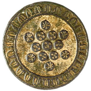
Sold2021Rev War 13 Stars American Colonies Patriot ButtonAmerican Revolution c. 1776 Rare Revolutionary War Period "13 Stars" Design American Colonies Patriotic Theme Decorative Button c. 1776 Revolutionary War Period 13 Stars American Colonies Patriotic BuSee Sold Price
Sold20231950 JD McGee American Folklore & Legends Map -- American Folklore & LegendsTitle: 1950 JD McGee American Folklore & Legends Map -- American Folklore & Legends Cartographer: JD McGee Year / Place: 1950 Map Dimension (in.): 20.1 X 31 in. This is an excellent pictorial map of tSee Sold Price
Sold2024Hand-Drawn Map, American School (19th century)American School (19th century), "A Map of the United States by Julia A. Benson, Aged 11," 1828, ink and watercolor on paper, sight: 19.5"h x 24"w, overall (with frame): 27.5"h x 33.5"wSee Sold Price
4 days LeftSMG MarketingEdward Willis Redfield- 5.75 x 3.25 Signed Vintage Notecard (Impressionist Painter)$150
3 days LeftSMG MarketingEdward Willis Redfield- 5.75 x 3.25 Signed Vintage Notecard (Impressionist Painter)$150
5 days LeftSMG MarketingEdward Willis Redfield- 5.75 x 3.25 Signed Vintage Notecard (Impressionist Painter)$150
Jun 02Schilb Antiquarian Rare Books1782 Spectacle Nature & Art Metalwork American Colonies ZODIAC Carpentry PLATES$6(3 bids)
3 days LeftJasper52RARE authentic and original English Lobster tail colonial helmet armor 1600-1640s era$120(4 bids)
2 days LeftWeatherham Estate TreasuresUnited States Map with American Flag 3-D Wall Mount Painting$300
2 hrs LeftRapid Estate Liquidators and Auction GalleryAmerican Heritage December 1958 Hardcover Magazine$25
2 days LeftWeatherham Estate TreasuresUnited States Map with American Flag 3-D Wall Mount Painting$300
Jun 02Schilb Antiquarian Rare Books1863 Emancipation of SLAVERY in America CIVIL WAR French Colonies Cochin RARE$27(3 bids)
Jun 08Early American History Auctionsc. 1794 AMOS DOOLITTLE Engraved Copper-Plate Portrait: The Honorable JOHN WINTHROP, Esq.$1,000


![[Map of Am. Colonies] Universal Magazine, 1754: THE UNIVERSAL MAGAZINE OF KNOWLEDGE AND PLEASURE… VOL XV. London: John Hinton, [1754.] 8vo. Engraved frontis and title-page, 329, [7] pp. With 23 plates/maps, 6 folding, wanting the last plate liste](https://p1.liveauctioneers.com/3532/111460/57224249_1_x.jpg?height=310&quality=70&version=1509131847)