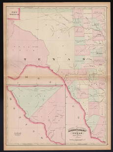
Scarce Johnson map of the Great Western states, 1864
Similar Sale History
View More Items in Maps & AtlasesRelated Maps & Atlases
More Items in Maps & Atlases
View MoreRecommended Transportation & Travel Collectibles
View More


Item Details
Description
Antique map of California, Nevada, Utah, Colorado, New Mexico, and Arizona. Published during a great time of expansion and change in the U.S. West, as well as during the Civil War. Here Utah displays its last configuration before the northeast corner was moved westward in 1868, when the coming of the railroad made it necessary to form a new territory from parts of Dakota, Utah and Idaho. The northwest corner of Arizona extends into what would become the bottom of Nevada. Includes mining districts, emigrant trails, the Santa Fe Trail, the Pony Express Route and several proposed railroads, Locates many American Indian tribes, shows geological features and political divisions. The Grand Canyon is labeled as the Colorado Canyon. A wealth of information is included throughout this large map. Original hand coloring, good detail of landforms, water bodies, and towns. Authentic vintage maps of the American West—especially during the years of constant boundary change--are extremely collectible. Exceptional examples with great color and crisp ink impressions are at the top of that list. This is one such specimen. Johnson’s California with Utah, Nevada, Colorado, New Mexico and Arizona by Johnson and Ward. Dated 1864 and published in Johnson and Ward’s New Illustrated Family Atlas. An impressive vintage map with a great impression. Repaired centerfold splits at top and bottom (about 2” each). 17 x 23.5
Reserve: $235.00
Shipping:Domestic: Flat-rate of $8.00 to anywhere within the contiguous U.S. International: Foreign shipping rates are determined by destination. International shipping may be subject to VAT. Combined shipping: Please ask about combined shipping for multiple lots before bidding. Location: This item ships from Ohio
Your purchase is protected:
Photos, descriptions, and estimates were prepared with the utmost care by a fully certified expert and appraiser. All items in this sale are guaranteed authentic.
In the rare event that the item did not conform to the lot description in the sale, Jasper52 specialists are here to help. Buyers may return the item for a full refund provided you notify Jasper52 within 5 days of receiving the item.
Reserve: $235.00
Shipping:
Your purchase is protected:
Photos, descriptions, and estimates were prepared with the utmost care by a fully certified expert and appraiser. All items in this sale are guaranteed authentic.
In the rare event that the item did not conform to the lot description in the sale, Jasper52 specialists are here to help. Buyers may return the item for a full refund provided you notify Jasper52 within 5 days of receiving the item.
Condition
Near fine
Buyer's Premium
- 15%
Scarce Johnson map of the Great Western states, 1864
Estimate $285 - $350
4 bidders are watching this item.
Shipping & Pickup Options
Item located in Ohio, US$8 shipping in the US
Payment
Accepts seamless payments through LiveAuctioneers
See More Items From This Jasper52 Seller

TOP


![Five Antique Maps of the Western United States: [Five Antique Maps of the Western United States], incl. "Map of the United States Territory of Oregon...", by Hood, 1838; "Johnson's California, with Utah...", Johnson and Ward, 1864; "Map Showing the](https://p1.liveauctioneers.com/268/141383/71622474_1_x.jpg?height=310&quality=70&version=1556895875)


![[Maps] Gio. Ant. Magnini, Italia, 1620: [Maps] Gio. Ant. Magnini, Italia, 1620, Giovanni Antonio Magnini. Italia, data in luce da Fabio suo figliuolo al Serenissimo Ferdinado Gonzaga Duca di Matoua edi Monserrato etc. Bologna, for Sebastian](https://p1.liveauctioneers.com/188/326797/176317457_1_x.jpg?height=310&quality=70&version=1713847031)


