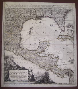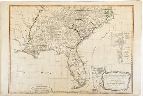
West Indies, Pt Manzanilla to San Juan 1844 British Admiralty Map
Similar Sale History
View More Items in Maps & AtlasesRelated Maps & Atlases
More Items in British Maps & Atlases
View MoreRecommended Transportation & Travel Collectibles
View More


Item Details
Description
Scarce original 1844 British Admiralty Nautical Chart West Indies, Sheet XI, from Pt Manzanilla to San Juan De Nicaragua, Surveyed by Commander E. Barnett 1837.
London Published according to Act of Parliament at the Hydrographic Office of the Admiralty March 9th 1844. Sold by R.B. Bate Agent for the Admiralty Charts 21 Poultry.
Sold by RB. Bate Agent for the Admiralty Charts 21 Poultry.
Dimensions: 25 x 19 inches. Canvas mounted.
London Published according to Act of Parliament at the Hydrographic Office of the Admiralty March 9th 1844. Sold by R.B. Bate Agent for the Admiralty Charts 21 Poultry.
Sold by RB. Bate Agent for the Admiralty Charts 21 Poultry.
Dimensions: 25 x 19 inches. Canvas mounted.
Condition
G+, signs of age, toning. Please refer to the photos or request additional info. The absence or brevity of a condition statement does not imply that the lot is in perfect condition or completely free from wear and tear, imperfections or the effects of aging. Condition reports are obtained via email or by phone. Any condition statement given as a courtesy to a client is only an opinion and not to be treated as a statement of fact. Zikorn AH shall have no responsibility for any error or omission.
Buyer's Premium
- 25%
West Indies, Pt Manzanilla to San Juan 1844 British Admiralty Map
Estimate $200 - $300
1 bidder is watching this item.
Get approved to bid.
Shipping & Pickup Options
Item located in New York, NY, usOffers In-House Shipping
Payment
Accepts seamless payments through LiveAuctioneers

Related Searches
TOP


![Des Barres Map of NY Harbor: *** START PRICE IS THE RESERVE *** [America] DES BARRES, Joseph Frederick Wallet (1729-1824). A Chart of New York Harbour with the Soundings Views of Land Marks and Nautical directions for the Use of](https://p1.liveauctioneers.com/1968/163248/82424572_1_x.jpg?height=310&quality=70&version=1583340284)


![North-west Europe. Nordic Countries. British Isles Scandinavia. THOMSON 1830 map: TITLE/CONTENT OF MAP: [Europe after the Congress of Vienna - North-west sheet] DATE PRINTED: 1830 IMAGE SIZE: Approx 53.0 x 65.0cm, 20.75 x 25.5 inches (Large); Please note that this is a folding map.](https://p1.liveauctioneers.com/5584/328641/177014337_1_x.jpg?height=310&quality=70&version=1715113718)
![North-west Europe. Nordic Countries. British Isles Scandinavia. THOMSON 1817 map: CAPTION PRINTED BELOW PICTURE: [Europe after the Congress of Vienna - North-west sheet] DATE PRINTED: Published in 1817. Engraved in 1816; this date is marked on the map IMAGE SIZE: Approx 53.0 x 63.0](https://p1.liveauctioneers.com/5584/328641/177014463_1_x.jpg?height=310&quality=70&version=1715113718)
![South-west Europe. Swiss Savoy. British Hanover. THOMSON 1817 old antique map: TITLE/CONTENT OF MAP: [South-west sheet of] A map of Europe, with the political divisions after the Peace of Paris and Congress of Vienna The map shows south west Europe after the Congress of Vienna.](https://p1.liveauctioneers.com/5584/328641/177014448_1_x.jpg?height=310&quality=70&version=1715113718)
![South-west & Central Europe. Switzerland includes Haute-Savoie. THOMSON 1830 map: TITLE/CONTENT OF MAP: [Europe after the Congress of Vienna - South-west sheet] An oddly-misshapen Switzerland erroneously includes what is now the French departement of Haute Savoie and part of Savoie](https://p1.liveauctioneers.com/5584/328641/177014316_1_x.jpg?height=310&quality=70&version=1715113718)


