Wheeler Survey Map of Eastern California and Western Nevada, 1877 [178904]
Similar Sale History
View More Items in Maps & AtlasesRelated Maps & Atlases
More Items in Maps & Atlases
View MoreRecommended Transportation & Travel Collectibles
View More


![Wheeler Survey Map of Eastern California and Western Nevada, 1877 [178904]](https://p1.liveauctioneers.com/2699/324080/174413215_1_x.jpg?quality=1&version=1711485545&width=486)
![Wheeler Survey Map of Eastern California and Western Nevada, 1877 [178904]](https://p1.liveauctioneers.com/2699/324080/174413215_1_x.jpg?quality=80&version=1711485545)
Item Details
Description
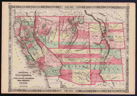
Wheeler survey map of eastern California and Western Nevada, Atlas sheets 40 7B and 40 7D, by Wheeler, U.S. Army, under the direction of Brig. Gen. A Humphreys, chief of engineers, US Army based on the expeditions of 1876 and 1877. 1 inch equals 4 miles, folded in several places, cloth backed. 34 inches tall 22 1/4 inches wide. This important map is essentially the first regional survey of the area extending from approximately 39? latitude north to 40 to 50 N. to 40? 40 minutes latitude, otherwise commonly the southern edge of Lake Tahoe North well past Honey Lake. The map shows all of the old and new routes including the old Overland Road, in and out of the Comstock, shows the central Pacific railroad and the Virginia and Truckee railroad routes and all the small communities throughout this entire map region. Rare, some foxing. California
Buyer's Premium
- 25%
Wheeler Survey Map of Eastern California and Western Nevada, 1877 [178904]
Estimate $700 - $1,000
1 bidder is watching this item.
Shipping & Pickup Options
Item located in Reno, NV, usOffers In-House Shipping
Local Pickup Available
Payment
Accepts seamless payments through LiveAuctioneers

Related Searches
TOP


![Lawson's Survey Map Upper Calif Mines, c1848 [178902]: Lawson's map from actual survey of the gold, silver and Quicksilver regions of upper California exhibiting the mines, diggings, roads, paths, houses, mills, stores, missions etc. by JT Lawson together](https://p1.liveauctioneers.com/2699/324084/174414792_1_x.jpg?height=310&quality=70&version=1711485923)


![1869 Mitchell Map of Western US [verso] Mexico and: Title: 1869 Mitchell Map of Western US [verso] Mexico and Central America -- XIX California, Oregon, Idaho, Utah, Nevada, Arizona and Washington [verso] XX Mexico and Central America Cartographer: S M](https://p1.liveauctioneers.com/5584/188299/94765046_1_x.jpg?height=310&quality=70&version=1608072723)


![Entrée de Norton & Détroit de Bhering. Bering Strait Norton Sound BONNE 1790 map: TITLE/CONTENT OF MAP: [Cook 3e Voyage] Carte de l'entrée de Norton et du Détroit de Bhering, où l'on voit le Cap le plus Oriental de l'Asie et la pointe la plus Occidentale de l'Amé](https://p1.liveauctioneers.com/5584/326888/175994368_1_x.jpg?height=310&quality=70&version=1713903186)
![Entrée de Norton & Détroit de Bhering. Bering Strait Norton Sound BONNE 1788 map: TITLE/CONTENT OF MAP: [Cook 3e Voyage] Carte de l'entrée de Norton et du Détroit de Bhering, où l'on voit le Cap le plus Oriental de l'Asie et la pointe la plus Occidentale de l'Amé](https://p1.liveauctioneers.com/5584/326888/175994363_1_x.jpg?height=310&quality=70&version=1713903186)


