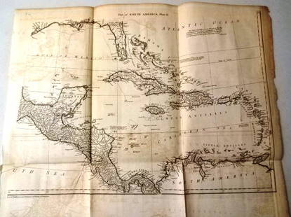
Cary map of North America 1806
Similar Sale History
View More Items in CollectiblesRelated Collectibles
More Items in Collectibles
View More


Item Details
Description
Heading: (North America)
Author: Cary, John
Title: A New Map of North America from the Latest Authorities
Place Published: London
Publisher:
Date Published: 1806
Description:
Author: Cary, John
Title: A New Map of North America from the Latest Authorities
Place Published: London
Publisher:
Date Published: 1806
Description:
Copper-engraved map, hand-colored. 46x51.6 cm. (18x20¼").
Significant map demonstrating the limited knowledge of the American West just prior to the publication of the findings from the expedition of Lewis & Clark. The United States is confined to the region east of the Mississippi River excluding eastern Florida. The west is shown mostly empty with ill-defined political boundaries, and the Rockies named the Stony Mountains. Western Canada is well developed from information gleaned from fur-traders and the Mackenzie expedition. The course of the Missouri River ends at the Pawnee village near "Villages of the tall Indians and Mandans."
Condition
Some minor discoloration and offset; very good.
Buyer's Premium
- 23%
Cary map of North America 1806
Estimate $300 - $500
3 bidders are watching this item.
Shipping & Pickup Options
Item located in San Francisco, CA, usSee Policy for Shipping
Payment

Related Searches
TOP


![CARY, JOHN. A New Map of North America. [and] A New Map of America.: CARY, JOHN. A New Map of North America. [and] A New Map of America. Together two engraved maps of the western hemisphere. 22x25½ inches each sheet size, wide margins; nice original hand-color in](https://p1.liveauctioneers.com/199/251723/130782287_1_x.jpg?height=310&quality=70&version=1655133895)


![A block puzzle with maps of Europe, England, Ireland, Scotland, America and the World: [BLOCK PUZZLE] Boxed set of 20 cubical blocks, each face with a portion of one of six hand-colored lithographed maps. Probably Irish: mid-nineteenth century. Blocks overall 7 5/8 x 6 1/4 inches (19.5](https://p1.liveauctioneers.com/292/330597/178279620_1_x.jpg?height=310&quality=70&version=1716409282)


![[CIVIL WAR]. [BELL, William H., photographer]. CDV of a wounded soldier identified as Private George: [CIVIL WAR]. [BELL, William H., photographer]. CDV of a wounded soldier identified as Private George Ruoss, 7th New York Veteran Infantry, featured naked below the waist. CDV on cardstock mount (light](https://p1.liveauctioneers.com/197/329785/177758300_1_x.jpg?height=310&quality=70&version=1715625218)


