
No upcoming results for "1754-colonies-map"
But we've sold 237 before. Follow this search to get notified as soon as more arrive.


You May Also Like

$40

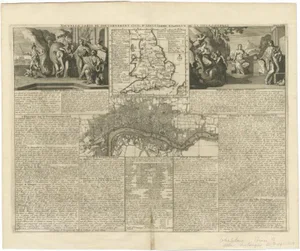
![1754 MAP of LONDON antique ALDERSGATE WARD: Title: 1754 MAP of LONDON antique ALDERSGATE WARD Description: ALDERSGATE WARD with its divisions into precincts and parishes [London; 1754] Copper engraving Size (including margins): 10 by 16 inches](https://p1.liveauctioneers.com/5584/422081/234946885_1_x.jpg?height=310&quality=70&version=1781894006)

![Carte du Mexique'. Central Mexico. BELLIN 1754 old antique map plan chart: Title: Carte du Mexique'. Central Mexico. BELLIN 1754 old antique map plan chart Description: Carte du Mexique [Map of Mexico] by Bellin, Jacques-Nicolas. Published 1754. Antique copperplate map. Size](https://p1.liveauctioneers.com/5584/420288/233830539_1_x.jpg?height=310&quality=70&version=1781102527)

![[FRENCH & INDIAN WAR] 1754 Gov. Shirley Doc re: French Fort: SHIRLEY WORKS TO REINFORCE BRITISH POSITIONS ON THE FRONTIER AT THE DAWN OF THE FRENCH AND INDIAN WAR Autograph document signed by Secretary of the Province Josiah Willard and Governor William](https://p1.liveauctioneers.com/7226/422185/235035067_1_x.jpg?height=310&quality=70&version=1781916990)
$100

$100


Similar Items on
Explore similar finds from our sister marketplace, Chairish

237 past auction results for "1754-colonies-map"
Browse a record of outcomes from past auctions, including sale prices and unsold items.
Loon EstatesSaint Paul, MN

Orange County Estate LiquidatorsOtisville, NY

Royal Treasures Warehouse LLCPort Saint Lucie, FL

Albion AuctionsChesterfield, Derbyshire

Hunt and Peck Estate Services, Inc.Luray, VA

Jasper52New York, NY

Jasper52New York, NY

Jasper52New York, NY

Hilliard & Co.Madison, VA

Stuart KingstonRehoboth Beach, DE

Jasper52New York, NY
![The West Indies and Central America. Jamaica & Caribbean. LOWRY 1860 old map: CAPTION PRINTED BELOW PICTURE: The West Indies and Central America [Showing the Colonies in possession of the various European Powers; with enlarged map Of] Jamaica DATE PRINTED: 1860 IMAGE SIZE: Appr](https://p1.liveauctioneers.com/5584/316569/169897385_1_x.jpg?height=280&quality=70&sharpen=true&version=1706046386&width=280)
Jasper52New York, NY

Albion AuctionsChesterfield, Derbyshire

Jasper52New York, NY

Jasper52New York, NY

Arader GalleriesNew York, NY

Arader GalleriesNew York, NY

Jasper52New York, NY

Brunk AuctionsAsheville, NC

J. James Auctioneers & AppraisersPlymouth, MA

Albion AuctionsChesterfield, Derbyshire

Albion AuctionsChesterfield, Derbyshire

Albion AuctionsChesterfield, Derbyshire

Albion AuctionsChesterfield, Derbyshire
TOP