Similar Sale History
View More Items in Maps & Atlases


Item Details
Description
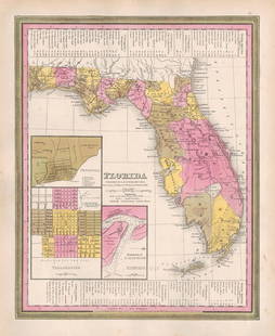
A lovely and scarce first printing of Mitchell’s 1846 map of South Carolina from the Antebellum Era. This interesting map shows the entirety of South Carolina as it appeared in 1846 during an era of rising political upheaval, eventually leading to the America Civil War. It was a time when vast and diverse infrastructure projects were being created across the landscape as states continued to deal with burgeoning populations. The 1840s was a period of great growth in South Carolina as its population rose from 595,00 in 1840 to 670,000 in 1850. The title of the map indicates this as numerous roads, railways and canals had been built across the state. By 1846, railways linked Charlestown to the capital Columbia and lines throughout the south by way of Augusta, Georgia. An inset in the lower left shows the city of Charleston, then the second busiest port in the South. A table in the lower right details the distances between several points in the state. Samuel Augustus Mitchell purchased Henry S. Tanner’s atlas publishing business in late 1845 and in early 1846 produced his first atlas, using the Tanner maps but putting on his own name and that of H. N. Burroughs, likely the map’s creator. Later that same year he dropped the Tanner borders (created by Carey & Hart) and substituted a new design, which he kept on all of his subsequent maps. Thus, the Carey & Hart first printing maps are easily identifiable, and have become quite scarce. Very clean map within the frame. Few light fox marks in the margin. Has some light toning to edges, typical of Mitchell maps of this era. 11.25 x 14
Reserve: $210.00
Shipping:Domestic: Flat-rate of $6.00 to anywhere within the contiguous U.S. International: Foreign shipping rates are determined by destination. International shipping may be subject to VAT. Combined shipping: Please ask about combined shipping for multiple lots before bidding. Location: This item ships from Ohio
Your purchase is protected:
Photos, descriptions, and estimates were prepared with the utmost care by a fully certified expert and appraiser. All items in this sale are guaranteed authentic.
In the rare event that the item did not conform to the lot description in the sale, Jasper52 specialists are here to help. Buyers may return the item for a full refund provided you notify Jasper52 within 5 days of receiving the item.
Reserve: $210.00
Shipping:
Your purchase is protected:
Photos, descriptions, and estimates were prepared with the utmost care by a fully certified expert and appraiser. All items in this sale are guaranteed authentic.
In the rare event that the item did not conform to the lot description in the sale, Jasper52 specialists are here to help. Buyers may return the item for a full refund provided you notify Jasper52 within 5 days of receiving the item.
Condition
Very good
Buyer's Premium
- 15%
Scarce 1st printing of 1846 S. Carolina map w/Carey & Hart borders
$210.00
$275
1 bidder is watching this item.
Shipping & Pickup Options
Item located in Ohio, US$6 shipping in the US
Payment
Accepts seamless payments through LiveAuctioneers
See More Items From This Jasper52 Seller

TOP


![Gossage, John [SIGNED]; The Thirty-Two Inch Ruler / Map of Babylon [SIGNED TWICE - FINE COPY]: SIGNED COPY Steidl, Gottingen. 2010. Hardcover in dust jacket. First edition, first printing. First book in color by Gossage. 80 pages, 180 colour plates. Essays by John Gossage and Gerhard Steidl. SI](https://p1.liveauctioneers.com/8658/325945/175540043_1_x.jpg?height=310&quality=70&version=1712964944)


![The first map of China printed in England: [MAP - CHINA] [PURCHAS, SAMUEL]. The Map of China. [Huang Ming yitong fang uy bei lan - Comprehensive view map fo the Imperial Ming.] London: circa 1625. First and only edition, from Purchas his Pilgr](https://p1.liveauctioneers.com/292/326828/175962849_1_x.jpg?height=310&quality=70&version=1713473479)


