![MELANESIA.New Caledonia.Ponérihouen-Bourail.WW2 ROYAL NAVY INTELLIGENCE MAP 1944: TITLE/CONTENT OF MAP: 'New Caledonia : Ponérihouen-Bourail based on official sources' DATE PRINTED: 1944 IMAGE SIZE: Approx 16.0 x 11.0cm, 6.25 x 4.25 inches (Small) TYPE: Vintage Second World Wa](https://p1.liveauctioneers.com/5584/332711/179480040_1_x.jpg?height=310&quality=70&version=1718142737)
![](https://p1.liveauctioneers.com/6667/334167/180576045_1_x.jpg?height=104&quality=70&version=1718993103&width=104)
![](https://p1.liveauctioneers.com/6667/334167/180576043_1_x.jpg?height=104&quality=70&version=1718993103&width=104)
![](https://p1.liveauctioneers.com/6667/334167/180576047_1_x.jpg?height=104&quality=70&version=1719266246&width=104)
![MELANESIA.New Caledonia.Ponérihouen-Bourail.WW2 ROYAL NAVY INTELLIGENCE MAP 1944: TITLE/CONTENT OF MAP: 'New Caledonia : Ponérihouen-Bourail based on official sources' DATE PRINTED: 1944 IMAGE SIZE: Approx 16.0 x 11.0cm, 6.25 x 4.25 inches (Small) TYPE: Vintage Second World Wa](https://p1.liveauctioneers.com/5584/332711/179480040_1_x.jpg?height=310&quality=70&version=1718142737)
![MELANESIA. New Caledonia. Pam-Ouaco. WW2 ROYAL NAVY INTELLIGENCE MAP 1944: TITLE/CONTENT OF MAP: 'New Caledonia : Pam-Ouaco based on official sources' DATE PRINTED: 1944 IMAGE SIZE: Approx 16.5 x 11.0cm, 6.5 x 4.5 inches (Small) TYPE: Vintage Second World War British Naval I](https://p1.liveauctioneers.com/5584/332711/179479996_1_x.jpg?height=310&quality=70&version=1718142737)
![World War 2. Guadalcanal Campaign 7-8 Aug 1942 Tulagi Landing Schedule 1959 map: CAPTION PRINTED BELOW PICTURE: 'The War with Japan - Guadalcanal Campaign - Landing Schedule and Operations in the Tulagi area, 7-8 August 1942' DATE PRINTED: 1959 IMAGE SIZE: Approx 25.0 x 33.0cm, 9.](https://p1.liveauctioneers.com/5584/332711/179480218_1_x.jpg?height=310&quality=70&version=1718142737)
![Gray's New Map of the United States: Title:Gray's New Map of the United States Publication Date: 1879 Cartographer:GRAY, FRANK A. Publisher: O.W. GRAY & SON Height: 15.5 Width: 26.9 Map showing entire U.S. as today, except for Dakota not](https://p1.liveauctioneers.com/5584/331526/178834532_1_x.jpg?height=310&quality=70&version=1717530687)
![1863 Johnson Chart of Local Times Globally and Distances from Washington: Title: 1863 Johnson Chart of Local Times Globally and Distances from Washington Cartographer: Johnson and Ward Year / Place: 1863, New York Map Dimension (in.): 15 X 13 in. This chart shows the time d](https://p1.liveauctioneers.com/5584/331526/178834587_1_x.jpg?height=310&quality=70&version=1717530687)
![Large Map of Alaska: Large Map of Alaska With map of Washington and Oregon [separately] on versos Cartographer: George Franklin Cram Dated: Circa 1900 Type: Color Lithograph Dimensions: 14](https://p1.liveauctioneers.com/5614/330257/178045317_1_x.jpg?height=310&quality=70&version=1716032806)
![Large Map of Yellowstone National Park: Large Map of Yellowstone National Park (Wyoming) With map of Idaho on verso Cartographer: George Franklin Cram Dated: Circa 1900 Type: Color Lithograph Dimensions: 14 1/](https://p1.liveauctioneers.com/5614/330257/178045316_1_x.jpg?height=310&quality=70&version=1716032806)
![A Pictorial Map of Florida by George D. Way 1951 old vintage plan chart: CAPTION PRINTED BELOW PICTURE: 'A Pictorial Map of Florida' A whimsical 1951 pictorial map of Florida drawn & illustrated by George D. Way. The map illustrates Florida's natural resources, wildlife an](https://p1.liveauctioneers.com/5584/332390/179263277_1_x.jpg?height=310&quality=70&version=1717528223)
![Third Battle of Ypres 1917 Map: Third Battle of Ypres - Summer and Autumn 1917 World War I One. Linen backed. Map 4 - Ordnance Survey - Large Map with Scale Publisher British Dated: 1919 Type: Colored Miltary Move](https://p1.liveauctioneers.com/5614/330257/178041417_1_x.jpg?height=310&quality=70&version=1716032806)
![Battle of Cambrai - Nov. Dec. 1917 Map: Battle of Cambrai - November December 1917 World War I One. Linen backed. Map 5 - Ordnance Survey - Large Map with Scale Publisher British Dated: 1919 Type: Colored Miltary Movemen](https://p1.liveauctioneers.com/5614/330257/178041415_1_x.jpg?height=310&quality=70&version=1716032806)
![German Offensive On the Somme - March 1916 Map: German Offensive On the Somme - March 1916 World War I One. Linen backed. Map 6 - Ordnance Survey - Large Map with Scale Publisher British Dated: 1919 Type: Colored Miltary Movement](https://p1.liveauctioneers.com/5614/330257/178041414_1_x.jpg?height=310&quality=70&version=1716032806)
![Descrittione… Santa Croce Mondo Nuovo PORCACCHI North America New World 1590 map: CAPTION PRINTED BELOW PICTURE: Descrittione dell' Isola et Terra di Santa Croce, overo Mondo Nuovo [Description of North America or the New World] DATE PRINTED: 1590 IMAGE SIZE: Approx 20.5 x 29.5cm,](https://p1.liveauctioneers.com/5584/332390/179262957_1_x.jpg?height=310&quality=70&version=1717528223)
![World War 2. Guadalcanal Campaign 7-8 Aug 1942 Landing. Henderson Field 1959 map: CAPTION PRINTED BELOW PICTURE: 'The War with Japan - Guadalcanal Campaign - Initial Landings and Capture of Henderson Field, 7-8 August 1942' DATE PRINTED: 1959 IMAGE SIZE: Approx 25.0 x 33.0cm, 9.75](https://p1.liveauctioneers.com/5584/332711/179480176_1_x.jpg?height=310&quality=70&version=1718142737)
![1834 Malte-Brun Map of Denmark -- Denmark: Title: 1834 Malte-Brun Map of Denmark -- Denmark Cartographer: M. Malte-Brun / S. Walker Year / Place: 1834, Boston Map Dimension (in.): 9.3 x 7.5 in. An attractive and highly detailed map with topogr](https://p1.liveauctioneers.com/5584/332709/179479062_1_x.jpg?height=310&quality=70&version=1718142738)
![1872 Asher and Adams Map of Minnesota -- Asher & Adams' Minnesota: Title: 1872 Asher and Adams Map of Minnesota -- Asher & Adams' Minnesota Cartographer: Asher & Adams Year / Place: 1872 New York Map Dimension (in.): 22.2 X 15.8 in. A very nice, large map of Minnesot](https://p1.liveauctioneers.com/5584/332709/179478794_1_x.jpg?height=310&quality=70&version=1718142738)
![1875 Balkans with Greece, By Hardesty: Title: 1875 Balkans with Greece, By Hardesty Date/Period: 1875 Materials: Hand color, steel engraving Size: 19 1/2 x 14” Balkans and Greece. 1875 map from H.H. Hardesty's 'Historical Atlas of th](https://p1.liveauctioneers.com/5584/331526/178834522_1_x.jpg?height=310&quality=70&version=1717530687)
![1875 Germany by Hardesty: Title: 1875 Germany by Hardesty Date/Period: 1875 Materials: Hand color, steel engraving Size: 19 1/2 x 26” 1875 map by H.H. Hardesty from the 'Historical Atlas of the World Illustrated', which](https://p1.liveauctioneers.com/5584/331526/178834507_1_x.jpg?height=310&quality=70&version=1717530687)
![Siam and the Malay Archipelago: Title: Siam and the Malay Archipelago Publication Date: 1911 Cartographer: COLLIER, PETER FENELON Publisher: P.F.COLLIER & SON Height: 9.1 Width: 14.25 Page 84 from their World atlas and gazetteer. Re](https://p1.liveauctioneers.com/5584/332709/179478868_1_x.jpg?height=310&quality=70&version=1718142738)
![1863 Johnson Map of the World Illustrating Land, Co-tidal Lines and Ocean Currents and River Systems: Title: 1863 Johnson Map of the World Illustrating Land, Co-tidal Lines and Ocean Currents and River Systems Cartographer: Johnson and Ward Year / Place: 1863, New York Map Dimension (in.): 14.8 X 9.8](https://p1.liveauctioneers.com/5584/331526/178834545_1_x.jpg?height=310&quality=70&version=1717530687)
![1875, New York State with insert of Long Island by Hardesty: Title: 1875, New York State with insert of Long Island by Hardesty Date/Period: 1875 Materials: Hand color, steel engraving Size: 19 1/2 x 26” 1875 map from H.H. Hardesty's 'Historical Atlas of](https://p1.liveauctioneers.com/5584/331526/178834569_1_x.jpg?height=310&quality=70&version=1717530687)
![1767 London Magazine Map of "Breadstreet Ward and Cordwainers Ward?": Title: 1767 London Magazine Map of "Breadstreet Ward and Cordwainers Ward?" Cartographer: London Magazine Year / Place: 1767 c., London Map Dimension (in.): 9.3 X 14. 2 in. This is an excellent and hi](https://p1.liveauctioneers.com/5584/331526/178834564_1_x.jpg?height=310&quality=70&version=1717530687)
![1684 Mallet Maps of the World Over Time -- Carte du Monde de Marc Paul [on sheet with] Carte du: Title: 1684 Mallet Maps of the World Over Time -- Carte du Monde de Marc Paul [on sheet with] Carte du Monde de Iacques Castaldo [and] Carte du Monde de Miguel Lopez Cartographer: A Mallet Year / Plac](https://p1.liveauctioneers.com/5584/331526/178834558_1_x.jpg?height=310&quality=70&version=1717530687)
![The German Retreat to the Hindenburg Line 1916 Map: The German Retreat to the Hindenburg Line 1916 - 1917 World War I One. Linen backed. Map 2 - Ordnance Survey - Large Map with Scale Publisher British Dated: 1919 Type: Colored Milta](https://p1.liveauctioneers.com/5614/330257/178041412_1_x.jpg?height=310&quality=70&version=1716032806)
![1817 3 VOYAGES of CAPTAIN COOK 6 vols ILLUSTRATED w/ WORLD MAP antique in FRENCH: Laharpe, J.-F., Abrege des trois voyages du Capitaine Cook, precede d'un extrait des voyages de Byron, Wall, Carteret et Bougainville, autour du monde. (Abridged from the three voyages of Captain Cook](https://p1.liveauctioneers.com/5584/331539/178838407_1_x.jpg?height=310&quality=70&version=1717530554)
News about Sports Memorabilia
![Historic maps and atlases chart course to Swann Dec. 7](https://www.liveauctioneers.com/news/wp-content/uploads/2023/11/165833907_1_x.webp)
Historic maps and atlases chart course to Swann Dec. 7
[av_heading heading=’Historic maps and atlases chart course to Swann Dec. 7′ tag=’h1′ style=” subheading_active=” show_icon=” icon=’ue800′ font=’entypo-fontello’ size=” av-desktop-font-size-title=” av-medium-font-size-title=” av-small-font-size-title=” av-mini-font-size-title=” subheading_size=” av-desktop-font-size=” av-medium-font-size=” av-small-font-size=” av-mini-font-size=” icon_size=” av-desktop-font-size-1=” av-medium-font-size-1=” av-small-font-size-1=” av-mini-font-size-1=” color=” custom_font=” subheading_color=” seperator_color=” icon_color=” margin=’,,35px,’ av-desktop-margin=” av-desktop-margin_sync=’true’ av-medium-margin=” av-medium-margin_sync=’true’ av-small-margin=’,,20px,’ av-mini-margin=” av-mini-margin_sync=’true’ headline_padding=” headline_padding_sync=’true’ av-desktop-headline_padding=” av-desktop-headline_padding_sync=’true’ av-medium-headline_padding=” av-medium-headline_padding_sync=’true’ av-small-headline_padding=” av-small-headline_padding_sync=’true’ av-mini-headline_padding=” av-mini-headline_padding_sync=’true’ […]
![Celebration of Scottish engineering on display at Lyon & Turnbull Feb. 7](https://www.liveauctioneers.com/news/wp-content/uploads/2024/01/Screenshot-2024-01-25-at-9.14.33 AM.png)
Celebration of Scottish engineering on display at Lyon & Turnbull Feb. 7
EDINBURGH – A cache of material from a well-known Scottish engineering dynasty will be offered at Lyon & Turnbull. The Rare Books, Manuscripts, Maps & Photographs auction on Wednesday, February 7 includes 50 lots from the Stevenson family – designers across four generations of many of the U.K.’s lighthouses. Absentee and Internet live bidding will […]
![Dickens & Twain set world records at Potter & Potter Aug. 28](https://www.liveauctioneers.com/news/wp-content/uploads/2021/09/395-1.jpg)
Dickens & Twain set world records at Potter & Potter Aug. 28
CHICAGO – Potter and Potter‘s spectacular August 28 Fine Books and Manuscripts Sale was the company’s highest-grossing auction to date. After a day of spirited bidding, 107 lots realized between $1,000-4,999; 22 lots realized between $5,000-9,999; and 16 lots broke the five digit mark.
![Jasper52 vintage map auction Nov. 5 going global](https://www.liveauctioneers.com/news/wp-content/uploads/2019/10/77325761_3_x.jpg)
Jasper52 vintage map auction Nov. 5 going global
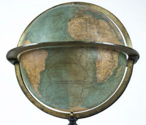
NEW YORK – A 19th century French terrestrial globe tops an auction of vintage maps that will be conducted by Jasper52 on Tuesday, Nov. 5. Fifteen globes and more than 130 maps and atlases are offered in the online auction. Bid absentee or live online exclusively through LiveAuctioneers.