![Map of the Railroad System of the Central Railroad and Banking Co. Of Georgia: Title: Map of the Railroad System of the Central Railroad and Banking Co. Of Georgia Publication Date: 1889-01-01 Cartographer: ANONYMOUS Publisher: POOR'S ? Height: 6.75 Width: 11 From the Investors'](https://p1.liveauctioneers.com/5584/332709/179478725_1_x.jpg?height=310&quality=70&version=1718142738)
Maps & Atlases
![Map of the Railroad System of the Central Railroad and Banking Co. Of Georgia: Title: Map of the Railroad System of the Central Railroad and Banking Co. Of Georgia Publication Date: 1889-01-01 Cartographer: ANONYMOUS Publisher: POOR'S ? Height: 6.75 Width: 11 From the Investors'](https://p1.liveauctioneers.com/5584/332709/179478725_1_x.jpg?height=310&quality=70&version=1718142738)
![Two Framed Maps Of Europe & Asia: Two Framed Maps Of Europe & Asia. As framed approximately 28.75W x 24.25H in. 26.25W x 22.75H in.](https://p1.liveauctioneers.com/5686/332436/179285571_1_x.jpg?height=310&quality=70&version=1717550414)
![c. 1640 Hand-Coloured Map of Cadore: Amsterdam, c.1640, French edition. Coloured. 385 x 500mm. map of Cadore, with fine cartouches for the title and scale, and the arms of Venice, lion. Page measures approx 23" x 19 1/2" Fair c](https://p1.liveauctioneers.com/7899/330448/178179037_1_x.jpg?height=310&quality=70&version=1716300571)
![4 ENGRAVINGS OF MAPS OF FLORIDA, REEFS & GULFSTREAM: This group of original engravings include: a small sketch of the survey of the Coast of Florida and Cedar Key Bay; a chart of St. Andrews Bay; A costal survey of the Florida Reefs; and a large Sketch](https://p1.liveauctioneers.com/6087/332305/179222960_1_x.jpg?height=310&quality=70&version=1717439546)
![2 ENGRAVING OF SURVEY'S OF FARALLON IS & HUDSON RIVER, NY: This group includes three antique engravings: one small map of South Farallon Island with illustrations of the island's topography. Engraved by G.B. Metzeroth & A. Peterson. Dimensions: 14.5"L x 15.5"](https://p1.liveauctioneers.com/6087/332305/179222957_1_x.jpg?height=310&quality=70&version=1717439546)
![NATIONAL BOHEMIA BEER MAP & 2 PLACE MATS: ~](https://p1.liveauctioneers.com/7573/333258/179912635_1_x.jpg?height=310&quality=70&version=1718304971)
![Audubon Natural History Maps - Arader Galleries: Audubon Maps Views Rare Books and Natural History Works on Paper - Arader Galleries Illustrations: Color Photos Dated: March 31, 2018 Pages: 53 Edition: First Edition Si](https://p1.liveauctioneers.com/5614/330257/178041263_1_x.jpg?height=310&quality=70&version=1716032806)
![Map of Livingston New York Lot: Lot including framed reprint map of Livingston New York (overall 17 1/2" x 22 1/2"), and fish print (overall 25" x 19").](https://p1.liveauctioneers.com/1122/332252/179211109_1_x.jpg?height=310&quality=70&version=1717432170)
![1863 Johnson Map of India and Southeast Asia -- Johnson's Hindostan or British India: Title: 1863 Johnson Map of India and Southeast Asia -- Johnson's Hindostan or British India Cartographer: Johnson & Ward Year / Place: 1863, New York Map Dimension (in.): 12.5 X 15.7 in. This is an ex](https://p1.liveauctioneers.com/5584/332709/179478731_1_x.jpg?height=310&quality=70&version=1718142738)
![Map of Colorado: Map of Colorado Dimensions: 10 x 13" Condition Report Good. Center fold as issued. Text on verso. Subject References: BL1830](https://p1.liveauctioneers.com/5614/330257/178045199_1_x.jpg?height=310&quality=70&version=1716032806)
![Map 1843 - First Settlement of 13 Colonies: Map 1843 - Showing the Dates of the First Settlements of the old 13 Colonies of the United States Map No. 11 Dated: Circa 1840 Dimensions: 6 x 4" Condition Report Toning. Rounded](https://p1.liveauctioneers.com/5614/330257/178041325_1_x.jpg?height=310&quality=70&version=1716032806)
![Map of 1763 From the Delawares to Canada: Map of 1763 From the Delawares to Canada Map No. 7 Dated: Circa 1840 Dimensions: 6 x 4" Condition Report Toning. Rounded left tips. Good Subject References: 220](https://p1.liveauctioneers.com/5614/330257/178041321_1_x.jpg?height=310&quality=70&version=1716032806)
![Map of 1733 From Georgia to Maine: Map of 1733 From Georgia to Maine Map No. 6 Dated: Circa 1840 Dimensions: 6 x 4" Condition Report Toning. Rounded left tips. Good Subject References: 220](https://p1.liveauctioneers.com/5614/330257/178041320_1_x.jpg?height=310&quality=70&version=1716032806)
![Map of Warren County, Pennsylvania, Early 19th C: Description: Map of Warren County, Pennsylvania, Early 19th C, inscribed on verso 'William West 300 acres Warren County PA,' with hand-drawn map and various inscriptions, likely early 19th centur](https://p1.liveauctioneers.com/4098/332502/179395379_1_x.jpg?height=310&quality=70&version=1717710292)
![Johnson's New Map of the State of Texas: Title: Johnson's New Map of the State of Texas Publication Date: 1862 Cartographer: JOHNSON, ALVIN JEWETT Publisher: JOHNSON AND WARD Height: 16.3 Width: 23.5 43.-44.Inset plan of Sabine Lake and Galv](https://p1.liveauctioneers.com/5584/332709/179478675_1_x.jpg?height=310&quality=70&version=1718142738)
![Ortelius Map of Portugal: ORTELIUS, Abraham (1547-1598). Portugalliae que olim Lisitania... Engraved map with original hand color. Antwerp, 1595. 17" x 21" sheet.](https://p1.liveauctioneers.com/1968/330639/178336639_1_x.jpg?height=310&quality=70&version=1716827770)
![Hand colored Map of Chicago & St. Louis: Map of Chicago, Illinois & St. Louis, Missouri Depicts railroad lines, common roads, canals, topography, etc. A beautiful & rare map. Cartographer: O. W. Gray Dated: Circa 1870 Type](https://p1.liveauctioneers.com/5614/330257/178041210_1_x.jpg?height=310&quality=70&version=1716032806)
![Jeffery's Map of the St. Laurence River Canada: JEFFERYS, Thomas (c. 1719-1771). An exact chart of the River St. Laurence, from Fort Frontenac to the Island of Anticosi... Engraved map with original hand color in outline. London: Sayer & Bennett, 1](https://p1.liveauctioneers.com/1968/330639/178336654_1_x.jpg?height=310&quality=70&version=1717781318)
![J. H. Colton Map of Mexico 1862: COLTON, J.H. (1800-1893). Nueva Mapa de Mejico / Colton's Map of Mexico, showing part of the United States... Lithographed map with original hand color. New York: J.H. Colton, 1862. 32 1/2" x 41 1/2"](https://p1.liveauctioneers.com/1968/330639/178336689_1_x.jpg?height=310&quality=70&version=1716827770)
![Group of Virginia Maps and Tourist Guides: all in fair to good condition](https://p1.liveauctioneers.com/3324/329920/177882979_1_x.jpg?height=310&quality=70&version=1715720689)
![CARL ROSE (1903-1971) Greenwich Village Street Maps and Landmarks.: CARL ROSE (1903-1971) Greenwich Village Street Maps and Landmarks. Ink on board; 30 x 20 inches. Illustration for an unidentified publication containing twenty-three smaller separate drawings related](https://p1.liveauctioneers.com/199/333055/179796916_1_x.jpg?height=310&quality=70&version=1718136712)
![French printing of large Jefferys map of New England 1777: Heading: (New England) Author: Le Rouge, Georges-Louis, publisher Title: A map of the most inhabited part of New England, containing the provinces of Massachusetts Bay and New Hampshire with the colon](https://p1.liveauctioneers.com/642/332628/179408759_1_x.jpg?height=310&quality=70&version=1717729056)
![Maps of the Miami Canal and Spring Grove, Avondale & Cincinnati Railway Deed: America, 19th century. A pair of maps detailing the Miami Canal and right of way for the railroad. 433](https://p1.liveauctioneers.com/7899/330448/178178959_1_x.jpg?height=310&quality=70&version=1716300571)
![(2) Maps / Blueprints of 1993 Indy Motor Speedway: (2) Maps / Blueprints of the 1993 Indianapolis Motor Speedway. One has some tearing on the top left, both have some creasing, discoloration, and wear from storage / display. Measures approximatley 24"](https://p1.liveauctioneers.com/1395/332888/179697952_1_x.jpg?height=310&quality=70&version=1717988359)
News about Maps & Atlases
![Historic maps and atlases chart course to Swann Dec. 7](https://www.liveauctioneers.com/news/wp-content/uploads/2023/11/165833907_1_x.webp)
Historic maps and atlases chart course to Swann Dec. 7
[av_heading heading=’Historic maps and atlases chart course to Swann Dec. 7′ tag=’h1′ style=” subheading_active=” show_icon=” icon=’ue800′ font=’entypo-fontello’ size=” av-desktop-font-size-title=” av-medium-font-size-title=” av-small-font-size-title=” av-mini-font-size-title=” subheading_size=” av-desktop-font-size=” av-medium-font-size=” av-small-font-size=” av-mini-font-size=” icon_size=” av-desktop-font-size-1=” av-medium-font-size-1=” av-small-font-size-1=” av-mini-font-size-1=” color=” custom_font=” subheading_color=” seperator_color=” icon_color=” margin=’,,35px,’ av-desktop-margin=” av-desktop-margin_sync=’true’ av-medium-margin=” av-medium-margin_sync=’true’ av-small-margin=’,,20px,’ av-mini-margin=” av-mini-margin_sync=’true’ headline_padding=” headline_padding_sync=’true’ av-desktop-headline_padding=” av-desktop-headline_padding_sync=’true’ av-medium-headline_padding=” av-medium-headline_padding_sync=’true’ av-small-headline_padding=” av-small-headline_padding_sync=’true’ av-mini-headline_padding=” av-mini-headline_padding_sync=’true’ […]
![Celebration of Scottish engineering on display at Lyon & Turnbull Feb. 7](https://www.liveauctioneers.com/news/wp-content/uploads/2024/01/Screenshot-2024-01-25-at-9.14.33 AM.png)
Celebration of Scottish engineering on display at Lyon & Turnbull Feb. 7
EDINBURGH – A cache of material from a well-known Scottish engineering dynasty will be offered at Lyon & Turnbull. The Rare Books, Manuscripts, Maps & Photographs auction on Wednesday, February 7 includes 50 lots from the Stevenson family – designers across four generations of many of the U.K.’s lighthouses. Absentee and Internet live bidding will […]
![Dickens & Twain set world records at Potter & Potter Aug. 28](https://www.liveauctioneers.com/news/wp-content/uploads/2021/09/395-1.jpg)
Dickens & Twain set world records at Potter & Potter Aug. 28
CHICAGO – Potter and Potter‘s spectacular August 28 Fine Books and Manuscripts Sale was the company’s highest-grossing auction to date. After a day of spirited bidding, 107 lots realized between $1,000-4,999; 22 lots realized between $5,000-9,999; and 16 lots broke the five digit mark.
![Jasper52 vintage map auction Nov. 5 going global](https://www.liveauctioneers.com/news/wp-content/uploads/2019/10/77325761_3_x.jpg)
Jasper52 vintage map auction Nov. 5 going global
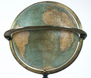
NEW YORK – A 19th century French terrestrial globe tops an auction of vintage maps that will be conducted by Jasper52 on Tuesday, Nov. 5. Fifteen globes and more than 130 maps and atlases are offered in the online auction. Bid absentee or live online exclusively through LiveAuctioneers.