Sold20231818 BRAZIL Koster Voyages in South America MAPS Portuguese History SLAVERY 2v1818 BRAZIL Koster Voyages in South America MAPS Portuguese History SLAVERY 2v Henry Koster was an early 19th-century English explorer known for his, albeit short, life in Brazil. While there, KosterSee Sold Price
Sold20191780 VOYAGES South America Guiana Guyana BRAZIL Panama1780 VOYAGES South America Guiana Guyana BRAZIL Panama Palikur Indians The best book of its kind! A rare book La Harpe’s ‘General History of Voyages’! This extensive work was begun by La Harpe,See Sold Price
Sold20191764 George Anson Voyage Round the World MAPS South1764 George Anson Voyage Round the World MAPS South America Brazil Peru Chile George Anson was an 18th-century British Navy admiral who is noted for his important world voyage in which he circumnavigaSee Sold Price
Sold2023c 1706 Pieter Van Der Aa North + South America Map as 1st Discovered by ColumbusHistoric Maps 1706 North & South America Map Discovered by Columbus First Voyage Published by Dutch Map Pieter Van Der Aa (1659-1733) c. 1706-1708, Original Map of North & South America (translated) tSee Sold Price
Sold20201761 George Anson Voyage Round the World MAPS Spain1761 George Anson Voyage Round the World MAPS Spain South America Brazil Peru George Anson was an 18th-century British Navy admiral who is noted for his important world voyage in which he circumnavigaSee Sold Price
Sold20201762 George Anson VOYAGE Round the World MAPS Spain1762 George Anson VOYAGE Round the World MAPS Spain South America Brazil Peru George Anson was an 18th-century British Navy admiral who is noted for his important world voyage in which he circumnavigaSee Sold Price
Sold20221749 George Anson Voyage Round the WorldMAPS Spain South America Brazil Peru. George Anson was an 18th-century British Navy admiral who is noted for his important world voyage in which he circumnavigated the globe. This voyage, beginning inSee Sold Price
Sold20211833 VOYAGES 3 Years USA Stuart Travels Slavery South1833 VOYAGES 3 Years USA Stuart Travels Slavery South Georgia Alabama West Map James Stuart was a Scottish Lawyer, politician, and traveler who wrote the book ‘Three Years in North America’ basedSee Sold Price
Sold2018ACUÑA, Cristóbal de (1597-1676?). Voyages andACUÑA, Cristóbal de (1597-1676?). Voyages and Discoveries in South-America. London: for S. Buckley, 1698. 8vo (190 x 111 mm). 2 folding engraved maps; 3 title-pages. (Pale spotting.) 19th-century taSee Sold Price
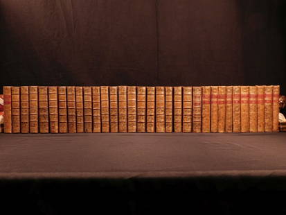
Sold20181780 1ed RARE Complete VOYAGES Maps Captain Cook Americ1780 1ed RARE Complete VOYAGES Maps Captain Cook America Explorers Africa 32v The best book of its kind! An extremely rare, 32-volume complete set of La Harpe’s ‘General History of Voyages’! ThiSee Sold Price
Sold2022South America.- Frézier (Amédée François) Relation du voyage de la Mer du SudSouth America.- Frézier (Amédée François) Relation du voyage de la Mer du Sud aux côtes du Chily et du Perou, second edition, half-title, 37 engraved maps and plates, many folSee Sold Price
Sold20221818 Map I Stati Uniti Nell America SettentrionaleHistoric Maps 1818 Rare Map Titled "I Stati Uniti Nell' America Settentrionale" by A.B. Borghi, Florence, Italy Choice Crisp Near Mint 1818-Dated, Four-Sheet Copper-Engraved, Hand-Colored Outlines, MaSee Sold Price
Sold2023Jaillot Map of South America with Exceptional ColorJAILLOT, Alexis Hubert (1632-1712). L'Amerique Meridionale. Engraved map with exceptional original color. Paris, c. 1691. 24 3/4" x 36 1/4" sheet. Large format map of South America, based upon earlierSee Sold Price
Sold20241831 Woodbridge Map of South America and Africa -- Comparative, Geographical & Statistical Map ofTitle: 1831 Woodbridge Map of South America and Africa -- Comparative, Geographical & Statistical Map of South America & Africa Cartographer: W. Woodbridge Year / Place: 1831, Hartford Map Dimension (See Sold Price
Sold2017America, Rare Early Map of the Americas"America", Rare Early Map of the Americas by Jodocus Hondius (Flemish/Dutch, 1563-1612) for a French edition of Mercator's Atlas, North and South America, hand-colored copper engraved map, published ASee Sold Price
Sold2022De Wit, Map of North and South America, c. 1720Property of a Private Collector, Hilton Head Island, SC Description: Frederick De Wit (circa 1629-1706), Nova Orbis Tabula In Lucem Edita, A.F. De Wit, Amsterdam: Covens and Mortier, c. 1720, publSee Sold Price
Sold2015Munster. TABULA NOVARUM INSULARUM... [c. 1558-59.][Munster, Sebastian] TABULA NOVARUM INSULARUM, QUAS DIVERSIS RESPECTIBUS OCCIDENTALES & INDIANAS UOCANT. Double-page woodcut map of North and South America by Sebastian Munster. First cut in 1540, thiSee Sold Price
Sold2022(AMERICAS.) Sebastian Münster. Die Neuwen Inseln. So Hinder Hispanien Gegeu Orient Bey Dem Land(AMERICAS.) Sebastian Münster. Die Neuwen Inseln. So Hinder Hispanien Gegeu Orient Bey Dem Land India Ligen. Hand-colored double-page woodcut map of North and South America. 12x15 inches sheet siSee Sold Price
Sold2016Brazil Prince Regent Joao Silver MedalBrazil 1809 Prince Regent Joao silver medal. Capture of Cayenne (the lone French colonial outpost in South America) silver medal, by Pidgeon, DPA #329, C #16, measures approximately 2 inches in diametSee Sold Price
Sold2020(COLONIAL SOUTH AMERICA.) Ottens, Reinier & Josua.(COLONIAL SOUTH AMERICA.) Ottens, Reinier & Josua. Nieuwe Gemeten Kaarte van de Colonie de Berbice met der Zelver Plantagien en de Namen der Bezitters in Het Ligt Gebragt Door. Large engraved map of tSee Sold Price
Sold2022Archive of approx 800 Pan-American SlidesOutstanding Archive of Approximately 800 Photographic Glass Magic Lantern slides of South America including scenes and historic views of Panama Canal, Uruguay, Brazil, Peru, Mexico, Argentina, Cuba, PSee Sold Price
Sold20231810-Dated Original Beautifully Engraved, South Carolina Society, Membership CertificateColonial America "South Carolina Society" Beautifully Engraved Certificate July 10, 1810-Dated Federal Period, Partially-Printed, "South Carolina Society" Certificate (Plate likely produced c. 1757),See Sold Price
Sold20221777 Revolutionary War Map AMERICA SEPTENTRIKONALHistoric Maps 1777 AMERICA SEPTENTRIKONALIS... Homann Heirs 1777-Dated American Revolutionary War Period, Hand-Colored Engraved Map titled, "AMERICA SEPTENTRIKONALIS...," by Homann Heirs, Nuremberg, CSee Sold Price
Sold20221782 ATLAS MAPS Expilly Geography Voyages Travel World America Asia Africa1782 ATLAS MAPS Expilly Geography Voyages Travel World America Asia Africa Jean-Joseph Expilly was an 18th-century French geography and historian who published numerous works on cosmography, history oSee Sold Price
3 days LeftHolabird Western Americana CollectionsSouth & Central America Map Lot c1800's [180163]US$100
6 days LeftWinter Associates Three historical engraved maps of the Caribbean, ranging from 1616-1814, each hand colored, framedUS$100(1 bid)
3 days LeftFreeman's | HindmanHARMON, Daniel Williams. A Journal of Voyages and Travels in the Interiour of North America. 1820.US$450(2 bids)
234 Lots AwayJasper521775-1780 French Guiana. Dutch Guiana and Northern Brazil. By Bonne and Raynal.US$20
4 days LeftSimpson Galleries, LLC.AN AMERICAN CIVIL WAR ERA ATLAS, "Johnson's New Illustrated Family Atlas of the World with PhysicalUS$300
209 Lots AwayJasper52Coin Types Issued by Various Islamic Rulers in the Indian Subcontinent By ProvostUS$25
3 days LeftFreeman's | HindmanCOOK, James, Captain. -- [SECOND VOYAGE]. A Voyage towards the South Pole, and Round the World...US$1,500
4 days LeftEarly American History Auctions1720 Colonial Northumberland County Virginia Manuscript Deed and Map PlotUS$400
Jun 28South Florida Auction & Estate Sale Services IncTITANIC First Sailing Maiden Voyage Notice PosterUS$6
5 days LeftHeartland Artifact Auctions Inc8.5/8" Mayan Blade, Translucent Chert, South America.US$40(3 bids)
5 days LeftHeartland Artifact Auctions Inc9.1/2" Pre-Colombian Jade Tirona Batwing Gorget, found in Colombia, South AmericaUS$18(3 bids)


![Munster. TABULA NOVARUM INSULARUM... [c. 1558-59.]: [Munster, Sebastian] TABULA NOVARUM INSULARUM, QUAS DIVERSIS RESPECTIBUS OCCIDENTALES & INDIANAS UOCANT. Double-page woodcut map of North and South America by Sebastian Munster. First cut in 1540, thi](https://p1.liveauctioneers.com/179/82189/42599755_1_x.jpg?height=310&quality=70&version=1447864785)


![South & Central America Map Lot c1800's [180163] (1 of 5)](https://p1.liveauctioneers.com/2699/331495/178785795_1_x.jpg?height=282&quality=70&version=1717094933)


![COOK, James, Captain. -- [SECOND VOYAGE]. A Voyage towards the South Pole, and Round the World... (1 of 2)](https://p1.liveauctioneers.com/197/329395/177650491_1_x.jpg?height=282&quality=70&version=1715364962)


