Sold2022Voyages.- Atkins (John) A Voyage to Guinea, Brasil, and the West-Indies;..., second edition, 1737.Voyages.- Atkins (John) A Voyage to Guinea, Brasil, and the West-Indies;..., second edition, printer's device to title, 6pp. advertisements at rear, p.212 and 218 soiled with ink, some light marginalSee Sold Price
Sold2022ATKINS, JOHN A Voyage to Guinea, Brasil, and the West Indies; in His Majesty's Ships the Swallow andATKINS, JOHN A Voyage to Guinea, Brasil, and the West Indies; in His Majesty's Ships the Swallow and Weymouth. Giving a Genuine Acco.. London: Ward and Chandler, 1737. Second edition. Three-quarters cSee Sold Price
Sold2021West Indies.- Speed (John) A Map of Jamaica [on sheetWest Indies.- Speed (John) A Map of Jamaica [on sheet with] Barbados, 2 maps on 1 sheet, each with decorative title cartouches, compass roses, ships and sea monsters, engravings with hand-colouring, 4See Sold Price
Sold20221796 John Reid American Map of the West Indies - by John Reid. AN ACCURATE MAP OF THE WEST INDIES1796 John Reid American Map of the West Indies - by John Reid. AN ACCURATE MAP OF THE WEST INDIES WITH THE ADJACENT COAST OF AMERICA. Engraved by D. Martin. Published in New York in "An American AtlasSee Sold Price
Sold2017West Indies Map, John Thomson, 1817Map: 'West Indies' The top image on the right hand side shows the entire map. To view a close up of the map showing the level of printed detail, please click on the bottom image on the right hand sideSee Sold Price
Sold2023EDWARDS, Bryan (1743-1800). The History, Civil and Commercial, of the British Colonies in the WestEDWARDS, Bryan (1743-1800). The History, Civil and Commercial, of the British Colonies in the West Indies. London: John Stockdale,1801. 3 volumes, 8vo (212 x 131 mm). Half-title in vol. III, engravedSee Sold Price
Sold20221646 Voyages West Indies South America Map PlatesHistorisch journael vande voyage ghedaen met ses schepen, uytghereed zijnde door de . Oost-Indische Compaignie . omme te varen door de Strate Magallanes naer de Molucques . Onder 't gebiedt van . JoriSee Sold Price
Sold2019West Indies.Title/Content of Map: West Indies. Date: 1817 Cartographer: THOMSON, JOHN & CO. Publisher: JOHN THOMSON, JUNR. & CO. Size: 19.25Height - 26.75Width No.46 from Thomson's New General Atlas 1817. Polar pSee Sold Price
Sold20201741 Rare West Indies Present War Havana St AugustineA Geographical and Historical Description of the Principal Objects of the Present War in the West-Indies..Shewing their Situation, Strength, and trade…, printed at London for T. gardner, 1741. TitleSee Sold Price
Sold2023West Indies. Caribbean islands Antilles Gulf of Mexico Florida. THOMSON 1830 mapTitle: West Indies. Caribbean islands Antilles Gulf of Mexico Florida. THOMSON 1830 map Description: West Indies' by Drawn & engraved for John Thomson's "New General Atlas" (1830). Antique early 19thSee Sold Price
Sold2023Thomson, John (Pub) 1825 Map. West Indies CaribbeanCopper Engraved Map Published 1825 by John Thomson, Edinburgh for "The Edinburgh School Atlas" by N. R. Hewitt. Maps Engraved by Hewitt. Original Outline Hand Colour. Rare. Paper Size: 10.5 x 8 inch (See Sold Price
Sold2023Walker, John C1805 Antique Map. West Indies CaribbeanCopper Engraved Map Published C1805, London for "The Universal Gazetteer: Being a Concise Description" [Walker's Geography] by John Walker. Folds as issued. Paper Size: 13.5 x 8 inch (35 x 20cm) GoodSee Sold Price
Sold2020Walker, John 1815 Antique Map of West IndiesCopper Plate Published 1815, London for "The Universal Gazetteer: Being a Concise Description" [Walker's Geography] by John Walker. Folds as issued. Paper Size: 13 x 8 inch (33 x 20cm) Minor toning/ofSee Sold Price
Sold2019Walker, John 1795 Map of The West Indies. CaribbeanCopper Engraved Map Published 1795, London for "Elements of Geography, and of Natural and Civil History" by John Walker. Folds as published. Paper Size: 14.5 x 8.5 inch (37 x 22cm) Minor toning on lefSee Sold Price
Sold2015Life and Services of General Lord Harris by LushingtonHeading: Author: Lushington, S. R. Title: The Life and Services of General Lord Harris, G.C.B., During his Campaigns in America, The West Indies, and India Place Published: London Publisher:John W. PSee Sold Price
Sold2022SHIP'S PASSPORT signed by PRESIDENT JOHN ADAMS107 Ton schooner "William and Mary" dated July 18th, 1797. Captain Samuel Briard (1762-1806) of Portsmouth, NH. The "William and Mary" mounted with no guns was active in the West Indies trade. SignedSee Sold Price
Sold20221736 COMPLETE HISTORY OF THE INQUISITION ILLUS.In Portugal, Spain, Italy the East and West Indies. by Rev. Mr. Baker, Westminster, O.Payne, 1736. 10 x 8 inches Condition: Good, toning, foxing, wear to cover, boards separatedSee Sold Price
Sold2022BOOKS ON WORLD TRAVELERS AND ADVENTURERSOur New Way Round the World by Coffin, Boston, Fields 1869, Expedition to Borneo by Keppel New York, Harper 1846, (map), Letters from the West Indies b y Hovey, New York, Gould and Newman 1838, SailorSee Sold Price
Sold2022A set of 4 photolithographs of West Indies subjects, 8.5" x 12.75", (21.5" x 32.5cm) (4).A set of 4 photolithographs of West Indies subjects, 8.5" x 12.75", (21.5" x 32.5cm) (4).See Sold Price
Sold20231792 Lt Wm Bligh A Voyage to the South Sea1792 Lt William Bligh "A Voyage to the South Sea… for the Purpose of Conveying the Bread-Fruit Tree to the West Indies in his majesty's ship The Bounty", London, 1st edition, all plates present,See Sold Price
Sold2020West Indies. Spanish galleons routes map.Title: West Indies. Spanish galleons routes map. Date/Period: 1744-1748. Materials: Copperplate engraved Dimensions: 19x16 1/4” By Emanuel Bowen. From, John Harris’s A Complete Collection of voyagSee Sold Price
Sold2019Accurate Map of the West Indies with the Adjacent CoastTitle/Content of Map: Accurate Map of the West Indies with the Adjacent Coast of America. 1796 Date: 1796 Cartographer: D. Martin Publisher: John Reid Size: 13.8Height - 17.6Width All upstate areas arSee Sold Price
Sold2024West Indies with the Harbour & Fort of Omoa from the best… JOHN LODGE 1780 mapTITLE/CONTENT OF MAP: 'West Indies, with the Harbour & Fort of Omoa. From the Best Authorities' DATE PRINTED: March 1780 IMAGE SIZE: Approx 31.5 x 66.5cm, 12.25 x 26 inches (Large); Please note that tSee Sold Price
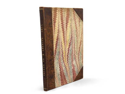
Sold2023Montule: Voyage to North America"A Voyage to North America, and the West Indies in 1817", E. Montule. First edition. London. Printed for Sir Richard Phillips and Co. 1821. 9-1/2in tall x 6in wide. | Philadelphia Metro area delivery,See Sold Price
2 days LeftJasper52WEST INDIES. Jamaica Barbados BVIs Martinique Trinidad Guadeloupe 1903 old mapUS$20
2 days LeftJasper52WEST INDIA ISLANDS'. Caribbean Indies Antilles Bahamas. TALLIS/RAPKIN 1851 mapUS$120
2 days LeftJasper52JAMAICA. Counties/parishes. Sugar Mill & Kingston views. RAPKIN/TALLIS 1851 mapUS$85
2 days LeftJasper52JAMAICA. Counties/parishes. Sugar Mill & Kingston views. RAPKIN/TALLIS 1851 mapUS$85
May 15University ArchivesEarly Arctic Exploration: "Journal of a Voyage for the Discovery of a North-West Passage" by WilliamUS$500
Featured2 days LeftJasper52Carte de l'Isle St. Christophe'. Saint Kitts/St Christopher. BELLIN 1760 mapUS$130
May 15David Skinner Antiques19th Century West Indies Jamaican Regency Mahogany Upholstered RecamierUS$700
May 16Zikorn Arts & History ObjectsWest Indies, Providence, Windward, Cuba 1834 British Admiralty MapUS$100(1 bid)
3 days LeftHunt and Peck Estate Services, Inc.1798 Bryan Edwards "The History Civil and Commercial of the british colonies in the west indiesUS$50
May 20Kensington Estate AuctionSurreal Nocturnal Landscape Impasto Painting w/ Poem, Signed, 1965US$100


![West Indies.- Speed (John) A Map of Jamaica [on sheet: West Indies.- Speed (John) A Map of Jamaica [on sheet with] Barbados, 2 maps on 1 sheet, each with decorative title cartouches, compass roses, ships and sea monsters, engravings with hand-colouring, 4](https://p1.liveauctioneers.com/5458/196505/99195241_1_x.jpg?height=310&quality=70&version=1614947560)


![Walker, John C1805 Antique Map. West Indies Caribbean: Copper Engraved Map Published C1805, London for "The Universal Gazetteer: Being a Concise Description" [Walker's Geography] by John Walker. Folds as issued. Paper Size: 13.5 x 8 inch (35 x 20cm) Good](https://p1.liveauctioneers.com/3952/311930/166897819_1_x.jpg?height=310&quality=70&version=1701713718)
![Walker, John 1815 Antique Map of West Indies: Copper Plate Published 1815, London for "The Universal Gazetteer: Being a Concise Description" [Walker's Geography] by John Walker. Folds as issued. Paper Size: 13 x 8 inch (33 x 20cm) Minor toning/of](https://p1.liveauctioneers.com/3952/179417/90414989_1_x.jpg?height=310&quality=70&version=1600436726)