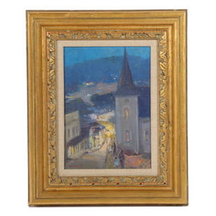
Sold20231693 HISTORY of BELGIUM ILLUSTRATED w/ MAP FOLIO antique CHRONICON vellumCHRONICON BALDUINI AVENNENSIS TOPARCHAE BELLIMONTIS SIVE HISTORIA GENEALOGICA COMITUM HANNONIAE ALIORUMQUE PRINCIPUM ANTE ANNOS QU[ADR]INGENTOS CONSCRIPTA [...]. by BAUDOUIN of AVESNES Antwerp; 1693 FSee Sold Price
20241897 HISTORICAL GEOGRAPHY of BRITISH COLONIES - AFRICA w/ MAPS V.4 antiqueHISTORICAL GEOGRAPHY of BRITISH COLONIES by C.P.LUCAS Vol. IV SOUTH and EAST AFRICA Part I: Historical Part II: Geographical Illustrated w/ maps Size 6 by 9.5" Very good condition, minor wear Text inSee Sold Price
Sold20221908 MOROCCO ITS PEOPLE & PLACES 2 VOLUMES illustrated w/ map ANTIQUE travelMOROCCO ITS PEOPLE & PLACES 2 VOLUMES Philadelphia, The John C. Winston Co.; 1908 by Edmondo De Amicis 226 and 253 pages Illustrated in b/w, with color map Very good condition Text in English Size 5 1See Sold Price
Sold20241719 BIBLE in DUTCH ILLUSTRATED w/ MAPS antique MASSIVE FOLIO BIBLIAantbooks1 BIBLIA, DAT IS DE GANTSCHE H. SCHRIFTURE, vervattende alle de canonijcke boecken des ouden en des nieuwen testaments (...). Laft Der Hoogha Mgh Heeren Dordrecht, Pieter Keur; 1719 IllustrateSee Sold Price
Sold20191688 DUTCH BIBLE antique MASSIVE FOLIO ILLUSTRATED w/Leather bound, hand tooled. Brass clasps (intact) and brass corner pieces. Illustrated with maps. Tight binding. Some wear. Size 11 by 16" Thickness 4 3/4" Reserve: $600.00 Shipping: Domestic: FlaSee Sold Price
Sold20241598 COSMOGRAPHY by Sebastian Munster antique RARE ILLUSTRATED w/ MAPS PIGSKINMUNSTER, Sebastian (1489-1552). Cosmographey, das ist, Beschreibung aller Länder, Herrschafften und fürnemesten Stetten des gantzen Erdbodens Cosmography: that is, description of all countries... BaSee Sold Price
Sold20231642 HISTORY of ULTRECHT NETHERLANDS antique VELLUM BOUND FOLIO in LATIN w/ MAPDE EPISCOPIS ULTRAIECTINIS, RECOGNITI ET NOTIS HISTORICIS ILLUSTRATI AB ARN. BUCHELIO BATAVO I.C. ACCEDUNT LAMB. HORTENSII MONTFORTII SECESSIONUM ULTRAIECTINARUM LIBRI, ET SIFFRIDI PETRI FRISII APPENDSee Sold Price
Sold2017Mclellan: Antique Map of Central & Southern Europe 1855Map: Central & Southern Europe Publication Date: 1855 Authors: HARPER & BROTHERS, MCLELLAN, D. Publisher: HARPER & BROTHERS Size: Folio – 15.10 H x 17.10 W Inches To illustrate Harper's Gazetteer. FSee Sold Price
Sold202416 TACITUS WORKS ILLUSTRATED antique FOLIO in DUTCH ROMAN HISTORY vellum boundALLE DE WERKEN VAN C. CORN. TACITUS Jaarboeken en historien, ook zyn Germanië, en 't leeven van J. Agricola. Dutch transl. by P.C. HOOFT (Complete works of Tacitus) Amst., H. and widow D. Boom, 1684See Sold Price
Sold20241569 MUNSTER COSMOGRAPHY LEAF w/ MAP antique 16th century1 leaf w/ woodcuts, from S. MUNSTER, Cosmographey (...) (Basel, 1569). With map. Double sided. With padding. Size 7 1/2 by 11 3/4 Pad 9 3/4 by 13 3/4" Text in German Very good condition Reserve: $140.See Sold Price
Sold2022WODEHOUSE, P.G. 1881-1975; and WESTBROOK, HERBERT. D.1959. By the Way Book. London: The Globe Pu...WODEHOUSE, P.G. 1881-1975; and WESTBROOK, HERBERT. D.1959. By the Way Book. London: The Globe Publishing Company, 1908. 8vo. Illustrated by W. K. Haselden. Publisher's pictorially decorated wrappers iSee Sold Price
Sold2022WODEHOUSE, P.G. 1881-1975, and WESTBROOK, HERBERT. D.1959. By the Way Book. London: The Globe Pu...WODEHOUSE, P.G. 1881-1975, and WESTBROOK, HERBERT. D.1959. By the Way Book. London: The Globe Publishing Company, 1908. 8vo. Illustrated by W. K. Haselden. Modern half morocco and marbled boards, publSee Sold Price
Sold20241795-1803 JAMES COOK TRAVELS 13 VOLUMES ILLUSTRATED w/ 200 ENGRAVINGS antiqueREIZEN RONDOM DE WAERELD, door JAMES COOK, vertaald door J.D.PASTEUR (Translated by J.D. Pasteur) Leyden, Amsterdam and The Hague, Honkoop Allart and Van Cleef, 1795-1803 First edition in Dutch LanguaSee Sold Price
Sold2024Antique W.J. Lucas Fresno CA 1908 #24 ViolinRare Antique W.J. Lucas, Fresno, California 1908 #24 Full Size Violin w Nylon Case. There is one other W. J. Lucas violin in known existence. This violin has been cared for and recently played. ThereSee Sold Price
Sold2024Antique Maps of LouisianaAntique Maps of Louisiana., maps from Capt. Marcy's book Exploration of the Red River of Louisiana, 1854, incl. "Map of the Country Upon Upper Red-River", 1854, 18 3/4 in. x 36 in.; and "Map of the CoSee Sold Price
Sold2024William Edouard Scott, African American, (1884-1964), church scene landscape at night, oilWilliam Edouard Scott Illinois, African American, Indiana / Haiti (1884-1964) church scene landscape at night oil on board signed lower right. 12 1/2"H x 8 3/4"W(sight), 20"H x 16 1/4"W(frame)See Sold Price
Sold2021Mattie Lou O'Kelley. Through The Town.Mattie Lou O'Kelley (1908-1997). Through The Town. 1985. Signed, dated and titled. Oil on canvas. Excellent condition. Image is 24"w x 18"h. Frame is 31"w x 25"h. Illustrated in the book CIRCUS! by MaSee Sold Price
Sold2022Large Antique Terracotta Sculpture PotteryLarge Antique Terracotta Sculpture Pottery Likely African West African Large Body Small Head and Face intricately detailed Size Approx 39" H x 10" W 45" H on Base Please Look at Photos Closely Out ofSee Sold Price
Sold2016ANTIQUE NEW-FRANCE HAND COLORED MAPANTIQUE NEW-FRANCE HAND COLORED MAP, H 27 1/2" IMAGE, W 20 1/2":Framed, measures H.30" x 23" overall.See Sold Price
Sold2020Ergebnisse der Südsee-Expedition 1908-1910Ergebnisse der Südsee-Expedition 1908-1910 Thilenius, G. Hamburg: L. Friederichsen & Co (1913). ISBN: none German Text/Edition 488 pages 564 b/w illustrations Softcover 31,4 x 23,5 x 5,2 cm. 2923 g CSee Sold Price
Sold2019Nguyen Gia Tri (Viet Nam, 1908-1993) Lacquer on BoardNguyen Gia Tri (Viet Nam, 1908-1993) Lacquer on Board, depicting the scenery of countryside of Viet Nam, H 110cm, W 75cmSee Sold Price
Sold2020Edouard CORTES (1882-1969) French oil on canvasEdouard CORTES (1882-1969) French oil on canvas. 17 5/8” H x 22 5/8” W including frame. 13” H x 18 1/4” W without frame. WE WILL ONLY ACCEPT WIRE TRANSFER OR CHECKS FOR THIS LOT, DO NOT BID IFSee Sold Price
Sold2022Nicholas Nickleby, 1st Ed., w/ Dickens ALSNICHOLAS NICKLEBY, First Edition, by Charles Dickens, illustrated by Hablot K. Brown (Phiz), published by Chapman and Hall, London, 1839. Hardcover octavo, 624 top edge gilt pages with frontispiece, tSee Sold Price
Sold2022Martin Chuzzlewit, 1st Ed. w/ Dickens ALSMARTIN CHUZZLEWIT, First Edition, Second Issue, by Charles Dickens, illustrated by Hablot K. Brown (Phiz), published by Chapman and Hall, London, 1844. Hardcover octavo, 624 top edge gilt pages with fSee Sold Price
7 days LeftJasper521800 MUNGO PARK VOYAGE to AFRICA 2 VOLS ILLUSTRATED w/ MAPS antique in FRENCHUS$320
7 days LeftJasper521890 IN DARKEST AFRICA by HENRY M. STANLEY antique 2 VOLUMES illustrated w/ mapsUS$75(1 bid)
7 days LeftJasper521733 BIBLE OLD TESTAMENT COMMENTARY by CALMET VELLUM FOLIO antique w/ LARGE MAPUS$160
May 30NY Elizabeth ANTIQUE MAP-ILLUSTRATED FLORAL ILLUSTRATION 1761 NEW DICTIONARY OF TRADE AND COMMERCE R. ROTHUS$50
7 days LeftJasper521757 DECAMERON by Giovanni BOCCACCIO antique 5 VOLUMES ILLUSTRATED w/ 110 platesUS$1,500
Featured13 hrs LeftJasper52Asie. Tartarie #42 South Kazakhstan. North Kyrgyzstan. VANDERMAELEN 1827 mapUS$60
13 hrs LeftJasper52Russie d'Asie 29 NW Kazakhstan Orenburg Chelyabinsk Russia VANDERMAELEN 1827 mapUS$50
13 hrs LeftJasper52ASIA Japanese Formosa British India Siam Oman Abu Debi (Dhabi) STANFORD 1894 mapUS$60
3 days LeftTrillium Antique Prints & Rare BooksPrevost - Chart of the Gulf of Mexico (with Florida & Lousiana)US$50(1 bid)


![1693 HISTORY of BELGIUM ILLUSTRATED w/ MAP FOLIO antique CHRONICON vellum: CHRONICON BALDUINI AVENNENSIS TOPARCHAE BELLIMONTIS SIVE HISTORIA GENEALOGICA COMITUM HANNONIAE ALIORUMQUE PRINCIPUM ANTE ANNOS QU[ADR]INGENTOS CONSCRIPTA [...]. by BAUDOUIN of AVESNES Antwerp; 1693 F](https://p1.liveauctioneers.com/5584/273386/143235584_1_x.jpg?height=310&quality=70&version=1672180773)