Sold2019H. B. Mollhausen Del. Lithograph [Navajos]H.B. Mollhausen Del. color lithograph, titled 'Navajos'. From Lt. Joseph C. Ives 'Report upon the Colorado River of the West, Explored in 1857 and 1858'. Washington, 1861. Chromolithograph by Sarony,See Sold Price
Sold2024Annual Report of "Western States" by Wheeler, 1875 [178528]1875 Annual Report upon the Geographical Surveys of the Territory of the United States West of the 100th Meridian, in the States and Territories of California, Colorado, Kansas, Nebraska,Nebraska, NevSee Sold Price
Sold2022JW Powell Survey Stereoview Utah TerritoryCanons of the Colorado River of the West, Cataract Canon Series. A Side Canon.See Sold Price
Sold2018Report Upon United States Geographical Survey West ofReport Upon United States Geographical Survey West of the Hundredth Meridian. Volume VI, Botany. Frontispiece, xx, 404p, 30 plates. 30cm. Brown cloth with titling in gilt on the spine. Covers rubbed,See Sold Price
Sold2020Wheeler Report - West of the 100th MeridianHeading: Author: Wheeler, George M. Title: Report upon United States Geographical Surveys, West of the One Hundredth Meridian Place Published: Washington Publisher:Government Printing Office DatSee Sold Price
Sold2022[WESTERN AMERICANA]. BELL, William (1830-1910), photographer. Grand Canon, Colorado River, Near[WESTERN AMERICANA]. BELL, William (1830-1910), photographer. Grand Canon, Colorado River, Near Paria Creek, Looking West. 1872. 8 x 10 7/8 in. albumen photograph on 16 x 20 in. "War Department" cardsSee Sold Price
Sold2020Wheeler survey Vol. III w/ O'Sullivan heliogravuresHeading: (O'Sullivan, Timothy) Author: Wheeler, George M. Title: Report Upon Geographical and Geological Explorations and Surveys West of the One Hundredth Meridian...Vol. III: Geology Place PublishedSee Sold Price
Sold2024Explorations & Surveys West of the One Hundredth Meridian [178529]1875 Report Upon Geographical and Geological Explorations and Surveys West of the One Hundredth Meridian by Humphreys. 1021pp, 45 plates, many in color. Based on explorations 1871-74. Sections on mammSee Sold Price
Sold2021Gissing, Roland - Ghost RiverGissing, Roland (1895-1967) Ghost River Description: Oil on panel, signed on lower right R. Gissing Dimension (PO): 12" x 16" Dimension (CM): 30.5 x 40.6 cm Condition report: UpoSee Sold Price
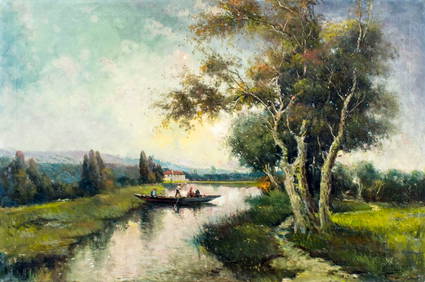
Sold2023Garo, Charles Tatossian - River - 1929Garo, Charles Tatossian (1925) River (1929) Description: Oil on canvas, signed lower right Dimension (PO): 20" x 16" Dimension (CM): 40 x 51 cm Condition report: Upon request, WeSee Sold Price
Sold2018Map No. 1 Rio Colorado of the West...Reserve Reduced! Title: Map No. 1 Rio Colorado of the West... Publication Date: 1858 Cartographer: Ives, Lt. Joseph C. Publisher: Floyd, Hon. John B./War Dept. Size: 14.8 X 34.8 Map of Colorado RiverSee Sold Price
Sold2023Two Volumes On The Mississippi River[Science] Two ex-libris copies of the Report upon the physics and hydraulics of the Mississippi River : upon the protection of the alluvial region against overflow ; and upon the deepening of the moutSee Sold Price
Sold2023Report of an Expedition Down the Zuni and Colorado Rivers Sitgreaves 185332nd Congress, 2nd Session. Senate Executive Document, no. 59. Published by Robert Armstrong, Public Printer, Washington, DC, 1853. Covers rough, partial missing spine, foxing. Map is missing. The SitSee Sold Price
Sold2017Expedition of the Zuni and Colorado Rivers byHeading: Author: Sitgreaves, L[orenzo] Title: Report of an Expedition Down the Zuñi and Colorado Rivers Place Published: Washington Publisher:Robert Armstrong Date Published: 1853 DescSee Sold Price
Sold2023Williamson, Lieut. R. S. 1856 HC Map. San Diego & Colorado River California"Geological Map of the Country Between San Diego and the Colorado River California" By W. P. Blake. Hand Colored Lithograph Map Published 1853-61, Washington for "Reports of explorations and surveys,See Sold Price
Sold2023Williamson, Lieut. R. S. 1856 LG Chart. California - Colorado River to the Pacific Ocean"Geological Section from the Colorado River to the Pacific Ocean" by William P. Blake. Lithograph Map Published 1853-61, Washington for "Reports of explorations and surveys, to ascertain the most pracSee Sold Price
Sold2022CDN. Nordbeck, Peter 1789-1861 A Lot of 5 5-3/4 InchCDN. Nordbeck, Peter 1789-1861 A Lot of 5 5-3/4 Inch Spoons VF Description: 70.1 gms. Very early Shell Pattern with obverse initials DD Condition report: Upon request, We will gladly answer all your iSee Sold Price
Sold2022CDN. Nordbeck, Peter 1789-1861 A Pair of 5-3/4 InchCDN. Nordbeck, Peter 1789-1861 A Pair of 5-3/4 Inch Spoons F-VF Description: 29.5 gms. Very early Shell Pattern with reverse initials WAA Condition report: Upon request, We will gladly answer all yourSee Sold Price
Sold2021Newfoundland 1861-62 #22, stamp VF *.Newfoundland 1861-62 #22, stamp VF *. Description: Eight pence (8d) rose imperforated. The stamp is mint hinged with jumbo margins !! Unitrade 2021 catalog $120.00. Condition report: Upon request, WeSee Sold Price
Sold2016William Darby, The Emigrant's Guide, and Captain L.William Darby, The Emigrant's Guide (Includes territorial maps), published by Kirk and Mercein, 1818; Captain L. Sitgreaves, Report of an Expedition Down the Zuni and Colorado Rivers, printed by RoberSee Sold Price
SoldA Zulu Fly SwatterA Zulu Fly Swatter South Africa Length of handle 8 1/2 inches. This lot is located in Chicago. Property from Peter Sinclair, West Hurley, New York Condition CondSee Sold Price
Sold2022CB&Q / Burlington 1906 Bound Annual ReportCB&Q / Burlington 1906 Bound Annual Report CB&Q / Burlington 1906 annual report for lines west of the Missouri River. Spine of the book reads, "Annual Reports C.B. & Q. R.R. Lines West of MO. River YeSee Sold Price
Sold20201861 Holy land. East and West Bank’s of the JordanTitle: 1861 Holy land. East and West Bank’s of the Jordan river. Insert of Jerusalem. By Johnson Date/Period: 1861 Materials: Steel engraved. Size: 18x14” 1861. By A. J. Johnson & J. H Colton. FroSee Sold Price
Sold2023[INTERNATIONAL BOUNDARY COMMISSION]. Report of the Boundary Commission Upon... the Boundary Between[INTERNATIONAL BOUNDARY COMMISSION]. Report of the Boundary Commission Upon the Survey and Re-Marking of the Boundary Between the United States and Mexico West of the Rio Grande, 1891-1896. WashingtonSee Sold Price
4 days LeftSanta Fe Art AuctionJoseph Roy Willis, Flag Mountain in the Red River Country, Near Taos, N.M.US$300
2 days LeftJasper521810 Ainslie map of County Renfrew near Glasgow in Scotland -- Map made out for John Wilson ESQ.rsUS$50
717 Lots AwaySeized Assets AuctioneersAdams - Looking Down the Colorado River Toward the Boulder DamUS$1
May 15University ArchivesAndrew Jackson Signs Land Grant for Quarter Section in Southern IllinoisUS$240(1 bid)
2 hrs LeftCurated Gallery AuctionsMax Weyl (1837 - 1914) Antique American Hudson River School Tranquil Fall River Oil PaintingUS$475(5 bids)
May 18Winfield Auction GalleryAntique Hudson River School Landscape Painting with Cattle, Stream and ChurchUS$300
3 days LeftSanta Fe Art AuctionVintage Young Buffalo Poster: King of the Wild West, Sheriff of Angel Gulch, ca. 1905US$400
4 days LeftFreeman's | HindmanJoellyn Duesberry (American, 1944-2016) The Snake River, Jackson, Wyoming, 1988US$2,000


![H. B. Mollhausen Del. Lithograph [Navajos]: H.B. Mollhausen Del. color lithograph, titled 'Navajos'. From Lt. Joseph C. Ives 'Report upon the Colorado River of the West, Explored in 1857 and 1858'. Washington, 1861. Chromolithograph by Sarony,](https://p1.liveauctioneers.com/5755/147592/74586260_1_x.jpg?height=310&quality=70&version=1565302309)


![Annual Report of "Western States" by Wheeler, 1875 [178528]: 1875 Annual Report upon the Geographical Surveys of the Territory of the United States West of the 100th Meridian, in the States and Territories of California, Colorado, Kansas, Nebraska,Nebraska, Nev](https://p1.liveauctioneers.com/2699/324084/174414762_1_x.jpg?height=310&quality=70&version=1711485923)


![[WESTERN AMERICANA]. BELL, William (1830-1910), photographer. Grand Canon, Colorado River, Near: [WESTERN AMERICANA]. BELL, William (1830-1910), photographer. Grand Canon, Colorado River, Near Paria Creek, Looking West. 1872. 8 x 10 7/8 in. albumen photograph on 16 x 20 in. "War Department" cards](https://p1.liveauctioneers.com/197/250551/130130231_1_x.jpg?height=310&quality=70&version=1654185975)

![Explorations & Surveys West of the One Hundredth Meridian [178529]: 1875 Report Upon Geographical and Geological Explorations and Surveys West of the One Hundredth Meridian by Humphreys. 1021pp, 45 plates, many in color. Based on explorations 1871-74. Sections on mamm](https://p1.liveauctioneers.com/2699/324084/174414763_1_x.jpg?height=310&quality=70&version=1711485923)


![Two Volumes On The Mississippi River: [Science] Two ex-libris copies of the Report upon the physics and hydraulics of the Mississippi River : upon the protection of the alluvial region against overflow ; and upon the deepening of the mout](https://p1.liveauctioneers.com/179/305680/163317660_1_x.jpg?height=310&quality=70&version=1697214016)

![Expedition of the Zuni and Colorado Rivers by: Heading: Author: Sitgreaves, L[orenzo] Title: Report of an Expedition Down the Zuñi and Colorado Rivers Place Published: Washington Publisher:Robert Armstrong Date Published: 1853 Desc](https://p1.liveauctioneers.com/642/110056/56485192_1_x.jpg?height=310&quality=70&version=1506974396)


![[INTERNATIONAL BOUNDARY COMMISSION]. Report of the Boundary Commission Upon... the Boundary Between: [INTERNATIONAL BOUNDARY COMMISSION]. Report of the Boundary Commission Upon the Survey and Re-Marking of the Boundary Between the United States and Mexico West of the Rio Grande, 1891-1896. Washington](https://p1.liveauctioneers.com/197/305583/163286601_1_x.jpg?height=310&quality=70&version=1697143109)
![[Folk Art] 3rd Ohio Infantry Crossing Salt River (1 of 2)](https://p1.liveauctioneers.com/7226/325455/175168987_1_x.jpg?height=282&quality=70&version=1712370394)


![[SLAVERY] 1854 Texas Slave Hire Document (1 of 1)](https://p1.liveauctioneers.com/7226/322253/173251505_1_x.jpg?height=282&quality=70&version=1710004847)


