Sold2016Map, Phelps Map of the United States Traveler's Guide25x21, containing, railroads, steam ships, canals & stage coach routesSee Sold Price
Sold2016Phelps' National Map 1852Heading: Author: Thayer, Horace & Co. Title: Phelps's National Map of the United States, a Travelers Guide. Embracing the Principal Railroads, Canals, Steamboat & Stage Routes Throughout the Union PlSee Sold Price
Sold20232 Travel Maps of US: Atwood Pocket Map 1851 & Williams Framed, 18541st item: PHELPS'S NATIONAL MAP OF THE UNITED STATES, TRAVELLERS GUIDE. EMBRACING THE PRINCIPAL RAIL ROADS, CANALS, STEAM BOAT & STAGE ROUTES THROUGHOUT THE UNION, by J. M. Atwood, published by ThayerSee Sold Price
Sold2019Phelps's National Map of the United States, aReserve Reduced! Title: Phelps's National Map of the United States, a Travellers Guide. ... Publication Date: 1847 Cartographer: ATWOOD, J.M./H. PHELPS Publisher: PHELPS, ENSIGNS & THAYER Size (inchesSee Sold Price
Sold20221847 Phelpss National Map of the United States..Historic Maps 1847 Map "Phelps's National Map of the United States..." 1847-Dated, "Phelps's National Map of the United States, A Traveller's Guide...", Hand-Colored Folding Map of the United States,See Sold Price
Sold2018With State Seals /Presidents Surrounding U.S. MapAtwood, J. M. (1818-c. 1880) & Phelps, Humphrey (fl. c. 1830-1860). Phelps's National Map of the United States, a Travellers Guide... Engraved map. Ensign & Thayer, 1851. 20 ½" x 25 ¾" sheet. "ESee Sold Price
Sold2017Phelps: Antique Pre-Civil War Map of United States 1848Patriotic Antique Pre-Civil War US Map; "Phelps's National Map of the United States, A Travellers Guide. Embracing the principal Rail Roads, Canals, Steam Boat & Stage Routes, Throughout the Union.".See Sold Price
Sold20211845 ENSIGN'S TRAVELER'S GUIDE AND MAP OF THE UNITEDSteel-engraved wall map of the United States, published by T. & E. H. Ensign in 1845, depicting the development and settlement of the United States, from the Atlantic, west to the Rio Grande, includinSee Sold Price
Sold2021MAP, Eastern US, Phelps & EnsignEastern United States. Phelps & Ensign, Phelps & Ensign's Travellers' Guide, and Map of the United States, Containing the Roads, Distances, Steam Boat and Canal Routes &c., 1842 (dated). Hand Color. TSee Sold Price
Sold2018Phelps' Traveller's Guide Through the United States. NYPhelps' Traveller's Guide Through the United States. NY 1849. 12mo. 70 p. Lacks map. Ornately gilt front cover featuring steamship vignettes and border vines. // Isaac Taylor. Scenes in America. LondoSee Sold Price
Sold20211832 Mitchell Map of the United States -- Mitchell'sTitle: 1832 Mitchell Map of the United States -- Mitchell's Travellers Guide Through the United States. A Map of the Roads, Distances, Steam Boat & Canal Routes & c. by J.H. Young Cartographer: S MitcSee Sold Price
Sold2015"Good-Natured" U.S. Map by Greyhound BusThis "Good Natured" map of the United States and a "Guide to the Wonderful West" was issued compliments of Greyhound and Union Pacific Stages. The litho was made in the USA by Sunset Press in San FranSee Sold Price
Sold20171848 Smith Pocket Map of United States1848 Smith Pocket Map of United States -- A New Map for Travelers through the United States of America, Showing the Railroads, Canals & Stage Roads Smith & Son 1848 New York 21 x 26.75 in. A relativelSee Sold Price
Sold20211836 Travel's Guide U.S. Map w/ Hand-Written NotesFramed Travel's Guide US Map - "Travel's Guide Through the United States, a Map of the Roads, Distances, Steam Boats & Canal Routes, by J.H. Young, Philadelphia, Published By S. Augustus Mitchell, 183See Sold Price
Sold20231893 Civil War Map of the South -- Section of G. Woolworth Colton's New Guide Map of the UnitedTitle: 1893 Civil War Map of the South -- Section of G. Woolworth Colton's New Guide Map of the United States and Canada with Railorads, Counties, etc. 1863. Used by General Grant in Marking the PropoSee Sold Price
Sold2018First Edition Mitchell's Traveller's GuideYoung, J. H. (1792-c. 1864). Mitchell's Traveller's Guide Through the United States, a Map of the Roads, Distances, Steam Boat and Canal Routes & C. by J.H. Young. Engraved map with full color. S. AugSee Sold Price
Sold2023(UNITED STATES.) Timothy and Edward Hooker Ensign. Ensign's Travellers' Guide, and Map of the United(UNITED STATES.) Timothy and Edward Hooker Ensign. Ensign's Travellers' Guide, and Map of the United States. Large engraved map of the United States bordered with inset city plans, tables, presidentiaSee Sold Price
Sold2024Three American Aviation Publications - 1953 and 1956 Official Airline Guides and 1948 Air TrafficThree publications from American Aviation including January 1948 Air Traffic Guide with 244 pages and fold out map of United States and Foreign Airline Schedules, Fares and Information, showing mild dSee Sold Price
Sold2016A New Map for Travelers through the United States ofA New Map for Travelers through the United States of America, by John Calvin Smith, Sherman & Smith, New York, 1849, Framed {Dimensions of frame 23 1/4 x 27 1/4 inches}See Sold Price
Sold2016Traveling map of U.S. by J. Calvin Smith 1849Heading: Author: Smith, John Calvin Title: A New Map for Travelers through the United States of America, Showing the Railroads, Canals & Stage Roads Place Published: New York Publisher:Sherman & SmitSee Sold Price
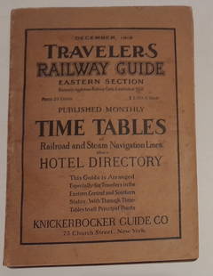
Sold20241915 Traveler's Guide Eastern US. A 344 page bookA 5 3/4" by 8" soft cover book with railroad timetables and other travel information: hotel ads, city, state maps, etc. Paper is supple and not pulpy.See Sold Price
Sold20181846 1st ed Plymouth PILGRIMS Colonial Americana1846 1st ed Plymouth PILGRIMS Colonial Americana Mayflower Indians MAP William Russell’s account of early, Colonial Americana is an important look into United States history. “Guide to Plymouth”See Sold Price
Sold2020Map of NYC by H. Tanner, 1834Scarce map from "Tanner's American Traveller, or Guide Through the United States" by H. S. Tanner, circa 1834. Map is matted. Frame of map has tiny bit of light offsetting. Small chip at right edge. NSee Sold Price
Sold20181855 Smith Map of the MidWest -- Guide through Ohio,Title/Content of Map: 1855 Smith Map of the MidWest -- Guide through Ohio, Michigan, Indiana, Illinois, Missouri, Wisconsin & Iowa Showing the Township Lines of the United States Surveys Date Printed:See Sold Price
Jun 12Dan Morphy AuctionsPHELPS’S TRAVELERS GUIDE THROUGH THE UNITED STATES; CONTAINING UPWARDS OF SEVEN HUNDREDUS$1,000
Featured4 days LeftJasper52Rand, McNally & Co.'S New Commercial Railroad Map of the United States [Chicago to Denver]US$25
6 days LeftSloans & KenyonMAP OF CONNECTICUT SHOWING PRINCIPAL HIGHWAYS, WITH ILLUSTRATIONS BY JOHN HELD JR AND HISTORICUS$350
Featured4 days LeftJasper52Johnson's New Military Map of the United States Showing the Forts, Military Posts &C. With EnlargedUS$65
Featured4 days LeftJasper52Railroad Map of the United States Showing the Through Lines of Communication...US$50
May 25Cain Modern AuctionsDouble Sided U.S. Map by Rand McNally, Illustrated & Equal Area ProjectionUS$75
20 hrs LeftActivity AuctionsAntique 1787 French Maritime Hydrography Map Eastern Coast United States M BonneUS$150
6 days LeftWeatherham Estate TreasuresUnited States Map with American Flag 3-D Wall Mount PaintingUS$300
6 days LeftWeatherham Estate TreasuresUnited States Map with American Flag 3-D Wall Mount PaintingUS$300
Jun 12Dan Morphy AuctionsPLATE CXIII. MAP OF INDIAN TERRITORY SHOWING DISTRIBUTION OF WOODLAND” FROM THE TWENTY-FIRSTUS$100
Jun 12Dan Morphy AuctionsGEOLOGY OF THE BLACK AND GRAND RAPIDS OF TEXAS INCLUDING THE EASTERN AND WESTERN CROSS TIMBERS,US$100
Jun 01Link Auction GalleriesHandbook of the United States of America, and Guide to Emigration; Giving the Lastest and MostUS$50


![Rand, McNally & Co.'S New Commercial Railroad Map of the United States [Chicago to Denver] (1 of 1)](https://p1.liveauctioneers.com/5584/329422/177662153_1_x.jpg?height=282&quality=70&version=1715717898)


