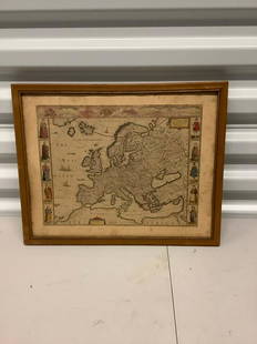
Sold20231782 COPPERPLATE ENGRAVED MAP OF EUROPEOriginal antique copperplate engraved map of “Europe” engraved for Baldwins New Complete and Universal System of Geography. Published by Thomas Conder circa 1782.Professionally framed andSee Sold Price
Sold2018Hand Colored Antique Map Of New Amsterdam (New York)Map of the Original Grants of Village Lots from the Dutch West India Company to the inhabitant of New-Amsterdam, (now New-York) living below the present line of Wall Street. 19 1/2 x 17 in. (Framed),See Sold Price
Sold2017Antique Framed Advertisement for Murad CigarettesHummert Estate Antique 1923 Framed Advertisement for Murad Cigarettes, matted and under glass, visual measures 5'' x 7'', FYI: ''In the early 1900s, manufactures of Turkish and Egyptian cigarettes triSee Sold Price
Sold2023Antique Framed Wayfarer's Map of New York 1939Antique Framed Wayfarer's Map of New York 1939. Framed. Signed by Charles D. Graves, possibly the map maker. Copyrighted 1939, Herbert C. Wyman, Pleasantville, NY. Wayfarer's Maps.See Sold Price
Sold20164Pcs New Amsterdam ANTIQUE ESTATE COLLECTIBLESDetails: This lot consists of the antique estate collectibles shown in the corresponding images.Included in this lot are an intricately crocheted throw blanket (measuring approximately 101" x 119"),See Sold Price
Sold2021ROBERT WILKINSON Antique Map framed. A New Map of IrelaROBERT WILKINSON Antique Map framed. A New Map of Ireland from the best Authorities 1791.-- Dimensions: Image Size: H: 11.5 inches: W: 9 inches -- FRAME SIZE: Frame Height 18 inches - Frame Width 14 iSee Sold Price
Sold2016FRAMED PRINT, ANTIQUE MAP OF AMSTERDAM ("AMISFVRTVM"),FRAMED PRINT, ANTIQUE MAP OF AMSTERDAM ("AMISFVRTVM"), FRAMED SIZE APPROX 21.5" X 24.75"See Sold Price
Sold2023Antique Framed Map of "Pars Scotiae Australi's"Description: This lot includes what appear to be an antique map titled "Pars Scotiae Australi's". The map is not dated however it appears to have age to it. See photos for details. Condition: ExpectedSee Sold Price
Sold2016Antique Framed Map of Israel, C. 1748.Ivdaea Sev Palaestina, ... Terra Sancta. By Johann Baptist Homann. Framed, 18.5" x 21.5" sight size. Visible foxing. From a Larchmont NY estate. Dimensions: 23" w x 20" h framed. Condition: Foxing, noSee Sold Price
Sold2021Antique Framed Map of Columbia County, NY 1829Antique Framed Map of Columbia County, NY, dated 1829. Engraved by Rawdon Clark & Co, Albany, NY. Also marked Rawdon Wright, New York. Map includes locations of mills, churches and stage roads. NicelySee Sold Price
Sold2017Antique Portuguese Brass Cast Iron Door KnockerHummert Estate Antique Lisbon Portugal Brass Cast Iron Turtle and Duck Door Knocker, measures 3'' x 8''L, late 1800's or early 1900's, purchased in 1992 in Santa Fe, New MexicoSee Sold Price
Sold2017Antique Marcel Curling IronHummert Estate: Antique Marcel Curling Iron, gas heater and turtle base, c. 1930's, purchased in 1985 in New Hartford, Connecticut at an Antique Show, measures 11''L x 4.5''WSee Sold Price
Sold2017Antique English Sequin Bead Turtle PincushionHummert Estate Antique English Sequined and Beaded Turtle Pincushion, measures 2.75''L x 1.75''W, purchased in 1992 in Albuquerque, New MexicoSee Sold Price
Sold2023ANTIQUE FLORIDA FRAMED MAPS - LOT OF 2148268 ANTIQUE FLORIDA FRAMED MAPS - LOT OF 2 Antique Florida map framed map to include one 1853 U.S. Coast Survey Chart or Map of St. George's Sound, Florida, and one unsigned map of Florida denotedSee Sold Price
Sold20211859 Map of New Amsterdam, (Manhattan) AS IS. 30" X 24"1859 MAP OF New Amsterdam (Manhattan)AS IS. 30" X 24". This map is actually a rendering after a 1664 map made in 1859.See Sold Price
Sold2016Framed Map Of Amsterdam Joannem de RamAmstelodami Veteris et Novissimi Delineatio per Joannem de Ram - de Ram J. Frame: 34.25" x 31" image: 20.5" x 18"See Sold Price
Sold2017Sanson: Antique Map of New World as Atlantis, 1690Map: Atlantis Insula Cartographer: G. Sanson / Covens & Mortier Place & Date: Amsterdam / 1690 Size: 21 1/2" x 16" Condition: outline color; overall age toning; minor fraying at edges of margins. TheSee Sold Price
Sold2017Allen: Framed Map of New Jersey Ocean Resorts, 1898Title/Content of Map: New Jersey Ocean Resorts on the Pennsylvania Railroad Date Printed: 1898 Cartographer: Allen, Lane, and Scott Size (inches): 12 x 16 Lithographed color Antique lithographed birdsSee Sold Price
Sold2022Antique NEW YORK CITY MAP - FramedAntique New York City Map. 28” x 16” New York City map, circa 1860, hand-colored, double matted and framed to 38 ½” x 26”.See Sold Price
Sold2017Vintage Framed Bedford Riding Lanes Mapvintage framed map of Bedford New York Riding Trails. measures 20 by 26 inches. property of Bedford Horse Farm EstateSee Sold Price
Sold20171778 PROVINCE of NEW JERSEY FRAMED MAPAntique map of New Jersey, issued by William Faden in 1778 and drawn from Bernard Ratzer’s survey made in 1769 just prior to the American Revolutionary War. This is a second edition that includes thSee Sold Price
Jun 22Trillium Antique Prints & Rare BooksPrevost - Volume 16 with 31 Maps & Engravings (Including Map or Australia)US$200(1 bid)
Jun 23Curated Gallery AuctionsVintage American Modernist Abstract Pop Art Signed Still Life Framed New York School Oil PaintingUS$10
Jun 22Trillium Antique Prints & Rare BooksHarris - Map of the Southern Continent (Australia, New Holland)US$75