


16th Century Town Plans from Braun & Hogenberg
0 Sold
Similar Sale HistoryUnlock All Sale Prices
Sold
Sold
Sold
Sold
Sold

Sold
Sold
Sold
Sold
Sold
Sold
Sold
Sold
Sold![Tudor Lead Tax Seal: 16th century A.D. Discoid in plan with low-relief design of a crown above a sun, fleur-de-lis and rose, within ropework roundel, surrounding legend beginning 'SVB[SIDII PANNORVM]' Cf. Stuart F. Elton,](https://p1.liveauctioneers.com/1191/296976/157932091_1_x.jpg?height=310&quality=70&version=1690371807)
Sold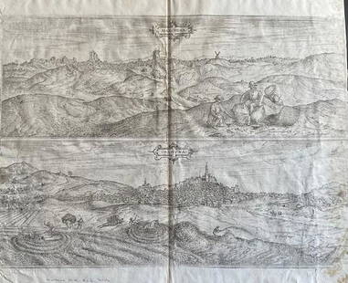
Sold
Sold
Sold
Sold
Sold
Sold![Indian and Oklahoma Territory Cabinet Cards (16); c. 1890s [153548]: Lot of 16 cabinet cards from towns in Indian Territory and Oklahoma Territory. These towns include Vinita, Wagoner, Tahlequah, and Purcell in the Indian Territory and Pawnee, Perry, Guthrie, El Reno,](https://p1.liveauctioneers.com/2699/254720/132471945_1_x.jpg?height=310&quality=70&version=1657566291)
Sold
Upcoming SalesView All


Featured
Featured


TOP