Sold2018FRAMED MAP OF CHESTER COUNTY 1847Framed Map Of Chester County 1847: Dated 1847. This map is adhered to a backing board. Projection and drawing by J.S Bowen, engraved by Edward Yeager of Philadelphia. 50"See Sold Price
Sold2017Framed map of Chester County, Pennsylvania, copyright 1Framed map of Chester County, Pennsylvania, copyright 1938, compiled and drawn by Charles B MuthSee Sold Price
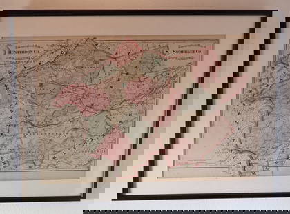
Sold2021Antique Engraved Map of Chester, EnglandAn antique hand colored map of the County of Chester, England. By Eman. Bowen. Framed under glass. Mat opening: 21 in x 27-1/2 in. Some light toning and spotting.See Sold Price
Sold20186 Volumes Pennsylvania, 3 archives with map, Ches6 Volumes Pennsylvania, 3 archives with map, Chester County, etc.-- Dimensions: ---See Sold Price
Sold2017Breou's Farm Maps of Chester County, Pennsylvania, WHBreou's Farm Maps of Chester County, Pennsylvania, WH Kirk, Philadelphia, 1883, unbound at spine, edges good-very good, full, boards fair-good, but may not contain all platesSee Sold Price
Sold2017Breou's Farm Maps of Chester County, Pennsylvania, WHBreou's Farm Maps of Chester County, Pennsylvania, WH Kirk, Philadelphia, 1883, taped at spine, edges good-very good, full, boards fair-good, but may not contain all platesSee Sold Price
Sold2017Breou's Farm Maps of Chester County, Pennsylvania, WHBreou's Farm Maps of Chester County, Pennsylvania, WH Kirk, Philadelphia, 1883, intact spine, edges good-very good, full, boards fair-good, but may not contain all platesSee Sold Price
Sold2017Breou's Farm Maps of Chester County, Pennsylvania, WHBreou's Farm Maps of Chester County, Pennsylvania, WH Kirk, Philadelphia, 1883, unbound at spine, edges tattered, losses to boards, full, but may not contain all platesSee Sold Price
Sold2017150 plus loose plates from Breou's Farm Maps of Chester150 plus loose plates from Breou's Farm Maps of Chester County, Pennsylvania, WH Kirk, Philadelphia, 1883, with a bindingSee Sold Price
Sold2021Antique Framed Map of Columbia County, NY 1829Antique Framed Map of Columbia County, NY, dated 1829. Engraved by Rawdon Clark & Co, Albany, NY. Also marked Rawdon Wright, New York. Map includes locations of mills, churches and stage roads. NicelySee Sold Price
Sold20231876 Atlas of Illinois- Cook County Map Framed PagTravel back in time to the late 19th century with this enchanting Framed Map Page from the 1876 Atlas of Illinois by Warner & Beers. This exquisite piece showcases the detailed cartography of Cook, DuSee Sold Price
Sold2021ANTIQUE WILLISTOWN CHESTER COUNTY MAPANTIQUE WILLISTOWN CHESTER COUNTY MAP Antique map of Willistown Township in Chester County, Pennsylvania. Surveyed for William Penn in 1684, Willistown was organized as a township in 170See Sold Price
Sold2022Map of Albany CountyFramed map of Albany County. Dated 1947. Overall 22" x 30 1/2".See Sold Price
Sold2024FRAMED WARREN COUNTY MAPWARREN CO., NEW JERSEY. MATTED AND FRAMED UNDER GLASS. 29 1/4" X 21 3/4". PLEASE READ CAREFULLY - Terms for Purchasing and Shipping of Auction Items. Please read carefully before bidding. All paymentsSee Sold Price
Sold2017Three framed local maps including Dutchess County NY,Three framed local maps including Dutchess County NY, Putnam County NY, and a hand colored City of Poughkeepsie. All in good condition, late 19th to early 20th century.See Sold Price
Sold20223 FRAMED CHARLESTON COUNTY MAPSThree (3) Framed Charleston County Maps showing Neighborhoods. Includes 1- The Peninsula of Charleston.2- East Cooper; Mt. Pleasant, Isle of Palms, Sullivans Island. 3- Sea Islands; Kiawah, Seabrook,See Sold Price
Sold2020FRAMED 19th c. MAP-DUTCHESS COUNTY, 20" X 13"FRAMED 19th c. MAP-DUTCHESS COUNTY, 20" X 13"See Sold Price
Sold2022Framed 1873 Columbia County MapFramed page from Columbia County Atlas, 1873, showing Malden Bridge, East Chatham, Chatham, Chatham Center, New Concord, and Claverack, 13 3/4" x 16 1/2" framed.See Sold Price
Sold2021FRAMED 1891 MAP OF ULSTER + DUTCHESS COUNTIES, 20" XFRAMED 1891 MAP OF ULSTER + DUTCHESS COUNTIES, 20" X 30.25"See Sold Price
Sold2023Hudson Valley MapFramed 1847 "NEW MAP OF THE HUDSON RIVER". Sight 26 1/2" x 9 1/2".See Sold Price
Sold2021Collection of Five Vintage PA Hunting LicensesA collection of five vintage Pennsylvania hunting licenses from 1926-1930, Chester County, PA. Nicely framed and matted. Frame: 19-1/2 in x 17-1/4 in.See Sold Price
Sold2015Framed Chinese WatercolorFramed Chinese Watercolor: Description: From chester county estate. Dimensions: 34" X 16" $200 - $400 Shipping:See Sold Price
Sold2015Framed Chinese WatercolorFramed Chinese Watercolor: Description: From Chester county estate. Dimensions: 29" X 11" $200 - $400 Shipping:See Sold Price
6 days LeftEarly American History Auctions1836 Hand-Colored Map, Country Twenty Five Miles Round The City Of New-York Published by D.S. StoneUS$260
6 days LeftEarly American History Auctions1753 Map of the County of Lancaster Divided into its Hundreds, by Royal Mapmaker Emanuel BowenUS$280
6 days LeftEarly American History AuctionsEight Judges, Signed Petition, Supporting a Fellow Chester, PA. Judge, Not be Removed from the BenchUS$300
Jun 14DuMouchellesWilliam H. Gamble (American, B. 1863) Hand Colored Engraving, Ca. 1863, "County Map of Michigan AndUS$50(1 bid)