Sold20211640 Jansson Map of Rhine River Area in Netherlands andTitle: 1640 Jansson Map of Rhine River Area in Netherlands and Germany in Part -- Descriptio Fluminum Rheni, Vahalis et Mosae Cartographer: J Jansson Year / Place: c 1640, Amsterdam Map Dimension (in.See Sold Price
Sold2015Jansson (Jan) - [Atlas Novus: Germany],single vol. lacking title, 106 mostly regional maps of Germany and northern Europe, but also including a general map of Germany, and classical maps of both Germany and Scandinavia, and several city plSee Sold Price
Sold2024De Jode, pub. 1593 - Map of Hesse, Germany (Hessiae Seu Cattorum Nobilissimorum?)This truly significant map is from one of the rarest atlases ever published, Gerard and Cornelis de Jode's Speculum orbis Terrae. The work was published in Antwerp in 1593 by Arnold Coninx for the widSee Sold Price
Sold2024De Fer Map of the Mississippi RiverDE FER, Nicolas (1646-1720). Partie Meridionale de la Riviere de Missipi, et ses environs, dans l'Amerique Septentrionale. Mis au jour par N. de Fer. Geographe de sa Majeste Catolique 1718. Engraved mSee Sold Price
Sold2024De Jode, pub. 1593 - Map of part of Germany (Reiterata Episcopatus Monasteriensis geographica?)This truly significant map is from one of the rarest atlases ever published, Gerard and Cornelis de Jode's Speculum orbis Terrae. The work was published in Antwerp in 1593 by Arnold Coninx for the widSee Sold Price
Sold2022SOL LEWITT (1928-2007) R706 Map of London with the area between the underground stations at Marb...SOL LEWITT (1928-2007) R706 Map of London with the area between the underground stations at Marble Arch, St. James Park, Leicester Square, Waterloo Station, Pimlico, Sloane Sq., Knightsbridge, BayswatSee Sold Price
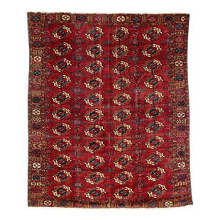
Sold2019Tekke Main CarpetMid 19th century, 210 x 180 cm, Central Asia, West Turkestan A Tekke main carpet with four x eleven primary güls, kurbaghe secondary motifs and a densely patterned border area. Extraordinarily fine iSee Sold Price
Sold2017Persian Hand Woven Area RugBlue floral medallion and main border in cream field, 4'7"w x 6'9"l. 2 linear holes located in the middle between the central medallion and the borders.See Sold Price
Sold2021Haunted Mansion Imagineering Map Blueline Print.(Disneyland, 1969) A large and remarkable WED Imagineering blueline design print of the Haunted Mansion drawn by Imagineer Dan Williams. Dated in the print 04-3-69, the 1/8":1' scale Key Area & LocatiSee Sold Price
Sold2018"View of the University of Virginia" Panoramic MapVIEW OF THE UNIVERSITY OF VIRGINIA, CHARLOTTESVILLE AND MONTICELLO, TAKEN FROM LEWIS MOUNTAIN, drawn and lithographed by Edward Sachse (Maryland/Germany, 1804-1873) and Company and the Sun Iron BuildiSee Sold Price
Sold2022MITCHELL, S. AUGUSTUS. A New Map of Texas, Oregon and California.MITCHELL, S. AUGUSTUS. A New Map of Texas, Oregon and California. Engraved pocket map of the American territories west of the Mississippi River. 22¾x21 inches overall, ample margins; strong origiSee Sold Price
Sold2022Rare Tony Sarg Colored Map of New Hope, Pennsylvania 1941Rare Tony Sarg (1880-1942) Colored Map of New Hope, Pennsylvania 1941, depicting George Washington crossing the Delaware River among other local points of interest 19 in. x 25 in. Framed 27.5 in. x 33See Sold Price
Sold2023Antique 1805 Map of the United States of America On Silk School Girl LivingstonAntique map of the United States on silk. Made by a school girl Mary Livingston 1805. Survives in excellent condition as it was discovered in a blanket chest along the Hudson River from an estate a feSee Sold Price
Sold2022Tekke Main CarpetSecond half 19th century, 240 x 208 cm, Central Asia, West Turkestan Slight signs of age and wear, three holes, two darned and minor repiled areas. Good overall pile condition. Damaged selvedges on thSee Sold Price
Sold2021Fascinating and scarce 1876 map of Montana TerritoryTitle: Fascinating and scarce 1876 map of Montana Territory Description: "Historic vintage map of the Montana Territory published the year of Custer’s massacre near the Little Big Horn River. This mSee Sold Price
Sold2023RARE BUCHOLTZ-LUDWIG ANTEBELLUM POCKET MAP OF VIRGINIARARE BUCHOLTZ-LUDWIG ANTEBELLUM POCKET MAP OF VIRGINIA, hand-colored lithograph, Map of the State of Virginia Containing the Counties, Principal Towns, Railroads, Rivers, Canals & All Other Internal ISee Sold Price
Sold2017Mouzon Map of CarolinasAn Accurate Map of North and South Carolina, with their Indian Frontiers, Shewing in a distinct manner all the Mountains, Rivers, Swamps, Marshes, Bays, Creeks, Harbours, Sandbanks and Soundings on thSee Sold Price
Sold2017Very Fine ANNA POTTERY / 1889 Stoneware Pig Flask w/Very Fine Cobalt-Decorated Stoneware Pig Flask with Incised Railroad Map, Inscribed "St. Louis the future Great / Latest and Only Reliable / Rail Road and River Guide / By / Anna Pottery / 1889", WallSee Sold Price
Sold2021Two Kayapo Ornaments Xingu River area, Mato GroTwo Kayapo Ornaments Xingu River area, Mato Grosso, Brazil, 20th century Including a large feather headdress and a diadem. Domestic bird feathers from macaw and parrot, shell, cotton, vegetal fibers HSee Sold Price
Sold2015View of Fortress on Rhine River, Signed James WebbJames Webb (English, 1825-1895). "View of Ehrenbreitstein on the Rhine" - 1873, oil on canvas, signed and dated lower right. Finely painted panoramic view of Ehrenbreitstein Fortress resting on the baSee Sold Price
Sold2016ENORMOUS LARGE CHINESE EMBROIDERY SILK, CIRCA 1855Mid 19th century Chinese silk wall hanging, circa 1855, couch embroidered with metallic threads on a red ground, the large central area with a birthday poem for a Cantonese high official, at the courtSee Sold Price
Sold2022YIPWON FIGURE KARAWARI RIVER, PAPUA NEW GUINEA.The auction featuring items from the Saul Brandman Foundation. Sculpture in carved wood fabrication. Region of origin: Korewori River area, Middle Sepik, PapuaNew Guinea. The sculpture is a Yipwon figSee Sold Price
Sold2017A hand-and-a-half swordBlade reinforced at the tang, grooved and stamped with crescent moons in the central area; steel hilt with parry quillons and ring chased and carved with animal heads, mascherons and scrollwork, metalSee Sold Price
Sold2022Johann Georg Schuz(German, 1755-1813) View of the Rhine River, signed lower right "Schuz. fecit", oil on canvas, 16-3/8 x 20-1/4 in.; 17th century Dutch or German, reverse profile ripple molding frame, 26-3/4 x 31-1/2See Sold Price
3 days LeftAkiba Galleries(2) Adolf Raufer (Germany, Austria, 1794 - 1856). Oil paintingsUS$100(3 bids)
3 days LeftJasper521598 Munster Map of Northern Adriatic Coastal Areas -- Sclavonia oder Windisch Marck Bossen CrabatenUS$140
May 16Potter & Potter AuctionsLISTER, James Wren (1897 – 1952). Avalon Town / Santa Catal...US$100(1 bid)
1 hr LeftRenew GalleryCirca 1815 Engraved Map A Plan of the Grand of the New Townships on the Grand or Ottawa RiverUS$100
7 days LeftMain Auction GalleriesBaron(19th Century, Germany) Bronze & Marble Sculptured Center bowlUS$300
May 05Curated Gallery AuctionsMax Weyl (1837 - 1914) Antique American Hudson River School Tranquil Fall River Oil PaintingUS$200(4 bids)
May 10New England Auctions - Fred GiampietroPair of Large German Copper-Colored Ceramic Crucible PlantersUS$50(1 bid)


![Jansson (Jan) - [Atlas Novus: Germany],: single vol. lacking title, 106 mostly regional maps of Germany and northern Europe, but also including a general map of Germany, and classical maps of both Germany and Scandinavia, and several city pl](https://p1.liveauctioneers.com/410/80717/41962763_1_x.jpg?height=310&quality=70&version=1445353131)