Sold2018Blackie, W. G. 1882 Lot of 10 MapsIncl Europe, North Atlantic, Denmark, Persia, Canada, Peru, Bolivia, South America, Turkey/Greece, Russia, and Italy. Lithograph Maps Published 1882 by Blackie & Son, London for "The Comprehensive AtlSee Sold Price
Sold2021Munster c1580 map of Greece & W. TurkeyFrom Sebastian Munster’s Cosmographia. “Neuw Griechenlandt mit andern anstossenden Landern wie es zu unsern zeiten beschriben ist.” Late 16th century double-page woodblock map of Greece, the AegSee Sold Price
Sold20221926 TURKEY & ARMENIA LAUSANNE TREATY w/ MAP vintageThe Lausanne Treaty Turkey and Armenia By American Committee Opposed to the Lausanne Treaty; 1926 First Edition 204 pages Illustrated with map of Armenia Hard bound Size 7 1/4 by 10 1/4" Very good conSee Sold Price
Sold2024C 1893 Victorian Map - Turkey - Armenia Cyprus Irak - Arabi - Turkish Empire 1850C 1893 Victorian Map - Turkey - Armenia Cyprus Irak - Arabi - Turkish Empire 1850 Measure 14"in H x 18"in WSee Sold Price
Sold2021Map - Abraham Ortelius Imperial Turkey 1573Abraham Ortelius map of Imperial Turkey, 1573. H 15-1/2" W 20". Provenance ; W. Grahm Arader. CONDITION: Trimmed margins, original color. Please copy & paste the link below for high-res images. https:See Sold Price
Sold2017Sidney Hall: Map of Persia, 1830Map: Persia. Maker: Longman, Rees, Orme, Brown and Green, Hall, Sidney Publication Date: 1830 Publisher: Longman, Rees, Orme, Brown and Green Size: Folio – 19.75 H x 16.25 W Inches Polar projection.See Sold Price
2017Jocelyn: Antique Map of Turkey in Europe, 1822Map: Turkey in Europe Publication Date: 1822 Authors: HOWE & SPAULDING, JOCELYN, N. & S.S. (SC.) Publisher: HOWE & SPAULDING Size: Quarto – 9.75 H x 7.80 W Inches From Sydney E. Morse and Jedidiah MSee Sold Price
Sold2017European School (16th century), Map of "PersiaEuropean School (16th century), Map of "Persia (Sophorum Regnum), Armenia, Assyria, Mesopotamia et Babylonia," hand-colored copper engraving, overall (with frame): 14.25"h x 16.5"w. Property from theSee Sold Price
Sold2017Sydney Hall: Map of Persia, 1830Map of Persia. Longman, Orme & Co., Hall, Sidney, 1830, London. Folio - 16.30 H x 20.00 W Inches, Scarce atlas map with beautiful color. Covers Iraq, Iran, Afghanistan region. Dry with margin repair.See Sold Price
Sold2017Neele: Antique Map of Turkey in Europe, 1783Map: The Southern & Middle Parts of Turkey in Europe. Publication Date: 1783-06-01 Authors: T. STACKHOUSE, NEELE, S. J. Publisher: T. STACKHOUSE Size: Quarto – 15.00 H x 14.25 W Inches Outline map oSee Sold Price
Sold2017Lodge: Antique Map of Turkey in Europe, 1770Map: A New and Accurate Map of Turkey in Europe, Publication Date: 1770 Authors: D. HENRY/F. NEWBERY, LODGE, J. Publisher: D. HENRY/F. NEWBERY Size: Quarto – 8.75 H x 10.00 W Inches drawn fromSee Sold Price
Sold2017Mallet: Map of Turkey in Europe, 1719Map: Tvrqvie En Europe | Die Europaeische Turckey Publication Date: 1719 Authors: MALLET, ALAIN MANESSON Size: Octavo – 5.75 H x 4.00 W Inches Engraved outline map of Greece and the Balkans. PleaseSee Sold Price
Sold2017TURKISH HANDWOVEN WOOL RUG 1935TURKISH HANDWOVEN WOOL RUG, 1935, W 4' 3", L 8' 5":Depicting a map of Turkey, dated 1935. From The George and Penny Simon Collection, Grosse Pointe Farms, Michigan.See Sold Price
Sold2020(3) SMITH'S ATLAS MAPS, EGYPT, ASIA & PERSIA(lot of 3) Unframed maps from Smith's Atlas, 19th c., published by Charles Smith, London, including: (1) "Persia, Arabia, and Cabul," engraved by W.R. Gardner, sheet: approx 12.5"h, 15.75"w, (1) "EgypSee Sold Price
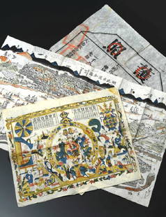
Sold2019China Missions, late 19th century, a small box ofChina Missions, late 19th century, a small box of various China Missionary items and ephemera, including a tissue paper map, passport to Rev. A W Nightingale expiring 1880, signed 'Bullock', printed sSee Sold Price
Sold2022Antique Caucasian RugAntique Caucasian Rug originating from the area of Caucasus, a mountain region bordering Persia and Turkey. Best known for their bold contrasting colors and shading techniques. Measures 68"L x 40"W. CSee Sold Price
Sold2019Two Copies of Johnson & Ward, A. J. Johnson, "Turkey inTwo Copies of Johnson & Ward, A. J. Johnson, "Turkey in Asia, Persia and Arabia, 1860, hand colored, H.- 13 3/4 in., W.- 18 in. (2 Pcs.)See Sold Price
Sold2021Stunning 12th C. Nishapur Pottery Pitcher w/ TL TestNear East, Persia (Iran and Turkey), Kashan or Nishapur, Medieval Period, ca. 1200 CE. A gorgeous pottery pitcher resting on a ring foot and covered in bright, turquoise blue glaze. The pitcher is molSee Sold Price
Sold2021Seljuk Leaded Bronze / Brass Mortar & Pestle w/ SilverMedieval Middle East / Central Asia, Persia (Iran and Turkey), Seljuk (Seljuq) Empire, ca. 12th to 13th century CE. A fine leaded-bronze mortar and brass pestle of hefty forms cast via the lost wax teSee Sold Price
Sold2019Two Maps by Johnson & Browning, "Austria, Turkey,Two Maps by Johnson & Browning, "Austria, Turkey, Greece," 1859; together with "Northern and Southern Italy," 1860-1863, hand colored, Italy- H.- 26 1/2 in., W.- 36 in., Austria- H.- 18 in., W.- 26 1/See Sold Price
Sold2019Turkey.- Pardoe (Julia) The Beauties of the Bosphorus,Turkey.- Pardoe (Julia) The Beauties of the Bosphorus, engraved frontispiece, vignette title, map and 43 plates after W.H.Bartlett; [The Danube Illustrated], no title, engraved frontispiece, map and 5See Sold Price
Sold20171860 MAP LOUISIANA, MISSISSIPPI, ARKANSASFramed hand colored 1860 map, 'Map of Louisiana, Mississippi and Arkansas" by Augustus Mitchell (American, 1790-1868), sight: 14"h, 11.25"w, overall: 21.5"h, 18.75"w, 4.25lbs Start Price: $100.00See Sold Price
Sold2019Two Maps by A. J. Johnson, "China and Japan," 1868,Two Maps by A. J. Johnson, "China and Japan," 1868, hand colored, H.- 18 in., W.- 26 1/2 in.; together with "China," 1863-1869, hand colored, H.- 13 7/8 in., W.- 18 in. (2 Pcs.)See Sold Price
Sold2022FRAMED AIR FRANCE POSTER BY LUCIEN BOUCHER"PLANISPHERE", CONSTELLATION MAP FROM 1938, AN EXAMPLE OF 200, 25 1/2" H, 40 1/2" W,See Sold Price
22 hrs LeftPrime Auction Gallery, Inc.Iran, Tabriz Hand Knotted Silk Large Persian Rug 'Map Of Iran'US$6,000
Featured5 days LeftJasper521831 Woodbridge Map of South America and Africa -- Comparative, Geographical & Statistical Map ofUS$70
7 days LeftHolabird Western Americana CollectionsWestern Missions and Missionaries, De Smet, 1859 [182513]US$120
6 days LeftTimeLine Auctions Ltd.Archaeological Books - Ancient Egyptian Research Discoveries - Various Titles£5
Jun 14DuMouchellesWilliam H. Gamble (American, B. 1863) Hand Colored Engraving, Ca. 1863, "County Map of Michigan AndUS$50(1 bid)
Jun 14DuMouchellesRigobert Bonne (French, 1727-1794) Hand Colored Engraving Ca. 18th Century, Les Etats Unis DeUS$50(1 bid)


![Turkey.- Pardoe (Julia) The Beauties of the Bosphorus,: Turkey.- Pardoe (Julia) The Beauties of the Bosphorus, engraved frontispiece, vignette title, map and 43 plates after W.H.Bartlett; [The Danube Illustrated], no title, engraved frontispiece, map and 5](https://p1.liveauctioneers.com/5458/156564/79035978_1_x.jpg?height=310&quality=70&version=1575370700)


![Western Missions and Missionaries, De Smet, 1859 [182513] (1 of 5)](https://p1.liveauctioneers.com/2699/331494/178785631_1_x.jpg?height=282&quality=70&version=1717094654)


