Sold2023Cary Antique Maps, Western European (4)Set of 4 maps including Europe, France, Netherlands, Portugal. John Cary, London, early 19th C. Hand-colored engravings. Center vertical folds, as issued.See Sold Price
Sold2023Group of 4 Early European MapsGroup of 4 early framed European maps, including; 'De L'Europe, figure III., Isle D'Albion", 'Westmorland', 'Wien in Oesterreich' and 'Milan'. Measures: 12" x 15 1/2" overall, largest.See Sold Price
Sold2020Bartholomew, John 1922 Lot of 4 Maps. EuropeIncl Europe Political, Orography/Vegetation/Races/Population, Western Europe Political, and Eastern Europe Political. Large Lithograph Maps Published 1922 by The Times, London for "The Times Survey AtSee Sold Price
Sold2016Lot 4 early 18th Century,Italian mapsLot 4 early maps, early 18th Century, "De Cremone, Italy", "le Duche de Mantoue", "Duche et Legation de Ferrare" & "Duche de Modene", 12.5" by 18.25" total size, 9.25" by 11.25" map only. Please referSee Sold Price
Sold2021Northern United States, NY, NJ, MD, PA and the NewTitle: Northern United States, NY, NJ, MD, PA and the New England states, By Bonne/ Raynal 1780 Date/Period: 1780 Materials: Copperplate engraved Size: 13 1/2 x 9 3/4'' Early map of a recognized indepSee Sold Price
Sold20184 Maps: Central Europe. Homann, Thomson , de Witt.[Homann/Thomson] 4 Maps. Hand colored. ++ L’Allemagne, distinguee en ses Cercles & subdivisee in ses Etats, contenant son Etendue presente… Mr. Schatz A. 1741 avec Privilege Imperial. Title aboveSee Sold Price
Sold2019Butler, George 1874 Lot of 4 Maps of EuropeIncl Europe Continent, France, Switzerland, and Spain/Portugal. Lithograph Maps Published 1874, London for "The Public School Atlas of Modern Geography" by Rev. George Butler. Paper Size: 13.75 x 10.5See Sold Price
Sold2019Bartholomew, John 1922 Lot of 4 Maps of EuropeIncl Europe Political, Eastern Europe Political, Western Europe Political, and Europe Physical Features & Population. Large Lithograph Maps Published 1922 by The Times, London for "The Times Survey AtSee Sold Price
Sold2020Bartholomew, John 1922 Lot of 4 Large Maps. EuropeIncl Europe Political, Orography/Vegetation/Races/Population, Western Europe Politcal, Eastern Political. Large Lithograph Maps Published 1922 by The Times, London for "The Times Survey Atlas of the WSee Sold Price
Sold2019Bryce, James 1881 Lot of 4 Maps of EuropeHistorical Maps of Europe, France and Britain. Lithograph Maps Published 1881, London for ""The International Atlas and Geography..." by James Bryce. Maps by Edward Weller & John Bartholomew. UncommonSee Sold Price
Sold2019(4) FRAMED EARLY EUROPEAN MAPS BY MERCATOR & HONDIUSHand colored engravings, in matching mahogany panel frames with malachite stone corners, including: "Veronae Vicentiiae et Patavii" per Gerardum Mercatorem (Mercator); PLUS "Saxonia Inferior et MeklenSee Sold Price
Sold20164 Hand colored early maps4 Hand colored early maps including Normandie, circa 1940. Taped; stained; tears; several small holes. 24 1/2 inches wide x 19 inches high.See Sold Price
Sold2019Cortambert, Eugene 1874 Lot of 4 Maps. UK, World EuropeTwo of the British Isles, Europe Physical Map and World on Mercators Projection. Hand Coloured Lithograph Maps Published 1874, Paris for "Atlas de la Geographie de L'Europe" by Eugene Cortambert. PapeSee Sold Price
Sold2019Bartholomew, John 1922 Lot of 4 Large Maps of EuropeLarge Lithograph Maps Published 1922 by The Times, London for "The Times Survey Atlas of the World" Maps by John George Bartholomew of the Edinburgh Geographical Institute. Centre fold as issued. PapeSee Sold Price
Sold2021Bartholomew, John 1922 Lot of 4 LG Maps of EuropeLarge Lithograph Maps Published 1922 by The Times, London for "The Times Survey Atlas of the World" Maps by John George Bartholomew of the Edinburgh Geographical Institute. Centre fold as issued. PapeSee Sold Price
Sold2017Arrowsmith: Map of Europe, 1806Map: Europe. Publication Date: 1806 Authors: Aaron Arrowsmith Publisher: Aaron Arrowsmith Size: 7.5 H x 9.3 W Inches From Arrowsmiths 4 Sheet Map of Europe Please note that this lot has a confidentialSee Sold Price
Sold2022(Early 20th c) MAPS OF EUROPE / MANY WARTIMEBataille de la Marne, French and British Front 1917, Ordnance Surveys Loughborough, Derby, Rickmansworth, Nouveau Plan de Paris Monumental N.B. circa 1890, printed by Defrenoy (Paris, France), overallSee Sold Price
Sold2023Early 4-color map of Rhode Island from very scarce McNally atlasBeautiful, precisely printed early 4-color map of Rhode Island from the 1881 McNally Indexed Atlas of the World, the earliest attainable edition of this atlas. McNally maps from the 1880s were far supSee Sold Price
Sold2023ESTATE OF SEYMOUR STEIN: 4 SMALL FRAMED MAPS (2) OF EUROPE (1) OF N. AMERICA (1) OF ASIA 12" X 15"ESTATE OF SEYMOUR STEIN: 4 SMALL FRAMED MAPS (2) OF EUROPE (1) OF N. AMERICA (1) OF ASIA 12" X 15"See Sold Price
Sold2021Barclay, James C1835 Lot of 4 Hand Col Europe MapsGermany, Holland/Belgium, France and Spain/Portugal. Hand Colored Steel Engraved Maps Published C1835, London for "A Complete and Universal English Dictionary" by the Rev. James Barclay et al. EngraveSee Sold Price
Sold2020Hand Colored Map of Europe, Early 19th C19th Century hand clored Map “Carte Politique et Itineraire de L’Europe et de L’Empire Francais en 1807”. By Chex Hyacinethe Langlois, Libraire, engraved by D. Derveaux, del. On laid paper. NoSee Sold Price
Sold2020Hand Colored Map of Europe, Early 19th C19th Century hand clored Map “Carte Politique et Itineraire de L’Europe et de L’Empire Francais en 1807”. By Chex Hyacinethe Langlois, Libraire, engraved by D. Derveaux, del.See Sold Price
Sold2023Early 19th Century Map Engravings of Europe by William Darton (1755-1819)New Map of Europe & A New Map of France Divided into its Departments 2 engravings on paper William Darton (1755-1819) 11.75 x 9.5 (plate) 15.5 x 12.25 inches (paper) (unframed) William Darton (175See Sold Price
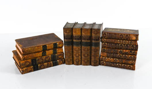
Sold2022GROUPING OF ANTIQUE LEATHER-BOUND BOOKSIncluding (7) vol. "Epochs of History" 1899, with fold-out maps of Europe; (4) vol. Dickens' Works, 1869, plus some miscellaneous volumes. Dimensions: (Overall linear) H 8.75" x W 19" Condition: As isSee Sold Price
Jun 04Mark Louis Weseloh Estate LiquidationsSix - 17th c. Maps of Europe, Asia, England, Germany x2, Crete, Greece.8 1/4" x 6 5/8".US$300
Jun 18DOYLE Auctioneers & AppraisersA block puzzle with maps of Europe, England, Ireland, Scotland, America and the WorldUS$100
2 days LeftNY Elizabeth 1704 AN ANTIQUE DETAIL OF EVERY SEAT IN THE CURRENT WARS OF EUROPE W/MAPSUS$50(1 bid)
Jun 05TimeLine Auctions Ltd.Early Byzantine Gold Ring with Pearls and Later Cloisonne Enamelled Figure£35(2 bids)
15 hrs LeftJasper5219th french lithogravure of fashion advertisement 1865 early magazine Set of 8US$95
2 days LeftThousand Planet Auction HouseA Neolithic Terracotta Spindle Whorl, Southeast Europe, 5000-4000 BCEUS$10


![4 Maps: Central Europe. Homann, Thomson , de Witt.: [Homann/Thomson] 4 Maps. Hand colored. ++ L’Allemagne, distinguee en ses Cercles & subdivisee in ses Etats, contenant son Etendue presente… Mr. Schatz A. 1741 avec Privilege Imperial. Title above](https://p1.liveauctioneers.com/179/117971/60557753_1_x.jpg?height=310&quality=70&version=1520636872)