Sold2020Johann Matthias Hase Homann Heirs World MapJohann Mathias Hase (1684-1742), "Planiglobii Terrestris Mappa Universalis: Utrumque Hemisphaerium Orient. et Occidentale Repraesentans," Nuremberg: Homann Heirs, 1746. Hand colored map of the world iSee Sold Price
Sold2018Tartariae. Maioris five Asiaticae tabvlaTitle/Content of Map: Tartariae. Maioris five Asiaticae tabvla Cartographer: Johann Matthias Haas (1684-1742) Height (inches): 18.75 Width (inches): 21.5Year: 1739 quae praesertim complectit TartariamSee Sold Price
Sold2017Haas & Heirs, map of AfricaHaas & Heirs, map of Africa, Johann Matthias Haas (German, 1684-1742), "Leonis Africani", 1737, 21"h x 25.25"w (sheet), unframed Provenance: Property from a major corporate art collection, NYSee Sold Price
Sold2018Framed "Planiglobii Terrestris Mappa Universalis" 1746"Planiglobii Terrestris Mappa Universalis Utrumqs Hemisphaerium Orient et Occidentale …. MDCCXXXXVI." Published in Nuremberg in 1746 by G.M. (George Moritz) Lowitz (1722-1774), Johann Matthias HaseSee Sold Price
Sold2017Homann: Map of the Americas, 1746Map: 1746 Homann Map of the Americas -- Americae Mappa Generalis Secundum Legitimas Projectionis Stereographicae Regulas… Cartographer: J. Homann Year / Place: 1746 Nurnberg Map Dimensions: 19.2 x 2See Sold Price
Sold2024Homann Map of New Spain 1720HOMANN, Johann Baptista (1664-1724). Regni Mexicani seu Novae Hispaniae. Engraved map. Nuremberg, 1720. 20" x 23 1/2" sheet. This superb map covers the region from the Great Lakes and Nova Scotia throSee Sold Price
Sold2016Reinecke: Australia/ New Zealand/ Hawaii Map 1804Map: Australia/ New Zealand/ Hawaii/ South Pacific "General Charte von Australien" Publishing: Reinecke, Johann Matthias: Weimar Date: 1804 Size: 17.75 x 24 inches An uncommon map described by TooleySee Sold Price
Sold2022[MAP]. HOMANN, Johann Baptist (1663-1724). Virginia, Marylandia et Carolina in America[MAP]. HOMANN, Johann Baptist (1663-1724). Virginia, Marylandia et Carolina in America Septentrionali. Nuremberg, [ca 1714].   Engraved map of the Mid-Atlantic with hand-coloring in wash and outlSee Sold Price
Sold2021Johann Baptiste Homann MapJohann Baptiste Homann "Amplissimae regionis Mississipi seu Provinciae Ludovicianae...", Nuremberg, 1720, hand-colored map, 19 1/2 in. x 22 5/8 in., framed, together with antique hand-colored map of LSee Sold Price
Sold2023[MAP]. HOMANN, Johann Baptist (1663-1724). Planiglobii Terrestris cum utroq Hemisphaerio[MAP]. HOMANN, Johann Baptist (1663-1724). Planiglobii Terrestris cum utroq Hemisphaerio Caelesti… Nuremberg, [ca 1720]. Engraved double-hemisphere map of the world with hand-coloring in wash anSee Sold Price
Sold2023[MAPS]. HOMANN, Johann Baptist (1663-1724). Four engraved continent maps with hand-coloring, each[MAPS]. HOMANN, Johann Baptist (1663-1724). Four engraved continent maps with hand-coloring, each matted and framed, comprising: Totius Americae… Nuremberg, [ca 1720]. Overall sheet 508 x 590 mmSee Sold Price
Sold2016Rare 1710 Johann Homann Color Celestial MapNuremberg; 1710. Johann Homann colored engraved celestial Hemispherium Coeli Boreale map printed on woven paper. It is displayed in eglomized glass and wood frame. Dimensions Map: 23" by 19" (58.4 cmSee Sold Price
Sold2020Homann World Map*** START PRICE IS THE RESERVE *** [World] HOMANN, Heirs (18th century). Planiglobii Terrestris Mappa Universalis utrumque. Engraved map with original hand color in part. Nuremberg: Homann Heirs, 1746See Sold Price
Sold2022Homann Atlas Compeniarius, 1748HOMANN, Johann Baptist (1663-1724). Atlas Compeniarius quinquaginta selectarum tabularum geographicarum Homanni. Nuremberg: Heirs of J.B. Homann, 1748 [maps dated 1741-1749]. Folio (21 x 12 inches). ESee Sold Price
Sold2022Homann - Map of North America, Louisiana ProvinceJohann Baptist Homann (German, 1664-1724), Amplissimae Regionis Mississipi Seu Provinciae Ludovicianae A R.P. Ludovico Hennepin Francisc Miss In America Septentrionali Anno 1687..., Nuremberg, circa 1See Sold Price
Sold2023[MAP] HOMANN. VIRGINIA MARYLANDIA CAROLINA (1715)Homann, Johann Baptist. VIRGINIA MARYLANDIA ET CAROLINA IN AMERICA SEPTENTRIONALI BRITANNORUM INDUSTRIA. Nuremberg: circa 1715. Handcolour outline, featuring pictorial cartouche illustrating scene witSee Sold Price
Sold2024Adam Friedrich Zurner (German 1679 - 1742) and Peter Schenk (German 1660 - 1711)Adam Friedrich Zurner (German 1679 - 1742) and Peter Schenk (German 1660 - 1711) "Americae tam Septentionalis quam Meridionalis in Mappa Geographica Delineato", circa 1709 Hand colored map engraving 2See Sold Price
Sold2015Old Master German Baroque Johann Ermels attrArtist: Johann F. Ermels (1641-1693), attributed to Title: untitled (portrait of an artist) Medium: Oil on Canvas Size: 36 x 28in (91.4 x 71.1cm) - NOT INCLUDING FRAME Date: 17th centurySee Sold Price
2018Important World Map from the Nuremberg Chronicle, 1493Title/Content of Map: World Map from the Nuremberg Chronicle. One of the most important world Maps ever produced Date Printed: 1493 Cartographer: Hartmann Schedel Material/Medium: Paper Size: 18" x 25See Sold Price
Sold20231753 Homann World Map -- Planiglobii Terrestris Mappa Universalis utrumque Hemisphaerium Orient etTitle: 1753 Homann World Map -- Planiglobii Terrestris Mappa Universalis utrumque Hemisphaerium Orient et Occidentale Repraesentans ex IV. Mappis Generalibus … / Mappe-Monde qui Represente les DSee Sold Price
Sold20181780 1ed RARE Complete VOYAGES Maps Captain Cook Americ1780 1ed RARE Complete VOYAGES Maps Captain Cook America Explorers Africa 32v The best book of its kind! An extremely rare, 32-volume complete set of La Harpe’s ‘General History of Voyages’! ThiSee Sold Price
Sold20171746 Homann World MapTitle: 1746 Homann World Map -- Planiglobii Terrestris Mappa Universalis utrumque Hemisphaerium Orient et Occidentale Repraesentans ex IV. Mappis Generalibus ... / Mappe-Monde qui Represente les DeuxSee Sold Price
Sold20201746 Homann Double Hemisphere World Map -- PlaniglobiiTitle/Content of Map: 1746 Homann Double Hemisphere World Map -- Planiglobii Terrestris Mappa Universalis utrumque Hemisphaerium Orient et Occidentale Repraesentans ex IV. Mappis Generalibus ... / MapSee Sold Price
Sold2024Histroric world map, ''PlaniglobHistroric world map, ''Planiglobii Terrestris Mappa Universalis. Utrumq Hemisphaerium Orient et Occidentale repraesentans ex IV. mappis generalibus'', partly col. Copper engraving by Homann Erben 1746See Sold Price
Jun 13Swann Auction Galleries(CELESTIAL.) Johann Gabriel Doppelmayr; and Homann Heirs. Tabula Selenographica in qua LunariumUS$375
Jun 12Nye & CompanyJohann Baptista Homann, German 1664-1724, Nova Anglia, Hand-Colored EngravingUS$250
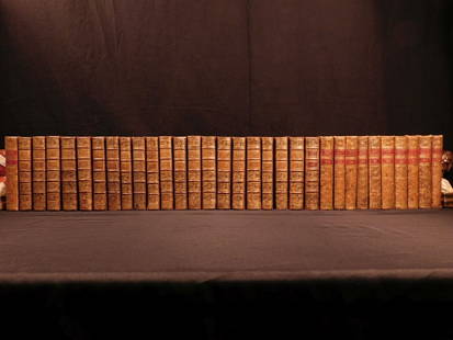
3 days LeftFreeman's | Hindman[MAPS]. HOMANN, Johann Baptist, HOMANN HEIRS, and Georg Matthäus SEUTTER. [Composite Atlas].US$15,000
14 hrs LeftJasper521696 SPECULAE PHYSICO-MATHEMATICO HISTORICAE by ZAHN antique ILLUSTRATED scarceUS$2,400
3 days LeftFreeman's | HindmanHOMANN, Johann Baptist. Amplissimae Regionis Mississipi Seu Provinciae Ludovicianae. Nuremburg, [caUS$425(2 bids)
4 days LeftTrillium Antique Prints & Rare BooksKohler & Weigel - Map of Louisiana Territory or Eastern United States (extends from New Mexico toUS$110(4 bids)
4 days LeftTrillium Antique Prints & Rare BooksKohler & Weigel - Map of Sicily and SardiniaUS$85(2 bids)


![[MAP]. HOMANN, Johann Baptist (1663-1724). Virginia, Marylandia et Carolina in America: [MAP]. HOMANN, Johann Baptist (1663-1724). Virginia, Marylandia et Carolina in America Septentrionali. Nuremberg, [ca 1714].   Engraved map of the Mid-Atlantic with hand-coloring in wash and outl](https://p1.liveauctioneers.com/197/243556/126318973_1_x.jpg?height=310&quality=70&version=1649293172)

![[MAP]. HOMANN, Johann Baptist (1663-1724). Planiglobii Terrestris cum utroq Hemisphaerio: [MAP]. HOMANN, Johann Baptist (1663-1724). Planiglobii Terrestris cum utroq Hemisphaerio Caelesti… Nuremberg, [ca 1720]. Engraved double-hemisphere map of the world with hand-coloring in wash an](https://p1.liveauctioneers.com/197/284572/150193667_1_x.jpg?height=310&quality=70&version=1680880467)
![[MAPS]. HOMANN, Johann Baptist (1663-1724). Four engraved continent maps with hand-coloring, each: [MAPS]. HOMANN, Johann Baptist (1663-1724). Four engraved continent maps with hand-coloring, each matted and framed, comprising: Totius Americae… Nuremberg, [ca 1720]. Overall sheet 508 x 590 mm](https://p1.liveauctioneers.com/197/284572/150193668_1_x.jpg?height=310&quality=70&version=1680880467)

![Homann World Map: *** START PRICE IS THE RESERVE *** [World] HOMANN, Heirs (18th century). Planiglobii Terrestris Mappa Universalis utrumque. Engraved map with original hand color in part. Nuremberg: Homann Heirs, 1746](https://p1.liveauctioneers.com/1968/163248/82424684_1_x.jpg?height=310&quality=70&version=1583340284)
![Homann Atlas Compeniarius, 1748: HOMANN, Johann Baptist (1663-1724). Atlas Compeniarius quinquaginta selectarum tabularum geographicarum Homanni. Nuremberg: Heirs of J.B. Homann, 1748 [maps dated 1741-1749]. Folio (21 x 12 inches). E](https://p1.liveauctioneers.com/1968/250616/130196470_1_x.jpg?height=310&quality=70&version=1654190895)

![[MAP] HOMANN. VIRGINIA MARYLANDIA CAROLINA (1715): Homann, Johann Baptist. VIRGINIA MARYLANDIA ET CAROLINA IN AMERICA SEPTENTRIONALI BRITANNORUM INDUSTRIA. Nuremberg: circa 1715. Handcolour outline, featuring pictorial cartouche illustrating scene wit](https://p1.liveauctioneers.com/8124/310027/165853625_1_x.jpg?height=310&quality=70&version=1700184289)


![[MAPS]. HOMANN, Johann Baptist, HOMANN HEIRS, and Georg Matthäus SEUTTER. [Composite Atlas]. (1 of 5)](https://p1.liveauctioneers.com/197/329395/177650530_1_x.jpg?height=282&quality=70&version=1715364962)


