Sold20221903 Mungo Park Travels in AFRICA Mandingo Slaves1903 Mungo Park Travels in AFRICA Mandingo Slaves Cannibalism Voyages Mungo Park was an 18th-century Scottish explorer who was well-known for his voyages in West Africa and the Niger River Basin. TheSee Sold Price
2018Pair of 19th c. Railroad Maps, Routes, SchedulesIncluding: ** WEST SHORE ROUTE. NEW YORK, WEST SHORE, & BUFFALO…. March, 1885. On light pink paper, some panels faded, Very Good. ** THE NORTH-WESTERN LINE… DIRECT CONNECTION TO AND FROM ALL POINTSee Sold Price
Sold2020West Indies. Spanish galleons routes map.Title: West Indies. Spanish galleons routes map. Date/Period: 1744-1748. Materials: Copperplate engraved Dimensions: 19x16 1/4” By Emanuel Bowen. From, John Harris’s A Complete Collection of voyagSee Sold Price
Sold2022Mitchell's large Mexican-American War map, 1847Heading: Author: Mitchell, Samuel Augustus Title: Map of Mexico, Including Yucatan & Upper California, Exhibiting the Chief Cities and Towns, the Principal Travelling Routes &c. Place Published: PhilSee Sold Price
Sold20181854 Thayer, Bridgman, Fanning Map of US, Mexico andTitle/Content of Map: 1854 Thayer, Bridgman, Fanning Map of US, Mexico and Caribbean -- Map of the United States, Canada, Mexico, and the West Indies with Central America, Showing All the Routes to CaSee Sold Price
Sold2022(GOLD RUSH.) J.M. Atwood. Map of the United States, Canada, Mexico, Central America, and the West(GOLD RUSH.) J.M. Atwood. Map of the United States, Canada, Mexico, Central America, and the West India Islands with a Portion of Venezuela & New Granada; Showing the Routes Overland and by the IsthmuSee Sold Price
Sold2020Air France. Flying Holidays this Year! Circa 1935.Air France. Flying Holidays this Year! Circa 1935. Offset lithograph travel poster with the airline’s route map printed within the outline of a propeller plane, covering major cities of Europe aSee Sold Price
Sold2023BUFFALO BILL'S WILD WEST POSTER - CHIEF IRON TAILAUTHENTIC, ORIGINAL, HALF SHEET, STROBRIDGE LITHO CO., 1908. WHILE THE ARTWORK WAS COPYWRITE 1908, THIS EXAMPLE ADDING PAWNEE BILL TITLE WAS ONLY USED IN 1909. RARE BUFFALO BILL'S WILD WEST COMBINED WSee Sold Price
Sold2016Schoolcraft explores the west 1821 with mapHeading: Author: Schoolcraft, Henry R. Title: Journal of a Tour into the Interior of Missouri and Arkansaw, from Potosi, or Mine à Burton, in Missouri Territory, in a South-West Direction, toward thSee Sold Price
Sold2018Currier & Ives, group of three colored lithographCurrier & Ives, group of three colored lithograph prints, "The Great West", "The Route to California", and "Through to the Pacific", sight size 9 1/2" x 12 1/2" Provenance: Property from the Credit SuSee Sold Price
Sold2021(16) 19TH C. MAPS OF THE WEST INDIES IN FOLIO,Including: "L'Isle de Ste. Domingue, et celle de Porto Rico", by Bonne, hand colored engraving,1778, 10" x 14 1/2"; PLUS "West Indies", Smith's Atlas, 1808, hand colored engraving, 1808, 11" x 14"; PLSee Sold Price
Sold2022LARGE MAP TRACKING SHIPPING ROUTE BETWEEN ENGLAND AND CHINA 24” x 37.5” sight. FramedLARGE MAP TRACKING SHIPPING ROUTE BETWEEN ENGLAND AND CHINA“A General Chart, on Mercator’s Projection, to shew the Track of the Lion and Hindustan from England to the Gulph of Pekin in ChiSee Sold Price
Sold2022Color map of San Francisco Chinatown 1885Heading: -1885 Author: Title: Official Map of Chinatown in San Francisco Place Published: San Francisco Publisher: Date Published: 1885 Description: Color lithographed map. 21.1See Sold Price
Sold2023Neolithic - Hongshan Culture - Carved Jade Sun God Deity.Neolithic - Hongshan Culture - Carved Jade Sun God Deity. The Hongshan culture was a Neolithic culture in the West Liao river basin in northeast China that existed from about 4700 to 2900 BC, was knowSee Sold Price
Sold2023[SLAVERY & ABOLITION].  $300 Reward. Ranaway...my Negro Boy George Johnson. Broadside with[SLAVERY & ABOLITION].  $300 Reward. Ranaway...my Negro Boy George Johnson. Broadside with autograph letter signed ("Nath'l W. Hays") on bifolium integral leaf to Chief of Police of West Chester,See Sold Price
Sold2022(WEST--KANSAS.) Letters and map from early Nemaha County.(WEST--KANSAS.) Letters and map from early Nemaha County. Printed map, 27½ x 19½ inches; toning, partial separations at folds, other minor wear. with 11 related letters to the Sage family daSee Sold Price
Sold202334 Civil War Related Papers and PhotosA fine collection of Civil War documents from 1861 - 1922. Highlighting the collection is a manuscript map in a contemporary hand showing a "Map of the route marched by 5th Regt P.R.v.C.(?) Starts inSee Sold Price
Sold2018Ottens: Antique Map of the Caribbean / West Indies 1730Title/Content of Map: 1730 Ottens Map of the Caribbean / West Indies -- Insula Americana nempe Cuba, Hispaniola, Jamaica, Pto Rico, Lucania,Antillae vulgo Caribe barlo et Soto vento etc. Date Printed:See Sold Price
Sold2024An 1809 map of the postal routes of FranceAn 1809 folding map of the postal routes of France (Carte itin?raire de la France, 1809)Carte de la France donnant toutes les Routes de Postes, les lieux de Relais, les Routes des Messageries et autreSee Sold Price
Sold20211889 Guide to West Coast Ports, with 3 mapsHeading: Author: Spreckels, J.D. and Frederick K. Samuels, compilers Title: Ports of San Francisco, San Diego, Puget Sound, Portland and Honolulu. (Cover title) Place Published: San Francisco PublishSee Sold Price
Sold2016Nova Virginia Tabula. [1671 or later].[Virginia] NOVA VIRGINIAE TABULA. Derived from the Hondius-Blaeu version of John Smith’s map. Oriented to the West. Tooley’s Derivative 8, State 1: Cartouche at upper left with no imprint. “NotaSee Sold Price
Sold2021MORA, Jo (1876-1947). California / El Dorado of theMORA, Jo (1876-1947). California / El Dorado of the West. Monterey, 1945. Lithograph pictorial map, or “carte,” of California. Numerous cartoonish illustrations of cities and towns, nationSee Sold Price
Sold2024Ancient Stone Idol from the Bura 300 AD -1500 AD Ex BeckerA ancient stone relic from West Africa, present day Niger and Burkina Faso, found in the Bura-Asinda-Sikka region, ca. 300 AD to 1500 AD. This heavily incised stone and decorated head in bulbous formSee Sold Price
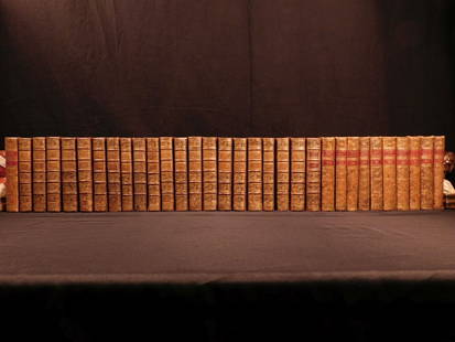
Sold20181780 1ed RARE Complete VOYAGES Maps Captain Cook Americ1780 1ed RARE Complete VOYAGES Maps Captain Cook America Explorers Africa 32v The best book of its kind! An extremely rare, 32-volume complete set of La Harpe’s ‘General History of Voyages’! ThiSee Sold Price
19 hrs LeftJasper52NIGERIA early explorers' routes. Lake Chad. Yariba Houssa Borgou SDUK 1844 mapUS$45
19 hrs LeftJasper52NIGERIA explorers' routes. Lander Clapperton Oudney Denham Allen. SDUK 1874 mapUS$60
19 hrs LeftJasper52WEST AFRICA Explorers' routes Senegal Ashanti. Mountains of Kong. SDUK 1857 mapUS$30
19 hrs LeftJasper52WEST AFRICA explorers' routes. Beaufort Gray Park Dochard Caillie. SDUK 1874 mapUS$40
19 hrs LeftJasper52WEST AFRICA I Explorers' routes Senegal Ashanti Ivory Gold Coast. SDUK 1851 mapUS$40
19 hrs LeftJasper52WEST AFRICA showing early explorers' routes & Mountains of Kong. SDUK 1844 mapUS$40
Jun 12Jasper52Part of the Western Coast of Africa…' by James Wyld. Sierra Leone 1840 old mapUS$280
19 hrs LeftJasper52NIGERIA w/ early explorers' routes. Lake Chad Yariba Houssa Borgou.SDUK 1844 mapUS$60
19 hrs LeftJasper52WEST AFRICA II. NIGERIA. Bight of Benin-Lake Chad. Yariba Houssa. SDUK 1851 mapUS$70
19 hrs LeftJasper52Eastern Sahara. Africa. Libya Niger Algeria Chad Nigeria 1885 old antique mapUS$15
3 days LeftEarly American History Auctions1853 Map, Basin of the St. Lawrence, by T. Keefer showing Natural + Artificial North American RoutesUS$220
Featured19 hrs LeftJasper52WEST AFRICA Niger/Gambia rivers tribes towns. 'Pays des Negres'. MALLET 1683 mapUS$15
19 hrs LeftJasper52NORTH & WEST AFRICA. Sahara Niger river 'Zaara ou le Desert'. MALLET 1683 mapUS$20
19 hrs LeftJasper52WESTERN AFRICA.Kong Mountains.Caravan routes.Slave Coast.TALLIS/RAPKIN 1851 mapUS$55
19 hrs LeftJasper52FRENCH WEST AFRICA. Afrique Occidentale Française. Plan of Niger floods 1938 mapUS$20
1 day LeftHolabird Western Americana CollectionsIndian Agent McGillicuddy Handwritten Letter 1882 [182354]US$400
19 hrs LeftJasper52West Africa WW2 Nigeria Sudan Egypt. Takoradi air reinforcement route 1954 mapUS$15
Jun 23Schilb Antiquarian Rare Books1877 Geology Geography Surveys 1ed Nevada Wyoming Utah George Wheeler US West 2vUS$1
6 days LeftWinter Associates Three historical engraved maps of the Caribbean, ranging from 1616-1814, each hand colored, framedUS$100(1 bid)


![[SLAVERY & ABOLITION].  $300 Reward. Ranaway...my Negro Boy George Johnson. Broadside with: [SLAVERY & ABOLITION].  $300 Reward. Ranaway...my Negro Boy George Johnson. Broadside with autograph letter signed ("Nath'l W. Hays") on bifolium integral leaf to Chief of Police of West Chester,](https://p1.liveauctioneers.com/197/277725/145989404_1_x.jpg?height=310&quality=70&version=1675442656)


![Nova Virginia Tabula. [1671 or later].: [Virginia] NOVA VIRGINIAE TABULA. Derived from the Hondius-Blaeu version of John Smith’s map. Oriented to the West. Tooley’s Derivative 8, State 1: Cartouche at upper left with no imprint. “Nota](https://p1.liveauctioneers.com/179/93063/47518642_1_x.jpg?height=310&quality=70&version=1472482862)


![Early California Map c1856 [179290] (1 of 1)](https://p1.liveauctioneers.com/2699/331495/178785754_1_x.jpg?height=282&quality=70&version=1717094933)

![Indian Agent McGillicuddy Handwritten Letter 1882 [182354] (1 of 1)](https://p1.liveauctioneers.com/2699/331494/178785237_1_x.jpg?height=282&quality=70&version=1717094654)


![Micrometer Calipers & Compass [181387] (1 of 6)](https://p1.liveauctioneers.com/2699/331494/178785671_1_x.jpg?height=282&quality=70&version=1717094654)

