Sold2024Willem Blaeu, Map of The AmericasAmsterdam, 1617. Together with "Early Maps" by Tony Campbell, Abbeville Press and "The United States in Old Maps and Prints, Eduard Van Ermen. 3 pieces Sight size: 16-1/2"h x 22"w Overall: 23-1/2"h xSee Sold Price
Sold2022Blaeu Novus Brasiliae Typus, c. 1640BLAEU, Willem Janszoon (1571-1638). Novus Brasiliae Typus. Engraved map with original hand color in full. Amsterdam. c. 1640. 18" x 21 7/8" sheet. Fine old color example of Blaeu's first map of BrazilSee Sold Price
Sold2021MAP, Western Hemisphere, BlaeuBlaeu's Stunning Carte-a-Figures Map of the Americas in Full Contemporary Color. Western Hemisphere - America. Willem Blaeu, Americae Nova Tabula, 1642 (circa). Hand Color. This stunning carte-a-figurSee Sold Price
Sold2024Anna Pottery Railroad and River Guide FlaskAmerican Second Half 19th Century. Pig Shaped with river and railroad map and inscribed "With a little good old rye in hogs.."See Sold Price
Sold2022NORDITALIENISCH-VENEZIANISCHE SCHULE DES 18. JH. FLUSSLANDSCHAFT MIT BURGANLAGE, GONDELN UNDNORTHERN ITALIAN-VENETIAN SCHOOL OF THE 18TH CENTURY RIVER LANDSCAPE WITH CASTLE, GONDOLAS AND FIGURAL STAFFAGE Oil on canvas (old relined). 49 x 92 cm (F. 68 x 110 cm). Partly damaged, paint cracks aSee Sold Price
Sold1919 Map of European Russia1919 Map of European Russia: Map showing the lines held by the Soviet Army on June 5th 1919, done by N.R.E.F. Mapping Section, in folded condition, size 40 cm x 42 cm.See Sold Price
Sold2018Blaeu: Landmark Map of the AmericasCartographer: Willem Blaeu Place/Date: Amsterdam / 1617/1665 Size: 21 1/2" x 16 1/2" Condition: contemporary color; minor spotting, a few small printer's creases at sides of image. Some waterstainingSee Sold Price
Sold2021Edward Hill 1879 - Old Man of Mountain SignedLandscape of Riders on Horses overlooking River and Old Man and the Mountain Signed "Edward Hill 1879" in gold Gild Frame - Canvas raised outward where it meets frame in lower left. Has some paint losSee Sold Price
Sold2022Joseph Vorst, Missouri (1897-1947), Old Man River, oil on canvasJoseph VorstMissouri, (1897-1947)Old Man Riveroil on canvassigned lower left, framed.Exhibited: Cedarhurst Center for the Arts, "An American Art Colony: The Art and Artists of Ste. Genevieve, MSee Sold Price
Sold2018NORTHERN WEI TIBETAN OLD BRONZE BUDDHANorthern Wei Tibetan Old Bronze Buddha; H: 69 cmSee Sold Price
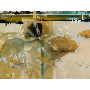
Sold2020Keith Joubert - LinyantiKeith Joubert South African, 1948-2013 Linyanti Oil on canvas Inscribed en verso In Northern Botswana the Linyanti River forms a natural border between Namibia and Botswana. The river follows a faultSee Sold Price
Sold2016Mumuyte standing figure, 20th c.A Benue River standing figure with old breaks at legs. Nigeria, Mumuyte/Chamba style. 20th century. 12"h x 3 1/2"w x 3 1/2"d. Provenance: Inventory and Collection from the Estate of Merton D. Simpson.See Sold Price
2021GREAT NORTHERN’S 2 GREAT TRAINS SYSTEM MAP.Huge dramatic reverse glass advertising Great Northern's two great trains, Empire Builder and Western Star. In script just below Great Northern logo it states "Steamliners twice a day, each way, betweSee Sold Price
Sold2024De Fer Map of the Mississippi RiverDE FER, Nicolas (1646-1720). Partie Meridionale de la Riviere de Missipi, et ses environs, dans l'Amerique Septentrionale. Mis au jour par N. de Fer. Geographe de sa Majeste Catolique 1718. Engraved mSee Sold Price
Sold2021Albert Backus 1906-1990 Florida Wetlands PaintingAlbert Ernest (Beanie) Backus (American, 1906-1990). Original Indian River School oil painting. Titled "Old Snag In The Wetlands," circa 1950. Features a lush Florida wetlands landscape with billowingSee Sold Price
Sold20172 Native American objects. 20th century.A group of 2 Native American Objects. ++ Jump Dance basket. Northern California, USA. Hupa. 20th century. ++ Basket. Northern California, USA. Lower Klamath River. 20th century. Note: "The Xay-ch´iSee Sold Price
Sold2015Jansson (Jan) - [Atlas Novus: Germany],single vol. lacking title, 106 mostly regional maps of Germany and northern Europe, but also including a general map of Germany, and classical maps of both Germany and Scandinavia, and several city plSee Sold Price
Sold2022Northstar Model 66DX40DSGI 3000 PSI Portable Power Washer like newNorthstar Model 66DX40DSGI 3000 PSI Portable Power Washer, ,Diesel/Kerosene or Fuel Oil Powered, this unit is only 2-3 years old. It was made by Northern Tool & Equipment and is fitted with a Honda moSee Sold Price
2022Blaeu, Johannes (Netherlands, 1596-1673) "The New World Map" Double Hemisphere World Map C. 1664Nova et Accuratissima Totius Terrarum Orbis Tabula Translated "The New World Map", Hand Colored w/ Elaborately Decorated Spandrels.   Sight View 16" x 21-1/2", Overall View 21" x 25-1/2"See Sold Price
2023Victorian c1900s Diamond Platinum Pendant NecklaceTitle: Victorian c1900s Diamond Platinum Pendant Necklace Description: Magnificent Victorian three-stone pendant created in Russia in the 1900's. Features two Old European cut diamonds set in platinumSee Sold Price
Sold2022MAPS IN BOOK, Atlases, CareyCarey's Famous 1814 General Atlas. Atlases. Mathew Carey, Carey's General Atlas, Improved and Enlarged: Being a Collection of Maps of the World and Quarters, Their Principal Empires, Kingdoms, &c., 18See Sold Price
Sold2016T-O World Map.- Lucanus (Marcus Annaeus) Pharsalia,Lucanus (Marcus Annaeus) Pharsalia, manuscript on paper, [Northern Italy (possibly Padua), first half of the fifteenth century]. 294 x 217mm., I + 149 + I leaves (including defective leaves and 3 blanSee Sold Price
Sold2021George III Figured Mahogany Eight Drawer Map CaseBritish, 18th century, in old surface with rich brown color, highly figured top over eight dovetailed drawers with oak linings, probably original gilt brass pulls, brass carrying handles, set on straiSee Sold Price
Sold2022MITCHELL, S. AUGUSTUS. A New Map of Texas, Oregon and California.MITCHELL, S. AUGUSTUS. A New Map of Texas, Oregon and California. Engraved pocket map of the American territories west of the Mississippi River. 22¾x21 inches overall, ample margins; strong origiSee Sold Price
Jun 07Freeman's | Hindman[MAP]. TODESCHI, Pietro. [Nova et Acurata Totius Americae Tabula auct. G.I. Blaeu] America quartaUS$5,000
Jun 23Schilb Antiquarian Rare Books1831 Northern Traveller Voyages to NIAGARA Falls Quebec Canada Illustrated MAPSUS$1(1 bid)
Featured3 days LeftJasper52Venezuela, New Granada & Ecuador by J.W. Lowry. Colombia 1860 old antique mapUS$40
Featured2 days LeftJasper521867 Beers Map of New York City Area -- Map of New York and Vicinity Accompanying "Atlas of New YorkUS$200
2 days LeftJasper521733 BIBLE OLD TESTAMENT COMMENTARY by CALMET VELLUM FOLIO antique w/ LARGE MAPUS$160
6 days LeftMynt Auctions1872 RUSSIAN 84 SILVER CHAMPAGNE COOLER ICE BUCKET BY IVAN VONIFATIYEVICHUS$10(1 bid)
3 days LeftJasper52Northern South America.Brazil Guianas Venezuela Colombia Ecuador Peru 1885 mapUS$15
Jun 08Ark Auctions IncAntique Estate Coral Platinum and Old Mine Cut Diamond Ring with Black OnyxUS$3,500


![Jansson (Jan) - [Atlas Novus: Germany],: single vol. lacking title, 106 mostly regional maps of Germany and northern Europe, but also including a general map of Germany, and classical maps of both Germany and Scandinavia, and several city pl](https://p1.liveauctioneers.com/410/80717/41962763_1_x.jpg?height=310&quality=70&version=1445353131)


![T-O World Map.- Lucanus (Marcus Annaeus) Pharsalia,: Lucanus (Marcus Annaeus) Pharsalia, manuscript on paper, [Northern Italy (possibly Padua), first half of the fifteenth century]. 294 x 217mm., I + 149 + I leaves (including defective leaves and 3 blan](https://p1.liveauctioneers.com/5458/94966/48431616_1_x.jpg?height=310&quality=70&version=1476369049)


![[MAP]. TODESCHI, Pietro. [Nova et Acurata Totius Americae Tabula auct. G.I. Blaeu] America quarta (1 of 1)](https://p1.liveauctioneers.com/197/329395/177650542_1_x.jpg?height=282&quality=70&version=1715364962)


