Sold2018Weller: Antique Map of England & Wales NW, 1863TITLE/CONTENT OF MAP: 'England & Wales, North-West sheet' Cumbria Lancashire Welsh coast Isle of Man. DATE PRINTED: 1863 IMAGE SIZE: Approx 45.5 x 32.5cm, 17.75 x 12.75 inches (Large) TYPE: Antique maSee Sold Price
Sold2023Nat. Encyclo. 1890's Mixed Lot of 32 Antique MapsIncl Sweden/Norway, Eastern USA, British Isles Geological, North America X 2, South America, Russia in Europe, Scotland, Britannia Antiqua, Suez Canal, China Proper, England and Wale, World HemisphereSee Sold Price
Sold2023THE SHETLAND ISLANDS antique map by GW BACON Scotland 1885 oldTITLE/CONTENT OF MAP: 'The Shetland Islands' DATE PRINTED: 1885 IMAGE SIZE: Approx 33.0 x 24.0cm, 13 x 9.5 inches (Large); Please note that this is a folding map. TYPE: Colour Antique Lithograph Map CSee Sold Price
Sold2018Bacons Motor Road Map: England & Wales, North. c.1920sTitle/Content of Map:Bacons Motor Road Map: England & Wales, North. c.1920s Date: c.1920s Cartographer: Bacons Motor Road Maps Material/Medium: Folded in boards color map reinforced with original gauzSee Sold Price
Sold2018Weller: Antique Map of England North East Coast, 1863TITLE/CONTENT OF MAP: 'England and Wales' ENGLAND NORTH EAST COAST Lincs Yorks Durham Northumbs. >Berwick DATE PRINTED: 1863 IMAGE SIZE: Approx 45.5 x 32.5cm, 18 x 12.75 inches (Large) TYPE: Antique mSee Sold Price
Sold2019Maps 1824-1911 Mixed Lot of 10 Antique MapsIncl Sweden, Denmark, Norway, Macedonia/Thrace, Asia Minor, Egypt, Siberia, England/Wales, Switzerland, and North Africa. Examples by Delamarche, Barthelemy, Becker, Bryce and Encyclopaedia BritannicaSee Sold Price
Sold2018Ettling: Antique Map of USA NORTH EAST, 1863TITLE/CONTENT OF MAP: 'United States of North America North Eastern sheet' New England & Mid-Atlantic states. DATE PRINTED: 1863 IMAGE SIZE: Approx 45.5 x 33.0cm, 17.75 x 13 inches (Large) TYPE: AntiqSee Sold Price
Sold2019Road-Map of England And WalesTitle: Road-Map of England And Wales Publication Date: 1835-03-25 Cartographer: BACON, G. W. & CO. Publisher: G.W. BACON & CO. Dimension: 33Height - 26.5Width Retailed by Forster Groom & Co. Ltd. DissSee Sold Price
Sold2024SOUTH AMERICA.North sheet.Brazil Peru Ecuador Colombia Venezuela Bacon 1895 mapTITLE/CONTENT OF MAP: 'South America North sheet' DATE PRINTED: 1895 IMAGE SIZE: Approx 33.5 x 44.5cm, 13.25 x 17.5 inches (Large); Please note that this is a folding map. TYPE: Antique colour map CONSee Sold Price
Sold2023SOUTH AMERICA NE. Brazil. Inset Rio de Janeiro; Trinidad. BACON 1893 old mapTitle: SOUTH AMERICA NE. Brazil. Inset Rio de Janeiro; Trinidad. BACON 1893 old map Description: South America; Inset maps of Environs of Rio de Janeiro; Trinidad' by GW Bacon (1893). Antique colour mSee Sold Price
Sold20241840 LEWIS MAP of ENGLAND & WALES on LINEN 4 PARTS antiqueLondon: Samuel Lewis, c.1839-1840. Complete in four sheets, dissected and laid on linen, each 35 x 41.5" Bound into original morocco gilt covers, with elaborate gilt tooling. Very good condition of thSee Sold Price
2020Bacon, G. W. 1898 Lot of 35 British County MapsIncl Devon North and South, Hampshire, Lancashire North and South, Leicester/Rutland, Lincoln, Monmouth, Salop (Shropshire) Staffordshire, Yorkshire, England/Wales, England SW, England SE, Wales N, WaSee Sold Price
Sold2020Bacon, G. W. 1898 Lot of 35 British County MapsIncl Devon North and South, Hampshire, Lancashire North and South, Leicester/Rutland, Lincoln, Monmouth, Salop (Shropshire) Staffordshire, Yorkshire, England/Wales, England SW, England SE, Wales N, WaSee Sold Price
Sold2021Four Antique MapsFour antique maps. Including a very early hand made paper map of Florida and Virginia. Fragment of old newspaper on back dated 1630. Unframed, each approx H 21" W 24". All in excellent condition, minoSee Sold Price
Sold2017Levasseur: Antique Map of North America, 1840Title/Content of Map: 1840 Levasseur Map of North America - Amerique Septrentionale Date Printed: 1840 Paris Cartographer: V. Levasseur Size: 11 x 16.5 in. Condition: Excellent. Minor age toning; issuSee Sold Price
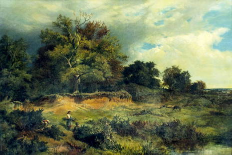
Sold2018"Nantile Lake - North Wales" By Alfred de Breanski Sr.Signed Alfred de Breanski (British, 1852 - 1928) (lower right); inscribed Nantile Lake / N.Wales (on the reverse). oil on canvas. 19th Century. DIMENSIONS: 17 in.H x 22 in.W x 2 in.D (43 cmH x 56 cmWSee Sold Price
Sold2022Sidney Richard Percy (UK,1821-1886) oil painting antiqueARTIST: Sidney Richard Percy (British, 1821 - 1886) NAME: Landscape - Near Capel Curig, North Wales YEAR: 1851 MEDIUM: oil on canvas CONDITION: Minor stable craquelure. One small inpainting 1/4" x 1/2See Sold Price
Sold2022Squirrel WeathervaneSquirrel weathervane. Braced heavy sheet iron with old paint. American, circa 1920. Condition: Excellent original condition. H 16-1/4" L 25-1/2". Copy and paste link for high-res image: https://www.drSee Sold Price
Sold2021Flag WeathervaneFolk Art flag weathervane. Sheet iron with an old, probably original painted surface. Circa 1900.H 39" W 20" D 9-1/2". H flag only 12-1/2" W flag only 15". Please refer to this link for high-res imageSee Sold Price
Sold2022DES BARRES, JOSEPH FREDERICK WALLET The North East Shore of the Gulph of Mexico. London: circa 1780.DES BARRES, JOSEPH FREDERICK WALLET The North East Shore of the Gulph of Mexico. London: circa 1780. A very large hand-colored engraved map on four joined sheets. Overall 30 x 84 inches (76 x 214 cm).See Sold Price
Sold2021Fine Antique English CelloFine antique cello. Probably English. Early 19th century. Solid payable instrument with great focused sound. Old 1912 repair label. Excellent condition. Overall length 46-1/2" Body L 29-3/4".See Sold Price
Sold2024Map of United States of North America, 1785Map of United States of North America, 1785, The Royal Islands of Newfoundland. 26 3/4 x 32 3/4 in framed. 19 x 25 in unframed.Local Pick up call one day before to make an appointment. TO SHIP THIS ITSee Sold Price
Sold2023Early Map of Tennessee, Daniel Smith, 1795A MAP OF THE TENNASSEE [sic] GOVERNMENT FORMERLY PART OF NORTH CAROLINA TAKEN CHIEFLY FROM SURVEYS BY GENL. D. SMITH & OTHERS, drawn by Daniel Smith, engraved by Joseph T. Scott, for "General Atlas FoSee Sold Price
Sold2022NEW ENGLAND QUEEN ANNE MAPLE SLANT LID DESK ON FRAMEold untouched surface; four graduated drawers (bales original); on frame with scalloped skirt and bandy cabriole legs; 9.5"h; 35"w; 17.5"d Collection of G.W. SamahaNOTE: Apologies, we cannot approve bSee Sold Price
Featured2 days LeftJasper52SOUTH AMERICA Brazil Argentina Chile Peru Ecuador by GW BACON 1898 old mapUS$40
Jun 07Freeman's | HindmanMURCHISON, Roderick Impey, Sir. The Silurian System. 1839. COMPLETE WITH VERY RARE HAND-COLOREDUS$1,500
Jun 30Broward Auction GalleryAFTER Leonardo Nierman (NY,Mexican,1932- 2023) acrylic paintingUS$10(1 bid)


![Early Map of Tennessee, Daniel Smith, 1795: A MAP OF THE TENNASSEE [sic] GOVERNMENT FORMERLY PART OF NORTH CAROLINA TAKEN CHIEFLY FROM SURVEYS BY GENL. D. SMITH & OTHERS, drawn by Daniel Smith, engraved by Joseph T. Scott, for "General Atlas Fo](https://p1.liveauctioneers.com/525/272425/142901899_1_x.jpg?height=310&quality=70&version=1671337478)


