Sold2017Linschoten: Map of Ascension Island, 1596Map: Vera effigies et delineatio Insulae Ascenscio Cartographer: Linschoten Place & Date: Amsterdam / 1596 Size: 13 3/8" x 9 1/4" The wonderfully decorative Ascension Island sheet from Linschoten's ItSee Sold Price
Sold20211602 Ortellius Map of Terceira in the Azores -- TerceraTitle: 1602 Ortellius Map of Terceira in the Azores -- Tercera Cartographer: A Ortelius Year / Place: 1602, Antwerp Map Dimension (in.): 3.1 X 4 in. This is an excellent smaller map of Terceira islandSee Sold Price
Sold2017Linschoten: Coastal Profiles St. Helena Island, 1596Map: Vera effigies et delineatio Insulae Sanctae Helenae Cartographer: Linschoten Place & Date: Amsterdam / 1596 Size: 18 3/4" x 12 1/4" Condition: b&w; folds as issued and some creasing; left, rightSee Sold Price
Sold2019Anon 1816 Hand Col Map. Island of St. Helena, Africa"The Island & Forts of St. Helena" Copper Engraved Map Published 1816 by Nuthall, Fisher & Co., Liverpool. Unknown Cartographer/Engraver. Paper Size: 10.5 x 8.5 inch (27 x 22cm) Chip to bottom marginSee Sold Price
Sold2017Neele: Antique Map Islands of the Pacific Ocean, 1817Map: Map of the Islands in the Pacific Ocean Publication Date: 1817 Cartographer: NEELE, sc. Publisher: THOMSON'S NEW GENERAL ATLAS Size: Folio – 19.50 H x 23.75 W Inches From a famous Scottish atlaSee Sold Price
Sold2023Frame Map "Islands of Minorca" 28" x 36"Frame Map "Islands of Minorca" 28" x 36"See Sold Price
Sold2021Tallis, John (Pub) 1852 Map Islands in the Indian OceanSteel Engraved Map with Original Outline Hand Color Published 1852-56 by John Tallis, London for "The Universal Pronouncing Dictionary" by Thomas Wright. Drawn & Engraved by John Rapkin. Centre fold aSee Sold Price
Sold2021Tallis, John (Pub) 1852 Map. Islands in the AtlanticShowing Canary Islands, Madeira and Bermuda. Steel Engraved Map with Original Outline Hand Color Published 1852-56 by John Tallis, London for "The Universal Pronouncing Dictionary" by Thomas Wright. DSee Sold Price
Sold2020Island Juan Fernandez 1748 J. N. BellinTitle/Content of Map: Island Juan Fernandez 1748 J. N. Bellin Cartographer:J. Nicolas. Bellin Date Printed: 1748 Material/Medium: Paper Size: Sheet Size 34 x 24 cm. Image 28 x 19 cm. Reserve: $95.00 SSee Sold Price
Sold2022Three Antique Hawaiian Maps, US Government3 1920s Hawaiian Maps. Island Of Oahu Map Approximately 47.1875 x 36.5 in. Hawaiian Islands Approximately 45.875 x 35.125 in. Hawaii To Oahu Approximately 46.4375 x 35.5625 in.See Sold Price
Sold2018Bellin: Antique Map of Haiti & Dominican Republic, 1740Title/Content of Map: Island of Hispaniola, Haiti & Dominican Republic by Bellin Date Printed: 1740-70's Cartographer: J.N. Bellin & J.F. La Harpe Material/Medium: Paper Size: 14" x 10" Copperplate enSee Sold Price
Sold2017Bellin: Antique Map of Island of Juan Fernandez, 1740Title/Content of Map: Island of Juan Fernandez rare and early view of Chile's island Date Printed: c 1740-70's Cartographer: J.N. Bellin & J.F. La Harpe Material/Medium: Paper Size: 13" x 9 1/2" CoppeSee Sold Price
Sold2017Bellin: Antique Map of New Zembla Island, 1750Title/Content of Map: Island of New Zembla Northern Russia Arctic Ocean Date Printed: 1750's -60's Cartographer: Jacques Nicolas Bellin Material/Medium: Paper Size: 9 1/2" x 7" Copperplate engraving.See Sold Price
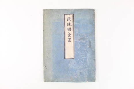
Sold2021Japanese Fold Out Handmade Ink Drawn Map,Islands,RoutesJapanese Fold Out Handmade Ink Drawn Map,Islands,Routes. This is a beautiful, handmade map of what appear to be islands and possibly routes. It is written in Japanese. The two hard covers are attachedSee Sold Price
Sold2019INDIAN OCEAN Madagascar Seychelles Maldives MauritiusReserve Reduced! TITLE/CONTENT OF MAP: 'ISLANDS IN THE INDIAN OCEAN. Madagascar, Amirantes, Seychelle Archipelago, Socotra, Lakadive Islands, Maldive Islands, Andaman Isles, Nicobar Isles, Chagos GrouSee Sold Price
Sold2019ATLANTIC ISLANDS. Bermuda Madeira Canaries.TenerifeTITLE/CONTENT OF MAP: 'Islands in the Atlantic' The map shows the islands of Madeira, the Azores, the "Bermudas or Summers Islands", the Canary Islands and teh Cape de Verde Islands. Vignettes: Fayal,See Sold Price
Sold2017Tallis: Map of Islands in the Indian Ocean, 1851Map: Islands in the Indian Ocean Cartographer: Tallis Place & Date: London/New York / 1851 Size: 13 1/4" x 10 1/2" The superb Indian Ocean islands map from Tallis' Illustrated Atlas extending from theSee Sold Price
Sold2016Caribbean Island Map, by Mount & Page, 1720 (rare &Spectacular sea chart of the Spanish Main to Puerto Rico, from Mount & Page's English Pilot, Fourth Book. Known as the most important English Atlas of Sea Chart covering the Mediterranean and North AmSee Sold Price
Sold2023Vintage 14K Gold Nantucket Island Map Pendant NecklaceVintage 14K Gold Nantucket Island Map Pendant Necklace, the reverse marked "14K", the chain marked "Italy 14K Aurea". Chain length 14 in. Width of pendant .9 in. Weight 3.7 dwt.See Sold Price
Sold20231790 George Anson World Voyage Spain South America HUGE MAP California Island1790 George Anson World Voyage Spain South America HUGE MAP California Island George Anson was an 18th-century British Navy admiral who is noted for his important world voyage in which he circumnavigaSee Sold Price
Sold20242PC Rhode Island Map & BookUnited States Late18th- 19th Century Includes "The Public Laws of the State of Rhode Island and Providence Plantations" printed by Carter and Wilkinson in 1798; and a map of Rhode Island by Henry F. WSee Sold Price
Sold20191640 Spice Island MapA 1640 Spice Island Map. Hand colored engraving. Fold line in center (two pages out of a book, with text verso); staining/discoloration/toning, edge damage. Image is 19 1/4" x 14 1/2" high, the sheetSee Sold Price
Sold2019Mallet map of island of California 1683Heading: Author: Mallet, Alain Manesson Title: Nouveau Mexique et Californie Place Published: Paris Publisher: Date Published: 1683 Description: Copper-engraved map. 14.5x1See Sold Price
Sold2019Massachusetts And Rhode Island MapMassachusetts and Rhode Island framed map. Sight 13" x 15".See Sold Price
4 hrs LeftRapid Estate Liquidators and Auction GalleryVintage Framed Cat Island Nautical Map PrintUS$55
2 days LeftJasper52A Map of the Island of Barbadoes', by Bryan EDWARDS. BARBADOS. West Indies 1794US$320
2 days LeftJasper52Rhode Island, part of Connecticut & Massachusetts shewing… LODGE 1780 old mapUS$500
2 days LeftJasper52Sketch of General Grant's position on Long Island, 1776. STEDMAN 1794 old mapUS$440
Featured1 day LeftJasper521787 Bonne Map of the Spice Island, Other Parts Indonesia and the Philippines -- La Presqu' Isle deUS$80
2 days LeftJasper52Hyperboreorum/Septentrionalum regionum. Bertius/Langenes. Europe Arctic 1603 mapUS$440
2 days LeftJasper52A New Chart of the Sea Coast of Scotland & Holy Island. MOUNT & PAGE 1758 mapUS$380
3 days LeftForum AuctionsWorld.- Blaeu (Johannes) Nova et Accuratissima Totius Terrarum Orbis Tabula Auctore Joanne Blaeu,£7,000
2 days LeftJasper52A New and accurate Map of Connecticut and Rhode Island… Universal Magazine 1780US$500
1 day LeftJasper521787 Bonne Map of Hispaniola and Purto Rico -- L'Isle de St. Domingue, et celle de Porto-RicoUS$55
Oct 12JM Hobby Supply and Railroad Artifact AuctionsChicago Rock Island and Pacific RY-1884 Watt-Stephen Genius of Steam BookUS$40
Oct 12JM Hobby Supply and Railroad Artifact AuctionsChicago Rock Island and Pacific RY Bound Volume-Annual Reports 1940-1947US$20(2 bids)
Oct 12JM Hobby Supply and Railroad Artifact AuctionsChicago Rock Island and Pacific RY Bound Volume-Annual Reports 1922-1930US$120(3 bids)
Oct 12JM Hobby Supply and Railroad Artifact AuctionsChicago Rock Island and Pacific RY-1887 Western Trail NewspaperUS$40(1 bid)
6 days LeftWoodcliff on The HudsonThree WWII Era Maps from Veterans Collection. France and JapanUS$50
Oct 12JM Hobby Supply and Railroad Artifact AuctionsChicago Rock Island and Gulf RY Employee Timetable #14 Supplement A-10/19/1910US$10
5 days LeftTrillium Antique Prints & Rare BooksCarey, pub. 1796 - 3 Maps of States in North AmericaUS$75(1 bid)