Sold2023Lake Pend Oreille Pictorial Map 1956 by M. McLeanFeatured in this lot is an in depth pictorial map of Lake Pend Oreille in Bonner and Kootenai Co., Idaho, USA. Drawn and compiled by Marie McLean in 1956 and published by the McLean Studio, Glengary BSee Sold Price
Sold20201877 European People and Language MapAuthor: Samuelsson Title: 1877 European People and Language Map Medium: Ink on Paper Dimensions: 12"X10" Map of Europe dated 1877. Compiled by Dr. Magnus Roth. Engraved and drawn by Otto WordenskjoldSee Sold Price
Sold20191834 SDUK Map of South Africa -- South Africa CompiledTitle/Content of Map: 1834 SDUK Map of South Africa -- South Africa Compiled from the M.S. Maps in the Colonial Office Captn. Owen's Survey &c Date: 1834, London Cartographer: SDUK Size: 12.3 x 15.5 iSee Sold Price
Sold2020Rare map of Eureka Mining District, NevadaHeading: (Nevada) Author: Hall, Leon M. Title: Compiled Map Showing Properties of the Eureka Mining District, Eureka County, Nevada Place Published: Eureka County, Nevada Publisher: Date PublisheSee Sold Price
Sold2022Butler, Samuel 1842 Lot of 5 European MapsIncl Germany/Prussia, North Italy/Switzerland, Russia, Denmark/Sweden/Norway, and Holland/Belgium. Steel Engraved Map Published 1842, London for "An Atlas of Modern Geography" by Samuel Butler. DrawnSee Sold Price
Sold2017MAP - Europe And The Near East - 33 x 39 – 1940Description: “Europe And The Near East” Map compiled and drawn – The National Geographic Society for The National Geographic Magazine- Gilbert Grosvenor, Editor. 33 x 39. Condition: Very Good.ShSee Sold Price
Sold2017Central Europe The Mediterranean Map 36 x 26 – 1939Description: “Central Europe The Mediterranean” Map compiled and drawn – The National Geographic Society for The National Geographic Magazine- Gilbert Grosvenor, Editor. 36” x 26”. Year: 193See Sold Price
Sold2022Hughes, William C1865 Lot of 4 European MapsIncl Europe, Ireland, Baltic and Scotland. Steel Engraved Maps Published C1865 London for "The History of England..." By David Hume, Tobias Smollett and others. Drawn and Engraved by William Hughes. CSee Sold Price
Sold20171853 Hand Drawn Map Sumter District South Carolinadrawn on what appears to be a handkerchief or piece of linen by Samuel N. Atkinson surveyor, at the request of M.E. Dixon. map depicts 751 acres and includes borders with Middleton Plantation and theSee Sold Price
Sold2022Korean War USAAF Army Air 1952 Aviator Restricted Silk Escape Map of Baku & Rasht Pacific1952 Restricted USSR BAKU & Asia RASHT Silk Aviator Map. Korean War Era. Compiled, drawn and reproduced by the S.P.C. War Office. Approximate size is 24 x 25.5 inches. Excellent mint condition.See Sold Price
Sold2023General Chart Map of Alaska (1890)General chart map of Alaska compiled and drawn by Adolph and Henry Lindenkohl, a coast and geodetic survey report for 1890 including Eastern Siberia, Russia, and the Aleutian Islands, dated 1890; unfrSee Sold Price
Sold2017Wall map of Marin County 1892Heading: (California - Marin County) Author: Dodge, George M. Title: Official Map of Marin County, California 1892 Compiled from Records and Surveys Place Published: San Francisco Publisher:Schmidt LaSee Sold Price
Sold20201851 Map of AustriaAuthor: Heck Title: 1851 Map of Austria Medium: Ink on Paper Dimensions: 11.5"X9.5" Map of the kingdom of Austria dated 1851. Drawn by G.Heck and engraved by M. Baer. Map was part of the IconographicSee Sold Price
Sold2023Historical Atlas of Solano County, 1877.HISTORICAL ATLAS OF MAP OF SOLANO COUNTY, CALIFORNIA, Compiled, Drawn and Published from Personal Examinations and Surveys. San Francisco: Thompson & West, 1878. Large folio. Half gilt-stamped leatherSee Sold Price
Sold2022Rare Ide's Map Of Missoula, Montana City 1891Featured in this lot we have a rare large map of Missoula Montana, 1891. Compiled and drawn by Kennedy & Powell Civil and mining engineers in Missoula, engraved by J.L. Smith, Philadelphia, PA. (as wrSee Sold Price
Sold2017Carey: Geographical & Statistical Map of Europe, 1822Geographical and Statistical Map of Europe. M. Carey, Young & Delleker 1822. Restriking of map, Europe: drawn from the best authorities for the illustration of Lavoisne's genealogical, historical, chrSee Sold Price
Sold20232 18th Cent. Maps of America, incl. Kitchin, Bonne1st item: AMERIQUE SEPTENTRIONALE, PAR M. BONNE, INGENIEUR -- HYDROGRAPHE DE LA MARINE map, drawn by Rigobert Bonne, Royal Cartographer to France in the office of the Hydrographer at Depot de la MarinSee Sold Price
Sold2017U.S. Army Atlas European Theater in World War IITitle: U.S. Army Atlas of the European Theater in World War II. Maps Created and Compiled by the Staff of the U.S. Army Center of Military History, Washington, D.C. New York. Barnes & Noble. 2004 AuthSee Sold Price
Sold2017Framed map of Chester County, Pennsylvania, copyright 1Framed map of Chester County, Pennsylvania, copyright 1938, compiled and drawn by Charles B MuthSee Sold Price
Sold20231871 Combination Atlas Map of Stephenson County IllinoisPublisher - Thompson and Everts, Geneva Illinois, Compiled, Drawn, and Published from personal examinations and surveys, With all pages and maps, Binding not attached to pages, Most pages not attachedSee Sold Price
Sold2023Pursuit of SMS Emden August-Nov 1914. Indian Ocean. First World War. 1920 mapOperations against S. M. S. Emden August to November 1914 [Battle of Cocos]. Map compiled by Sir Julian Stafford Corbett. Published by Ordnance Survey 1919 (1920). Antique military history map, 58.5 xSee Sold Price
Sold2023Railroad Map: Carson & Colorado Proposed 1889 Extension [170579]Large 22"x 42" hand drawn original map on vellum map of the "Proposed Extension of the Carson & Colorado Railroad from Keeler to Mahave. The scale is four miles to the inch. The map was compiled by L.See Sold Price
Sold2023Helena Mining District Claim Map [142993]Helens Mining District, Montana, Scratch Gravel, Marysville, Rimini, Corbin, Lump Gulch, Unionville, Clancy, Wickes. Compiled and drawn by the Engineering Corporation, consulting engineers, mineral suSee Sold Price
Sold2022HAND DRAWN MAP OF THE UNITED STATES.Ca. 1912, pen and ink, watercolor on ledger paper. "Drawn by M.C. Killian", the continental United States. The back of the paper has a paragraph about livestock hooves by Alice E. Bechtel, Reamstown,See Sold Price
2 days LeftJasper52U.S. War Department. Map of the Yellowstone and Missouri Rivers and Their Tributaries.US$240
May 12Schilb Antiquarian Rare Books1883 FLORIDA for Tourists & Settlers Illustrated Fort Barrancas MAP Fine BINDINGUS$78(5 bids)
1040 Lots AwayClaydon Auctioneers LtdBooks: A quantity of assorted reference books comprising Marino Marini edited by Pierre Case, 1999;£10
May 14Adam's AuctioneersA DIAMOND AND SAPPHIRE ‘TWENTY 4’ RING, BY PATEK PHILIPPE The broad band of openwork de€0
Jun 02Nazmiyal AuctionsVintage Cotton Italian Dinner Textile by Josef Frank 2 ft 5 in x 4 ft 1 in (0.74 m x 1.24 m)US$500
Jun 02Nazmiyal AuctionsAntique 17th century Transylvanian Rug 5 ft 9 in x 4 ft 2 in (1.75 m x 1.27 m)US$12,000
Jun 02Nazmiyal AuctionsAntique Irish Arts and Crafts Rug 20 ft 6 in x 14 ft (6.25 m x 4.27 m)US$7,000(1 bid)


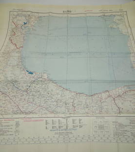


![Pursuit of SMS Emden August-Nov 1914. Indian Ocean. First World War. 1920 map: Operations against S. M. S. Emden August to November 1914 [Battle of Cocos]. Map compiled by Sir Julian Stafford Corbett. Published by Ordnance Survey 1919 (1920). Antique military history map, 58.5 x](https://p1.liveauctioneers.com/5584/306990/164073697_1_x.jpg?height=310&quality=70&version=1698786195)
![Railroad Map: Carson & Colorado Proposed 1889 Extension [170579]: Large 22"x 42" hand drawn original map on vellum map of the "Proposed Extension of the Carson & Colorado Railroad from Keeler to Mahave. The scale is four miles to the inch. The map was compiled by L.](https://p1.liveauctioneers.com/2699/299063/159201766_1_x.jpg?height=310&quality=70&version=1692045182)
![Helena Mining District Claim Map [142993]: Helens Mining District, Montana, Scratch Gravel, Marysville, Rimini, Corbin, Lump Gulch, Unionville, Clancy, Wickes. Compiled and drawn by the Engineering Corporation, consulting engineers, mineral su](https://p1.liveauctioneers.com/2699/299063/159201974_1_x.jpg?height=310&quality=70&version=1692045182)