Sold2024Robert Morden (British, 1650-1703) Map AssortmentRobert Morden (British, 1650-1703) Map Assortment (5) items including (4) by Morden pulled from Gibson's edition of 'Camden's Britannia', first Morden edition, published by Abel Swale and John ChurchiSee Sold Price
Sold2023Britanna Romana Antique Hand Colored Map by Robert Morden, 1722Britanna Romana antique hand colored map. Originally by Robert Morden (1650 – 1703). Map depicting British Isles from Camden's Britannia, there is a fold in the middle where it was folded intoSee Sold Price
Sold2015A FRAMED BRITISH HAND COLORED COPPER PLATE CARTOGRAPHICA FRAMED BRITISH HAND COLORED COPPER PLATE CARTOGRAPHIC ENGRAVING OF THE BRITISH ISLES, AFTER ROBERT MORDEN (British 1650-1703) "BRITANNIA, OR A CHOROGRAPHICAL DESCRIPTION OF GREAT BRITAIN AND IRELANDSee Sold Price
Sold2017ROBERT MORDEN (ENGLISH 1650-1703), HAND COLOREDROBERT MORDEN (ENGLISH 1650-1703), HAND COLORED ENGRAVED MAP OF SURREY, SIGNED. SIGHT 14 3/4 X 17 1/2"; FRAMED AND GLAZED-16 X 18 1/2"See Sold Price
Sold2018* MORDEN, Robert (ca 1650-1703). Geography Rectified:* MORDEN, Robert (ca 1650-1703). Geography Rectified: or, A Description of the World. London: for Robert Morden and Thomas Cockeril, 1680. Small 4to (200 x 157 mm). Title printed in red and black, hanSee Sold Price
Sold2019Philip, George C1895 Lot of 7 British County MapsIncl Scotland, Scotland Railways, South Wales, North Wales and British Isles. Lithograph Maps Published C1895 by George Philip & Son, London for "Phillips' Atlas of the British Isles" Centre fold as iSee Sold Price
Sold2019Blackie & Weller 1882 Lot of 4 Maps. UK & IrelandIncl Ireland South Part, Scotland South Part, British Islands and The North Sea, and England & Wales. Lithograph Maps Published 1882 by Blackie & Son, London for "The Comprehensive Atlas & Geography oSee Sold Price
Sold2017Robert Morden - English Plantations in AmericaRobert Morden (d. 1703) and William Berry (fl. 1669-1708) makers A New Map of the English Plantations in America both Continent and Ilands Shewing their true Situation and distance from England or oneSee Sold Price
Sold2020Morden, Robert 1701 Hand Col Map of Staffordshire, UKHand Colored Copper Engraved Map Published 1701-08, London for "The New Description and State of England, containing the Mapps of the Counties of England and Wales" by Robert Morden. Light folds as isSee Sold Price
Sold2020David Cox. "View In North Wales, Winter"(British, 1783-1859). Watercolor on paper, identifying information on verso, inscribed "Cox" in brown chalk on verso, sight size: 7 3/4 x 12 in., framed.Property from the collection of Robert and NancSee Sold Price
Sold2023Laurie & Whittle Map of the British Colonies of North AmericaLAURIE, Robert (1755-1836), and WHITTLE, James (1757-1818). A New and Correct Map of the British Colonies in North America comprehending Eastern Canada...with the adjacent states of New England. EngraSee Sold Price
Sold2015TEESDALE, HENRY. New British AtlasTEESDALE, HENRY. New British Atlas Containing a *Complete Set of County Maps...Preceded by General Maos of England, Ireland, Scotland, North & South Wales, the Whole Carefully Revised and CorrecteSee Sold Price
Sold2023Nat. Encyclo. 1890's Mixed Lot of 32 Antique MapsIncl Sweden/Norway, Eastern USA, British Isles Geological, North America X 2, South America, Russia in Europe, Scotland, Britannia Antiqua, Suez Canal, China Proper, England and Wale, World HemisphereSee Sold Price
Sold2022Tallis, John (Pub) 1854 Map. New South Wales, AustraliaSteel Engraved Map Published 1854-55 by John Tallis, London for "The British Colonies; Their History, Extent, Condition and Resources" by Robert Montgomery Martin. Drawn & Engraved by John Rapkin. CenSee Sold Price
Sold2017SAMUEL DUNN HAND COLORED PRINTED MAPSAMUEL DUNN, HAND COLORED PRINTED MAP, IMAGE: H 19", W 12 1/2", "A NEW MAP OF THE UNITED STATES OF NORTH AMERICA":"--- with the British Dominions on the continent"; printed for Robert Sayer; framed.See Sold Price
2020Bacon, G. W. 1898 Lot of 35 British County MapsIncl Devon North and South, Hampshire, Lancashire North and South, Leicester/Rutland, Lincoln, Monmouth, Salop (Shropshire) Staffordshire, Yorkshire, England/Wales, England SW, England SE, Wales N, WaSee Sold Price
Sold2020Bacon, G. W. 1898 Lot of 35 British County MapsIncl Devon North and South, Hampshire, Lancashire North and South, Leicester/Rutland, Lincoln, Monmouth, Salop (Shropshire) Staffordshire, Yorkshire, England/Wales, England SW, England SE, Wales N, WaSee Sold Price
Sold2022William Mellor (British, 1851-1931) Welsh Llyn, North WalesWilliam Mellor (British, 1851-1931) Welsh Llyn, North Wales signed 'William Mellor' (lower right) oil on canvas 50.8 x 76.2cm (20 x 30in). Footnotes: Provenance With Haynes FineSee Sold Price
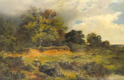
Sold2021Sidney Richard Percy ''Near Capel Curig, North Wales"Sidney Richard Percy (1821-1886 British) ''Near Capel Curig, North Wales'' 1851 Oil on Canvas 24''x36'' Image. A countryside composition with woman and men gathering and sheep in background. Signed anSee Sold Price
Sold2018Key map of Popple's British North AmericaHeading: Author: Popple, Henry Title: A Map of the British Empire In America with the French, Spanish and the Dutch Settlements adjacent thereto by Henry Popple Place Published: Amsterdam Publisher:ISee Sold Price
Sold2018JANSON, HONDIAS C. 1650 MAP OF NORTH AMERICAOriginal hand colored engraving with center fold. French text verso. Titled "America Septentrionalis." Famous map with California as an island. Dimensions: (Frame) H 26" x W 29", (Sight) H 19.25" x WSee Sold Price
Sold20241755 French & Indian War Period, Map of the NORTH AMERICAN BRITISH + FRENCH SETTLEMENTSHistoric Maps 1755 French & Indian War "A Map of the BRITISH and FRENCH SETTLEMENTS in NORTH AMERICA" 1755 French and Indian War Period, Map of North America titled, "A Map of the British and French SSee Sold Price
Sold2023Alfred Fontville de Breanski Jr.(British, 1877-1955) Sunrise, Llyn Cwnellyn, North Wales, signed lower right "A.F. de Breanski" and signed and titled verso canvas, 16-1/8 x 24-1/8 in.; original gilt wood and composition frame, 24-3/See Sold Price
Sold2017Edward Wells, map North AmericaEdward Wells, map North America, Edward Wells (British, 1667-1727), "A New Map of North America Shewing its Principal Divisions, Chief Cities, Townes... Dedicated to His Highness William Duke of GloucSee Sold Price
Jun 09Worthington GalleriesFirst Edition Hand-colored Map THE NORTH RIDING OF YORKSHIRE by Robert MordenUS$50
9 hrs LeftNY Elizabeth RICHARD DAVIES' 1752 "AN ACCOUNT OF EXERCISES, SERVICES, AND TRAVELS" VINTAGE AMERICANUS$50
Jun 10First Arts Premiers Inc.ROBERT RIDLEY, HAIDA, NORTHWEST COAST, Model Hollow Back Totem Pole, c. 1900-1915CA$1,400