Sold20201640 Territorium Metense Auctore Ab Fabert ConsuleThis decorative old color map by Willem Blaeu is centered on the city of Metz in northeastern France, and covers much of the drainage of the Moselle river. The map is richly embellished in each cornerSee Sold Price
Sold2017SCHEMA CORPORIS SOLARIS MAP BY P . SCHEINEROSchema Corporis Solaris, prout ab Auctore et P. Scheinero. Map of the Sun from the 'Mundi Subterranei', one of the first depictions of sunspot activity. Kircher, a Jesuit scholar, was one of the firstSee Sold Price
Sold2022Antique Map Print - Map of Bohemia - Map of Czech Republic - KingdomAntique outline hand colored map from edition of Meyer’s world atlas, edited by Ludwig Ravenstein, published by Bibliographic Institute in 1872. Technique: Engraving. Place: Leipzig, Germany. SSee Sold Price
Sold2022Antique Map Print - North America - Africa - South America - WorldSet of 4 Map Prints. Hand-colored map print of the edition of 1851 from the work Universal Historical and Geographical Atlas ("Atlas Universel Historique et Geographique"). This iconic map contains diSee Sold Price
Sold2022Antique Map Print - Italy - Empire Greece - EuropeSet of 4 Map Prints. Hand-colored map print of the edition of 1851 from the work Universal Historical and Geographical Atlas ("Atlas Universel Historique et Geographique"). This iconic map contains diSee Sold Price
Sold2022Antique Map Print - Italy - Greece - Europe - SpainSet of 4 Map Prints. Hand-colored map print of the edition of 1851 from the work Universal Historical and Geographical Atlas ("Atlas Universel Historique et Geographique"). This iconic map contains diSee Sold Price
Sold2022Antique Map Print - Gaul - Turkey - russia - FranceSet of 4 Map Prints. Hand-colored map print of the edition of 1851 from the work Universal Historical and Geographical Atlas ("Atlas Universel Historique et Geographique"). This iconic map contains diSee Sold Price
Sold2022Antique Map Print - Palestine - England - Terre SainteSet of 4 Map Prints. Hand-colored map print of the edition of 1851 from the work Universal Historical and Geographical Atlas ("Atlas Universel Historique et Geographique"). This iconic map contains diSee Sold Price
Sold2022Original Antique Map -Pommern Provinz - Map of Bornholm Island Baltic SeaAntique outline hand colored map from edition of Meyer’s world atlas, edited by Ludwig Ravenstein, published by Bibliographic Institute in 1872. Technique: Engraving. Place: Leipzig, Germany. SSee Sold Price
Sold2022Antique Map Print - La France - France - EuropeSet of 4 Map Prints. Hand-colored map print of the edition of 1851 from the work Universal Historical and Geographical Atlas ("Atlas Universel Historique et Geographique"). This iconic map contains diSee Sold Price
Sold2022Antique Map Print - Empire Italy - EuropeSet of 4 Map Prints. Hand-colored map print of the edition of 1851 from the work Universal Historical and Geographical Atlas ("Atlas Universel Historique et Geographique"). This iconic map contains diSee Sold Price
Sold2022Antique Map Print - Angleterre - England - EuropeSet of 4 Map Prints. Hand-colored map print of the edition of 1851 from the work Universal Historical and Geographical Atlas ("Atlas Universel Historique et Geographique"). This iconic map contains diSee Sold Price
Sold2022Antique Map Print - La Gaule - La RussieSet of 4 Map Prints. Hand-colored map print of the edition of 1851 from the work Universal Historical and Geographical Atlas ("Atlas Universel Historique et Geographique"). This iconic map contains diSee Sold Price
Sold2022Antique Map Print - England - PalestineSet of 4 Map Prints. Hand-colored map print of the edition of 1851 from the work Universal Historical and Geographical Atlas ("Atlas Universel Historique et Geographique"). This iconic map contains diSee Sold Price
Sold2022Original Antique Map - Mecklenburg-Schwerin - Map of Northern GermanyAntique outline hand colored map from edition of Meyer’s world atlas, edited by Ludwig Ravenstein, published by Bibliographic Institute in 1872. Technique: Engraving. Place: Leipzig, Germany. SSee Sold Price
Sold2022Original Antique Map -Bremen Oldenburg - Map of Bremen OldenburgAntique outline hand colored map from edition of Meyer’s world atlas, edited by Ludwig Ravenstein, published by Bibliographic Institute in 1872. Technique: Engraving. Place: Leipzig, Germany. SSee Sold Price
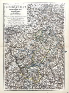
Sold2022Original Antique Map -Hessen Nassau - Map of Furstenthum WaldeckAntique outline hand colored map from edition of Meyer’s world atlas, edited by Ludwig Ravenstein, published by Bibliographic Institute in 1872. Technique: Engraving. Place: Leipzig, Germany. SSee Sold Price
Sold2022Antique Map Print - Map of Schleswig - Holstein - Map of Germany - LauenburgAntique outline hand colored map from edition of Meyer’s world atlas, edited by Ludwig Ravenstein, published by Bibliographic Institute in 1872. Technique: Engraving. Place: Leipzig, Germany. SSee Sold Price
Sold2022Antique Map Print - Map of Mecklenburg-Schwerin - Map of Germany - Roman EmpireAntique outline hand colored map from edition of Meyer’s world atlas, edited by Ludwig Ravenstein, published by Bibliographic Institute in 1872. Technique: Engraving. Place: Leipzig, Germany. SSee Sold Price
Sold2022Original Antique Map - Konicreich Bohmen - Map of Bohmen - Prague - CarlsbadAntique outline hand colored map from edition of Meyer’s world atlas, edited by Ludwig Ravenstein, published by Bibliographic Institute in 1872. Technique: Engraving. Place: Leipzig, Germany. SSee Sold Price
Sold2022Antique Map Print - Map of Rheinprovinz - Map of Germany - Prussian StateAntique outline hand colored map from edition of Meyer’s world atlas, edited by Ludwig Ravenstein, published by Bibliographic Institute in 1872. Technique: Engraving. Place: Leipzig, Germany. SSee Sold Price
Sold2022Antique Map Print - Map of Pomerania - Map of Germany - South of the Baltic SeaAntique outline hand colored map from edition of Meyer’s world atlas, edited by Ludwig Ravenstein, published by Bibliographic Institute in 1872. Technique: Engraving. Place: Leipzig, Germany. SSee Sold Price
Sold2022Antique Map Print - Map of Oldenburg - Map of Germany - Lower Saxony - HunteAntique outline hand colored map from edition of Meyer’s world atlas, edited by Ludwig Ravenstein, published by Bibliographic Institute in 1872. Technique: Engraving. Place: Leipzig, Germany. SSee Sold Price
Sold2022Antique Map Print - Map of Hesja-Nassau - Map of Austria - Prussian ProvinceAntique outline hand colored map from edition of Meyer’s world atlas, edited by Ludwig Ravenstein, published by Bibliographic Institute in 1872. Technique: Engraving. Place: Leipzig, Germany. SSee Sold Price
3 days LeftAkiba GalleriesAntique Mast, Crowell, & Kirkpatrick Map Of Texas, California, & NevadaUS$25(1 bid)
5 days LeftEarly American History Auctions1776 Map, PARTIE ORIENTALE DU CANADA, AVEC LA NOUVELLE ANGLETERRE, L'ACADIE... by P. Santini, FramedUS$950
5 days LeftEarly American History Auctions1836 Hand-Colored Map, Country Twenty Five Miles Round The City Of New-York Published by D.S. StoneUS$260
6 days LeftWorthington GalleriesFirst Edition Hand-colored Map THE NORTH RIDING OF YORKSHIRE by Robert MordenUS$50
4 days LeftHolabird Western Americana CollectionsCalifornia Map by Colton in Frame, 1855 [180767]US$150(1 bid)
Jun 15Riverfront AuctionsC. 1730 Map of North Rhine-Westphalia, Germany after N. Sanson by Covens and MortierUS$5
Jun 30Global Auctions CompanyHand Colored Engraved Map of Europe, Jean Baptiste Bourguignon Anville 1754US$450


![California Map by Colton in Frame, 1855 [180767] (1 of 3)](https://p1.liveauctioneers.com/2699/331495/178785753_1_x.jpg?height=282&quality=70&version=1717094933)


