Sold2023Hearne Brothers Somerset County NJ MapPolyconic Projection map. Approx 50" x 65"See Sold Price
Sold2019Vintage Road Maps (14)Including 1980-1981 New Jersey map & guide; (3) Somerset & Hunterdon Counties New Jersey map; Burlington Bridges Area Road map; Northern Hunterdon County, NJ map; Sunoco New York map; Texaco Florida,See Sold Price
Sold2021Vintage Pull Down Map Hearne Brothers Official ChicagoVintage 1960s Retractible Pull Down Map Hearne Brothers Official Chicago and Southern Cook County . Measures approx 48" x 68" Condition: Map is partially disconnected from the bottom rod. PleSee Sold Price
Sold2023Metal Franklin Township NJ Fire Department HelmetCairns and Brothers Senator style fire helmet with original front from the Franklin Township NJ Fire District located in Somerset County. The helmet is in very good condition and dates to pre-1949 wheSee Sold Price
Sold2023Map of Somerset County, New JerseyMap of Somerset County with inset of Somerville lower right, hand-colored lithograph by J. W. Otley and J. Keily, printed by Lloyd Van Derveer, Camden, NJ, 1850 Overall: 47-3/4"h x 40"w Sight: 44-3/4"See Sold Price
Sold2018Vintage Hearne Brothers Map of Stamford CTVintage Hearne Brothers Polyconic Projection Pulldown Map of Stamford metropolitan area Connecticut. Some creases in map and five small tears to left side. Slight rusting to top metal bracket. MeasureSee Sold Price
Sold2022GROUP LOT OF VINTAGE PAPER GOODSINCLUDING: 19TH/20TH C. CORRESPONDENCE, PHOTOS, TRADE CARDS, NJ HISTORY/DIRECTORY, REPRINT OF SUSSEX COUNTY, NJ MAP AND MORE Terms: Hartzell's Auction Gallery will handle most of the shipping in-houseSee Sold Price
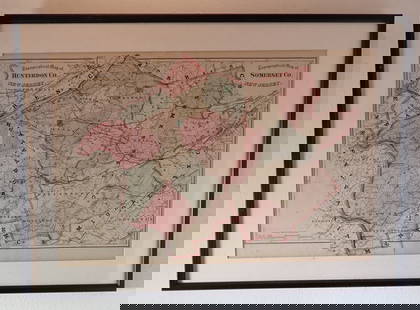
Sold2022Hamilton Farm James Cox Brady ResidenceHunterdon Somerset & Morris Counties Map is approx 33 1/2" x 43 1/2"See Sold Price
Sold20221902 Map of Hunterdon County NJ Irving C HicksIrving Hicks Publisher, Pugh & Downing Engineers. Approx 42" x 50 1/2"See Sold Price
Sold2020Schoolhouse Map Late 1920s Early 1930s Hearne BrothersSchoolhouse Map Late 1920s Early 1930s Hearne BrothersSee Sold Price
Sold20161856 MAP OF NEWTONTHOMAS HUGHES - ORIGINAL MAP OF NEWTON, NEW JERSEY SUSSEX COUNTY NJ 46"X34"See Sold Price
Sold2022Topographical Atlas of Bergen County NJ (US) 1876Topographical Illustrated, Historical Descriptive, A.H. Walker, Published by C.C. Pease, Successor to A.H. Walker. Color maps, home sites, business locations in fold-out pages. Cover in green with blaSee Sold Price
Sold2022FRAMED MAP OF THE HAMILTON FARM, NEW JERSEY"Map of Hamilton Farm and Adjacent Properties, Bridle Paths, Roads, etc. in Hunterdon, Morris & Somerset Counties, in the State of New Jersey" by F.S. Tainter, March, 1935. Details include Somerset HiSee Sold Price
Sold2018MAP OF NEW JERSEY COUNTIESOf Hamilton Farm, Hunterton, Morris, and Somerset Counties. Frame size: 27"h x 22 1/2"wSee Sold Price
Sold2019Weller, Edward C1860 Lot of 7 UK County MapsIncl Northants, Worcester, Lancashire, Monmouth, Hereford, and Somerset. Lithograph Maps Published C1860, London for "The Dispatch Atlas" and/or "The Weekly Dispatch" by Edward Weller and others. InclSee Sold Price
Sold2024Dugdale & Archer C1840 Lot of 7 British County MapsIncl Oxford, Staffordshire, Somerset, Shropshire, Rutland, Nottinghamshire and Northumberland. Steel Engravinged Maps C1835-60 London for "Curiosities of Great Britain. England & Wales Delineated..."See Sold Price
Sold2020NJ TOPOGRAPHICAL MAP CENTRAL HIGHLANDS MORRIS & SUSSEXNJ TOPOGRAPHICAL MAP CENTRAL HIGHLANDS MORRIS & SUSSEX COUNTIES 1888 JOHN C. SMOCK STATE GEOLOGIST, OVERALL DIMENSIONS INCLUDING FRAME 31 3/4 IN X 42 3/4 INSee Sold Price
Sold2020Road Map of Hunterdon County New JerseyRoad map of Hunterdon County New Jersey. Published and distributed by Hunterdon County Democrat, Flemington, NJ, Delaware Valley News, Frenchtown, NJ. On a blue card stock type paper. Has some loss inSee Sold Price
Sold2018Two Maps - Duttons, NY and Essex, NJA Map Showing The New Locale of Dutton, Inc. 270 Park Avenue. 20" x 15"; South Moutain Reservation Essex County Park System map, 1937. 13" x 26"See Sold Price
Sold2024Map of Texas and Indian TerritoryMap of Texas and Indian Territory West Central States and States of the Plains - Southern Division. Color Map. Publisher Harper Brothers Dated: 1888 Dimensions: 12 x 9" ConSee Sold Price
Sold2024Physical Map of North AmericaPhysical Map of North America Color Map. Publisher Harper Brothers Dated: 1888 Dimensions: 12 x 9" Condition Report Text on verso. Good Plus. Subject ReferencSee Sold Price
Sold2023Map of the North Atlantic States - New EnglandNorth Atlantic States - New England Color Map. Publisher Harper Brothers Dated: 1888 Dimensions: 12 x 9" Condition Report Text on verso.See Sold Price
6 days LeftConestoga Auction Company Division of Hess Auction GroupRare Glazed Redware Inkstand Signed "F*S* 1811".$150(1 bid)