Sold20241775-1780 West Africa. Ocean currents. By Bonne & RaynalThis antique map, created by R. Bonne and Raynal between 1775 and 1780, focuses on West Africa and the coast of Guinea. It highlights ocean currents in the region. The map is part of "Histoire PhilosoSee Sold Price
Sold2021North America. By Bonne/Raynal. 1780Title: North America. By Bonne/Raynal. 1780 Date/Period: 1780 Materials: Copperplate engraved Size: 13 1/2 x 9 3/4'' The most striking feature of this map is the blank space for the North American wesSee Sold Price
Sold2021Spice island (Indonesia, Malaysia) by Bonne/Raynal 1780Title: Spice island (Indonesia, Malaysia) by Bonne/Raynal 1780 Date/Period: 1780 Materials: Copperplate engraved Size: 13 1/2 x 9 3/4'' All of modern Indonesia, Malaysia, Brunei, Singapore are shown aSee Sold Price
Sold2021Africa. 1780 by J. de la Porte, ParisTitle: Africa. 1780 by J. de la Porte, Paris Date/Period: 1780 Materials: Hand colored copper plate engraved Size: 9x7'' Africa is shown with many coastal settlements but the interior is mostly speculSee Sold Price
Sold2021Arabian peninsula by Bonne/Raynal 1780Title: Arabian peninsula by Bonne/Raynal 1780 Date/Period: 1780 Materials: Copperplate engraved Size: 13 1/2 x 9 3/4'' The whole Arabian peninsula shown covers modern Saudi Arabia, Oman, Yemen, BahraiSee Sold Price
Sold2021Canary Islands. By Bonne/Raynal 1780Title: Canary Islands. By Bonne/Raynal 1780 Date/Period: 1780 Materials: Copperplate engraved Size: 13 1/2 x 9 3/4'' Detailed and beautiful map of the island group. Rarely seen depiction for the era.See Sold Price
Sold2021Russian empire. by Bonne/Raynal 1780Title: Russian empire. by Bonne/Raynal 1780 Date/Period: 1780 Materials: Copperplate engraved Size: 13 1/2 x 9'' 1780, cartographer Rigobert Bonne one of the most important and highly regarded map makSee Sold Price
Sold2022Northern and Western Africa, 1780/81 scarce map by J. B. NolinTitle: Northern and Western Africa, 1780/81 scarce map by J. B. Nolin Date/Period: 1780/ 1781 Materials: Hand colored copper plate engraved Size: 14 1/2 x 10 1/4" Many new rivers from the west coast oSee Sold Price
Sold2021Double Hemisphere world map by Bonne/ Raynal 1780Title: Double Hemisphere world map by Bonne/ Raynal 1780 Date/Period: 1780 Materials: Copperplate engraved Size: 17 1/2 x 9 3/4”. Maps shows the North American west empty, misshaped Alaska, theSee Sold Price
Sold2021Chile & Argentina By Bonne/ Raynal. 1780Title: Chile & Argentina By Bonne/ Raynal. 1780 Date/Period: 1780 Materials: Copperplate engraved Size: 13 1/2 x 9 3/4 In detail the coast of Chile in the west to the Rio de la plata in the east, to PSee Sold Price
Sold2021Central and Eastern Europe by Bonne/ Raynal 1780Title: Central and Eastern Europe by Bonne/ Raynal 1780 Date/Period: 1780 Materials: Copperplate engraved Size: 13 1/2 x 9'' Map centers on Germany, but Netherlands, Belgium, Luxembourg, Austria, SwitSee Sold Price
Sold2021Europe. By Bonne/ Raynal 1780Title: Europe. By Bonne/ Raynal 1780 Date/Period: 1780 Materials: Copperplate engraved Size: 13 1/2 x 9'' 1780, cartographer Rigobert Bonne one of the most important and highly regarded map makers ofSee Sold Price
2021Persia, Central Asia to Tibet by Bonne/ Raynal 1780Title: Persia, Central Asia to Tibet by Bonne/ Raynal 1780 Date/Period: 1780 Materials: Copperplate engraved Size: 13 1/2 x 9 3/4'' From eastern Black Sea to the Caspian Sea down to the Persian gulf aSee Sold Price
Sold2021Cuba by Bonne/ Raynal 1780Title: Cuba by Bonne/ Raynal 1780 Date/Period: 1780 Materials: Copperplate engraved Size: 13 1/2 x 9 3/4'' 1780, cartographer Rigobert Bonne one of the most important and highly regarded map makers ofSee Sold Price
Sold2021South America by Bonne/ Raynal. 1780Title: South America by Bonne/ Raynal. 1780 Date/Period: 1780 Materials: Copperplate engraved Size: 13 1/2 x 9 3/4 Beautiful detailed map shows all the principle cities, rivers. 1780, cartographer RigSee Sold Price
Sold2021British isles with Ireland by Bonne/ Raynal 1780Title: British isles with Ireland by Bonne/ Raynal 1780 Date/Period: 1780 Materials: Copperplate engraved Size: 13 1/2 x 9'' 1780, cartographer Rigobert Bonne one of the most important and highly regaSee Sold Price
Sold2016Northern Africa by Bonne 1780Map Title: Carte Des Royaumes de Fez D'Alger de Tunis et de Tripoli Subject: Northern Africa Maker: Rigobert Bonne Date: 1780 Size: 16 x 20 inches From the Atlas De Toutes Les parties Connues Du GlobeSee Sold Price
Sold20231780 Voyages in AFRICA Slave Trade PIRATES Snelgrave Ivory Coast Congo Angola1780 Voyages in AFRICA Slave Trade PIRATES Snelgrave Ivory Coast Congo Angola The best book of its kind! A rare book La Harpes General History of Voyages! This extensive work was begun by La Harpe, anSee Sold Price
Sold20231780 Voyages in AFRICA Slave Trade Alvise Cadamosto Senegal Sierra Leone1780 Voyages in AFRICA Slave Trade Alvise Cadamosto Senegal Sierra Leone The best book of its kind! A rare book La Harpes General History of Voyages! This extensive work was begun by La Harpe, and, afSee Sold Price
Sold2017Bonne: Antique Map of Africa showing Trade Wings, 1780Title/Content of Map: 'Afrique' A map of Africa, showing the trade winds Date Printed: 1780 Image Size: Approx 23.0 x 34.0cm, 9 x 13.25 inches (Large); Please note that this is a folding map. Type: AnSee Sold Price
Sold2023French map of Africa published by Bonne 1780Rigobert Bonne (6 October 1727 – 2 September 1794) work represents an important step in the evolution of the cartographic ideology away from the decorative work of the 17th and early 18th centuSee Sold Price
Sold2020Rollin, Charles 1780 Map of North Africa"The Carthaginian Empire in Africa" Copper Engraved Map Published 1780, London for "The Ancient History..." by Charles Rollin. Folds as issued. Paper Size: 19 x 9.5 inch (48 x 24cm) Very minor toning.See Sold Price
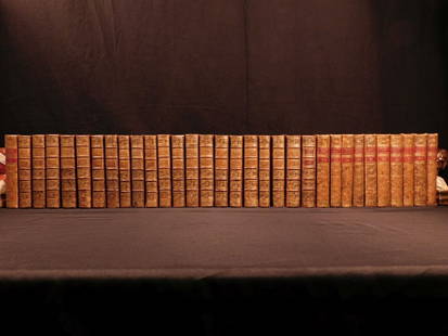
Sold20181780 1ed RARE Complete VOYAGES Maps Captain Cook Americ1780 1ed RARE Complete VOYAGES Maps Captain Cook America Explorers Africa 32v The best book of its kind! An extremely rare, 32-volume complete set of La Harpe’s ‘General History of Voyages’! ThiSee Sold Price
Sold20181780 1ed RARE Complete VOYAGES Maps Captain Cook1780 1ed RARE Complete VOYAGES Maps Captain Cook America Explorers Africa 32v The best book of its kind! An extremely rare, 32-volume complete set of La Harpe’s ‘General History of Voyages’! ThiSee Sold Price
6 days LeftTremont AuctionsA fine pair of Chippendale mahogany dining chairs with ball and claw feet, circa 1780.$200(1 bid)
6 days LeftTremont AuctionsChippendale mahogany serpentine front desk, Boston circa 1780. Slant front with fitted interior$1,000
6 days LeftCarlsen Gallery, Inc.C. 1780 AMERICAN 4 DR CHIPPENDALE CHEST ON OGEE FEET, OLD REPLACED HARDWARE & 2 BOARD BACK (36 3/4"$250(1 bid)
605 Lots AwayHermann Historica GmbHA fine Louis XVI console table with marble top, Paris, circa 1780See Sold Price
6 days LeftSchilb Antiquarian Rare Books1875 1st ed ISMAILIA Central Africa Slave Trade SUDAN Egypt Illustrated Baker$8(3 bids)
Jun 04DOYLE Auctioneers & AppraisersLouis XVI Gilt-Bronze and White Marble Figural Mantel Clock Circa 1780$2,000
Jun 23Schilb Antiquarian Rare Books1890 Livingstone 1ed In Darkest Africa Henry Stanley Emin Pasha Expedition MAP$26(5 bids)
Jun 23Schilb Antiquarian Rare Books1818 FAMOUS Journal of James Riley Shipwreck Brig Commerce Arabs Morocco Africa$20(2 bids)
Jun 08Early American History Auctionsc. 1780 Providence, Rhode Island Pewter Porringer Bearing the Distinct American Eagle Touchmark of$650


![[AFRICA] LOT OF 3 ALBUMEN PRINTS SOLD TOGETHER (1 of 4)](https://p1.liveauctioneers.com/8124/329546/177689710_1_x.jpg?height=282&quality=70&version=1715469494)

![[AFRICA] LOT OF 2+1 PRINTS SOLD TOGETHER (1 of 4)](https://p1.liveauctioneers.com/8124/329546/177689709_1_x.jpg?height=282&quality=70&version=1715469494)
![[AFRICA] LOT OF 11 PRINTS SOLD TOGETHER (1 of 5)](https://p1.liveauctioneers.com/8124/329546/177689712_1_x.jpg?height=282&quality=70&version=1715469494)
![[AFRICA] LOT OF 6 SILVER PRINTS TOGETHER. 1917 (1 of 4)](https://p1.liveauctioneers.com/8124/329546/177689711_1_x.jpg?height=282&quality=70&version=1715469494)


![[AFRICA] SCARIFICATION. BAKUTU WOMAN (1 of 3)](https://p1.liveauctioneers.com/8124/329546/177689715_1_x.jpg?height=282&quality=70&version=1715469494)
![[AFRICA] BEAUTY PARLOR, BOCA TRIBE. 1955 (1 of 4)](https://p1.liveauctioneers.com/8124/329546/177689714_1_x.jpg?height=282&quality=70&version=1715469494)
![[AFRICA] MRS. PAT NIXON IN AFRICA, 1972. LOT OF 3 (1 of 4)](https://p1.liveauctioneers.com/8124/329546/177689713_1_x.jpg?height=282&quality=70&version=1715469494)


