Sold2021Kent Estate Map, Chevening.- Barham (surveyor) The HomeKent Estate Map, Chevening.- Barham (surveyor) The Home Farm In Chevening Kent Belonging to The Ri.t Hon.ble Lord Amherst, manuscript watercolour estate map on vellum, fold, 475 x 500mm., 1797; and anSee Sold Price
Sold2022Real estate map for south part of San Francisco 1868Heading: -1868 Author: Kower, Emile Title: Map of the Golden Gate Homestead Association Place Published: San Francisco Publisher:Britton & Rey's Lithographic Steam Press Date Published: 1868<See Sold Price
Sold2022KENT – LYDD – MANUSCRIPT ESTATE MAP 'A Map of a Farm lying in the Parish of Lydd in ...KENT – MANUSCRIPT ESTATE PLAN 'A Map of a Farm lying in the Parish of Lydd in the County of Kent Belonging to the Reverd. Mr Richard Monins 1774.', manuscript map by Henry Maxted & Isaac Terry,See Sold Price
Sold2020Real estate map of Berkeley Woods with ms. noted, 1917Heading: (California - Contra Costa County) Author: Title: Map of Berkeley Woods Contra Costa County, Cal. Scale 1 in. = 100 feet Place Published: [Berkeley, CA] Publisher: Date Published:See Sold Price
Sold2020Pocket real estate map of Bellingham WA 1910Heading: (Washington - Bellingham) Author: Title: Map of Bellingham north, Washington Place Published: Bellingham, Wash. Publisher:Bellingham Bay Improvement Co Date Published: 1910 DeSee Sold Price
Sold2022Sutro Heights real estate map c.1895Heading: -1895 Author: Title: Map of Sutro Heights. Lots for Sale by Will E. Fisher & Co., Agents Place Published: San Francisco Publisher: Date Published: c.1895 Description: LSee Sold Price
Sold2022France.- Manuscript estate maps.- Marche (Lecoy de la) [Survey of the estates of Château-France.- Manuscript estate maps.- Marche (Lecoy de la) [Survey of the estates of Château-Renault], manuscript, double-page preface and 2 tables, 9 double-page hand-coloured maps (numbered 2-10, aSee Sold Price
Sold2015(2pc) [INSURANCE MAPS OF GREENWICH, CONN.]published by Sanborn Map Company, 1920; plus a Greenwich real estate map, 25 3/4 x 23 1/2"See Sold Price
Sold2017A large quantity of English and Irish table linensA large quantity of English and Irish table linens, to include small tablecloths and doilies, most embroidered with crown and initial Provenance: From a prominent Suffolk estate.See Sold Price
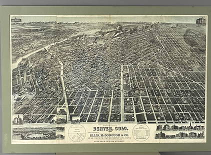
Sold2017Antique Real Estate Zone Map of Chicago, 1910Title/Content of Map: 1910 c. Real Estate Zone Map of Chicago -- Zone Map of Chicago Date Printed: 1910 c., Chicago Cartographer: Cook Co. Real estate Digest Size: 16.3 X 10.8 in. An interesting realSee Sold Price
Sold2015Antique Continental Bronze Mounted SecretaireAbatant . Great quality bronzes on this cabinet from a Suffolk County estate . Dimensions: 35"W x 18"D x 59"H . Condition: Some losses, scuffs, scratches, tight splits.See Sold Price
Sold20231646 Blaeu Map of Suffolk -- Suffolcia. Vernacule SuffolkeTitle: 1646 Blaeu Map of Suffolk -- Suffolcia. Vernacule Suffolke Cartographer: J Blaeu Year / Place: 1646 c., Amsterdam Map Dimension (in.): 15.1 X 19.7 in. This is a superb double-page map of SuffolSee Sold Price
Sold2017Vintage Paper W Canvas Map of Suffolk CoVintage Paper W Canvas Map of Suffolk Co. Reads as the 'Map of Suffolk. Co. L.I. New York." Also reads published by John a Douglas. Some stains on canvas and wear to paper. Printed Paper map mounted oSee Sold Price
Sold2023E. Belcher Hyde Map Co. - Maps of Suffolk, Group of 4Lot 49 E. Belcher Hyde Map Co. American Manufacturer (fl. c. 1880 - 1920) Maps of Suffolk, Group of 4 (1916) lithograph with hand coloring from Suffolk County 1916 Vol 2 Long Island, New York, includeSee Sold Price
Sold2022MAPS: John Speed (England, 1552-1629), threeMAPS: John Speed (England, 1552-1629), three hand-colored maps on paper: one a map of Suffolk with town plan of Ipswich, dated 1610 in block, described and divided into hundreds, inset plan of IpswichSee Sold Price
Sold2017Prefete Duffaut (Haitian) Jacmel, Map of Haiti (CitiesPrefete Duffaut (Haitian/Jacmel, 1923-2012) Map of Haiti (Cities & Deities), dated 2007 Oil on canvas, 30 x 40 in. Framed 31 5/8 x 41 5/8 in. Provenance: Dr. Bob Brictson Estate Lot Essay: Rare map ofSee Sold Price
Sold2017Blome: Map of Turkish Empire in Asia & Europe, 1682Blome, A Map of the Estates of the Turkish Empire in Asia and Europe, 1682. An original copperplate engraving published by Richard Blome in 1682, with original outline color. This is an especially uniSee Sold Price
Sold2023ESTATE OF SEYMOUR STEIN: "A MAP OF LONG ISLAND" FRAMED VINTAGE MAP 22" X 29 1/2" OVERALLESTATE OF SEYMOUR STEIN: "A MAP OF LONG ISLAND" FRAMED VINTAGE MAP 22" X 29 1/2" OVERALLSee Sold Price
Sold2024Awesome Pair Of 20" Hand Embroidered Silk Map Samplers (1770s-1820s)Awesome pair of 20" hand embroidered silk map samplers (1770s-1820s). Estate fresh, real nice condition for the age. From the Harrison estate, marked on back C. Scheck HullSee Sold Price
Sold2021EARLY URSA MAJOR CONSTELLATION MAP, FRAMED, FROM OLDEARLY URSA MAJOR CONSTELLATION MAP, FRAMED, FROM OLD ESTATE IN WOODSTOCK, N.Y. HAS AGE FOXING, BUT STILL WONDERFULLY ILLUSTRATED. MEASURES 12.5" X 15.5".See Sold Price
Sold2022H.M. Stanley’s Wonderful Adventures in Africa"H.M. Stanley’s Wonderful Adventures in Africa", the Hon. J. T. Headley. 1890. Excelsior Publishing. Illustrated and with a color fold out map. Provenance: From the estate of Ann Dickinson DaleSee Sold Price
Sold2022Two framed wall maps. Oarsmans map of the River Thames, 87 x 46cm, and Bacon's Excelsior Map ofTwo framed wall maps. Oarsmans map of the River Thames, 87 x 46cm, and Bacon's Excelsior Map of Norfolk and Suffolk, 113 x 89cm (2)See Sold Price
Sold2022New York World's Fair 1940 MapUp for auction is a recent estate find, a 1940's map of the New York World's Fair. The 1939-1040 World's Fair was turbulent, seeing the demolition and removal of the Axis country sections, including tSee Sold Price
4 days LeftHunt and Peck Estate Services, Inc.Jacques Nicolas Bellin Map Of Western Part Of New France Or Canada$220(2 bids)
4 days LeftHunt and Peck Estate Services, Inc.1794 Laurie & Whittle after Thomas Jefferys Map Of The United States Of America$360(2 bids)
4 days LeftHunt and Peck Estate Services, Inc.Abraham Ortelius Map Middle East "Turcici Imperii Descriptio"$240(1 bid)
4 days LeftHunt and Peck Estate Services, Inc.1779 J. Carver "Travels Through The Interior Parts of North-America"$50(1 bid)
4 days LeftHunt and Peck Estate Services, Inc.1813 "A Concise History of the United States of America from the Discovery of America till 1813"$100(1 bid)
4 days LeftHunt and Peck Estate Services, Inc.P. Cosmografo Coronelli Map Of Constantinople Canal$500
4 days LeftHunt and Peck Estate Services, Inc.ANTONIO ZATTA (ITALIAN, 18TH CENTURY) MAP OF VIRGINIA$80(2 bids)
4 days LeftHunt and Peck Estate Services, Inc.1798 Bryan Edwards "The History Civil and Commercial of the british colonies in the west indies$50
4 days LeftHunt and Peck Estate Services, Inc.1694 Alexis-Hubert Jaillot Highly Detailed Map Of Italy$200(1 bid)
4 days LeftHunt and Peck Estate Services, Inc.The Scots Settlement in America called New Caledonia$100
4 days LeftHunt and Peck Estate Services, Inc.Abraham Ortelius Map Of Fezza And Morocco Kingdom Of Africa Celeberrima$100
4 days LeftHunt and Peck Estate Services, Inc.1696 Jaillot Mapping The Ottoman Empire at the End of the 17th Century$140
4 days LeftHunt and Peck Estate Services, Inc.Abraham Ortelius Map Middle East "Turcici Imperii Descriptio"$140
4 days LeftHunt and Peck Estate Services, Inc.ANTONIO ZATTA (ITALIAN, 18TH CENTURY) MAP OF VIRGINIA$70(1 bid)
4 days LeftHunt and Peck Estate Services, Inc.Abraham Ortelius map of Bitiurigum from Theatrum Orbis Terrarum$50


![Real estate map of Berkeley Woods with ms. noted, 1917: Heading: (California - Contra Costa County) Author: Title: Map of Berkeley Woods Contra Costa County, Cal. Scale 1 in. = 100 feet Place Published: [Berkeley, CA] Publisher: Date Published:](https://p1.liveauctioneers.com/642/174090/87617742_1_x.jpg?height=310&quality=70&version=1595023143)


![France.- Manuscript estate maps.- Marche (Lecoy de la) [Survey of the estates of Château-: France.- Manuscript estate maps.- Marche (Lecoy de la) [Survey of the estates of Château-Renault], manuscript, double-page preface and 2 tables, 9 double-page hand-coloured maps (numbered 2-10, a](https://p1.liveauctioneers.com/5458/260724/135800184_1_x.jpg?height=310&quality=70&version=1662479034)
![(2pc) [INSURANCE MAPS OF GREENWICH, CONN.]: published by Sanborn Map Company, 1920; plus a Greenwich real estate map, 25 3/4 x 23 1/2"](https://p1.liveauctioneers.com/522/81470/42273580_1_x.jpg?height=310&quality=70&version=1446235682)


