


Auction Curators:

International Head of Books and Works on Paper
Modern First Editions and 20th Century Literature


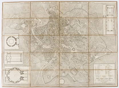
![Italy.- Naples.- Rizzi-Zannoni (Giovanni Antonio) [Two: NO RESERVE Italy.- Naples.- Rizzi-Zannoni (Giovanni Antonio) [Two double-page sheets of the Naples region], sheet nos. 9 and 23, engravings on thick laid paper, each approx. 530 x 760 mm. (20 3/4 x](https://p1.liveauctioneers.com/5458/162099/81861709_1_x.jpg?height=310&quality=70&version=1582043994)


Auction Details

Bid Increments
PriceBid Increment
£0£5
£100£10
£200£20
£500£50
£1,000£100
£2,000£200
£5,000£500
£10,000£1,000
£20,000£2,000
£50,000£5,000
Preview
220 Queenstown Road, London SW8 4LP
Wedneday 19th February - Friday 28th February by prior appointment
Monday 2nd March 10.00am-5.30pm
Tuesday 3rd March 10.00am-5.30pm
Wednesday 4th March 10.00am-5.30pm
Day of sale from 10.00am
220 Queenstown Road
London, SW8 4LP
UK
Buyer's Premium
- 30% up to £150,000.00
- 25% up to £1,000,000.00
- 17% above £1,000,000.00
Terms & Conditions
GENERAL INFORMATION FOR BUYER'S AT AUCTION
1. Introduction The following notices are intended to assist buyers, particularly those that are new to our saleroom and internet bidding platforms. Our auctions are governed by our Terms and Conditions of Business incorporating the Terms of Consignment and Terms of Sale, supplemented by any notices that are displayed in our saleroom, the online catalogue listing or announced by the auctioneer at the auction. Our Terms and Conditions of Business are available for inspection at our saleroom and online at www.forumauctions.co.uk. In registering to bid with us you are committing to be bound by our Terms of Sale.
2. Agency As auctioneers we usually act on behalf of the seller whose identity, for reasons of confidentiality, is not normally disclosed. If you buy at auction your contract for the goods is with the seller, not with us as auctioneer.
3. Estimates Estimates are intended to indicate the sum that might be involved for the purchase of a particular lot. The lower estimate may represent the reserve price (the minimum price for which a lot may be sold) and cannot be below the reserve price. Estimates do not include the buyer's premium, VAT or other taxes and fees (where chargeable). Estimates may be altered by a saleroom notice.
4. Buyer's Premium The Terms of Sale oblige you to pay a buyer's premium on the hammer price of each lot purchased. All lots are offered under the Auctioneer's Margin Scheme and VAT (at 20%) is included within the buyer's premium. Our rate of buyer's premium is 30% of the first £150,000 of hammer, reducing to 24% of the hammer price from £150,001 to £1,000,000 and then 14.4% of hammer price in excess of £1,000,000. Buyers wishing to purchase outside of the margin scheme must notify us and will be subject to VAT (at 20%) on the hammer price in addition to buyer's premium and any other applicable charges. This may be reclaimed as input tax or in the event of export outside of the EU.
5. Items with zero rated VAT Please note that VAT is not added to the buyer's premium on certain goods, such as qualifying books.
6. Inspection of goods by the buyer You will have ample opportunity to inspect the goods and must do so for any lots that you might wish to bid for. Please note carefully the exclusion of liability for the condition of lots set out in Clause 11 of our Terms of Sale.
7. Export of goods If you intend to export goods you must find out in advance if:
a. there is a prohibition on exporting goods of that character e.g. if the goods contain prohibited materials such as ivory
b. if they require an Export Licence on the grounds of exceeding a specific age and/or monetary value threshold as set by the Export Licensing Unit. We are happy to offer the submission of necessary applications on behalf of our buyers but we will charge for this service only to cover the costs of our time.
8. Bidding Bidders will be required to register with us before bidding. Purchases will be invoiced to the buyer's registered name and address only. When first registering for an account with us you will need to provide us with proof of your identity in a form acceptable to us. In registering for any sale you agree to be bound by our terms and conditions regardless of your bidding method.
9. Commission bidding You may leave commission bids with us indicating the maximum amount (excluding the buyer's premium and/or any applicable VAT, fees or other taxes) you authorise us to bid on your behalf for a lot. We will execute commission bids at the lowest price possible having regard only to the vendor reserve and competing bids on the lot. Please note that we accept commission bids at standard bidding increments and reserve the right to reduce an off-increment bid down to the next lowest bidding increment or otherwise at our sole discretion.
10. Live online bidding When using our BidFORUM platform to participate in the auction through your account on our website there will be no additional charges. If you are using a third party live bidding platform then additional fees of 5% are applicable. We will invoice these to you as an additional service and any applicable VAT will be separated out.
11. Methods of Payment We accept payments only in the currency in which the invoice is issued and payment is due within 3 working days of the auction. We process card payments securely over our website and accept and all major debit and credit cards issued by a UK or EU bank free of charge from personally issued cards only. If paying with a corporate card or from outside the EU, an additional 3% charge will be levied on the invoice total. We also accept bank transfers (details below), cash payments up to an equivalent of ?10,000, and cheques if issued by UK banks in sterling only. All funds need to have cleared into our account before items are collected. For bank transfers, please quote the Invoice Number as the payee reference.
Our bank details for electronic transfers are:
HSBC, 16 King St, London WC2E 8JF
Account Name: Forum Auctions Limited
Account Number: 12213079
Sort Code: 40-04-09
IBAN: GB44HBUK40040912213079
BIC: HBUKGB4106D
12. Collection and storage Please note what the Terms of Sale say about collection and storage. It is important that you pay for and collect your goods promptly. Any delay may result in you having to pay storage charges of at least £1.50 per Lot per day as set out in Clause 7 of our Terms of Sale and interest charges of 1.5% per month on the Total Amount Due as set out in Clause 8 of our Terms of Sale.
13. Loss and Damage to Goods We are not authorised by the FCA to provide insurance services. Liability for a lot passes to the buyer on the fall of the hammer or conclusion of an online auction (as applicable).
14. Other symbols within the catalogue
a. (ARR) denotes a lot where Artist's Resale Right (alternatively called Droite de Suite) royalty charges may be applicable to the Lot. Presently these charges are levied on a sliding scale at 4% of the hammer price up to Euro 50,000; 2% from Euro 50,001 to 200,000; 1% from Euro 200,001 to 350,000; 0.5%from Euro 350,001 to 500,000; and 0.25% above Euro 500,000 subject always to a maximum royalty charge of Euro 12,500. We will collect and pay royalty charges on your behalf and calculate the £ sterling equivalent of the Euro amount.
b. (IMPORT) denotes that Import VAT at 5% is payable on the hammer price of the Lot.
c. (VAT) denotes that VAT at 20% is payable on the hammer price as well as the buyer's premium of the Lot, which may be reclaimed as input VAT.
15. Shipping We can help you arrange packing and shipping of your purchases by arrangement with our shipping department. If you would like us to source indicative pricing for packing and shipping, please be aware that at busy times it may take some time for us to revert with a quote.
Definitions and interpretation
Both the sale of goods at our auctions and your relationship with us are governed by the Terms of Consignment (primarily applicable to sellers) the Terms of Sale (primarily applicable to bidders and buyers) and any notices displayed in the saleroom or announced by us at the auction (collectively, the "Conditions of Business"). The Terms of Consignment and Terms of Sale are available at our saleroom on request.
TERMS OF SALE
Please read these Terms of Sale carefully. Please note that if you register to bid and/or bid at auction this signifies that you agree to and will comply with these Terms of Sale. If registering to buy over a Live Online Bidding Platform, including our own BIDFORUM platform accessible via our website, you will be asked, at every auction, to confirm your agreement to these terms before you are able to place a bid.
In these Terms of Sale, the words 'you', 'yours', etc. refer to you as the Buyer. The words "we", "us", etc. refer to the Auctioneer. Any reference to a 'Clause' is to a clause of these Terms of Sale unless stated otherwise
To make these Terms of Sale easier to read, we have given the following words a specific meaning:
"Auctioneer" means Forum Auctions Ltd, a company registered in England and Wales with registration number 10048705 and whose registered office is located at 220 Queenstown Road, London SW8 4LP or its authorised auctioneer, as appropriate;
"Bidder" means a person participating in bidding at the auction;
"Bidding Platform" means the live online bidding platform over which an auction is broadcast allowing bidders to place bids. Bidding Platforms may be operated by the Auctioneer, or by a third party service provider on the Auctioneer's behalf;
"Buyer" means the person who makes the highest bid for a Lot accepted by the Auctioneer;
"Buyer's premium" means the additional auctioneer fees applicable to the hammer price;
"Commission" means:
a. the commission that we charge you on the sale of the Goods as set out in Clause 4 below; and
b. any additional charges, fees, duties or taxes
"Consumer" means an individual acting for purposes which are wholly or mainly outside that individual's trade, business, craft or profession;
"Consumer Contracts Regulations" means the Consumer Contracts (Information, Cancellation and Additional Charges) Regulations 2013;
"Deliberate Forgery" means:
(a) an imitation made with the intention of deceiving as to authorship, origin, date, age, period, culture or source;
(b) which is described in the catalogue as being the work of a particular creator without qualification; and
(c) which at the date of the auction had a value materially less than it would have had if it had been as described;
"Exclusively Online Auction" means only an auction held exclusively over the Website or any Bidding Platforms and where we have not made the Goods available for viewing or inspection. NB this does not apply for any auctions, howsoever held, where we have made the Goods available for inspection;
"FCA" means the Financial Conduct Authority
"Good(s)" means the goods that you consign to us for sale at our auction;
"Hammer Price" means the level of the highest bid accepted by the Auctioneer for a Lot and signalled by the fall of the hammer;
"Listing" means a listing of Goods for sale;
"Lot(s)" means the goods that we offer for sale at our auctions;
"Online Listing" means a listing of Goods for sale on the Website or any Bidding Platform;
"Order Confirmation" means the email confirmation that we send to you to confirm that we have accepted your bid to purchase a Lot;
"Pledge" Any security or charge over the Goods in favour of ourselves or any third party;
"Premium" means the fee that we will charge you on your purchase of a Lot to be calculated as set out in Clause 3;
"Premium Inclusive Auction" means the buyer's premium is zero;
"Price" means the total of the Hammer Price, Premium and any applicable VAT;
"Proceeds" means the net amount due to the Seller;
"Reserve" means the minimum hammer price at which a Lot may be sold save that the auctioneer may use their discretion to accept a lower hammer price than the reserve;
"Seller" means the persons who consign Lots for sale at our auctions;
"Terms of Consignment" means the terms on which we agree to offer Lots for sale in our auctions as agent on behalf of Sellers;
"Terms of Sale" means the terms that any bidder enters into when registering for one of our auctions;
"Total Amount Due" means the Hammer Price for a Lot, the Premium, any applicable artist's resale right royalty, any VAT or import duties due and any additional charges payable by a defaulting buyer under these Terms of Sale;
"Trader" means a Seller who is acting for purposes relating to that Seller's trade, business, craft or profession, whether acting personally or through another person acting in the trader's name or on the trader's behalf;
"VAT" means Value Added Tax or any equivalent sales tax; and
"Website" means our website available www.forumauctions.co.uk.
1 Information that we are required to give to Consumers
1.1 A description of the main characteristics of each Lot as contained in the auction catalogue;
1.2 Our name, address and contact details as set out herein, in our auction catalogues and/or on our Website;
1.3 The price of the Goods and arrangements for payment as described in Clauses 3, 4 and 6;
1.4 The arrangements for collection of the Goods as set out in Clauses 7 and 8;
1.5 Your right to return a Lot and receive a refund if the Lot is a Deliberate Forgery as set out in Clause 12;
1.6 We and Trader Sellers have a legal duty to supply any Lots to you in accordance with these Terms of Sale;
1.7 If you have any complaints, please send them to us directly at the address set out on our Website.
2 Bidding procedures and the Buyer
2.1 You must register your details with us before bidding and provide us with any requested proof of identity and billing information, in a form acceptable to us;
2.2 We strongly recommend that you either attend the auction in person or inspect the Lots prior to bidding at the auction. You are responsible for your decision to bid for a particular Lot. If you bid on a Lot, including by telephone and online bidding, or by placing a commission bid, we assume that you have carefully inspected the Lot and satisfied yourself regarding its condition;
2.3 If you instruct us in writing, we may execute commission bids on your behalf. Commission bids will be accepted with reference only to our standard bidding increments and any off-increment bids will be reduced to the next increment immediately below. Neither we nor our employees or agents will be responsible for any failure to execute your commission bid. Where two or more commission bids at the same level are recorded we have the right, at our sole discretion, to prefer one over others;
2.4 The Bidder placing the highest bid accepted by the Auctioneer for a Lot will be the Buyer at the Hammer Price. Any dispute about a bid will be settled at our sole discretion. We may reoffer the Lot during the auction or may settle any dispute in another way. We will act reasonably when deciding how to settle the dispute;
2.5 Bidders will be deemed to act as principals, even if the Bidder is acting as an agent for a third party;
2.6 We may bid on Lots on behalf of the Seller up to one bidding increment (as set at our sole discretion) below the Reserve;
2.7 We may at our sole discretion refuse to accept any bid;
2.8 We are unable to accept any responsibility for missed bids;
2.9 Bidding increments will be set at our sole discretion.
3 The purchase price
As Buyer, you will pay:
a. the Hammer Price;
b. a premium of 25% of the Hammer Price up to a Hammer Price of £150,000; plus 20% of the Hammer Price from £150,001 to £1,000,000; plus 12% of the Hammer Price exceeding £1,000,000;
c. any VAT, import duty or other duties, fees or taxes applicable to the Lot;
d. any artist's resale right royalty payable on the sale of the Lot; and
e. for Premium Inclusive Auctions there will be no buyer's premium, though there may be additional fees, duties or taxes applicable.
4 VAT and other duties
4.1 You shall be liable for the payment of any VAT and other fees, taxes or duties applicable on the Hammer Price and premium due for a Lot. Please see the symbols used in the auction catalogue for that Lot and the "Information for Buyers" in our auction catalogue for further information.
4.2 We will charge VAT and other fees, taxes or duties at the current rate at the date of the auction.
5 The contract between you and the Seller
5.1 The contract for the purchase of the Lot between you and the Seller will be formed when the hammer falls accepting the highest bid for the Lot at the auction;
5.2 You may directly enforce any terms in the Terms of Consignment against a Seller to the extent that you suffer damages and/or loss as a result of the Seller's breach of the Terms of Consignment;
5.3 If you breach these Terms of Sale, you may be responsible for damages and/or losses suffered by a Seller or us. If we are contacted by a Seller who wishes to bring a claim against you, we may at our discretion provide the Seller with information or assistance in relation to that claim;
5.4 We normally act as an agent only and will not have any responsibility for default by you or the Seller (unless we are the Seller of the Lot);
5.5 For Exclusively Online Auction only, Clauses 16 and 17 may apply.
6 Payment
6.1 Immediately following your successful bid on a Lot you will:
6.1.1 give to us, if not already provided to our satisfaction, proof of identity in a form acceptable to us (and any other information that we require in order to comply with our anti-money laundering obligations); and
6.1.2 pay to us within 3 working days the Total Amount Due in any way that we agree to accept payment or in cash (for which there is an aggregate upper limit of 10,000 euros for all purchases made in any auction);
6.2 If you owe us any money, we may use any payment made by you to repay prior debts before applying such monies towards your purchase of the Lot(s).
7 Title and collection of purchases
7.1 Once you have paid us in full the Total Amount Due for any Lot, ownership of that Lot will transfer to you. You may not claim or collect a Lot until you have paid for it.
7.2 You will (at your own expense) collect any Lots that you have purchased and paid for not later than 10 business days following the day of the auction; or
7.3 If you do not collect the Lot within this time period, you will be responsible for any reasonable removal, storage and insurance charges in relation to that Lot amounting to at least £1.50 per Lot per day.
7.4 Risk of loss or damage to the Lot will pass to you at the fall of the Hammer or when you have otherwise purchased the Lot.
7.5 If you do not collect the Lot that you have paid for within forty-five days after the auction, we may sell the Lot. We will pay the proceeds of any such sale to you, but will deduct any storage charges or other sums that we have incurred in the storage and sale of the Lot. We reserve the right to charge you a selling commission at our standard rates on any such resale of the Lot.
8 Remedies for non-payment or failure to collect purchases
8.1 Please do not bid on a Lot if you do not intend to buy it. If your bid is successful, these Terms of Sale will apply to you. This means that you will have to carry out your obligations set out in these Terms of Sale. If you do not comply with these Terms of Sale, we may (acting on behalf of the Seller and ourselves) pursue one or more of the following measures:
8.1.1 take action against you for damages for breach of contract;
8.1.2 reverse the sale of the Lot to you and/or any other Lots sold by us to you;
8.1.3 resell the Lot by auction or private treaty (in which case you will have to pay any difference between the Total Amount Due for the Lot and the price we sell it for as well as the charges outlined in Clause 7.5 and 8.1.5). Please note that if we sell the Lot for a higher amount than your winning bid, the extra money will belong to the Seller;
8.1.4 remove, store and insure the Lot at your expense;
8.1.5 if you do not pay us within 10 business days of your successful bid, we may charge interest at a rate not exceeding 1.5% per month on the Total Amount Due;
8.1.6 keep that Lot or any other Lot sold to you until you pay the Total Amount Due;
8.1.7 reject or ignore bids from you or your agent at future auctions or impose conditions before we accept bids from you; and/or
8.1.8 if we sell any Lots for you, use the money made on these Lots to repay any amount you owe us.
8.2 We will act reasonably when exercising our rights under Clause 8.1. We will contact you before exercising these rights and try to work with you to correct any non- compliance by you with these Terms of Sale.
9 Health and safety
Although we take reasonable precautions regarding health and safety, you are on our premises at your own risk. Please note the lay-out of the premises and security arrangements. Neither we nor our employees or agents are responsible for the safety of you or your property when you visit our premises, unless you suffer any injury to your person or damage to your property as a result of our, our employees' or our agents' negligence.
10 Warranties
10.1 The Seller warrants to us and to you that:
10.1.1 the Seller is the true owner of the Lot for sale or is authorised by the true owner to offer and sell the lot at auction;
10.1.2 the Seller is able to transfer good and marketable title to the Lot, subject to any restrictions set out in the Lot description, to you free from any third
party rights or claims;
10.1.3 as far as the Seller is aware, the main characteristics of the Lot set out in the auction catalogue (as amended by any notice displayed in the saleroom or announced by the Auctioneer at the auction) are correct. For the avoidance of doubt, you are solely responsible for satisfying yourself as to the condition of the Lot in all respects; and
10.1.4 Unless otherwise described the Lot is capable of free circulation in the European Union save that certain types of Lots may be deemed to be of cultural or heritage importance and may require an export permit prior to their removal from the UK.
10.2 If, after you have placed a successful bid and paid for a Lot, any of the warranties above are found not to be true, please notify us in writing. Neither we nor the Seller will be liable, under any circumstances, to pay you any sums over and above the Total Amount Due and we will not be responsible for any inaccuracies in the information provided by the Seller except as set out below.
10.3 Please note that many of the Lots that you may bid on at our auction are second- hand.
10.4 If in an Exclusively Online Auction a Lot is not second-hand and you purchase the Lot as a Consumer from a Seller that is a Trader, a number of additional terms may be implied by law in addition to the Seller's warranties set out at Clause 10.1 (in particular under the Consumer Rights Act 2015). These Terms of Sale do not seek to exclude your rights under law as they relate to the sale of these Lots.
10.5 Save as expressly set out above, all other warranties, conditions or other terms which might have effect between the Seller and you, or us and you, or be implied or incorporated by statue, common law or otherwise are excluded.
11 Descriptions and condition
11.1 Our descriptions of the Lot will be based on: (a) information provided to us by the Seller of the Lot (for which we are not liable); and (b) our opinion (although we do not warrant that we have carried out a detailed inspection of each Lot).
11.2 We will give you a number of opportunities to view and inspect the Lots before the auction. You (and any consultants acting on your behalf) must satisfy yourself about the accuracy of any description of a Lot. We shall not be responsible for any failure by you or your consultants to properly inspect a Lot.
11.3 Representations or statements by us as to authorship, genuineness, origin, date, age, provenance, condition or estimated selling price involve matters of opinion. We undertake that any such opinion will be honestly and reasonably held, subject always to the limitations in 10.1, and accept liability for opinions given negligently or fraudulently.
11.4 It is your responsibility to establish whether a Lot may be subject to export restrictions, duties, taxes or fees.
11.5 Please note that Lots (in particular second-hand Lots) are unlikely to be in perfect condition.
11.5.1 Lots are sold "as is" (i.e. as you see them at the time of the auction). Neither we nor the Seller accept any liability for the condition of second-hand Lots or for any condition issues affecting a Lot if such issues are included in the description of a Lot in the auction catalogue (or in any saleroom notice) and/ or which the inspection of a Lot by the Buyer ought to have revealed.
11.5.2 In the case of Exclusively Online Auctions the provisions of Clauses 16 and 17 may apply.
12 Deliberate Forgeries
12.1 You may return any Lot which is found to be a Deliberate Forgery to us within twelve months of the auction provided that you return the Lot to us in the same condition as when it was released to you, accompanied by a written statement identifying the Lot from the relevant catalogue description and a written statement of defects prepared by an accredited expert.
12.2 If we are reasonably satisfied that the Lot is a Deliberate Forgery, we will refund the money paid by you for the Lot (including any Premium and applicable VAT) provided that if:
12.2.1 the catalogue description reflected the accepted view of experts as at the date of the auction; or
12.2.2 you personally are not able to transfer good and marketable title in the Lot to us,
you will have no right to a refund under this Clause 12.
12.3 If you have sold the Lot to another person, we will only be liable to refund the Total Amount Due for the Lot. We will not be responsible for repaying any additional money you may have made from selling the Lot or any other costs you have incurred in relation to the Lot save for those Lots purchased in exclusively online auctions from a Trader.
12.4 Your right to return a Lot that is a Deliberate Forgery does not affect your legal rights and is in addition to any other right or remedy provided by law or by these Terms of Sale.
13 Limitation of our liability to you
13.1 We will not be liable for any loss of opportunity or disappointment suffered as a result of participating in our auction.
13.2 It is your responsibility to establish whether a Lot may be subject to export restrictions, duties, taxes or fees.
13.3 In addition to the above, neither we nor the Seller shall be responsible to you and you shall not be responsible to the Seller or us for any other loss or damage that any of us suffer that is not a foreseeable result of any of us not complying with the Conditions of Business. Loss or damage is foreseeable if it is obvious that it will happen or if at the time of the sale of the Lot, all of we, you and the Seller knew it might happen.
13.4 Subject to Clause 13.4, if we are found to be liable to you for any reason (including, amongst others, if we are found to be negligent, in breach of contract or to have made a misrepresentation), our liability will be limited to the Total Amount Due as paid by you to us for any Lot.
13.5 Notwithstanding the above, nothing in these Terms of Sale shall limit our liability (or that of our employees or agents) for:
13.5.1 death or personal injury resulting from negligence (as defined in the unfair Contract Terms Act 1977);
13.5.2 fraudulent misrepresentation; or
13.5.3 any liability which cannot be excluded by law.
14 Notices
14.1 All notices between you and us regarding these Terms of Sale must be in writing and signed by or on behalf of the party giving it.
14.2 Any notice referred in these Terms of Sale may be given:
14.2.1 by delivering it by hand;
14.2.2 by first class pre-paid post or Recorded Delivery; or
14.2.3 by email, provided that a copy is also sent by pre-paid post or Recorded Delivery.
14.3 Notices must be sent as follows:
14.3.1 by hand or registered post:
a. to us, at our address set out in these Terms of Sale or at our registered office address appearing on our Website; and
b. to you, at the last postal address that you have given to us as your contact address in writing; or
14.3.2 by email:
a. to us, at the following email addresses: info@forumauctions.co.uk and office@forumauctions.co.uk
b. to you, by sending the notice to any email address that you have given to us as your contact email address.
14.4 Notices will be deemed to have been received:
14.4.1 if delivered by hand, on the day of delivery;
14.4.2 if sent by first class pre-paid post or Recorded Delivery, two business days after posting, exclusive of the day of posting; or
14.4.3 if sent by email, at the time of transmission unless sent after 17.00 in the place of receipt in which case they will be deemed to have been received on the next business day in the place of receipt (provided that a copy has also been sent by pre-paid post or Recorded Delivery).
14.5 Any notice or communication given under these Terms of Sale will not be validly given if sent by fax, email (unless also delivered Recorded Delivery), any form of messaging via social media or text message.
15 Data Protection
We will hold and process any personal data in relation to you in accordance with the principles underlying the Data Protection Act. Our registration number with the Information Commissioner is ZA178875.
16 Conditional Right to cancel following an Exclusively Online Auction only
16.1 If you are contracting as a Consumer and the Seller of a Lot is a Trader, you will have a statutory right to cancel your purchase of that Lot if you change your mind for any reason. The provisions below set out your legal right to cancel. Further advice about your legal right to cancel your purchase is available from your local Citizens Advice Bureau or Trading Standards office.
16.2 You may cancel your purchase at any time from the date of the Order Confirmation up to the end of the fourteenth day after the day of collection of the Lot by you or the person specified by you for collection (e.g. if you receive an Order Confirmation on 1 January and you collect a Lot on 10 January, you may cancel at any time between 1 January and the end of the day on 24 January).
16.3 To cancel your purchase, you must inform us of your intention to cancel it. The easiest way to do so is to complete the model cancellation form attached to your Order Confirmation. If you use this method, we will email you to confirm that we have received your cancellation. Alternatively, you can email us at office@forumauctions.co.uk. If you send us your cancellation notice by email or by post, then your cancellation is effective from the date you send us the email or post the letter to us.
16.4 If you exercise your right to cancel your purchase, you will receive a refund of the Total Amount Due paid for the Lot in accordance with Clause 17. When exercising the cancellation right, you must return the Lots to us immediately at your own cost (as set out below).
16.5 Following purchasing of Lots, you are entitled to a reasonable opportunity to inspect the Lots (which will include removing them from their packaging and inspecting them). At all times, you must take reasonable care of the Lots and must not let them out of your possession. If you are in breach of your obligations to take reasonable care of the Lots, we will have a claim against you and may deduct from the refund costs incurred by us as a result of the breach.
16.6 Details of this statutory right, and an explanation of how to exercise it, are also provided in the Order Confirmation. This provision does not affect your statutory rights.
16.7 The cancellation right described in this Clause is in addition to any other right that you might have to reject a Lot, for instance because it is a Deliberate Forgery as set out in Clause 12.
17 Exercising the right to cancel following an Exclusively Online Auction only
17.1 Where you have validly returned a Lot to us under your right of cancellation described in Clause 16, we will refund the full amount paid by you for the Lot.
17.2 Please note that we are permitted by law to reduce your refund to reflect any reduction in the value of the Lot, if this has been caused by your handling of the Lot in a way contrary to the conditions specified in these terms or which would not be permitted during a pre-sale exhibition held prior to an auction. If we refund you the price paid before we are able to inspect the Lot and later discover you have handled the Lot in an unacceptable way, you must pay us an appropriate amount.
17.3 You will be responsible for returning the Lot to us at your own cost.
17.4 We will process any refund due to you within the deadlines below:
17.4.1 if you have collected the Lot but have not returned it to us: fourteen days after the day on which we receive the Lot back from you or, if earlier, the day on which you provide us with evidence that you have sent the Lot back to us; or
17.4.2 if you have not collected the Lot or you have already returned the Lot to us: fourteen days after you inform us of your decision to cancel the Contract.
17.5 We will refund you using the same means of payment that you used for the transaction.
17.6 Legal ownership of a Lot will immediately revert to the Seller if we refund any such payment to you.
17.7 For further information on how to return Lots to us, please get in touch with us using the contact details provided on our Website.
18 General
18.1 We may at our sole discretion, though acting reasonably, refuse admission to our premises or attendance at our auctions by any person.
18.2 We act as an agent for our Sellers. The rights we have to claim against you for breach of these Terms of Sale may be used by either us, our employees or agents, or the Seller, its employees or agents, as appropriate. Other than as set out in this Clause, these Terms of Sale are between you and us and no other person will have any rights to enforce any of these Terms of Sale.
18.3 We may use special terms in the catalogue descriptions of particular Lots. You must read these terms carefully along with any glossary provided in our auction catalogues.
18.4 Each of the clauses of these Terms of Sale operates separately. If any court or relevant authority decides that any of them are unlawful, the remaining clauses will remain in full force and effect.
18.5 We may change these Terms of Sale from time to time, without notice to you. Please read these Terms of Sale for every sale in which you intend to bid carefully, as they may be different from the last time you read them.
18.6 Except as otherwise stated in these Terms of Sale, each of our rights and remedies are: (a) are in addition to and not exclusive of any other rights or remedies under these Terms of Sale or general law; and (b) may be waived only in writing and specifically. Delay in exercising or non-exercise of any right under these Terms of Sale is not a waiver of that or any other right. Partial exercise of any right under these Terms of Sale will not preclude any further or other exercise of that right or any other right under these Terms of Sale. Waiver of a breach of any term of these Terms of Sale will not operate as a waiver of breach of any other term or any subsequent breach of that term.
18.7 These Terms of Sale and any dispute or claim arising out of or in connection with them (including any non-contractual claims or disputes) shall be governed by and construed in accordance with the laws of England and the parties irrevocably submit to the exclusive jurisdiction of the English courts.
VAT and other additional charges
Please note our buyer's premium including VAT is as follows:
For books (without VAT) - 25%
For other items - (with VAT) - 30%
A 5% web charge will also apply to lots bought over a third party platform.
Artist's Resale Right (alternatively called Droite de Suite) royalty charges may apply to some lots, details of which can be found in our terms and conditions.
TOP