

![BIBLE, [London: Robert Barker 1613, folio]](https://p1.liveauctioneers.com/503/304101/162266169_1_x.jpg?height=300&quality=70&version=1696237168)
Done
Cambridge, Cambridgeshire, United Kingdom
Auction Details
The Library Sale
Sale of fine books, manuscripts, prints and maps


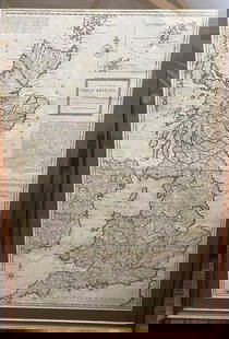
![D'ANVILLE: D'ANVILLE An Atlas of Ancient Geography … with two additional maps, London: R H Laurie [1821], folio, 55 x 37cm, 11 double page and 1 single page maps, hand coloured in outline, ink owner's name to](https://p1.liveauctioneers.com/503/304101/162266149_1_x.jpg?height=310&quality=70&version=1696237168)


Auction Details

Bid Increments
PriceBid Increment
£0£10
£200£20
£500£50
£1,000£100
£2,000£200
£5,000£500
£10,000£1,000
£20,000£2,000
£50,000£5,000
£100,000£10,000
Buyer's Premium
- 24.5%
Terms & Conditions
CONDITIONS OF BUSINESS
INFORMATION FOR BUYERS
1. Introduction. The following informative notes are intended to assist Bidders and Buyers and form part of our Conditions of Business. All sales are governed by our printed Conditions of Business, including the Information for Buyers, Conditions of Sale, and the Terms of Consignment for Sellers, which are readily available for inspection in our printed catalogues or in our saleroom. Buyers should carefully read the Conditions of Sale and Terms of Consignment for Sellers prior to bidding at auction, as Bidders and Buyers will be deemed to have accepted these terms and conditions once a bid has been placed. Our staff will be happy to help you if there is anything you do not fully understand.
Please refer to clause 1 of the Conditions of Sale if you are unsure about the meaning of a defined term.
2. Agency. As auctioneers we act as agent for the Seller whose identity, for reasons of confidentiality, is not normally disclosed to the Buyer. If a Buyer purchases at auction, the contract of sale is made directly between the Buyer and the Seller.
3. Pre-sale Estimates. Pre-sale estimates are intended as a guide to help Buyers gauge approximate prices for the purchase of a particular lot. The actual Hammer Price realised at auction may be higher or lower than the pre-sale estimate. The lower estimate may represent a reserve price which we have agreed with the Seller. Pre-sale estimates do not include the Buyer's Premium or VAT. Estimates printed in the sale catalogue are prepared some time before the sale and may be altered by announcement prior to the auction. It is advisable for the Buyer to consult us nearer the time of the auction for any updates or revisions to pre-sale estimates.
4. Buyer's Premium. A Buyer's Premium on the Hammer Price of each lot purchased is payable to us by the Buyer and will consist of an amount calculated by applying the following bands and rates:
24.5% on the first ?200,000 of the Hammer Price;
20% on the excess of ?200,001 and up to ?3,000,000 of the Hammer Price; and
12.5% on the excess of ?3,000,001 of the Hammer Price.
In addition, VAT is chargeable on the Buyer's Premium (see paragraph 5 of this Information For Buyers section in relation to VAT).
Please note, an online surcharge of 3% is payable on top of our standard premium.
5. VAT. Our sale catalogues include guidance in relation to the VAT implications of purchasing particular lots. Please note that this is general guidance only and is subject to relevant tax legislation in force at the time of sale. Buyers should seek independent advice from a tax advisor.
The dagger symbol (?) indicates a lot on which VAT is payable by the Buyer at the standard rate (presently 20%) on the Hammer Price.
The asterisk symbol (*) indicates that the lot has been imported from outside the European Union and is currently liable to a reduced rate of VAT (5%) on the hammer price, the buyer's premium of 29.4% (24.5% + VAT at the standard rate) is also due.
Lots which appear without either of the above symbols indicate that no VAT is payable on the Hammer Price. Such lots are sold using a Margin Scheme.
Buyers should note that any VAT which may be included within the Buyer's Premium for these lots is not recoverable as input tax.
When a Buyer is located outside of the European Union, VAT will be charged to the Buyer but can be refunded once the Buyer has provided us with proof of export from the European Union for the purchased lot within 3 months of the date of the sale. We can assist you with the forms necessary for recovering VAT.
6. Description and Condition of Lots. As agents for the Seller, we are primarily dependent on information provided by the Seller, and any statement made by us in respect of any lot, as to authorship, genuineness, origin, date, age, provenance, condition or estimated selling price, including condition reports that may be provided at the Buyer's request, is a statement of opinion honestly held by us. It is recommended that prospective Buyers inspect the lots on which they intend to bid at pre-sale viewings in our saleroom. Accordingly, we accept bids from potential Buyers on the basis that Buyers (or their advisors) have fully inspected the lot prior to bidding and have satisfied themselves prior to bidding in relation to the condition and accuracy of the description of the lot.
The nature of the lots sold at auction is such that they will rarely be in perfect condition and are likely, due to their nature and their age, to show signs of wear and tear, damage, or other imperfections, restoration or repair. Any reference to condition by Cheffins will not amount to a full description of condition. Photographs included in Cheffins' sale catalogues are not representative of the condition of any lot.
We draw the Buyer's attention to the exclusion of liability for the condition of lots contained in the Conditions of Sale. Neither the Seller nor we, as the auctioneers, accept any responsibility for the condition of any lot.
In certain specified circumstances, lots that are misdescribed because they are deliberate forgeries may be returned by the Buyer and repayment made by the Seller. There is a 3-week time limit for a Buyer to return a lot on this basis (please see the Conditions of Sale for the definition of "Deliberate Forgery").
7. Electrical and Mechanical Goods. All electrical and mechanical goods are sold for their decorative and artistic value and are not guaranteed to be in working order. Prior to use, the electrical system of such goods must be checked and approved by a qualified electrician for compliance with safety regulations.
8. Soft Furnishings. Soft furnishings sold at auction may not comply with statutory safety and fire regulations. Prior to use, it is the Buyer's responsibility to ensure that such goods are reupholstered, restuffed and/or recovered as appropriate in order that they comply with safety regulations.
9. Endangered Species. Property sold at auction may incorporate endangered or other species of wildlife and plant life, for example ivory, tortoiseshell, crocodile skin, whale bone, ebony or rosewood. Several countries restrict or prohibit the import or export of objects containing these materials or require a permit for their movement (for example, a CITES licence). Prior to bidding on an item which may include these or similar organic materials, Buyers should familiarise themselves with the relevant customs laws and regulations if they intend to move the property to another country.
10. Jewellery. Gemstones are often treated to enhance their colour and improve their appearance. They may be heated or treated by oil or resin to intensify colour and transparency. Other techniques such as dyeing, irradiation, coating and impregnation may also be used. Buyers should be aware that unless the catalogue description specifically states that the stone is natural, Cheffins has assumed that any treatment may not be permanent, and that special care of the stone may be needed in the future.
11. Bidding. Bidders will be required to register before a sale commences in order to place a bid on any lot. Proof of identification (photo identification and proof of current address) will be required at the time of registration if the Bidder is unknown to us.
Lots will only be invoiced to the name and address on the bid registration form and cannot be transferred to another name and address. We can only accept payment for the lot from the registered Bidder.
12. Other Ways to Bid. There are several alternatives to bidding in person in the sale room at the time of the sale.
Commission bids may be left with the Auctioneer by a Bidder indicating the maximum amount to be bid (excluding VAT and Buyer's Premium and any other charges that may apply). Subject to the reserve price of the lot and any other bids received, the sale may be concluded for less than the maximum bid.
Bidders may also register to bid on the telephone or online during the sale. Please enquire in advance about our arrangements for alternative means of placing bids. Bids must be received by Cheffins not less than 24 hours before the sale.
If two Bidders submit identical bids, the Auctioneer will endeavour to ensure the first bid received has priority.
13. Payment. Payment is due immediately after the auction. We accept the following methods of payment:
? Bank Transfer - direct to our bankers, Barclays Bank, 9-11 St. Andrews St, Cambridge, CB2 3AA, Sort Code: 20-17-68, Account number: 50690961, IBAN: GB44BARC20176850690961, Swift Code: BARCGB22
? Secure Online Gateway - an electronic invoice will be provided to the Buyer which contains a link to our secure payment page for online payment by credit or debit card.
? Cash - As a consequence of the Money Laundering Regulations 2003, we are no longer able to accept cash payments for sums in excess of ?7,500. This includes single payments amounting to this sum or multiple payments totalling ?7,500.
? Cheques - supported by a valid guarantee card, cheques are accepted entirely at our discretion and any cheques tendered will need to be cleared before removal of the lot is permitted (please note you must allow 6 working days for a cheque to clear before we release any goods purchased).
? Debit cards - payments can be made in person or over the telephone (please note there is a ?500 limit for payments over the telephone).
? Credit cards - Payments can be made in person or over the telephone (please note there is a ?500 limit for payments over the telephone).
Sold lots can only be released to the Buyer on Cheffins' receipt of payment in full and cleared funds of the Purchase Price.
14. Export of Goods. Any lot purchased at auction may be subject to export restrictions or may require a licence for export out of the United Kingdom, for example depending on the age and value of the lot or if the lot contains organic or endangered materials that are restricted from export (as discussed at paragraph 9 above).
The Buyer is responsible for obtaining any licences that may be required (including any licence that may be required for import into the destination country). The delay or denial of any such licence will not be grounds for the Buyer to cancel any purchase.
At the Buyer's request, we can assist in the application for the export of goods outside of the UK.
15. Collection and storage. Please note that all lots must be paid for and collected by the Buyer promptly following the auction and in any event within 10 days following the sale. Lots cannot be released until payment (including Buyer's Premium and VAT where applicable) has been received by us in full and cleared funds. Any delay of payment may involve the Buyer in incurring storage charges.
At the Buyer's request, we may assist in arranging shipment of lots. Otherwise, collection of lots is the Buyer's sole responsibility. Buyers will be required to produce proof of identity on collection of the lot.
If a Buyer arranges for a third party to collect a sold lot on the Buyer's behalf, we will require from the Buyer written evidence of the third party's authority to collect the lot in advance of releasing it. Cheffins accepts no liability for loss or damage to any lot once it has been collected.
Failure by the Buyer or their authorised representative to collect within the specified timeframe may lead to removal of the lot to offsite storage for which the Buyer will be charged removal and storage.
TERMS OF CONSIGNMENT FOR SELLERS
All aspects of the relationship between Sellers, Buyers and/or Cheffins regarding the sale, purchase or holding of property by Cheffins are governed by Cheffins' Conditions of Business, including these Terms of Consignment, the Conditions of Sale, the Information for Buyers and any additional terms, conditions or notices as may be referred to herein or that may be amended by way of notices posted in the saleroom or by way of announcements made by the Auctioneer.
Sellers' attention is specifically drawn to paragraphs 4, 5, 8 and 12.4, which contain specific obligations on Sellers and limitations and exclusions of Cheffins' legal liability. These limitations and exclusions are consistent with Cheffins' role as a provincial auction house.
The Seller agrees that all property will be sold in accordance with Cheffins' Conditions of Business.
1. DEFINITIONS.
1.1. Unless otherwise stated, all defined terms have the same meaning in these Terms of Consignment as set out in the Conditions of Sale.
1.2. In these Terms of Consignment:
"Net Sale Proceeds" means the Hammer Price of the lot sold (as received by Cheffins in full and cleared funds from the Buyer), less Seller's Commission and any other expenses payable by the Seller to Cheffins in accordance with these Terms of Consignment.
"Seller's Commission" means the commission payable by the Seller to Cheffins in relation to the sale of a lot which is consigned by the Seller, such commission payable at the date of the sale together with any applicable VAT at the rates set out in these Terms of Consignment (or as may otherwise be updated or agreed with Cheffins).
2. SELLER'S AUTHORITY.
2.1. The Seller authorises Cheffins to act as agent on its behalf and to charge and receive commission from the Buyer at the standard rates set out in the Conditions of Business.
2.2. The Seller authorises Cheffins to deduct commission at the stated rate and all expenses incurred for the Seller's account from the Hammer Price, including but not limited to catalogue and other reproductions and illustrations, any customs duties, licences, marketing, packing, shipping or storage costs, taxes, or bank charges plus an amount in respect of applicable VAT. The Seller consents to Cheffins' right to retain beneficially the premium paid by the Buyer in accordance with Cheffins' Conditions of Sale and any interest earned on the sale proceeds until the date of settlement to the Seller (subject always to payment by the Buyer).
3. SELLER'S COMMISSION.
3.1. Seller's Commission is charged at the following rates: -
3.1.1. Fine Art and Specialist Sales: 17.5% (+ VAT) on the Hammer Price subject to a minimum charge per lot of ?20 (+ VAT) whether the lot is sold or not.
3.1.2. Antiques and Interiors Sales: 20% (+VAT) on the Hammer Price subject to a minimum charge per lot of ?10 (+VAT) whether the lot is sold or not.
4. SELLER'S WARRANTIES AND CONDITIONS.
4.1. The Seller represents and warrants to Cheffins and to the Buyer that at all relevant times (including but not limited to the time of consignment and at the time of the sale):
4.1.1. The Seller is the legal owner of the lot consigned to Cheffins, or is fully authorised to sell the Property by the legal owner of it;
4.1.2. The Seller is able to and shall transfer possession to the Buyer good and marketable title to the lot free from any third-party rights, claims or potential claims;
4.1.3. The Seller has provided Cheffins with all information concerning the provenance of the lot that is known to the Seller and has notified Cheffins in writing of any concerns expressed by third parties in relation to the ownership, condition, authenticity, attribution, or export or import of the lot;
4.1.4. The Seller is unaware of any matter or allegation which would render any description given to Cheffins in relation to the lot inaccurate or misleading in any way;
4.1.5. The lot is not stolen;
4.1.6. The lot has been or will be lawfully imported and lawfully and permanently exported as required by the laws of any country in which it is or was located. Any required declarations upon the export and import of the lot have been or will be properly made and any duties and taxes on the export and import of the lot have been or will be paid by the Seller.
4.1.7. The Seller has paid or will pay any applicable taxes and/or duties that may be due on the Purchase Price of the lot;
4.1.8. The Seller is not aware of any restrictions, in copyright or otherwise, relating to the lot (other than those imposed by law) or any restrictions on Cheffins's rights to reproduce photographs or any images of the lot;
4.1.9. Unless the Seller notifies Cheffins to the contrary, any electrical or mechanical goods or components are in a safe operating condition if reasonably used for the purpose for which they were designed and are free from any defect not obvious on external inspection which could prove dangerous to human life or health.
4.2. Where Cheffins reasonably believes that there is or may be a breach of any such representation or warranty, Cheffins is entitled in its sole discretion to rescind the Sellers lot from sale.
4.3. Items for sale must be consigned to the saleroom by any deadline as stated by Cheffins. All costs and expenses incurred for packing, shipping and delivery to Cheffins prior to sale are at the Seller's sole expense.
5. INDEMNITY.
5.1. The Seller agrees to indemnify Cheffins, their respective servants, directors, officers and employees and the Buyer against any loss or damage resulting from any breach or alleged breach of any of the above representations or warranties.
5.2. The Seller's representations, undertakings and indemnities will survive completion of the sale of the lot.
6. ESTIMATES AND DESCRIPTIONS.
6.1. Lots may be included in a sale at Cheffins' sole discretion, including how the lot is described and illustrated in the sale catalogue and any marketing of the lot.
6.2. Any estimates given by Cheffins are honestly held opinions only and are only an indication of the price a lot may achieve at the sale. The price achieved may be higher or lower and the Seller may not rely on Cheffins' estimates. Estimates may be revised at any time prior to sale at Cheffins' sole discretion.
6.3. The description of a lot is a matter of Cheffins' opinion and not of fact, and depends on several factors, including but not limited to the information provided by the Seller, the condition of the lot, and the generally accepted expert opinion regarding the lot at the time of cataloguing.
6.4. Cheffins may at its sole discretion consult with or refer any lot to a third party for further research or additional expert opinion. Cheffins is in no way obligated to consult any third party expert in relation to any lot.
6.5. Subject to the limitations and exclusions set out in these Terms of Consignment, Cheffins exercises reasonable care in compiling descriptions of lots and any other related reports, consistent with its role as a provincial auction house.
7. ILLUSTRATIONS.
Lots may be illustrated in the sale catalogue at Cheffins' sole discretion. The cost of any illustrations is borne by the Seller. The copyright in respect of such illustrations shall be the property of Cheffins, as is the text of the catalogue.
8. LIMITATION OF LIABILITY AND EXCLUSIONS.
8.1. Cheffins is dependent on information from the Seller and is not responsible for any errors or omissions in the information provided by the Seller.
8.2. Cheffins is not liable for any acts or omissions arising from the conduct of auctions or in relation to sale of any lot, whether negligent or not.
8.3. Cheffins does not exclude or limit its liability in relation to fraudulent misrepresentation by Cheffins. Subject to the foregoing, any claim against Cheffins by the Seller is limited to the Net Sale Proceeds of the relevant lot and does not include any indirect or consequential losses of the Seller.
9. RESERVES.
9.1. Lots will normally be offered for sale subject to a reserve to be agreed between Cheffins and the Seller before the sale, that is, the minimum Hammer Price at which that lot may be sold. A reserve once set cannot be changed except with Cheffins' consent. Reserves must be reasonable and Cheffins may decline to offer goods which in its opinion would be subject to an unreasonably high reserve. No reserve may exceed the lot's final low pre-sale estimate. Lots with estimates of ?100 or lower will be sold without reserve.
9.2. Cheffins shall in no circumstances be liable if bids are not received to the level of the reserve. Cheffins may at its discretion sell lots below the reserve provided Cheffins pays the Seller the sale proceeds it would have received if the lot had sold for the reserve.
10. BIDDING.
The Seller may not bid or instruct a third party to bid on its behalf for property that it consigns for sale.
11. POST-SALE.
Following the sale, the Seller will be liable to pay Cheffins the Seller's Commission and any other expenses set out in these Terms of Consignment. All monies due to Cheffins by the Seller will be deducted from the payment of the Hammer Price received from the Buyer.
12. PAYMENT TO SELLER.
12.1. After the sale of the Seller's property, settlement of the Net Sale Price due to the Seller shall normally be made not later than 21 working days following the sale, subject always to Cheffins receiving payment of the Purchase Price in full and cleared funds from the Buyer. In the event the Buyer has not paid for the lot, no settlement will be made to the Seller until payment is received.
12.2. Cheffins may take the Seller's instructions regarding recovery of payment, subject to the Conditions of Sale, but it is at Cheffins' sole discretion whether to take any action against a Buyer or seek any of the remedies as set out in the Conditions of Sale. Cheffins is under no obligation to investigate the ability of any Bidder to pay for purchased lots or to pursue any Buyer for non-payment.
12.3. The Seller agrees to inform Cheffins of any action which it chooses to take against a Buyer in order to enforce payment by the Buyer.
12.4. The Seller's attention is drawn to its liability to reimburse the proceeds of sale to Cheffins in the event any lot is deemed to be a Deliberate Forgery (as described in paragraph 10 of the Conditions of Sale).
13. LOSS AND DAMAGE OF PROPERTY.
13.1. Unless otherwise agreed in writing with the Seller as set out below, Cheffins assumes liability for loss or damage to property consigned to it at the low pre-sale estimate commencing when the property is received by Cheffins until title passes to the Buyer, in the event the property is sold. If the property is unsold, Cheffins' liability will cease when the property is collected by the Seller, or 10 days after the sale, whichever is earlier.
13.2. The liability assumed by Cheffins for loss or damage to any lot shall be limited to the low pre-sale estimate, or to the Hammer Price if the lot has sold, or to the reserve if the lot was unsold.
13.3. The Seller must instruct Cheffins in writing if it does not wish Cheffins to assume liability for consigned property as set out above. The property will then remain entirely at the Seller's risk unless and until the property passes to the Buyer or is collected by or on behalf of the Seller.
13.4. Sellers do not in any event have the right to claim for loss or damage to property under Cheffins' insurance policy.
14. UNSOLD AND WITHDRAWN ITEMS.
14.1. In the event a lot remains unsold at auction, the Seller authorises Cheffins at its discretion to negotiate a sale by private treaty for a period of 10 days following the auction. The charges and expenses as set out in these Terms of Consignment will be payable by the Seller as if such lot had been sold at auction. Insofar as appropriate, the Conditions of Business are applicable to any such private treaty sale.
14.2. If an item is unsold it may with the Seller's consent be re-offered at a future auction. The Conditions of Business shall be applicable to any items reconsigned for sale. Where in Cheffins' opinion an item is unsaleable, the Seller must collect such items from the saleroom promptly on being so informed and in any event within 10 days of such notification.
14.3. Alternatively, unsold items may be collected by the Seller within 10 days of the sale in which the lot was entered, subject to payment by the Seller of any expenses due to Cheffins.
14.4. Cheffins may in its absolute discretion withdraw an item from sale if it reasonably believes that the warranties given by the Seller under the Conditions of Business in relation to that item may be breached, or if it becomes aware of an actual breach of the warranties in relation to that item. Cheffins will notify the Seller if the Seller's property is withdrawn from sale. The Seller must collect its property promptly on being so informed and in any event within 10 days of such notification.
14.5. Failure by the Seller to collect any item within the specified time will incur storage charges at a daily rate of ?5/day (+VAT), such charges to accrue until the Seller collects the item.
14.6. A fee of 15% (+ VAT) of Cheffins' pre-sale mid estimate is chargeable on all lots withdrawn from sale.
14.7. Unsold and withdrawn lots will not be released to the Seller until the fees and expenses under these Terms of Consignment are paid to Cheffins by the Seller.
15. TRANSPORT AND STORAGE.
15.1. The Seller is solely responsible for packing and delivery of their property to Cheffins prior to sale, and for collection in the event the property is unsold. Cheffins may agree with the Seller to arrange for a third party shipper, at the Seller's expense. Any expenses incurred by Cheffins in relation to transport of Seller's property will be chargeable to the Seller.
15.2. Cheffins is not liable for any loss or damage to any property caused by any third party in relation to handling, packing, transport or storage.
15.3. In the event property has been delivered to Cheffins' saleroom without sufficient sale instructions and/or remains uncollected and/or unconsigned for sale, Cheffins reserves the right to charge ?5 (+ VAT) per lot per day for warehousing. Cheffins will notify the Seller on record in writing at the Seller's last known address. If the property is not removed within 6 months from such notification, Cheffins reserves the right to sell the property and defray its expenses from any net proceeds of sale. Alternatively, Cheffins may at the Seller's expense give the property to the local authority or other body for disposal.
CONDITIONS OF SALE
Cheffins Fine Art ("Cheffins") carries on business with Bidders, Buyers and Sellers on the following Conditions of Sale, the Terms of Consignment for Sellers, the Information for Buyers and on such other terms, conditions and notices as may be referred to herein or that may be amended by way of notices posted in the saleroom or by way of announcements made by the Auctioneer.
1. DEFINITIONS
In these Conditions:
"Auctioneer" means Cheffins or its authorised auctioneer, as appropriate.
"Bidder" means the person considering, making or attempting to make a bid on a lot, in person or by any other means, including the Buyer.
"Buyer" means the Bidder who makes the highest bid accepted by the Auctioneer.
"Buyer's Premium" means additional payment on the Hammer Price of each lot purchased, payable to Cheffins by the Buyer, on which VAT is chargeable.
"Client" means an individual who may be either the Bidder, Buyer or Seller depending on the context.
"Deliberate Forgery" means an imitation made with the intention of deceiving as to authorship, origin, date, age, period, culture or source but which is unequivocally described in the catalogue as being the work of a particular creator and which at the date of the sale had a materially lesser value than it would have had if it had been in accordance with the catalogue description.
"Hammer Price" means the highest bid reached (at or above any reserve) and accepted by the Auctioneer when the Auctioneer brings down the hammer and the sale of the lot is final.
"Purchase Price" means the Hammer Price in respect of the lot sold, together with any Buyer's Premium, Value Added Tax chargeable and any additional charges payable by a Buyer in accordance with these Conditions.
"Seller" means the legal owner of the lot offering it for sale, including their agents (other than Cheffins), executors or personal representatives.
"Terms of Consignment" means the stipulated terms and rates of commission on which Cheffins accepts instructions from Sellers or their agents and which form part of these Conditions of Business.
The singular includes the plural and vice versa as appropriate.
2. BIDDING
2.1 Bidders are required to register their details before bidding and to supply any information or references required by Cheffins before entering the auction room to bid or before Cheffins will accept any other form of bid, whether by commission, telephone or otherwise. Proof of the Bidder's identification (photo identification and proof of current address) will be required at the time of registration.
2.2 The Bidder with the highest bid accepted by the Auctioneer conducting the sale shall be the Buyer at the Hammer Price.
2.3 Bidders shall be deemed to act as principals and require Cheffins' written consent at the time of Bidder registration to bid as agent for another party. Bidders are personally liable for their bid and jointly and severally liable with their principal if bidding as agent (whether or not Cheffins has consented to the Bidder acting as agent).
2.4 Lots will only be invoiced to the name and address of the Bidder on the bid registration form and cannot be transferred to another name and address. Cheffins can only accept payment for the lot from the registered Bidder.
2.5 Cheffins expressly reserves the right to bid on behalf of the Seller up to the amount of any reserve. The Auctioneer has discretion to refuse any bid from any Bidder, and to withdraw or re-offer any lot if the Auctioneer believes there has been an error or dispute. Any dispute about a bid shall be settled at the Auctioneer's absolute discretion, the Auctioneer acting reasonably at all times.
2.6 All lots (unless otherwise specified) are offered subject to a confidential reserve price agreed between Cheffins and the Seller below which Cheffins may not sell the lot. The reserve price shall be no higher than the low pre-sale estimate of the lot at the time of auction.
2.7 Bidding increments shall be at the Auctioneer's sole discretion. By way of example only, Cheffins bidding increments may be:
Range Increment
?0 - ?200 ?10
?200 - ?500 ?20
?500 - ?1,000 ?50
?1,000 - ?2,000 ?100
?2,000 - ?5,000 ?200
?5,000 - ?10,000 ?500
?10,000 - ?20,000 ?1,000
Cheffins is not bound to implement any of the above increments.
2.8 Cheffins' knowledge in relation to any lot is dependent on information provided by the Seller of the lot. Cheffins is not able to and does not carry out exhaustive due diligence on each lot. Bidders acknowledge this fact and accept responsibility for carrying out inspections and investigations to satisfy themselves as to the lots on which they bid.
2.9 Each lot offered for sale at Cheffins is available for inspection by Bidders prior to the auction. Cheffins accepts bids by any means on the basis that Bidders (and/or independent advisors acting on the Bidder's behalf) have fully inspected the lot prior to bidding and have satisfied themselves prior to bidding as to both the condition of the lot and the accuracy of its description. All lots are offered for sale in the condition they are in at the time of the auction.
2.10 Sale catalogues, catalogue illustrations and condition reports are for information purposes only and do not necessarily convey the full information regarding any lot. Information provided to Bidders or their advisors prior to the sale in respect of any lot, whether written or oral and including any information in the sale catalogue or condition or other report, is a statement of opinion honestly held by Cheffins and is not a statement of fact.
2.11 Subject to the conditions of paragraphs 2.8 - 2.10, Cheffins exercises reasonable care when making statements of opinion consistent with its role as a provincial auction house, on the basis of information provided by the Seller, available scholarship, and the generally accepted opinions of relevant experts (at the time any such expert expressly states such opinion). Cheffins is in no way required to seek the opinion of any expert outside Cheffins.
2.12 A sale contract is made directly between the Buyer and the Seller on the fall of the Auctioneer's hammer, following which the Buyer becomes liable to pay the Purchase Price.
3. OTHER TYPES OF BIDS
3.1 Subject to the conditions set out in paragraph 2, Cheffins will, if so instructed by a Bidder clearly in writing not less than 24 hours prior to auction, execute bids on the Bidder's behalf by commission bid, or the Bidder can register not less than 24 hours prior to auction to bid during the auction by telephone or online. Neither the Auctioneer nor its employees or agents shall be responsible for any failure to execute any instructions to bid for any reason, including but not limited to technical failures of phones or online connection.
3.2 Where applicable, if two Bidders submit identical bids, the Auctioneer will endeavour to ensure the first bid received has priority.
4. VALUE ADDED TAX
Value Added Tax on the Hammer Price is imposed by the laws of England and Wales on all items identified with an asterisk (*) or dagger (?) and will be imposed on the Buyer's Premium. Value Added Tax is charged at the appropriate rate in accordance with legislation in force at the date of sale and is payable by Buyers of relevant lots (Please refer to "Information for Buyers" for a brief explanation of the VAT position).
5. PAYMENT
5.1 Unless otherwise agreed with Cheffins, the Buyer will pay to Cheffins the Purchase Price immediately following the sale of any lot.
5.2 Any payments by the Buyer to Cheffins may be applied by Cheffins towards any sums owing from the Buyer to Cheffins on any account whatever without regard to any directions of the Buyer, whether express or implied.
5.3 Title in a purchased lot will not pass to the Buyer until Cheffins has received the Purchase Price of the lot in full and cleared funds. Cheffins will not release any lot to the Buyer for collection until payment of the Purchase Price and any additional charges to the Buyer (as set out below in clause 7.2) is received.
6. COLLECTION OF LOTS
6.1 The Buyer shall at their own risk and expense collect any lots for which the Buyer has paid in full from Cheffins' premises not later than 10 days following the date of the relevant auction.
6.2 The Buyer shall be required to show proof of purchase and identification prior to the lot being released. Any packers or shippers acting on the Buyer's behalf will require written authorisation by the Buyer before Cheffins will release any purchased lot to them.
6.3 All packing and handling of lots will be at the Buyer's sole risk. Cheffins will not be responsible for any acts or omissions of third party packers or shippers.
7. FAILURE TO COLLECT PURCHASES
7.1 If the Buyer pays the Purchase Price and any related expenses but fails to collect a purchased lot within 10 days following the date of the relevant auction, the lot will be stored at the Buyer's expense and risk, at Cheffins or with a third party.
7.2 The Buyer shall be required to pay all additional expenses, including but not limited to handling and storage, incurred for failing to collect a purchased lot before the lot is released to the Buyer for collection.
8. REMEDIES FOR NON-PAYMENT
8.1 If any lot is not paid for in full and collected in accordance with these Conditions or if there is any other breach of these Conditions, Cheffins, as agent for the Seller and on its own behalf, shall at its absolute discretion and without prejudice to any other rights Cheffins or the Seller may have, be entitled to exercise one or more of the following rights and remedies:
(a) to commence legal proceedings against the Buyer to recover the Purchase Price and any related expenses for that lot, together with interest and costs of such proceedings on a full indemnity basis;
(b) to cancel the sale of that lot and/or any other lots sold by Cheffins to the Buyer;
(c) to resell the lot (by auction or private treaty) with estimates and reserves at Cheffins' sole discretion. The Buyer shall be responsible for payment of any resulting shortfall in the total amount due (after crediting any part payment and adding any resale costs);
(d) to remove, store and insure the lot at the Buyer's sole risk and expense and, in the case of storage, either at Cheffins' premises or elsewhere;
(e) to charge interest at a rate not exceeding 1.5% per month on the total amount due from the Buyer to the extent it remains unpaid for more than 10 days after the sale until such time as all payments are received in full and cleared funds;
(f) to retain the lot or any other lot sold to the Buyer until the Buyer pays the total amount due and to exercise a lien over any of the Buyer's property in Cheffins' possession for any purpose until the debt due is satisfied;
(g) to reject or ignore bids from the Buyer or the Buyer's agent at future auctions or to impose conditions before any such bids shall be accepted;
(h) to apply any proceeds of sale of other lots due or in future becoming due to the Buyer towards the settlement of the total amount due; and/or
(i) to release the name and address of the Buyer to the Seller to enable the Seller to commence legal proceedings to recover the amounts due and legal costs. Cheffins will take reasonable measures to notify the Buyer prior to releasing such details to the Seller.
8.2 We shall, as agent for the Seller and on our own behalf pursue these rights and remedies only so far as we deem at our sole discretion is reasonable to make appropriate recovery in respect of breach of these Conditions of Business. We are in no way obligated to exercise any of the above rights or remedies.
9. WARRANTIES AND LIMITATION OF LIABILITY
9.1 The Seller warrants to the Bidder that it is the legal owner of the property consigned for sale, or is properly authorised by the legal owner to consign it for sale, and is able to transfer good and marketable title to the property free from any third party claims.
9.2 Subject to paragraph 9.1, neither Cheffins nor the Seller is liable for any errors or omissions provided to Bidders by Cheffins, whether orally or in writing, where negligent or otherwise, except as set out in paragraph 2.11.
9.3 Subject to paragraphs 9.6 and 10, neither Cheffins nor the Seller gives any guarantee or warranty to the Bidder. Any implied warranties and conditions are excluded (except where such warranties and conditions cannot be excluded by law), other than the express warranties given by the Seller to the Buyer in the Terms of Consignment for Sellers.
9.4 Neither Cheffins nor the Seller accepts responsibility to any Bidder for acts or omissions (whether negligent or otherwise) by Cheffins in relation to the conduct of any auction.
9.5 Any claim by a Bidder or a Buyer against Cheffins or the Seller is limited to the Purchase Price in respect of the relevant lot and shall not include under any circumstances indirect or consequential losses.
9.6 This paragraph 9 shall not exclude or limit Cheffins' liability in respect of any fraudulent misrepresentation made by Cheffins or the Seller.
10. DELIBERATE FORGERIES
10.1 Notwithstanding the conditions in paragraph 9, any lot which proves to be a Deliberate Forgery (as defined in paragraph 1) may be returned to Cheffins by the Buyer within 21 days of the relevant auction, provided it is in the same condition as when bought, and is accompanied by particulars identifying it from the relevant catalogue description and a written statement of defects. If Cheffins is satisfied at its sole discretion that the above criteria have been met and that the lot is a Deliberate Forgery, the sale will be cancelled and Cheffins shall refund the money paid by the Buyer for the lot including any Buyer's Premium.
10.2 Paragraph 10.1 shall not apply if either: (1) the catalogue description reflected the generally accepted view of scholars and experts as at the date of sale, or the catalogue description indicated that there was a conflict of opinion; or (2) the only method of establishing at the date of sale that the item was a Deliberate Forgery would have been not then generally available or accepted, unreasonably expensive or impractical to use, or likely to have caused damage or loss of value (in Cheffins' reasonable opinion) of the lot; or (3) there has been no material loss in value of the lot from its value had it been in accordance with its description.
10.3 If the Buyer is not personally able to transfer a good and marketable title to Cheffins, then the Buyer shall have no rights under this paragraph 10. The right of return provided by this paragraph 10 is additional to any right or remedy provided by law or by these Conditions of Sale.
10.4 Cheffins may require the Buyer to obtain at the Buyer's expense the reports of up to two independent and recognised experts in the field, mutually acceptable to Cheffins and to the Buyer. Cheffins shall not be bound by any reports produced by the Buyer, and reserves the right to seek additional expert advice at its own expense.
11. EXPORT AND LICENCING
It is the Buyer's sole responsibility to identify and obtain any necessary licences for a lot, including but not limited to export, import, or endangered species. Cheffins and the Seller make no representations or warranties as to whether any lot is or is not subject to export or import restrictions. The denial of any licence or permit shall not entitle the Buyer to cancel the sale contract or delay payment of the lot.
12. ARTIST'S RESALE RIGHTS
12.1 In addition to the Purchase Price, lots indicated with this symbol (?) may qualify for and be subject to payment by the Buyer of the Artist's Resale Right at a percentage of the Hammer Price calculated as follows:
Portion of the Hammer Price Percentage rate
From ?1,000 to ?50,000 4%
From ?50,001 to ?200,000 3%
From ?200,001 to ?350,000 1%
From ?350,001 to ?500,000 0.5%
Exceeding ?500,000 0.25%
The total amount payable will be the aggregate of the sum payable under each of the above rate bands, up to a maximum total amount of ?12,500 for any single lot.
12.2 Any Artist's Resale Rights royalties will be calculated on the pound sterling/Euro exchange rate quoted on the date of the sale by the European Central Bank.
13. DATA PROTECTION
13.1 Cheffins will request and use personal information from Clients and, where that personal information is considered to be 'personal data' as defined in the General Data Protection (EU) Regulation 2016/679 (the 'GDPR'), that personal data will be processed according to this clause 13 and our full privacy policy ('Privacy Policy'), a copy of which is available on the Cheffins website at www.cheffins.co.uk. In respect of the personal data of Clients processed according to this clause 13, Cheffins will act as a controller.
13.2 The personal information collected by Cheffins from a Client may include the Client's name, proof of identity and financial information. Cheffins does not envisage that it will collect 'sensitive personal data' but will seek the Client's consent before it does so.
13.3 The legal basis on which Cheffins will process personal data will usually be that the processing of personal data is necessary for the performance of a contract to which the Client is a party or in order to take steps at the Client's request prior to entering into a contract. In certain circumstances, Cheffins may also rely on certain other legal justifications for processing personal data, such as consent to the processing (where that consent has been obtained lawfully from the Client), where the processing is necessary for the purposes of the legitimate interests pursued by Cheffins (which will be explained to the Client) or where the processing is necessary for compliance with a legal obligation to which Cheffins is subject.
13.4 Personal data collected from a Client according to this clause 13 may be used for the following purposes:
? the provision of auction-related services;
? Client administration;
? marketing;
? the supply of Client services; or
? as required by law.
13.5 Cheffins may send marketing material about its services to the Client where it has obtained the consent of the Client to do so or if the services are similar to those which Cheffins has previously provided to the Client and the Client has been given the opportunity to opt-out of future marketing at the time of the collection of that personal data. On sending the Client electronic marketing material, Cheffins will offer the Client the option of opting out of receiving further electronic marketing material with each such communication. The Client may opt out of receiving marketing material by post by contacting Cheffins' Compliance Officer using the contact details provided below.
13.6 For the purposes of providing the services to the Client, Cheffins may share the Client's personal data with third parties, including but not restricted to: the Buyer or Seller following an auction; to our partners who provide third party support for our auctions services, such as RFC; to our other service providers, such as credit and reference providers, to provide references to mortgage lenders, to help prevent dishonesty, for administrative and accounting purposes, or for occasional debt tracing and fraud prevention; and to relevant solicitors. For further details please contact the Compliance Officer at Cheffins using the contact details provided below.
13.7 Cheffins may be required to share personal data with organisations that are outside of the European Economic Area. Where Cheffins shares personal data in this way it will either do this in order to conclude or perform a contract to which the Client is a party or it will take other appropriate safeguards to protect that personal data. For further information of the appropriate safeguards referred to in this clause please contact the Compliance Officer at Cheffins using the contact details provided below.
13.8 The Client has a number of rights under the GDPR, including being able to request a copy of the personal data held about him/her (a 'right of access'). A right of access can usually be exercised without a charge being paid by the Client, unless the requests from the Client are manifestly unfounded or excessive. To exercise the right of access the Client should contact the Compliance Officer at Cheffins using the contact details provided below. For further details of the rights available to him/her under the GDPR, the Client should refer to the full Privacy Policy.
13.9 Further details of the processing of the Client's personal data can be found in the full Privacy Policy.
13.10 Further details about the processing of personal data can be obtained from, and queries should be directed to, the Compliance Officer at Cheffins, whose telephone number is 01223 271 973 and whose email address is privacy@cheffins.co.uk
13.11 Clients should note that telephone calls to Cheffins relating to auction bids may be recorded.
14. ANTI-MONEY LAUNDERING
14.1 The Client acknowledges that due to The Money Laundering, Terrorist Financing and Transfer of
Funds (Information on the Payer) Regulations 2017, Cheffins and any person acting on behalf of Cheffins may require further documentation verifying the identity of the Client. The Client further agrees to provide Cheffins with any information as Cheffins determines to be necessary and appropriate to verify compliance with The Money Laundering, Terrorist Financing and Transfer of Funds (Information on the Payer) Regulations 2017 and anti-money laundering regulations of any applicable jurisdiction or to respond to requests for information concerning the identity of the Client from any governmental authority, self-regulatory organisation or financial institution in connection with its anti-money laundering compliance procedures, and to update such information as necessary. We may not be able to tell you if a disclosure has been made to the relevant authorities and, if this is the case, we will not be liable for any loss, damage or expense as a result of any delay or otherwise caused by us when complying with our statutory obligations.
14.2 We may not be able to provide services to the Client if we do not receive information as required by this clause 14.
15. AGENCY
15.1 The Auctioneer acts as agent only and disclaims any responsibility for default in relation to any of these Conditions of Business by Sellers or by Buyers.
16. THIRD PARTY LIABILITY
16.1 All members of the public on Cheffins' premises are there at their own risk and must note the lay-out of the building and any security arrangements. Accordingly, neither the Auctioneer nor its employees or agents shall incur liability for death or personal injury (except as required by law) or similarly for the safety of the property of persons visiting the premises.
17. GENERAL
17.1 Cheffins reserves the right to alter these Conditions of Business at any time.
17.2 Cheffins shall have the right in its absolute discretion to refuse admission to its premises or attendance at its auctions by any person
17.3 Special terminology may be used in catalogue descriptions of particular types of goods, and the descriptions should be interpreted in accordance with any glossary appearing in the sale catalogue.
17.4 All images and other materials produced for the auction are the copyright of Cheffins for use at Cheffins' discretion.
17.5 Any notice to any Buyer, Seller or Bidder may be given by first class mail to the last address of which Cheffins has been formally notified and shall be deemed to have been received by the addressee 48 hours after posting. Any notice to Cheffins by the Bidder, Buyer or Seller should be in writing.
17.6 Any extension or waiver of any provision of these Conditions of Business that may be granted to Bidders, Buyers or Sellers by Cheffins for a specific lot shall not have any consequence on the enforceability of these Conditions and in all other respects these Conditions shall remain in full force and effect. Should any provision of these Conditions of Business be deemed unenforceable for any reason, the remaining provisions shall remain in full force and effect.
17.7 These Conditions of Business are not assignable by any Buyer or Seller without Cheffins' prior written consent but are binding on the Buyer's and the Seller's respective successors, assigns and representatives. No act, omission or delay by Cheffins shall be deemed a waiver or release of any of its rights.
17.8 The Contracts (Rights of Third Parties) Act 1999 is excluded by these Conditions and shall not apply to any contract made pursuant to them.
17.9 The Conditions of Sale, the Terms of Consignment for Sellers, the Information for Buyers, and any additional notices issued by Cheffins form the entire agreement between the parties. It is agreed that no party has entered into any contract pursuant to these terms in reliance on any representation, warranty or undertaking not expressly referred to in these documents (save in respect of liability for fraudulent misrepresentation).
17.10 These Conditions of Business, including the Information for Buyers and the Terms of Consignment for Sellers, and all transactions or disputes to which they relate, are governed by the laws of England and Wales. The Buyer and the Seller agree that the Courts of England and Wales shall have exclusive jurisdiction in relation to any dispute arising.
TOP