![1799 Cary Map of Hungary -- A New Map of Hungary, with Its Divisions into Gespanchafts or Counties;: Title: 1799 Cary Map of Hungary -- A New Map of Hungary, with Its Divisions into Gespanchafts or Counties; the Principality of Transylvania, Croatia &c. from the Latest Authorities Cartographer: J Car](https://p1.liveauctioneers.com/5584/332709/179478678_1_x.jpg?height=310&quality=70&version=1718142738)
Maps & Atlases
![1799 Cary Map of Hungary -- A New Map of Hungary, with Its Divisions into Gespanchafts or Counties;: Title: 1799 Cary Map of Hungary -- A New Map of Hungary, with Its Divisions into Gespanchafts or Counties; the Principality of Transylvania, Croatia &c. from the Latest Authorities Cartographer: J Car](https://p1.liveauctioneers.com/5584/332709/179478678_1_x.jpg?height=310&quality=70&version=1718142738)
![A Tinker Bell's Map Sculpture.: (Disney, 2002) A Tinker Bell’s Map sculpture by Imagineer Terri Hardin. The sculpture depicts the “”Peter Pan” pixie with glittery wings tip-toeing across a map of Neverland. This piec](https://p1.liveauctioneers.com/4633/333131/179836354_1_x.jpg?height=310&quality=70&version=1718229530)
![1841 Bradford Map of Manhattan -- New York: Title: 1841 Bradford Map of Manhattan -- New York Cartographer: T Bradford Year / Place: 1841, Boston Map Dimension (in.): 14 X 11.3 in. This is an excellent map of New York City's lower Manhattan, fr](https://p1.liveauctioneers.com/5584/332709/179478672_1_x.jpg?height=310&quality=70&version=1718142738)
![POLYNESIA/PACIFIC ISLANDS. inc Sandwich/Hawaiian islands. RAPKIN/TALLIS 1851 map: CAPTION PRINTED BELOW PICTURE: 'Polynesia or Islands in the Pacific Ocean' Vignettes: Resolution Bay, Marquesas; Harbour of Dory, New Guinea; Otaheite [Tahiti]; Kalakakooa, Sandwich Islands [Hawaiian](https://p1.liveauctioneers.com/5584/332711/179480021_1_x.jpg?height=310&quality=70&version=1718142737)
![Ortelius Map of Portugal: ORTELIUS, Abraham (1547-1598). Portugalliae que olim Lisitania... Engraved map with original hand color. Antwerp, 1595. 17" x 21" sheet.](https://p1.liveauctioneers.com/1968/330639/178336639_1_x.jpg?height=310&quality=70&version=1716827770)
![1772 GREEK BIBLE NEW TESTAMENT antique BIBLIA LATIN text MAP NOVUM TESTAMENTUM: Lugduni Batavorum, Apud Wetstenios Londini, Apud Johannem Nourse; 1772 Size 3 3/4 by 6 1/4" Folding map [6] 699 pp. Repaired spine Some toning. Otherwise very good condition Text in Greek and Latin in](https://p1.liveauctioneers.com/5584/332364/179251568_1_x.jpg?height=310&quality=70&version=1718142848)
![Jeffery's Map of the St. Laurence River Canada: JEFFERYS, Thomas (c. 1719-1771). An exact chart of the River St. Laurence, from Fort Frontenac to the Island of Anticosi... Engraved map with original hand color in outline. London: Sayer & Bennett, 1](https://p1.liveauctioneers.com/1968/330639/178336654_1_x.jpg?height=310&quality=70&version=1717781318)
![J. H. Colton Map of Mexico 1862: COLTON, J.H. (1800-1893). Nueva Mapa de Mejico / Colton's Map of Mexico, showing part of the United States... Lithographed map with original hand color. New York: J.H. Colton, 1862. 32 1/2" x 41 1/2"](https://p1.liveauctioneers.com/1968/330639/178336689_1_x.jpg?height=310&quality=70&version=1716827770)
![Holmes Map of the Upper East Side, New York: HOLMES, John Bute (Ca.1820-1887). Map of Property in Harlem showing the farm lines, old road, lanes, &c. as they existed over 100 years ago on the... Hand-colored lithograph map printed by Meyer Merke](https://p1.liveauctioneers.com/1968/330639/178336683_1_x.jpg?height=310&quality=70&version=1716827770)
![Forlani map of the Mediterranean: FORLANI, Paolo (fl. 1560-1571), compiled by Diogo Homem. La carta del navigare...dell'Europa, et parte dell'Africa, et dell'Asia. Engraved map. Venice: 1569. 21" x 31 7/8" sheet, 32 1/2" x 43 1/2" fra](https://p1.liveauctioneers.com/1968/330639/178336628_1_x.jpg?height=310&quality=70&version=1716827770)
![Historical map of Ethiopia, "Presbi: Historical map of Ethiopia, "Presbiteri Iohannis, sive, Abissinorum Imperii Descriptio", Northeast Africa with the Arabian Peninsula, decorative colored copper engraving map by Abraham Ortelius around](https://p1.liveauctioneers.com/609/331536/178837977_1_x.jpg?height=310&quality=70&version=1716988473)
![COLOR LITHOGRAPH "COFFEE MAP OF THE REPUBLIC OF COLOMBIA" New York, 1939 32" x 27". Framed.: COLOR LITHOGRAPH "COFFEE MAP OF THE REPUBLIC OF COLOMBIA"New York, 1939National Federation of Coffee Growers map, with colored regions, charts and data boxes.32" x 27". Framed.](https://p1.liveauctioneers.com/7634/332462/179305422_1_x.jpg?height=310&quality=70&version=1717603891)
![The Royal Geographical Society Silver Map, 14 1/2" x 22" with Certificate.: The Royal Geographical Society Silver Map, 14 1/2" x 22" with Certificate.](https://p1.liveauctioneers.com/210/333574/180167109_1_x.jpg?height=310&quality=70&version=1718417779)
![CARL ROSE (1903-1971) Greenwich Village Street Maps and Landmarks.: CARL ROSE (1903-1971) Greenwich Village Street Maps and Landmarks. Ink on board; 30 x 20 inches. Illustration for an unidentified publication containing twenty-three smaller separate drawings related](https://p1.liveauctioneers.com/199/333055/179796916_1_x.jpg?height=310&quality=70&version=1718136712)
![History of Colonial Mexico - Viceroyalty of New Spain - Large and Very Rare Exceptional Map of New: Engraving on paper, hand-colored, from the region of Nueva Galicia, current Jalisco and Nayarit, with beautiful motifs of Chichimicas Indians honoring the Imperial shield of Los Austrias, a clear exam](https://p1.liveauctioneers.com/8129/332582/180196864_1_x.jpg?height=310&quality=70&version=1718446070)
![French printing of large Jefferys map of New England 1777: Heading: (New England) Author: Le Rouge, Georges-Louis, publisher Title: A map of the most inhabited part of New England, containing the provinces of Massachusetts Bay and New Hampshire with the colon](https://p1.liveauctioneers.com/642/332628/179408759_1_x.jpg?height=310&quality=70&version=1717729056)
![(2) Maps / Blueprints of 1993 Indy Motor Speedway: (2) Maps / Blueprints of the 1993 Indianapolis Motor Speedway. One has some tearing on the top left, both have some creasing, discoloration, and wear from storage / display. Measures approximatley 24"](https://p1.liveauctioneers.com/1395/332888/179697952_1_x.jpg?height=310&quality=70&version=1717988359)
![1863 Johnson Map of Northern Germany - Johnson's Germany No. 1: Title: 1863 Johnson Map of Northern Germany - Johnson's Germany No. 1 Cartographer: Johnson & Ward Year / Place: 1863, New York Map Dimension (in.): 12.4 X 15.4 in. This is a superb map of northern Ge](https://p1.liveauctioneers.com/5584/332709/179478703_1_x.jpg?height=310&quality=70&version=1718142738)
![Original 1830 Hand-Colored Map of England & Wales: Beautiful antique hand-colored engraved map of England and Wales with part of Scotland including the new lines of canals, rail roads etc. Published in 1830 by Pigot & Co, London and Manchester. Issued](https://p1.liveauctioneers.com/6087/332305/179222954_1_x.jpg?height=310&quality=70&version=1717439546)
![World Map - Air Canada Cargo travel poster: 1976, 34x52, A- condition](https://p1.liveauctioneers.com/1037/330291/178052707_1_x.jpg?height=310&quality=70&version=1716066261)
![Map of the Adirondack Lands ?: Title: Map of the Adirondack Lands ? Publication Date: 1909 Cartographer: STATE OF NEW YORK THE FOREST, FISH AND GAME COMMISSION /J. B. KOETTERITY Publisher: STATE FOREST COMMISSION Height: 34.5 Width](https://p1.liveauctioneers.com/5584/332709/179478996_1_x.jpg?height=310&quality=70&version=1718142738)
![N I | N II | N III Detroit 1820: Title: N I | N II | N III Detroit 1820 Publication Date: c1900 Cartographer: THOMPSON, DAVID | WILLIAM A. BIRD Publisher: CANADA BOUNDARY COMMISSION Height: Width: "We certify this to be a true map of](https://p1.liveauctioneers.com/5584/332709/179478887_1_x.jpg?height=310&quality=70&version=1718142738)
News about Maps & Atlases
![Historic maps and atlases chart course to Swann Dec. 7](https://www.liveauctioneers.com/news/wp-content/uploads/2023/11/165833907_1_x.webp)
Historic maps and atlases chart course to Swann Dec. 7
[av_heading heading=’Historic maps and atlases chart course to Swann Dec. 7′ tag=’h1′ style=” subheading_active=” show_icon=” icon=’ue800′ font=’entypo-fontello’ size=” av-desktop-font-size-title=” av-medium-font-size-title=” av-small-font-size-title=” av-mini-font-size-title=” subheading_size=” av-desktop-font-size=” av-medium-font-size=” av-small-font-size=” av-mini-font-size=” icon_size=” av-desktop-font-size-1=” av-medium-font-size-1=” av-small-font-size-1=” av-mini-font-size-1=” color=” custom_font=” subheading_color=” seperator_color=” icon_color=” margin=’,,35px,’ av-desktop-margin=” av-desktop-margin_sync=’true’ av-medium-margin=” av-medium-margin_sync=’true’ av-small-margin=’,,20px,’ av-mini-margin=” av-mini-margin_sync=’true’ headline_padding=” headline_padding_sync=’true’ av-desktop-headline_padding=” av-desktop-headline_padding_sync=’true’ av-medium-headline_padding=” av-medium-headline_padding_sync=’true’ av-small-headline_padding=” av-small-headline_padding_sync=’true’ av-mini-headline_padding=” av-mini-headline_padding_sync=’true’ […]
![Celebration of Scottish engineering on display at Lyon & Turnbull Feb. 7](https://www.liveauctioneers.com/news/wp-content/uploads/2024/01/Screenshot-2024-01-25-at-9.14.33 AM.png)
Celebration of Scottish engineering on display at Lyon & Turnbull Feb. 7
EDINBURGH – A cache of material from a well-known Scottish engineering dynasty will be offered at Lyon & Turnbull. The Rare Books, Manuscripts, Maps & Photographs auction on Wednesday, February 7 includes 50 lots from the Stevenson family – designers across four generations of many of the U.K.’s lighthouses. Absentee and Internet live bidding will […]
![Dickens & Twain set world records at Potter & Potter Aug. 28](https://www.liveauctioneers.com/news/wp-content/uploads/2021/09/395-1.jpg)
Dickens & Twain set world records at Potter & Potter Aug. 28
CHICAGO – Potter and Potter‘s spectacular August 28 Fine Books and Manuscripts Sale was the company’s highest-grossing auction to date. After a day of spirited bidding, 107 lots realized between $1,000-4,999; 22 lots realized between $5,000-9,999; and 16 lots broke the five digit mark.
![Jasper52 vintage map auction Nov. 5 going global](https://www.liveauctioneers.com/news/wp-content/uploads/2019/10/77325761_3_x.jpg)
Jasper52 vintage map auction Nov. 5 going global
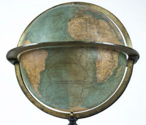
NEW YORK – A 19th century French terrestrial globe tops an auction of vintage maps that will be conducted by Jasper52 on Tuesday, Nov. 5. Fifteen globes and more than 130 maps and atlases are offered in the online auction. Bid absentee or live online exclusively through LiveAuctioneers.