![Bahamas. Turks & Caicos. New Providence. Nassau plan. 53x67cm. STANFORD 1896 map: CAPTION PRINTED BELOW PICTURE: 'The Bahamas // Island of New Providence // Nassau' DATE PRINTED: 1896 IMAGE SIZE: Approx 53.0 x 66.0cm, 20.75 x 26 inches (Large); Please note that this is a folding ma](https://p1.liveauctioneers.com/5584/333313/179948458_1_x.jpg?height=310&quality=70&version=1718743877)
![](https://p1.liveauctioneers.com/6667/334167/180576045_1_x.jpg?height=104&quality=70&version=1718993103&width=104)
![](https://p1.liveauctioneers.com/6667/334167/180576043_1_x.jpg?height=104&quality=70&version=1718993103&width=104)
![](https://p1.liveauctioneers.com/6667/334167/180576047_1_x.jpg?height=104&quality=70&version=1718993103&width=104)
Maps & Atlases
![Bahamas. Turks & Caicos. New Providence. Nassau plan. 53x67cm. STANFORD 1896 map: CAPTION PRINTED BELOW PICTURE: 'The Bahamas // Island of New Providence // Nassau' DATE PRINTED: 1896 IMAGE SIZE: Approx 53.0 x 66.0cm, 20.75 x 26 inches (Large); Please note that this is a folding ma](https://p1.liveauctioneers.com/5584/333313/179948458_1_x.jpg?height=310&quality=70&version=1718743877)
![GUADELOUPE. Marie-Galante, Désirade, Iles des Saintes.Vuillemin. 1903 old map: TITLE/CONTENT OF MAP: 'Guadeloupe, Marie-Galante, La Désirade, et Iles des Saintes' (Le Guadeloupe et Ses Dépendances) DATE PRINTED: 1903 IMAGE SIZE: Approx 22.5 x 25.0cm, 8.75 x 9.75 inches](https://p1.liveauctioneers.com/5584/333313/179947998_1_x.jpg?height=310&quality=70&version=1718743877)
![NEW PROVIDENCE. Vintage map. Bahamas. Caribbean 1927 old vintage chart: TITLE/CONTENT OF MAP: 'Island of New Providence, Bahamas' DATE PRINTED: 1927 IMAGE SIZE: Approx 13.0 x 18.0cm, 5 x 7 inches (Small); Please note that this is a folding map. TYPE: Vintage colour map CO](https://p1.liveauctioneers.com/5584/333313/179947997_1_x.jpg?height=310&quality=70&version=1718743877)
![Ortelius' landmark map of Americas: Heading: (America) Author: Ortelius, Abraham Title: Americae Sive Novi Orbis, Nova Descriptio Place Published: Antwerp Publisher: Date Published: 1579 Description: Copper-engraved m](https://p1.liveauctioneers.com/642/332628/179408734_1_x.jpg?height=310&quality=70&version=1717729056)
![NICHOLAS SCULL & GEORGE HEAP’S ENGRAVED MAP OF PHILADELPHIA 1777 Sheet 16" x 13.25".: NICHOLAS SCULL & GEORGE HEAP’S ENGRAVED MAP OF PHILADELPHIA1777"Plan of the City and Environs of Philadelphia". Engraved by Will Faden.Sheet 16" x 13.25".](https://p1.liveauctioneers.com/7634/333445/180037679_1_x.jpg?height=310&quality=70&version=1718397629)
![EARLY MAP OF COASTAL MAINE 30" x 42" sight. Framed 32" x 45".: EARLY MAP OF COASTAL MAINEPublished by Des Barres, 1776.30" x 42" sight. Framed 32" x 45".](https://p1.liveauctioneers.com/7634/333445/180037678_1_x.jpg?height=310&quality=70&version=1718397629)
![MAP "PLAN OF THE TOWN OF BOSTON" Circa 1775 11.75" x 5.75" sight. Framed 16.5" x 9.5".: MAP "PLAN OF THE TOWN OF BOSTON"Circa 1775"Plan of the town of Boston with the attack on Bunkers-Hill in the peninsula of Charlestown the 17th of June 1775".11.75" x 5.75" sight. Framed 16.5" x 9.5".](https://p1.liveauctioneers.com/7634/333445/180037672_1_x.jpg?height=310&quality=70&version=1718397629)
![Dominica, British West Indies. Caribbean. US Navy sea chart 1892 (1917) map: CAPTION PRINTED BELOW PICTURE: 'West Indies - Island of Dominica (British)' DATE PRINTED: Surveyed to 1872. Published 1892. Corrections to 1917 IMAGE SIZE: Approx 102.5 x 68.0cm, 40.5 x 26.75 inches (](https://p1.liveauctioneers.com/5584/333313/179947987_1_x.jpg?height=310&quality=70&version=1718743877)
![Leeward Islands. West Indies Virgin Antigua Dominica St. Kitts STANFORD 1896 map: CAPTION PRINTED BELOW PICTURE: 'The Leeward Islands' DATE PRINTED: 1896 IMAGE SIZE: Approx 50.5 x 64.0cm, 19.75 x 25.25 inches (Large); Please note that this is a folding map. TYPE: Large (folio) anti](https://p1.liveauctioneers.com/5584/333313/179947999_1_x.jpg?height=310&quality=70&version=1718743877)
![COLONIAL CARIBBEAN. West Indies. Danish Virgin Islands.Telegraph cables 1886 map: CAPTION PRINTED BELOW PICTURE: 'The West India Islands, and Central America; Inset map of Jamaica' DATE PRINTED: 1886 IMAGE SIZE: Approx 36.0 x 52.0cm, 14.25 x 20.5 inches (Large); Please note that th](https://p1.liveauctioneers.com/5584/333313/179947996_1_x.jpg?height=310&quality=70&version=1718743877)
![MAP OF BROOKLINE, MASSACHUSETTS, BELIEVED TO BE THE FIRST PUBLISHED MAP OF THE TOWN, Circa 1844 22": MAP OF BROOKLINE, MASSACHUSETTS, BELIEVED TO BE THE FIRST PUBLISHED MAP OF THE TOWNCirca 1844"Map of the Town of Brookline, Mass. Surveyed in 1844 By Order of The Town Authorities by E.F. Woodward". (](https://p1.liveauctioneers.com/7634/333445/180037676_1_x.jpg?height=310&quality=70&version=1718397629)
![1874 Map of India: 1874 Map of India. Sight 16" x 14", overall 17 1/2" x 15". Provenance: The Edward Herrmann Estate, Salisbury Connecticut.](https://p1.liveauctioneers.com/1122/332252/179210672_1_x.jpg?height=310&quality=70&version=1717432170)
![Reverse Painted Glass, Map, Celestial Chart: Rare Hand Painted Reverse On Glass 'Sceno Syste Coper Graphia Matis Nicani' After Andreas Cellarius Framed. Map and celestial imagery in the center. Size: 28.5"T x 32"L, 2" frame](https://p1.liveauctioneers.com/5908/333812/180333243_1_x.jpg?height=310&quality=70&version=1718742605)
![5 TVA Map Books incl. Tennessee & New York c. 1935-1950: Five (5) Tennessee Valley Authority USGS quadrangle topographic map books, circa 1935-1950. 1st-4th items: Various Southern cities and counties including areas in and around Knoxville, Nashville,](https://p1.liveauctioneers.com/525/332535/179370647_1_x.jpg?height=310&quality=70&version=1717684324)
![1876 Bachelder View of Pickett's Charge at Gettysburg -- Battle of Gettysburg (Repulse of: Title: 1876 Bachelder View of Pickett's Charge at Gettysburg -- Battle of Gettysburg (Repulse of Longstreet's Assault) Cartographer: J Bachelder Year / Place: 1876, Boston Map Dimension (in.): 14.3 X](https://p1.liveauctioneers.com/5584/333309/179943857_1_x.jpg?height=310&quality=70&version=1718737084)
![Emanuel Bowen (English, 1697-1767), Map of the American Southeast: Emanuel Bowen (English, 1697-1767), Map of the American Southeastbeing A New & Accurate Map of the Provinces of North & South Carolina Georgia &c. (London, circa 1750), copperplate engraving with out](https://p1.liveauctioneers.com/250/333695/180278739_1_x.jpg?height=310&quality=70&version=1718649382)
![Amér Sep Grandes Antilles 73 Jamaica Pedro Bank San Andrés VANDERMAELEN 1827 map: CAPTION PRINTED BELOW PICTURE: Amér. Sep. - Grandes Antilles [Ile Jamaïque] - No. 73 The map covers the Caribbean Sea between the southern coast of Jamaica, the Pedro Bank & Cays, and the Co](https://p1.liveauctioneers.com/5584/333313/179947988_1_x.jpg?height=310&quality=70&version=1718743877)
![Kingston Harbour Port Royal Jamaica Caribbean ADMIRALTY chart 1960 (1966) map: CAPTION PRINTED BELOW PICTURE: 'West Indies - Jamaica - South Coast - Kingston Harbour including Port Royal // Ship Channel' DATE PRINTED: Surveyed 1949-1959. Published 1960. Corrections to 1966 IMAGE](https://p1.liveauctioneers.com/5584/333313/179947993_1_x.jpg?height=310&quality=70&version=1718743877)
![Grenada, Tobago, Trinidad & Curaçao. West Indies Caribbean. THOMSON 1830 map: TITLE/CONTENT OF MAP: 'Grenada // Tobago // Trinidad // Curaçao // Fort Amsterdam' DATE PRINTED: 1830 IMAGE SIZE: Approx 53.0 x 64.0cm, 21 x 25.25 inches (Large); Please note that this is a foldi](https://p1.liveauctioneers.com/5584/333313/179947995_1_x.jpg?height=310&quality=70&version=1718743877)
![Two Early 19th Century Maps of North Carolina: Two Early 19th Century Maps of North Carolinato include: North Carolina From the Latest Surveys by Samuel Lewis, (Philadelphia: John Carey, 1814), hand colored, sheet size 16-3/4 x 21 in. unframed; pl](https://p1.liveauctioneers.com/250/333695/180278738_1_x.jpg?height=310&quality=70&version=1718649382)
![CIRCA 1775 MAP OF BOSTON 10" x 7.5". Framed.: CIRCA 1775 MAP OF BOSTON"A New and Correct Plan of the Town of Boston" from the "Gentleman's Magazine", November 1775.10" x 7.5". Framed.](https://p1.liveauctioneers.com/7634/333445/180037675_1_x.jpg?height=310&quality=70&version=1718397629)
![Ortelius' historical map of antique "Magna Graecia," present-day Southern Italy: [MAP - SOUTHERN ITALY] ORTELIUS, ABRAHAM. Italia nam tellus Graecia Maior erat... Antwerp: Abraham Ortelius, 1595 or later. 14 1/4 x 19 1/2 inches (36 x 49.5 cm) visible area; hand-colored engraved ma](https://p1.liveauctioneers.com/292/333665/180258206_1_x.jpg?height=310&quality=70&version=1718633049)
![Vintage Disneyland Map: Vintage Disneyland Map - Dated 1972. Measures 30" x 44". Good condition for age. All invoices must be paid within 24 hours of the sale. We offer multiple shipping options please read the shipping term](https://p1.liveauctioneers.com/315/332593/179393367_1_x.jpg?height=310&quality=70&version=1717694197)
![Johnson's West Indies. Bermuda Islands. Caribbean Bahamas Antilles 1866 map: CAPTION PRINTED BELOW PICTURE: 'Johnson's West Indies // The Bermuda Islands' DATE PRINTED: 1866 IMAGE SIZE: Approx 41.0 x 58.0cm, 16 x 23 inches (Large); Please note that this is a folding map. TYPE:](https://p1.liveauctioneers.com/5584/333313/179947990_1_x.jpg?height=310&quality=70&version=1718743877)
![The Bahamas, Cuba & Bermuda "or Summer Islands". THOMSON 1817 old antique map: TITLE/CONTENT OF MAP: 'Chart of the Bahama Islands. The Bermudas or Summer Islands. Island of Cuba' DATE PRINTED: Published in 1817. Engraved in 1816; this date is marked on the map IMAGE SIZE: Approx](https://p1.liveauctioneers.com/5584/333313/179948333_1_x.jpg?height=310&quality=70&version=1718743877)
![British, Dutch & French Guiana. Suriname Guyana. LOWRY 1860 old antique map: CAPTION PRINTED BELOW PICTURE: 'British, Dutch, and French Guiana' DATE PRINTED: 1860 IMAGE SIZE: Approx 36.5 x 30.5cm, 14.5 x 12 inches (Large); Please note that this is a folding map. TYPE: Antique](https://p1.liveauctioneers.com/5584/333313/179948002_1_x.jpg?height=310&quality=70&version=1718743877)
![North America 1771 Colonial Map - 13 Colonies - 20x24: This is a great Classic Map originally Published circa 1771. This Map shows the early American Colonies just before the Revolutionary War. The wording reads: "A new and accurate map of North America,](https://p1.liveauctioneers.com/8810/333126/180420613_1_x.jpg?height=310&quality=70&version=1718811240)
![A Jack Sayers' Pre-Opening WED Walt Disney World Map.: (Walt Disney World, 1968) A color presentation map of the early proposed layout of Walt Disney World with revisions. This map hung in the WED office of Jack Sayers, later Vice President of Lessee Rela](https://p1.liveauctioneers.com/4633/333131/179836686_1_x.jpg?height=310&quality=70&version=1718229530)
![Map of Livingston New York Lot: Lot including framed reprint map of Livingston New York (overall 17 1/2" x 22 1/2"), and fish print (overall 25" x 19").](https://p1.liveauctioneers.com/1122/332252/179211109_1_x.jpg?height=310&quality=70&version=1717432170)
![Map of Connecticut: Early framed map of Connecticut. Overall in frame 32" x 35 1/2".](https://p1.liveauctioneers.com/1122/332252/179210991_1_x.jpg?height=310&quality=70&version=1717432170)
![Rare Antique 17th Century William Beery English Map of Bavaria: Rare Antique 17th Century William Beery English Map of Bavaria, Rare 2 sheet map of the Swabia region of Germany, published by William Berry in London. Entitled "Circle of Swabia", circa 1689, Berry's](https://p1.liveauctioneers.com/7116/334083/180514896_1_x.jpg?height=310&quality=70&version=1718979081)
![Diverse Group of Railroad Paper and Photos - Early 1900s N&W Telegrams, W&LE Photos and Yard Maps,: Wide ranging railroad paper group including 150+ Norfolk and Western telegrams ranging from 1905-1909. These telegrams appear to have all been sent to the Division Freight Office at Columbus Ohio, The](https://p1.liveauctioneers.com/7489/331729/178958345_1_x.jpg?height=310&quality=70&version=1717425366)
![1935 c. Caples Map of Reno -- Reno: Title: 1935 c. Caples Map of Reno -- Reno Cartographer: R Caples Year / Place: 1935 c. Map Dimension (in.): 12.2 X 15.7 in. This is an excellent, humorous pictorial map of Reno presented in a globe sh](https://p1.liveauctioneers.com/5584/333309/179943839_1_x.jpg?height=310&quality=70&version=1718737084)
![British West Indies. Virgin Leeward Windward Islands. Bermuda. SWANSTON 1860 map: CAPTION PRINTED BELOW PICTURE: 'The West Indies // The most important of the lesser British islands on an enlarged scale. Virgin islands. Leeward islands. Windward Islands. The Bermudas' DATE PRINTED:](https://p1.liveauctioneers.com/5584/333313/179947994_1_x.jpg?height=310&quality=70&version=1718743877)
![Bahamas. Turks & Caicos. New Providence. Nassau plan. 53x67cm. STANFORD 1896 map: CAPTION PRINTED BELOW PICTURE: 'The Bahamas // Island of New Providence // Nassau' DATE PRINTED: 1896 IMAGE SIZE: Approx 53.0 x 66.0cm, 20.75 x 26 inches (Large); Please note that this is a folding ma](https://p1.liveauctioneers.com/5584/333313/179948458_1_x.jpg?height=310&quality=70&version=1718743877)
News about Maps & Atlases
![Historic maps and atlases chart course to Swann Dec. 7](https://www.liveauctioneers.com/news/wp-content/uploads/2023/11/165833907_1_x.webp)
Historic maps and atlases chart course to Swann Dec. 7
[av_heading heading=’Historic maps and atlases chart course to Swann Dec. 7′ tag=’h1′ style=” subheading_active=” show_icon=” icon=’ue800′ font=’entypo-fontello’ size=” av-desktop-font-size-title=” av-medium-font-size-title=” av-small-font-size-title=” av-mini-font-size-title=” subheading_size=” av-desktop-font-size=” av-medium-font-size=” av-small-font-size=” av-mini-font-size=” icon_size=” av-desktop-font-size-1=” av-medium-font-size-1=” av-small-font-size-1=” av-mini-font-size-1=” color=” custom_font=” subheading_color=” seperator_color=” icon_color=” margin=’,,35px,’ av-desktop-margin=” av-desktop-margin_sync=’true’ av-medium-margin=” av-medium-margin_sync=’true’ av-small-margin=’,,20px,’ av-mini-margin=” av-mini-margin_sync=’true’ headline_padding=” headline_padding_sync=’true’ av-desktop-headline_padding=” av-desktop-headline_padding_sync=’true’ av-medium-headline_padding=” av-medium-headline_padding_sync=’true’ av-small-headline_padding=” av-small-headline_padding_sync=’true’ av-mini-headline_padding=” av-mini-headline_padding_sync=’true’ […]
![Celebration of Scottish engineering on display at Lyon & Turnbull Feb. 7](https://www.liveauctioneers.com/news/wp-content/uploads/2024/01/Screenshot-2024-01-25-at-9.14.33 AM.png)
Celebration of Scottish engineering on display at Lyon & Turnbull Feb. 7
EDINBURGH – A cache of material from a well-known Scottish engineering dynasty will be offered at Lyon & Turnbull. The Rare Books, Manuscripts, Maps & Photographs auction on Wednesday, February 7 includes 50 lots from the Stevenson family – designers across four generations of many of the U.K.’s lighthouses. Absentee and Internet live bidding will […]
![Dickens & Twain set world records at Potter & Potter Aug. 28](https://www.liveauctioneers.com/news/wp-content/uploads/2021/09/395-1.jpg)
Dickens & Twain set world records at Potter & Potter Aug. 28
CHICAGO – Potter and Potter‘s spectacular August 28 Fine Books and Manuscripts Sale was the company’s highest-grossing auction to date. After a day of spirited bidding, 107 lots realized between $1,000-4,999; 22 lots realized between $5,000-9,999; and 16 lots broke the five digit mark.
![Jasper52 vintage map auction Nov. 5 going global](https://www.liveauctioneers.com/news/wp-content/uploads/2019/10/77325761_3_x.jpg)
Jasper52 vintage map auction Nov. 5 going global
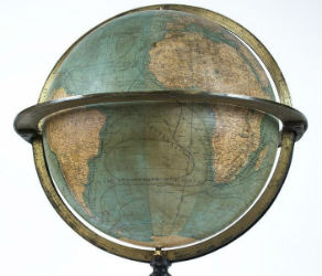
NEW YORK – A 19th century French terrestrial globe tops an auction of vintage maps that will be conducted by Jasper52 on Tuesday, Nov. 5. Fifteen globes and more than 130 maps and atlases are offered in the online auction. Bid absentee or live online exclusively through LiveAuctioneers.