Antiquarian Maps of Asia 2017-09-02 Auction - 101 Price Results - Jasper52 in NY - Page 3
LiveAuctioneers Logo

Ortelius: First Map of Japan in European Atlas, 1595de Vaugondy: Antique Map of Empire of Japan, 1750Mitchell: Rare Antique Map of Asia, 1848
Done
New York, NY, United States
Auction Details

Antiquarian Maps of Asia

Jasper52

Jasper52

badge TOP RATED
Explore both land and sea with this array of antique maps of Asia. With this focused yet diverse auction, discover antique views of this vast continent, including 17th century views of Southeast Asia, unique colored maps of Japan, and more. Not only will these maps serve as decorative pieces, but they also will reveal innumerable ways to view our world.
Auction Curator:
Steve Kovacs
Steve Kovacs
Maps Expert
Lot Number: Lowest
24
Morse: Antique Map of Asia, 1798: Map: AsiaPublication Date: 1798 ca.Authors: MORSE, JEDIDIAH ?Size: Duodecimo – 3.25 H x 4.70 W Inches Map of the continent Asia, from a suite derived from an unidentified English language
0057: Morse: Antique Map of Asia, 1798Est. US$90-US$100Lot Passed
Tanner: Antique Map of Asia, 1828: Map: 1828 Tanner Map of Asia -- AsiaCartographer: H S TannerYear / Place: 1828, PhiladelphiaDimensions: 18 x 20.8 in.Condition: Excellent. Sharp strike and well colored. Just a slight hint of age
0058: Tanner: Antique Map of Asia, 1828Est. US$100-US$115Lot Passed
Sold
Mitchell: Rare Antique Map of Asia, 1848: Scarce 1848 Mitchell map of Asia. Vivid original hand coloring. Inset of Australia. Shows the entire breadth of Asia. Mitchell maps of the mid-to-late 1840s were some of the better maps produced in
0061: Mitchell: Rare Antique Map of Asia, 1848Est. US$135-US$150
See Sold Price
Sold
Mitchell: Antique Map of Persia, Arabia, 1848: 1848 Persia, Arabia &c. by S. Augustus Mitchell. Vivid original hand coloring. A lovely map. Mild toning to three edges (common for Mitchell maps of this period). From the exceedingly scarce 1848
0062: Mitchell: Antique Map of Persia, Arabia, 1848Est. US$100-US$115
See Sold Price
Sold
Bellin: Antique Map of Arabia & Red Sea, 1728: Map: 1728 Bellin Map of Arabia and Red Sea -- Carte de la Coste d'Arabie, Mer Rouge, et Golfe de PerseCartographer: J BellinYear / Place: 1740, ParisDimensions: 8.6 x 9.8 in.Condition: Very good.
0063: Bellin: Antique Map of Arabia & Red Sea, 1728Est. US$155-US$175
See Sold Price
Sold
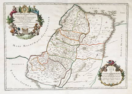
Liebaux: Antique Holy Land Tribal Map, 1767: Map: Carte de la Terre Promise dressée par l'auteur du commentaire sur JosuéCartographer: LiebauxPlace & Date: Paris / 1767Size: 9" x 18 1/2"Condition: b&w folding map; backed to repair split folds
0065: Liebaux: Antique Holy Land Tribal Map, 1767Est. US$50-US$60
See Sold Price
Sold
Mitchell: Antique Map of Palestine, 1848: 1861 Johnson’s China. Lovely map of China with original hand coloring. Features two insets: Harbor & Island of Amoy, and Map of Canton and Adjacent Islands. Very clean with good impression. From
0066: Mitchell: Antique Map of Palestine, 1848Est. US$80-US$90
See Sold Price
Sold
Johnson: Antique Map of Palestine, 1861: 1861 Johnson’s Palestine. Beautiful layout with engraved view of City of Damascus and inset map of Jerusalem. Excellent impression and great original hand coloring. From the final Johnson &
0067: Johnson: Antique Map of Palestine, 1861Est. US$80-US$90
See Sold Price
Sold
Antique Map of the Exodus Route: Map: Voyage des Infans d'Israel d'Egypt par la Mer Rouge jusques au Pays de CanaanCartographer: Philippe de la Rue / Covens & MortierPlace & Date: Amsterdam / 1730Size: 18 1/2" x 15 5/8"Condition:
0070: Antique Map of the Exodus RouteEst. US$140-US$155
See Sold Price
View:
24
TOP