Antiquarian Maps of the Americas 2018-05-22 Auction - 108 Price Results - Jasper52 in NY
LiveAuctioneers Logo

Coronelli: Antique Map of the Western Hemisphere, 16911639 Janssen Map of East Coast of North AmericaH. Bailleul / Daudet: The Americas
Done
New York, NY, United States
Auction Details

Antiquarian Maps of the Americas

Jasper52

Jasper52

badge TOP RATED
Explore both land and sea with this array of North, Central, and South American maps. With this focused yet varied auction, discover a variety of antique views of American states, or re-live history with a rare Janssen map of America's east coast. Not only will these maps serve as decorative pieces, but they also will reveal innumerable ways to view our world.
Auction Curator:
Steve Kovacs
Steve Kovacs
Maps Expert
Lot Number: Lowest
24
Vermont by Colton: Title/Content of Map: Vermont by Colton Date: 1871Cartographer: G.W. ColtonMaterial/Medium: PaperSize: 15" x17" Provenance: New York Hand colored lithograph. Published in New York in 'Colton's
0001: Vermont by ColtonEst. US$30-US$40Lot Passed
Sold
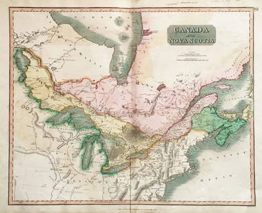
Thomson: Upper & Lower Canada, Nova Scotia: Map: Canada and Nova ScotiaCartographer: ThomsonPlace/Date: Edinburgh / 1814/1817Size: 23 3/4" x 19 1/8"Condition: wash color; light browning along centerfold and in margins; some staining in upper
0002: Thomson: Upper & Lower Canada, Nova ScotiaEst. US$60-US$70
See Sold Price
Sold
de Vaugondy: Hispaniola and Martinique: Map: Isles de Saint Domingue ou Hispaniola et de la Martinique.Cartographer: Gilles Robert de VaugondyPlace/Date: Paris / 1750Size: 20 1/4" x 19"Condition: outline color/b&w cartouche; overall age
0005: de Vaugondy: Hispaniola and MartiniqueEst. US$70-US$80
See Sold Price
H. Bailleul / Daudet: The Americas: Map: L'Amerique Septentrionale et Meridionale Divisee selon les differentes Possessions.Cartographer: H. Bailleul / DaudetPlace/Date: Lyons / 1748Size: 27 1/4" x 19 1/4"Condition: outline color (wash
0011: H. Bailleul / Daudet: The AmericasEst. US$900-US$1,100Lot Passed
Jansonius: Antique Map of Barmudas, 1650s: Title/Content of Map: Mappa Aestivarum Insularum Alias BARMUDASDate: 1652-1658Cartographer: J. JANSONIUS 1588-1664Material/Medium: Printed on paperSize: 39cm by 51cmProvenance: Amsterdam Originally
0013: Jansonius: Antique Map of Barmudas, 1650sEst. US$1,100-US$1,500Lot Passed
Sold
Western Hemisphere by Reinecke *RARE*: Title/Content of Map: Western Hemisphere by Reinecke *RARE*Date: 1804Cartographer: J.C. M. Reinecke Material/Medium: PaperSize: 27" x 23" Provenance: New York Rare hand colored engraved Map. Please
0016: Western Hemisphere by Reinecke *RARE*Est. US$150-US$200
See Sold Price
Meyer: North America in 1853: Map: Nord AmericaCartographer: Bibliographischen Instituts.Place/Date: Hildburghausen / 1853Size: 11 3/4" x 14 3/8"Condition: original color; overall age toning, some spotting in the margins The
0020: Meyer: North America in 1853Est. US$50-US$60Lot Passed
View:
24
TOP