Private Collectors Premium Antiquarian Maps 2023-05-17 Auction - 154 Price Results - Jasper52 in NY
LiveAuctioneers Logo

Excellent example of Johnson’s Texas, 1866Desirable “Plan of New York City” by Mitchell, 1860Extremely scarce 1814 map of Maryland by M. Carey
Done
New York, NY, United States
Auction Details

Private Collectors Premium Antiquarian Maps

Jasper52

Jasper52

badge TOP RATED
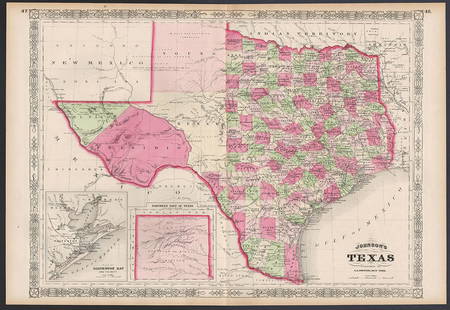
Authentic vintage antique maps from the private collection of a longtime map seller. All maps have been well cared for and kept in protective sleeves under ideal climate-controlled conditions. Maps ship flat with protective backing boards to insure they are not damaged or folded during shipment. Most maps in this auction are very good or better condition. Of particular interest in this sale are a number of very scarce 1814 Mathew Carey maps. Maps from the extremely rare first printing of S. A. Mitchell Jr’s first atlas are present, as are a good selection from Cowperthwait’s 1853 and 1854 New Universal Atlases. Maps are included from probably the last American atlas to employ hand-coloring, the scarce 1894 Potter-Bradley Atlas of the World. A few maps from a scarce 1855 Von Spruner atlas will be found here, as well as several items from Johnson & Ward’s 1865 and 1867 New Illustrated Family Atlases featuring maps of the eastern part of the U. S. created during the Civil War. There will also be a number of gems from such diverse map makers as Allain Mallett, Justus Perthes, Frank and O. W. Gray and constellation maps by Elijah Burritt.
Lot Number: Lowest
24
Sold
Lovely vintage pre-Civil War RR map of Michigan: Fascinating, highly detailed map of Michigan with original full hand-coloring. Cowperthwait produced some of the most attractive state maps of the period and this one is particularly nice. Positioned
0005: Lovely vintage pre-Civil War RR map of MichiganEst. US$140-US$185
See Sold Price
Great 1850 railroad map of Missouri: Attractive and informative map of Missouri, hand colored by counties and showing forts, stage routes, towns, common roads, railroads and other interesting details. Just west of Missouri is Indian
0008: Great 1850 railroad map of MissouriEst. US$100-US$150Lot Passed
Sold
1850 map of W. Indies from Cowperthwait atlas: Nice example of Cowperthwait map of West Indies. Covers from Florida and the Bahamas south through the Caribbean islands of Cuba and Hispaniola (Haiti & the Dominican Republic) to the northern Part
0009: 1850 map of W. Indies from Cowperthwait atlasEst. US$100-US$150
See Sold Price
Sold
Excellent example of Johnson’s Texas, 1866: Authentic and impressive vintage map of Texas. One of the more collectible maps to be produced in the mid-19th century. A highly desirable map that details the state in full. Shows the elevated Table
0012: Excellent example of Johnson’s Texas, 1866Est. US$350-US$425
See Sold Price
Sold
Johnson’s fascinating 1867 North America map: Johnson’s great map of North America showing several western U. S. states with unsettled borders. Wyoming is in a strange configuration and won’t change until its borders are settled
0017: Johnson’s fascinating 1867 North America mapEst. US$140-US$180
See Sold Price
View:
24
TOP