18th-20th Century Antiquarian Map Auction 2016-12-11 Auction - 79 Price Results - Jasper52 in NY - Page 3
LiveAuctioneers Logo

Carte Contenant le Royaume du Mexique la Floridie, 1719Geographical, Statistical & Historical Map Canada, 1826Carte du Canada ou de la Nouvelle France, 1719
Done
New York, NY, United States
Auction Details

18th-20th Century Antiquarian Map Auction

Jasper52

Jasper52

badge TOP RATED
Designed by premier cartographers, these maps reveal innumerable ways to view the globe. Explore historical territories spanning from the Pacific Northwest's rocky coast to Tuscan hillsides. Unlike modern charts, these atlases trace borders that shifted with each global exploration. Anchors aweigh for a sale that is all over the map.
Lot Number: Lowest
24
Johnston: Map of North America, 1860: Map: North AmericaMaker: W. & A.K. Johnston, Keith JohnstonPublished: 1860 in EdinburghSize: Folio, 24.2 x 19.25 inchesPlate 41 from Keith Johnston's General atlasBoundaries for New Mexico and
0045: Johnston: Map of North America, 1860Est. US$200-US$300Lot Passed
Equador, 1758: Map: Carte De La Riviere De La Plata Pour Servir a L'histoire Generale Des Voyages...Publishing: Didot, Bellin, Jaques Nicolas Elder (1703-1772), Paris, 1758Size: Octavo, 7.4 x 11.3 inches Mouth of
0048: Equador, 1758Est. US$200-US$300Lot Passed
Haiti, 1754: Map: Carte De L'Isle d'HaytiPublishing: Didot, Bellin, Jaques Nicolas Elder (1703-1772), Paris, 1754Size: Quarto, 8.6 x 13.2 inchesDescribed: "aujourd'hui l'Espagnole, ou l'Isle de St.Domingue avec
0049: Haiti, 1754Est. US$200-US$300Lot Passed
Malacca, 1749: Map: Carte Du Detroit De MalaccaPublishing: Didot, Bellin, Jaques Nicolas Elder (1703-1772), Paris, 1749Size: Octavo, 6 x 11 inches From Tom.III. Pag.1 of Abbe Prevost's Voyages. Please note that
0050: Malacca, 1749Est. US$200-US$300Lot Passed
Sold
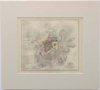
Modern Jerusalem, 1858: Map: Jerusalem before the Roman DestructionPublishing: Sarony & Major, 1858Medium: Hand colored lithographSize: 13.5 x 15 inches Napoleon Sarony (1821-1896) was an American lithographer and a highly
0051: Modern Jerusalem, 1858Est. US$300-US$400
See Sold Price
Environs of London, 1856: Map: Environs of LondonPublishing: J. H. Colton, New York, 1856Medium: EngravingSize: 19.25 x 22 inchesDisplayed in a handmade mat Please note that this lot has a reserve. When you leave a bid in
0053: Environs of London, 1856Est. US$300-US$400Lot Passed
J.B. Ghisi: Sarmatia, 1774: Map: Sarmatia, RussiaPublishing: J.B. Ghisi, Cellarius, Christophorus (1638-1707), Rome, 1774Size: Folio, 12 x 17.75 inches Map of ancient European Russia in Roman times. Plate VIII. The Sarmatians
0055: J.B. Ghisi: Sarmatia, 1774Est. US$200-US$300Lot Passed
J. Tallis: North America, 1851: Map: North AmericaCartographer: J. TallisPublishing: London, 1851Size: 14 x 9.5 inches This is a decorative and striking steel engraved map of North America, featuring Texas with an enlarged
0056: J. Tallis: North America, 1851Est. US$200-US$400Lot Passed
Sold
J. Tallis: United States, 1851: Map: United StatesCartographer: J. TallisPublishing: London, 1851Medium: EngravingSize: 9.5 x 13.5 inches This is fantastic engraved map shows the young US republic in the early 1850's. Aside from
0057: J. Tallis: United States, 1851Est. US$300-US$450
See Sold Price
Sold
Sheldon and Co: United States, 1880: Map: United StatesPublisher: Sheldon and Co.Origin: New YorkDate: 1880Size: 19.25 x 12 inchesFor "Common School Geography" No Reserve: This lot starts at $1 and has no reserve as a courtesy so that
0057A: Sheldon and Co: United States, 1880Est. US$50-US$150
See Sold Price
Sold
Carte des Etats-Unis d'Amerique, du Canada, 1832: Map: Carte des Etats-Unis d'Amerique, du Canada, du Nouveau Brunswick et d'une Partie de la Nouvelle BretagneCartographer: Pierre M. LapiePublishing: Paris, 1832Size: 16 x 20 inchesMatted A great
0059: Carte des Etats-Unis d'Amerique, du Canada, 1832Est. US$250-US$500
See Sold Price
H. Tanner: New York, 1847: Map: New YorkCartographer: Henry TannerPublishing: Philadelphia, 1847Size: 21 x 25 folded out inches A lovely pocket map of New York state with colored counties and details on towns, villages and
0062: H. Tanner: New York, 1847Est. US$200-US$500Lot Passed
View:
24
TOP