Sold2021(VIEW) NEW ENGLAND, NEW JERSEY AND NEW YORK: 303(VIEW) NEW ENGLAND, NEW JERSEY AND NEW YORK: 303 POSTCARDSEarly to-Mid 20th Century11 Vermont, 80 New Hampshire, 70 Maine, 45 Connecticut, 13 New Jersey, 2 Rhode Island and 97 New York. Early: AlbanySee Sold Price
Sold2020New England, New York, New Jersey, Pennsylvania,Title: New England, New York, New Jersey, Pennsylvania, important colonial era map Date/Period: 1732/1736 Materials: Copper plate engraved Dimensions: 13 1/2 x 9”. By. H. MOLL. From atlas minor. PSee Sold Price
2021Revolutionary war era New England, New York, New JerseyTitle: Revolutionary war era New England, New York, New Jersey and Pennsylvania, 1780, by J. de la Porte. Paris Date/Period: 1780 Materials: Hand colored copperplate engraved Size: 9x7'' Very interestSee Sold Price
Sold2021Revolutionary war era New England, New York, New JerseyTitle: Revolutionary war era New England, New York, New Jersey and Pennsylvania, 1780, by J. de la Porte. Paris Date/Period: 1780 Materials: Hand colored copperplate engraved Size: 9x7'' Very interestSee Sold Price
Sold2022BEAVER MAP, HERMAN MOLL (DUTCH/BRITISH, 1654-1732)A New and Exact Map of the Dominions of the King of Great Britain on ye Continent of North America containing Newfoundland, New Scotland, New England, New York, New Jersey, Pensilvania, Maryland, VirgSee Sold Price
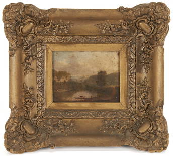
Sold2022James Crawford Thom O/C Landscape Painting, Children FishingJames Crawford Thom (New Jersey/New York/England/France, 1835-1898) oil on board Hudson River School style landscape genre painting depicting two children, dressed in peasant style clothing, fishing iSee Sold Price
Sold2018Amérique Septentrionale. British French Spanish NorthThis fabulous map shows North America divided between British (red), French (Green) and Spanish (Yellow) possessions. At this time the British colonies of New England, New York, New Jersey, PennsylvanSee Sold Price
Sold20231732 H. Moll New England New York, NJ. & PA Map1732 H. Moll New England New York, New Jersey, and Pennsylvania with hand coloring. Framed, 8 by 11 1/2 in acid free matt. Beautiful Map.See Sold Price
Sold20231729 Map of New England, New York, Herman Moll1729 English Map of New England, Herman Moll (1654-1732). Map titled, "NEW ENGLAND NEW YORK NEW JERSEY and PENNSYLVANIA". Map with detailed depiction of the North East, with hand coloring. Good conditSee Sold Price
Sold2017John Carey. North America map(English, 1754-1835). "Part of North America comprehending Ohio, New England, New York, New Jersey, Pennsylvania, Maryland, Virginia, Carolinas & Georgia" (sic) hand colored map, circa 1782, 9 1/2 x 1See Sold Price
Sold2022N Am.18th C Map W & I Mount & T. PageNorth American Map. Hand Colored map "A Chart of the Sea Coast of New Foundland, New Scotland, New England, New York, New Jersey with Virginia and Maryland" by W & I Mount & T. Page on Tower Hill LondSee Sold Price
Sold2021(VIEW) NEW YORK AND NEW JERSEY: 138 POSTCARDS Early to(VIEW) NEW YORK AND NEW JERSEY: 138 POSTCARDSEarly to Late-20th CenturyNY (122 cards): real photo steamer "Adirondack" with passengers and YWCA parade float with flags and signage urging &quSee Sold Price
Sold2018Lot of Two: Early Stoneware Flasks, Northeastern U.S.Two Stoneware Flasks, Northeastern U.S. origin, early 19th century, one with flattened sides and cobalt-highlighted spout, New York State, New Jersey, or New England origin; the other with slightly-flSee Sold Price
Sold20231755 Robert De Vaugondy Map of North America Large1755 Robert De Vaugondy Map of America. Mid-Atlantic, New York, New Jersey, Pennsylvania Virginia, Maryland, New England, Carolina and Ohio. Partie De L'Amerique Septentrionale. Map in matte is aboutSee Sold Price
Sold2023JAMES EDWARD BUTTERSWORTH (New Jersey/New York/United Kingdom, 1817-1894), Yachting in the Sound,JAMES EDWARD BUTTERSWORTHNew Jersey/New York/United Kingdom, 1817-1894Yachting in the Sound, with a view of New York. Signed lower right ìJ. E. Buttersworthî. Handwritten inscription verso ìYSee Sold Price
Sold2023View of New York Harbor - Etching1855 view of New York Harbor with New Jersey and Brooklyn in the distance, hand-colored etching by Charles Mottram after J.W. Hill. [Sight: 35" H x 56" W; Frame: 42" H x 64" W]. In overall good conditSee Sold Price
Sold2019Bryce, James 1881 Lot of 10 Maps of Canada & USADominion of Canada, North America, Middle States. New York, Pennsylvannia, New Jersey, Delaware and Maryland, New England States. Maine, New Hampshire, Vermont, Massachusetts, Rhode Island and ConnectSee Sold Price
Sold2023Thos. Worthington Whittredge 1846 Oil Painting, Shaker Ferry - Kentucky RiverEarly miniature landscape view of Pleasant Hill, KY, by Thomas Worthington Whittredge (New Jersey/New York/Ohio, 1820-1910). The oil on paper laid on board painting, titled "Shaker Ferry- View on KentSee Sold Price
Sold2024Henry Hammond Ahl(Massachusetts/New York, 1869 -1953) Oil on artist board likely New England or New York, Hamptons beach view. Very nicely rendered and framed well. Good condition throughout. H 9 3/4" W 13 3/4" withouSee Sold Price
Sold20202 Early Documents New York & New JerseyTwo early American documents. People of State of NY, Chautaugua County, 1842. Frame size: H 11-5/8", W 9-1/4".Indenture, Mary Stout New Jersey, 1808. frame size: H 14-3/4", W 10". Excellent condition.See Sold Price
Sold2022CHARLES WARREN EATON (New York/New Jersey/The Netherlands, 1857-1937), "Sunrise in New England".,CHARLES WARREN EATONNew York/New Jersey/The Netherlands, 1857-1937"Sunrise in New England". Signed lower right "C. Warren Eaton". Titled on typewritten label verso.Oil on canvas, 28" x 30". Framed 35"See Sold Price
Sold2017Two Emanuel Bowen Maps Showing the East Coastfrom A Complete System of Geography (London, 1747), copperplate engravings with outline color as follows: A New and Accurate Map of New Jersey, Pennsylvania, New York and New England and A New & AccurSee Sold Price
Sold2017Emanuel Bowen, map Eastern SeaboardEmanuel Bowen, map Eastern Seaboard, Emanuel Bowen (British, 1694-1767), "A New and Accurate Map of New Jersey, Pennsylvania, New York, and New England", c. 1744, from Maryland to Nova Scotia, hand-coSee Sold Price
Sold2022Emanuel Bowen Map USA Eastern Seaboard 1740s New YorkEmanuel Bowen, map of United States Eastern Seaboard, Emanuel Bowen (British, 1694-1767), "A New and Accurate Map of New Jersey, Pennsylvania, New York, and New England", c. 1744, from Maryland to NovSee Sold Price
Featured6 days LeftJasper521775-1780. New York, New Jersey, Pennsylvania, Maryland, Virginia and New England states. By Bonne &US$120
BonhamsTHREE NEW ENGLAND GLASS CO. BLOWN FRUIT PAPERWEIGHTS, c. 1860, on cookie bases, unsigned, the pe...US$200
Jun 13Swann Auction Galleries(NEW JERSEY.) Oakley Hoopes Bailey. Atlantic Highlands, New Jersey.US$750
7 days LeftJasper52NEW YORK CITY antique town city map plan. Manhattan Brooklyn Jersey. SDUK 1844US$550
Jun 13Swann Auction Galleries(NEW JERSEY.) William Kitchell; and Robert Pearsall Smith. Topographical Map of the State of NewUS$600
Jun 13Robinhood AuctionsCharles Fazzino, "There's Music: New Jersey, New York, Long Island Too!!" Framed 3D Limited EditionUS$1,000
4 hrs LeftFederal Assets AuctioneersThere's Music: New Jersey, New York, Long Island Too!! by Fazzino, CharlesUS$1
4 days LeftRobinhood AuctionsCharles Fazzino- 3D Construction Silkscreen Serigraph "There's Music... New Jersey, New York, LongUS$800
6 days LeftRobinhood AuctionsCharles Fazzino- 3D Construction Silkscreen Serigraph "There's Music: New Jersey, New York, LongUS$1,100
2 days LeftSeized Assets AuctioneersThere's Music: New Jersey, New York, Long Island Too!! by Fazzino, CharlesUS$1
4 days LeftSeized Assets AuctioneersThere's Music: New Jersey, New York, Long Island Too!! by Fazzino, CharlesUS$1
4 days LeftSeized Assets AuctioneersThere's Music: New Jersey, New York, Long Island Too!! by Fazzino, CharlesUS$1
6 days LeftFederal Assets AuctioneersThere's Music: New Jersey, New York, Long Island Too!! by Fazzino, CharlesUS$1


![View of New York Harbor - Etching: 1855 view of New York Harbor with New Jersey and Brooklyn in the distance, hand-colored etching by Charles Mottram after J.W. Hill. [Sight: 35" H x 56" W; Frame: 42" H x 64" W]. In overall good condit](https://p1.liveauctioneers.com/1221/295608/157038571_1_x.jpg?height=310&quality=70&version=1689102631)