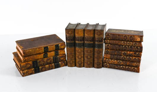
Sold2022GROUPING OF ANTIQUE LEATHER-BOUND BOOKSIncluding (7) vol. "Epochs of History" 1899, with fold-out maps of Europe; (4) vol. Dickens' Works, 1869, plus some miscellaneous volumes. Dimensions: (Overall linear) H 8.75" x W 19" Condition: As isSee Sold Price
Sold20241869 Map of the Railroads of New Jersey1869 Map of the Railroads of New Jersey A framed Map of the Railroads of New Jersey dated 1869 from the Pennsylvania Railroad General Office Library. The 19 1/2" x 27 1/2" wooden frame holds a map takSee Sold Price
Sold2023Antique Map Print - Europe - Map of Ancient Sicily - Italy - Philipp CluverTitle: Antique Map Print - Europe - Map of Ancient Sicily - Italy - Philipp Cluver Date: 1701 Material: Paper Dimensions: 15 cm x 13 cm Description: A detailed small map from ”Introductionis inSee Sold Price
Sold2024Antique Europe Map/ France. Pieced down in sections. Sight size 26-1/2 x 36 inches. Overall framedAntique Europe Map/ France. Pieced down in sections. Sight size 26-1/2 x 36 inches. Overall framed size is 32 x 42 inchesSee Sold Price
Sold2023Oceanica exhibiting its various divisions… Pacific Hawaii. MITCHELL 1869 mapTITLE/CONTENT OF MAP: 'Map of Oceanica, Exhibiting its Various Divisions, Island Groups &c // Map of the Sandwich Islands' DATE PRINTED: 1869 IMAGE SIZE: Approx 28.5 x 36.0cm, 11.25 x 14.25 inches (LaSee Sold Price
Sold2023Antique Map Print - Europe - Map of Silesia - Poland - Czech Republic - WroclawDescription: Map of Silesia. Silesia is a historical region of Central Europe that lies mostly within Poland, with small parts in the Czech Republic and Germany. Date: 17th Century Material: Paper DimSee Sold Price
Sold2023South America. Proposed Atrato-Inter-Oceanic Canal Routes. MITCHELL 1869 mapTitle: South America. Proposed Atrato-Inter-Oceanic Canal Routes. MITCHELL 1869 map Description: Map of South America showing its Political Divisions // Map of the Proposed Atrato-Inter-Oceanic CanalSee Sold Price
Sold2023New Granada Venezuela Guiana Peru Equador Argentine Argentina MITCHELL 1869 mapTitle: New Granada Venezuela Guiana Peru Equador Argentine Argentina MITCHELL 1869 map Description: Map of New Granada, Venezuela, and Guiana // Map of Peru and Equador // Map of the Argentine ConfedeSee Sold Price
Sold2023Antique Map Print - Europe - Map of Poland and Silesia - Pieter van de KeereTitle: Antique Map Print - Europe - Map of Poland and Silesia - Pieter van de Keere Date: 1632 Material: Paper Dimensions: 30 cm x 24 cm Description: Gerard Mercator. Polonia et Silesia (Poland and SiSee Sold Price
Sold2017J.H. Colton: Turkey In Europe MapTurkey in Europe, 17 x 14 in, 1857, J. H. Colton Please note that this lot has a confidential reserve. When you leave a bid in advance of the auction, submit your maximum. Jasper52 will bid on your beSee Sold Price
Sold2024North East Africa. Egypt Abyssinia Arabia Abu Dhabi Sharja. COLTON 1869 mapTITLE OF MAP (NOT PRINTED ON THE PAGE):'Africa - north eastern sheet' DATE PRINTED: 1869 IMAGE SIZE: Approx 42.0 x 33.5cm, 16.5 x 13.25 inches (Large) TYPE: Antique engraved hand coloured atlas map COSee Sold Price
Sold2018Europe Map Atlas Universel Illustre'Europe Map Atlas Universel Illustre', Pelissier. Imp. de Lemercier, Paris. We ship all items in this auction in-house with the most fair shipping charges possible.See Sold Price
Sold20231891 Mitchell Map of Europe -- Map of Europe…Title: 1891 Mitchell Map of Europe -- Map of Europe… Cartographer: S Mitchell Year / Place: 1891, Philadelphia Map Dimension (in.): 8.2 X 10.6 in. This is an excellent map of Europe. Countries aSee Sold Price
Sold20201869 Map of the Sacred LandAuthor: Brehier Title: 1869 Map of the Sacred Land Medium: Ink on Paper Dimensions: 18.5"X13" Description: Map of the Sacred Land dated 1869. Double folio map drawn by Brehier. Published by Belin in PSee Sold Price
Sold20201869 Map of AfricaAuthor: Jenotte Title: 1869 Map of Africa Medium: Ink on Paper Dimensions: 18.5"X13" Double folio map of Africa dated 1869. Drawn by Blechir and engraved by Jenotte. Published in Paris. Color coded foSee Sold Price
Sold20211798 Europe MapAuthor: Langevin Title: 1798 Europe Map Medium: Ink on Paper Dimenions: 13.5"X10.5" Description: Map of Europe dated 1798. Engraved by Langevin. Published in Paris. Key lower right. Double folio. DetaSee Sold Price
Sold20211869 Map of AustraliaTitle: 1869 Map of Australia Author: Jenotte Medium: Ink on paper Dimensions: 18.5"X13" Description: Map of Australia dated 1869. Drawn by Blechir and engraved by Jenotte. Published in Paris. Double fSee Sold Price
Sold20201869 Map of North AmericaAuthor: Brehir Title: 1869 Map of North America Medium: Ink on Paper Dimensions: 18.5"X13' Map of North America dated 1869. Drawn by Brechir and engraved by Jenotte. Published in Paris. Extensive explSee Sold Price
Sold20211869 Map of the Ancient WorldAuthor: Jenotte Title: 1869 Map of the Ancient World Medium: Ink on Paper Dimensions: 18.5"X13" Map of the Ancient World dated 1869. Drawn by Blechir and engraved by Jenotte. Published in Paris. Key lSee Sold Price
Sold20201869 Map of the MediteraneanAuthor: Jenotte Title: 1869 Map of the Mediteranean Medium: Ink on Paper Dimensions: 18.5"X13" Description: Map of the Mediteranean during the Roman Empire dated 1869. Drawn by Blechir and engraved bySee Sold Price
Sold20241839 Europe Map by MoninTitle: 1839 Europe Map by Monin Date/Period: 1839 Materials: Hand colored, engraved Size: 17 1/2” x 12 1/2” 1839. By V. Monin. Paris. Hand-colored, engraved. Good condition, with some foxiSee Sold Price
Sold2023Colton's Argentine Republic, Chili, Uruguay & Paraguay. Argentina Chile 1869 mapTitle: Colton's Argentine Republic, Chili, Uruguay & Paraguay. Argentina Chile 1869 map Description: Colton's Argentine Republic, Chili, Uruguay & Paraguay' by Joseph Hutchins Colton (1869). Antique eSee Sold Price
Sold2022Antique Map of Europe - Map of Switzerland - Geneva - Luzern - John LodgeA fine 1778 map of Switzerland by the English map publisher John Lodge. Technique: Hand colored steel engraving. Date: ca 1778. Artist: John Lodge. Place: London, England. Size: 10” x 8” iSee Sold Price
Jun 09Worthington GalleriesAntique H/C Map EUROPE SOUS CHARLEMAGNE EN 814: EMPIRES D'OCCIDENT ET D'ORIENTUS$25
7 days LeftMark Louis Weseloh Estate LiquidationsSix - 17th c. Maps of Europe, Asia, England, Germany x2, Crete, Greece.8 1/4" x 6 5/8".US$300
Jun 18DOYLE Auctioneers & AppraisersA block puzzle with maps of Europe, England, Ireland, Scotland, America and the WorldUS$100
7 days LeftJasper521803 Poirson Map of Europe -- L'Europe divisee en ses Principaux Etats et d'apres le Traite de PaixUS$95
Jun 30Global Auctions CompanyHand Colored Engraved Map of Europe, Jean Baptiste Bourguignon Anville 1754US$450
7 days LeftJasper521775 d'Anville Map of Middle Ages Europe -- Germany, France, Italy, Spain, British Isles, In anUS$70
4 days LeftGold Coast Auctioneers17th-19th c. French Wall Art Collection Map City Sea Scapes Scenes etc.US$50
Jun 07Freeman's | Hindman[MAP]. ORTELIUS, Abraham. Presbiteri Iohannis, sive, Abissinorum Imperii Descriptio. 1592.US$200


![[MAP]. ORTELIUS, Abraham. Romani Imperii Imago. 1592. (1 of 2)](https://p1.liveauctioneers.com/197/329395/177650537_1_x.jpg?height=282&quality=70&version=1715364962)

![[MAP]. ORTELIUS, Abraham. Presbiteri Iohannis, sive, Abissinorum Imperii Descriptio. 1592. (1 of 2)](https://p1.liveauctioneers.com/197/329395/177650536_1_x.jpg?height=282&quality=70&version=1715364962)
