Sold2022FRAMED 1832 MAP OF THE STATE OF NY BY DAVID H. BURR 20"FRAMED 1832 MAP OF THE STATE OF NY BY DAVID H. BURR 20" X 25 1/2"See Sold Price
Sold2016Burr Map of Queens, Kings & Richmond.Map of Queens, Kings & Richmond. David H. Burr (1803-1875). Engraving with original hand color. Ithaca, NY: Stone Clark, 1839. 17 1/4 x 22 1/4 inches sheet, 22 x 27 inches framed. This map from The AtSee Sold Price
Sold20211839 MAP OF ULSTER COUNTY, NEW YORK, BY DAVID H. BURR,1839 MAP OF ULSTER COUNTY, NEW YORK, BY DAVID H. BURR, STONE & CLARK PUBLISHERS, ITHICA, N.Y. NICELY FRAMED, FROM PROMINENT ELLENVILLE, N.Y. ATTORNEYS OFFICE. MAP MEASURES 22" X 23", NICELY FRAMED, ANSee Sold Price
Sold20211829 County Map of Rensselaer County NY by David H BurrMap of the County of Rensselaer from 1829, by David H Burr. Rensselaer County sits on the bank of the Hudson River and was founded in 1791. Wooden frame with gold border. Great local map. DimensionsSee Sold Price
Sold2016America.- Burr (David H.) - An Atlas of the State ofContaining a Map of the State and of the Several Counties, [third edition], engraved title, 51 hand-coloured engraved maps and plans on 52 sheets as issued, including double-page and folding, some foxSee Sold Price
Sold2024Pre-Central Park Map of New York City, David H. Burr / Simeon DeWitt 1829Sight size 21" x 50.5" framed to 24.75" x 54.5". Some tears and seams with attempts at repair, foxing and toning, not examined out of frame.See Sold Price
Sold20171829 David Burr Clinton County, NY map1829 David Burr Clinton County, NY map, Rawdon Clark & Co., Albany & Rawdon Wright & Co., NY hand colored, earliest known printed map of Clinton County, plate size 17 3/4" x 20", sheet size 24" x 21 1See Sold Price
Sold202119th Century Maps of the New York City Area and the19th Century Maps of the New York City Area and the State of New Jerseyas follows: Map of the Country Twenty Five Miles Round the City of New - York (New York: David H. Burr, 1831), centered on ManhatSee Sold Price
Sold2023Burr - Map of North AmericaThis hand-colored map is from David H. Burr's A New Universal Atlas; comprising separate maps of all the principal empires, kingdoms & states throughout the world: and forming a distinct atlas of theSee Sold Price
Sold2016Antique Framed Map of Israel, C. 1748.Ivdaea Sev Palaestina, ... Terra Sancta. By Johann Baptist Homann. Framed, 18.5" x 21.5" sight size. Visible foxing. From a Larchmont NY estate. Dimensions: 23" w x 20" h framed. Condition: Foxing, noSee Sold Price
Sold2020Framed Map of ManhattanMap of Manhattan. [Map: 20" H x 50" W; Frame: 23 1/2" H x 53 1/2" W].See Sold Price
Sold2017Antique Map "Siciliae Veterisiypus"Framed map, dated 1696. Dimensions: Map- - Sight: 15" H x 20" W; Frame: 23.75" H x 27.75" W; See Sold Price
Sold2022John SPEED: Two Antique Maps of IrelandTwo framed antique maps of Ireland by John Speed, a well known English cartographers circa 17th century. [Maps: 15" H x 20" W; Frames: 24" H x 28 1/2" W].See Sold Price
Sold2021Two WWII Illustrated Campaign Maps FramedOperations of First United States Army in Europe from June 6, 1944 to May 9, 1945, surrounded by division logos. Measures 20"H x 19.5"W framed, 17.75"H x 18"W unframed. First U.S. Army & Fifth USSR CaSee Sold Price
Sold2023Two Framed Antique Hand-Colored Maps"Europa" and "Ischia", two hand-colored maps. [Art: approx. 16" H x 22" W; Frame: 20" H x 25" W]. Appearance of age, and creases.See Sold Price
Sold2023Peter Tassone (NY,20/21C) acrylic paintingARTIST: Peter H Tassone (New York, 20/21 centuries) TITLE: Illustration - Empire State Railway Museum, NY MEDIUM: acrylic on board CONDITION: Very good. No visible inpaint under UV light. Framed underSee Sold Price
Sold2016Map of North America...David H. Vance, engraved by J.H. Young. Philadelphia: Anthony Finley, 1825. Engraved map in 5 parts with original hand color in outline. 25 7/8 x 20 1/2 inches sheet, 30 5/8 x 25 1/2 inches framed.See Sold Price
Sold2023Antique pocket map of New York State with latest improvements by H. Phelps. Handcolored andAntique pocket map of New York State with latest improvements by H. Phelps. Handcolored and published in 1832. "New York" stamped on front cover. Measures 5" X 27/8" folded, about 20" X 16.5" open. SmSee Sold Price
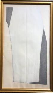
Sold2015David Shapiro "Suki II", Mixed MediaMixed media on paper. Titled bottom right and numbered "10/15" bottom left. Framed under glass. [Art: 25" H x 20 1/4" W; Frame: 27 1/4" H x 22 1/2" W]. Toning.See Sold Price
Sold2022Reprint of 1885 Florida Map And Clipper Ship PrintReprint of 1885 Florida map and clipper ship print * 1885 Colton Map Reprint - Reprinted In 1967. - Framed - Approx. 18"h X 20.5"l. * Clipper Ship Lithograph. - G.p. 1832. - Approx. 22"h X 18"l. PhotoSee Sold Price
Sold2021DAVID PARK FIGURATIVE OIL ON PAPER PAINTING V$18,000MEASUREMENTS:20"WX20"H FRAMED MINT CONDITION/"in the style of"David Park was an American painter/Private collection, Liveauctioneers policy requires to state "in the style of", no documentation. We ofSee Sold Price
Sold2021Pocket map entitled "Map Of The State of New York WithPocket map entitled "Map Of The State of New York With The Latest Improvements / By H. Phelps", hand colored and published in 1832. The 20" x 16 1/2" size map, folds into a 5" x 2 7/8" booklet - the fSee Sold Price
Sold2019Charcoal drawing by Gary Stephan, Orrin H RileyOriginal charcoal drawing by Gary Stephan, Provenance: Orrin H Riley storage unit.Framed later.////11" x 20" in a frame 12" x 22".///////(From Wiki):"Gary Stephan (born: Brooklyn, NY, 1942) is an artiSee Sold Price
Sold2023Framed Antique Agricultural Map Of NY State, 1843Marked on lower left corner reads Agricultural map of the state of New York. Lith of G & W endicott New York, Map is colored in correspondence with the color of agriculture throughout the state. FrameSee Sold Price
5 days LeftMynt AuctionsNY 1908 R.H. Macy & Company Herald Square Broadway 34th St Custom Framed PrintUS$10


![America.- Burr (David H.) - An Atlas of the State of: Containing a Map of the State and of the Several Counties, [third edition], engraved title, 51 hand-coloured engraved maps and plans on 52 sheets as issued, including double-page and folding, some fox](https://p1.liveauctioneers.com/410/84263/43496522_1_x.jpg?height=310&quality=70&version=1453293226)


![Framed Map of Manhattan: Map of Manhattan. [Map: 20" H x 50" W; Frame: 23 1/2" H x 53 1/2" W].](https://p1.liveauctioneers.com/1221/185484/93762114_1_x.jpg?height=310&quality=70&version=1606596560)

![John SPEED: Two Antique Maps of Ireland: Two framed antique maps of Ireland by John Speed, a well known English cartographers circa 17th century. [Maps: 15" H x 20" W; Frames: 24" H x 28 1/2" W].](https://p1.liveauctioneers.com/1221/264089/138965458_1_x.jpg?height=310&quality=70&version=1667576821)

![Two Framed Antique Hand-Colored Maps: "Europa" and "Ischia", two hand-colored maps. [Art: approx. 16" H x 22" W; Frame: 20" H x 25" W]. Appearance of age, and creases.](https://p1.liveauctioneers.com/1221/292690/155846568_1_x.jpg?height=310&quality=70&version=1687814778)


![David Shapiro "Suki II", Mixed Media: Mixed media on paper. Titled bottom right and numbered "10/15" bottom left. Framed under glass. [Art: 25" H x 20 1/4" W; Frame: 27 1/4" H x 22 1/2" W]. Toning.](https://p1.liveauctioneers.com/1221/73831/38332720_1_x.jpg?height=310&quality=70&version=1434487859)