Sold2022MAP, Germany, JanssonSoutheastern Germany. Jan Jansson, Franconiae Nova Descriptio, from Atlas Novus..., 1646 (circa). Hand Color. This elegantly engraved map focuses on the Franconia region of Germany, located in BavariaSee Sold Price
Sold2016Map of Ancient Germany by JanssonHeading: Author: Jansson, Jan Title: Germaniae Veteris, Typus Place Published: Amsterdam Publisher: Date Published: c.1640 Description: Copper-engraved map, hand-colored inSee Sold Price
Sold2015Jansson (Jan) - [Atlas Novus: Germany],single vol. lacking title, 106 mostly regional maps of Germany and northern Europe, but also including a general map of Germany, and classical maps of both Germany and Scandinavia, and several city plSee Sold Price
Sold20211640 Jansson Map of Rhine River Area in Netherlands andTitle: 1640 Jansson Map of Rhine River Area in Netherlands and Germany in Part -- Descriptio Fluminum Rheni, Vahalis et Mosae Cartographer: J Jansson Year / Place: c 1640, Amsterdam Map Dimension (in.See Sold Price
Sold20191661 Cluver/Jansson Map of the Arabian Peninsula --Title/Content of Map: 1661 Cluver/Jansson Map of the Arabian Peninsula -- Arabia Eudaemon ex Plinio Lib VI Cap. 28 Date: Wolfenbuttel, Germany, 1661 Cartographer: Cluver/Jansson Size: 6.2 X 8 in. ThisSee Sold Price
Sold2017Majorca, Minorca, & Ibiza Islands Map, Jansson, 1650Insulae Balearides et Pytiusae. Jansson's edition of Blaeu's beautiful map of the islands of Majorca, Minorca, and Ibiza, including the coasts of Catalonia and Valencia. As in Blaeu's version, sea monSee Sold Price
Sold2023MAP, Germany, Braun & HogenbergMainz & Wurzburg, Germany & Sion, Switzerland. Braun & Hogenberg, Moguntia, Germaniae Metropolis, ad Rheni... [on sheet with] Herbipolis, Comuniter Wirtzburg... [and] Sedunum, Primaria & MetropoliticaSee Sold Price
Sold2023MAP, Germany, MunsterSouthern Germany. Sebastian Munster, Das Algow, from Cosmographey oder Beschreibung Aller Laender, 1578 (published). Hand Color. This charming woodblock map of southwestern Bavaria oriented with northSee Sold Price
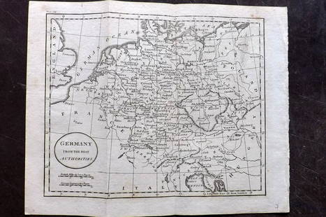
Sold2018FRAMED MAP, GERMANY NORTH OF THE MAYNEFramed map, "Germany, North of the Mayne", drawn and engraved for Thomson's New General Atlas, 1816, London engraved, hand colored highlights, sight approx: 20"h, 24.5"w, overall: 30"h, 34.5"w, 10.5lbSee Sold Price
Sold202118th C Large Handcolored Mercator Map GermanyLarge beautifully handcolored map of Braunswyck and Meydburg after Gerard Mercator circa 1640, this being an 18th century restike.. Printed at Amsterdam. Measures 23 x 19". Fine, reinforced central veSee Sold Price
Sold2022Barclay, James C1800 Hand Col Map. GermanyHand Colored Copper Engraved Map Published C1800 Halifax & Newcastle, England for "Barclay's Universal English Dictionary…" by James Barclay. Maps Engraved by Clerk, Milton and others. Paper Size: 1See Sold Price
Sold2019Barclay, James 1809 Hand Col Map. Germany & BohemiaHand Coloured Copper Engraved Map Published 1809, Leeds for "Barclay's Complete and Universal Dictionary of the English Language..." by the Rev. James Barclay. Folds as issued. Paper Size: 11 x 10 incSee Sold Price
Sold2021Wilkes, John 1805 Hand Col Map. GermanyFinely Hand Colored Copper Engraved Map Published 1796-1828 London for "Encyclopaedia Londinensis, or universal dictionary of arts, sciences and literature" by John Wilkes et al. Paper Size: 10.5 x 8.See Sold Price
Sold2022Barclay, James 1812 Hand Col Map. GermanyHand Colored Copper Engraved Map Published 1812-13 by Brightly & Childs, Bungay for "A Complete and Universal Dictionary of the English Language..." by the Rev. James Barclay. Paper Size: 10.5 x 8 incSee Sold Price
Sold2022Times Atlas 1895 Lot of 7 Maps. GermanyLithograph Map Published 1895, London for "The Times Atlas" Two with Centre fold as published. Paper Size: Up to 21 x 16 inch (53 x 41cm) A couple with centre fold splits. A few other minor faults inSee Sold Price
Sold2021Tallis, John (Pub) 1852 Map. GermanySteel Engraved Map with Original Outline Hand Color Published 1852-56 by John Tallis, London for "The Universal Pronouncing Dictionary" by Thomas Wright. Drawn & Engraved by John Rapkin. Centre fold aSee Sold Price
Sold2021Tallis, John (Pub) 1852 Map. GermanySteel Engraved Map with Original Outline Hand Color Published 1852-56 by John Tallis, London for "The Universal Pronouncing Dictionary" by Thomas Wright. Drawn & Engraved by John Rapkin. Centre fold aSee Sold Price
Sold2021Thomson, John (Pub) 1825 Map. GermanyCopper Engraved Map Published 1825 by John Thomson, Edinburgh for "The Edinburgh School Atlas" by N. R. Hewitt. Maps Engraved by Hewitt. Engraved Vignette in corner. Original Outline Hand Colour. RareSee Sold Price
Sold2023Thomson, John (Pub) 1825 Map. GermanyCopper Engraved Map Published 1825 by John Thomson, Edinburgh for "The Edinburgh School Atlas" by N. R. Hewitt. Maps Engraved by Hewitt. Original Outline Hand Colour. Rare. Paper Size: 10.5 x 8 inch (See Sold Price
Sold2021Guthrie, William 1806 Map. GermanyCopper Engraved Map Published 1806, London for "A New Geographical, Historical and Commercial Grammar..." by William Guthrie. The maps are by John Senex, Thomas Kitchin and others. Folds as issued. PaSee Sold Price
Sold2019Antique Map: Germany (Deutschland)Description: Antique Map: Germany (Deutschland), Holstein, Hanover, Mecklenburg, the Prussian States, Saxony. Antique steel engraved map with original outline hand coloring. Date of printing: 1844. CaSee Sold Price
Sold2021Guthrie, William 1798 Map. GermanyCopper Engraved Map Published 1798, London for "A New Geographical, Historical and Commercial Grammar..." by William Guthrie. The maps are by John Senex, Thomas Kitchin and others. Folds as issued. PaSee Sold Price
Sold2019Philip, George 1856 LG Hand Col Map. Germany North PartLarge Folio Lithograph Map Published Published 1856 by George Philip, Liverpool for "Philips' Commercial Atlas of the World" Paper Size: 26 x 21 inch (66 x 53cm) Light horizontal bend in centre. NeatlSee Sold Price
Sold2021Guthrie, William 1798 Map. GermanyCopper Engraved Map Published 1798, London for "A New Geographical, Historical and Commercial Grammar..." by William Guthrie. The maps are by John Senex, Thomas Kitchin and others. Folds as issued. PaSee Sold Price
7 days LeftJasper521575 BAVARIA GERMANY MAP LEAF from BELLEFOREST EDITION of MUNSTER COSMOGRAPHYUS$25
7 days LeftJasper521552 Munster Regional German Map Centered on Bamberg -- Franconia XIII Nova TabulaUS$95
7 days LeftJasper521691 Coronelli Map of Northwest Germany and Netherlands -- La Vestfalia, detta Altrimenti / DieUS$120
7 days LeftJasper521552 Munster Map of Central Germany along the Rhein -- Secunda Rheni et IX Nova TabulaUS$120


![Jansson (Jan) - [Atlas Novus: Germany],: single vol. lacking title, 106 mostly regional maps of Germany and northern Europe, but also including a general map of Germany, and classical maps of both Germany and Scandinavia, and several city pl](https://p1.liveauctioneers.com/410/80717/41962763_1_x.jpg?height=310&quality=70&version=1445353131)


![MAP, Germany, Braun & Hogenberg: Mainz & Wurzburg, Germany & Sion, Switzerland. Braun & Hogenberg, Moguntia, Germaniae Metropolis, ad Rheni... [on sheet with] Herbipolis, Comuniter Wirtzburg... [and] Sedunum, Primaria & Metropolitica](https://p1.liveauctioneers.com/6576/279721/147265449_1_x.jpg?height=310&quality=70&version=1677104593)


![Map of German Empire, c1800's [180903] (1 of 1)](https://p1.liveauctioneers.com/2699/331495/178785779_1_x.jpg?height=282&quality=70&version=1717094933)


![Early Maps of Stuttgart Germany [180133] (1 of 3)](https://p1.liveauctioneers.com/2699/331495/178785747_1_x.jpg?height=282&quality=70&version=1717094933)

