Sold20191831 McNeill Map of the Very Early New England RailroadTitle/Content of Map: 1831 McNeill Map of the Very Early New England Railroad Plans -- Map Exhibiting the Several Routes Surveyed for a Proposed Rail Road from Boston to Providence and also to TauntonSee Sold Price
Sold20221862 RR map of Mass., Conn., Rhode Island, MitchellDetailed map of Southern New England, colored by counties and showing towns, railroads, rivers and other details. Shows the railway system in this region in the early years of the Civil War. One of thSee Sold Price
Sold2018Early Map of New England: Robert MordenReproduced from the Original in the John Carter Brown Library, Brown University, Circa 1960's. Colored Collotype, Title: A map of New England, New Yorke, New Jersey, Virginia and Maryland Sold By RobeSee Sold Price
Sold2021An early map of mostly New England area including "PartAn early map of mostly New England area including "Part of the Province of Maine", Massachusetts, New Hampshire, Vermont and part of New York border. Sealed document marked on reverse published in 178See Sold Price
Sold20191874 Gray Map of New England -- Map of the Railroads ofTitle/Content of Map: 1874 Gray Map of New England -- Map of the Railroads of New York and Part of New England Date: 1874, Philadelphia Cartographer: OW and FA Gray / Colton copyright Size: 16.5 x 25.See Sold Price
Sold2020EARLY FRENCH MAP OF NEW ENGLANDHand-colored. Ca 1750-1760. Map in French. Map 14 1/2 x 12 1/2 inches. Fold marks and water stains. Overall 21 inches x 19 inches. Stains and cut down.See Sold Price
Sold2023Foldable Railroad Map on Linen 1849Railroad Map of New England New England & Eastern New York 1849 Foldable on Linen.See Sold Price
Sold20177 Early New England Stock Certificates 1847-1881A group of seven early stock and bond certificates from New England Railroads: (1) Northern of New Hampshire - 4 shares 1848 (2) New Hampshire Central - 1 share 1852 (3) Old Colony & Newport - 3 shareSee Sold Price
Sold2017New England Railroad Tickets & EphemeraA group of tickets and other paper items from New England Railroads: (1) about 20 tickets, some very early like Rutland & Burlington 1855, Western (pre-1869). Several others like Fitchburg, Old ColonySee Sold Price
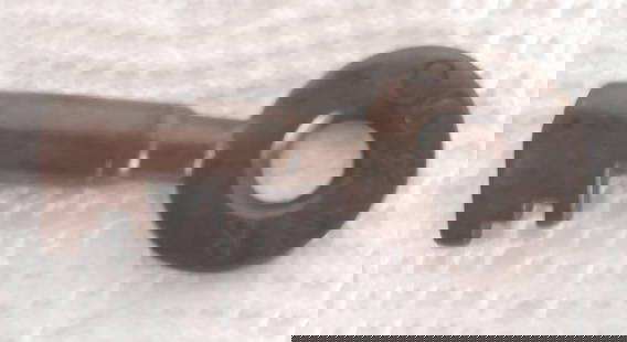
Sold2024Old Colony & Newport Railroad Switch KeyAn early New England key from the successor of the Old Colony & Fall River Railroad. The OC&N existed from 1864-1872 when it was taken over by the Old Colony Railroad. Nice markings with a tapered barSee Sold Price
Sold20231748 Map of North America, Comprehending 'The Course to Ohio'America, 18th century. An early map of the eastern coast, detailing New England, New York, and more. No maker marks present. Overall good condition; complete on laid paper.See Sold Price
Sold2022Early Painted Map BoxPainted map box. Early sage green paint. Square nail construction. New England, early to mid 19th century. L 14-3/4" H 4-3/4" W 4-1/2". Condition: Excellent condition, one of three leather hinges is bSee Sold Price
Sold2021Map- Pieter Goos Oost Indien - 1666Early map - Pieter Goos. Pascaetre Van'T Westslycke Deel Van Oost Indien. Amsterdam 1666. Full hand color. H 17-3/4" W 22-1/2". Provenance : Philadelphia print shop. CONDITION: Excellent. Please copySee Sold Price
Sold2016New Haven Railroad "Merchants" China PlateThis plate measures 8 1/2" in diameter. It has a fine New England scene with an I-5 steam locomotive hauling the "Merchants Limited" train across a map of New England. It has a stanmdarrd Buffalo ChinSee Sold Price
Sold2016early 19thC New England pine fall front map case thatearly 19thC New England pine fall front map case that can be free standing or hung on the wall - 24" tall x 24 1/2" wide x 5 1/4" deep - Fairfield, CT estateSee Sold Price
Sold20182 New Haven Railroad Menus 1906, 19082 New York New Haven & Hartford Railroad menus. Both are about 6" by 8". The first is a single fold with a date code of 12266 (December 26, 1906) and it has a map of New England on the cover and 2 pagSee Sold Price
Sold2021Northern United States, NY, NJ, MD, PA and the NewTitle: Northern United States, NY, NJ, MD, PA and the New England states, By Bonne/ Raynal 1780 Date/Period: 1780 Materials: Copperplate engraved Size: 13 1/2 x 9 3/4'' Early map of a recognized indepSee Sold Price
Sold2017New Haven Merchants Pattern Plates (2)2 pieces of New York New Haven & Hartford Railroad china in the "Merchants" pattern: Both are 8 1/4" plates with an I-5 streamlined locomotive and Merchants train across map of New England. One has daSee Sold Price
Sold2017New Haven Merchants Pattern China (2)2 pieces of New York New Haven & Hartford Railroad china in the "Merchants" pattern: (1) 8 1/4" plate with I-5 streamlined locomotive and Merchants train across map of New England (2) grapefruit bowlSee Sold Price
Sold2022New Haven "Merchants" Plate 8 1/2" BuffaloStandard New Haven Railroad "Merchants" pattern 8 1/2" plate. It has the map of New England with I5 class steam locomotive hauling a passenger train. Standard weak Buffalo china backstamp. Clean, dispSee Sold Price
Sold2018early 20th c NE travel pamphlets, mapsearly 20th c New England travel pamphlets, maps (64 pcs), including NHSee Sold Price
Sold20181856 Cruchley Map of Europe with Early Railroads ShownTitle/Content of Map: 1856 Cruchley Map of Europe with Early Railroads Shown -- A New Map of Europe Exhibiting its Natural & Political Divisions Drawn from the Most Recent Authorities Improved to theSee Sold Price
Sold2021Four Antique MapsFour antique maps. Including a very early hand made paper map of Florida and Virginia. Fragment of old newspaper on back dated 1630. Unframed, each approx H 21" W 24". All in excellent condition, minoSee Sold Price
May 23Sloans & KenyonTOTAL ECLIPSE OF THE SUN : SEE NIGHT-TIME WHEN ITS DAY IN NEW ENGLAND WHILE YOU PLAY JOHN HELD JRUS$1,000
6 days LeftJasper521892 Black Map of US New England to New York, Pennsylvania, New Jersey and Canadian Maritimes plusUS$85
Jun 23Schilb Antiquarian Rare Books1831 Northern Traveller Voyages to NIAGARA Falls Quebec Canada Illustrated MAPSUS$1
15 hrs LeftEldred'sSHERATON TWO-DRAWER STAND New England, Early 19th Century Height 27.75". Width 19". Depth 16".US$400
May 23Sloans & KenyonMOTOR ROUTES TO "REAL NEW ENGLAND INNS" MAP JOHN HELD JR, CIRCA 1930S. - Sight: 41 x 27 inches.US$750
Featured6 days LeftJasper52Rand, McNally & Co.'S New Commercial Railroad Map of the United States [Chicago to Denver]US$25
16 hrs LeftPotter & Potter AuctionsNASON, Ben (1915 – ?). The Berkshires / New Haven Railroad....US$350


![Rand, McNally & Co.'S New Commercial Railroad Map of the United States [Chicago to Denver] (1 of 1)](https://p1.liveauctioneers.com/5584/329422/177662153_1_x.jpg?height=282&quality=70&version=1715717898)


